Want to See Iowa’s Driftless Bluffs? These 3 Mississippi Towns Put You Right Above Them
We may earn money or products from the companies mentioned in this post. This means if you click on the link and purchase the item, I will receive a small commission at no extra cost to you ... you're just helping re-supply our family's travel fund.
Most of Iowa is flat farmland, so the Driftless bluffs in Iowa come as a surprise. In the northeast corner of the state, the Mississippi River cuts through limestone cliffs that rise several hundred feet above the water, and three river towns put you almost directly on top of them: Lansing, McGregor and Bellevue.
The bluffs exist because the area was bypassed by the glaciers that flattened the rest of the Midwest. Here are the three towns, what to see in each and how to plan a trip along the Great River Road.
Why the Driftless Region Looks Different
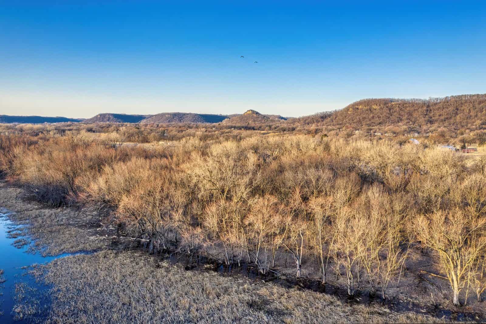
The Driftless Area covers about 24,000 square miles across northeast Iowa, southwest Wisconsin, southeast Minnesota and a corner of northwest Illinois. During the last ice ages, glaciers advanced around it but did not cover it, so the land never received the layer of glacial drift, the loose sand, clay and gravel that smoothed the rest of the region. Instead, rivers carved deep valleys into the limestone and sandstone, leaving steep bluffs, cold-water trout streams, caves and sinkholes.
For travelers, this means a landscape that looks more like the Appalachians than the Corn Belt. The Mississippi River here is wide and slow, bordered by wooded cliffs and marked by locks and dams. The Great River Road, a national scenic byway, runs along the Iowa side, and the three towns sit along it.
When to go
Fall is the most popular season, with color usually peaking in the second and third weeks of October, though timing varies. Late spring brings green hillsides and wildflowers, and summer offers river activities, though humidity can be high. Winter is quiet, with bald eagles gathering near the locks and dams in the coldest months, and some attractions closed. Check hours before you go.
Three Mississippi Towns for Driftless Bluffs in Iowa
The three towns lie within about a 90-minute drive of one another along the river, so you can visit all three on a long weekend. Lansing sits to the north, McGregor in the middle and Bellevue to the south, closer to Dubuque and the Quad Cities.
1. Lansing and Mount Hosmer
Lansing is a small river town of about 1,000 people in Allamakee County, in the northeast corner of the state. Its best-known overlook, Mount Hosmer City Park, sits on a bluff roughly 450 feet above the Mississippi, just west of downtown. A short paved road climbs to the top, where a stone-walled viewing area looks over the river, its islands and the wooded hills on the Wisconsin side. On clear days, you can see for miles. The park is free, has picnic tables, and was named for a local pioneer family.
The Black Hawk Bridge, a steel cantilever bridge that opened in 1931, crosses the river at Lansing and is a photogenic landmark. Downtown has a few cafes, shops and a small museum, and the town has a riverfront park with boat access. Lansing also has a large Fish Days festival each summer, a tradition for decades, so check dates if you want to join or avoid the crowd.
- Best for: sunrise or sunset views, a quiet river town and photography.
- Time needed: a few hours, or an overnight.
- Nearby: Effigy Mounds National Monument and the Yellow River State Forest are within a short drive.
2. McGregor and Pikes Peak State Park
McGregor, in Clayton County, is a small town of about 800 people that sits at the foot of tall bluffs, with a historic main street of brick buildings along the river. It faces Prairie du Chien, Wisconsin, across the water. Just south of town, Pikes Peak State Park offers some of the most dramatic views in the region. Its overlooks stand about 500 feet above the Mississippi, near the point where the Wisconsin River joins it, and you can see the confluence from the high deck. The park is named for Zebulon Pike, who visited the area in 1805, and it is one of the few places where the bluffs are open to easy walking.
Trails lead to Bridal Veil Falls, a small waterfall, and to sandstone formations along the bluff. Some trails are steep or rocky, so wear sturdy shoes. The park has campsites and picnic shelters, and is open year-round.
Nearby, Effigy Mounds National Monument, near Marquette and Harpers Ferry, protects more than 200 prehistoric mounds, many in the shape of bears and birds, built by Native peoples roughly 1,000 to 2,500 years ago. Hiking trails climb to bluff-top overlooks, and the Fire Point and Hanging Rock routes offer broad views. Check the National Park Service site for current trail conditions, since parts of the monument have closed at times for repairs.
- Best for: the most dramatic overlooks, history and hiking.
- Time needed: a full day, including the monument.
- Nearby: Marquette and its Mississippi views, Pikes Peak’s picnic areas and Prairie du Chien.
3. Bellevue and Bellevue State Park
Bellevue is a town of about 2,500 people in Jackson County, midway between Dubuque and Clinton. Its downtown has historic limestone buildings, antique shops and a long riverfront, and the town sits beside Lock and Dam 12. On the bluff above town, Bellevue State Park offers two units, the Nelson Unit and the Dyas Unit, with trails, a butterfly garden and a lookout over the river and the dam. The overlooks sit several hundred feet above the water, and visitors can watch barges lock through.
The park has trails for hiking and mountain biking, camping and a nature center. Spring wildflowers on the bluff are a highlight. Bellevue’s downtown has several restaurants and bars, and the river path is pleasant for evening walks. The town is also near the Mississippi River Trail and local bike routes.
- Best for: families, wildflowers, barge watching and a more developed town.
- Time needed: half a day to a full day.
- Nearby: Dubuque, with the Fenelon Place Elevator and Eagle Point Park, is about 30 minutes north.
A Three-Day Plan
If you want to see all three, start in the north and work south, or the reverse. Spend the first morning in Lansing, driving up Mount Hosmer, and then follow the Great River Road south through Harpers Ferry and Marquette to Effigy Mounds. Hike for two to three hours, then continue to McGregor for dinner. On the second day, visit Pikes Peak State Park, spend the afternoon in McGregor and Prairie du Chien and consider a stop at the Villa Louis, a historic estate across the river. On the third day, drive to Bellevue, with stops at Guttenberg’s riverfront and its lock and dam, and spend the late afternoon at Bellevue State Park.
Lodging and food
Lodging in the river towns includes small inns, bed-and-breakfasts, cabins and campgrounds. Rooms fill on fall weekends, so book early. Restaurants range from supper clubs and diners to modern cafes, and local specialties include walleye, cheese curds and pie. Bring cash for some small shops, though most take cards.
Practical Tips
- Bring layers, since river bluffs can be windy and cool even in summer.
- Wear sturdy shoes, because trails can be steep and wet.
- Check road conditions in winter, as bluff roads can ice over.
- Carry water and snacks, since services are limited between towns.
- Keep a respectful distance from cliffs and observe railings.
- Watch for ticks in tall grass and brush, and check yourself after hikes.
- Stay on trails at Effigy Mounds, which are sacred sites to many Native nations.
More Ways to See the Bluffs
The three towns are not the only places to get above the river, but they give you the easiest access. A few additional options round out the trip.
Dubuque and Eagle Point Park
If you arrive from the south or east, Dubuque is a natural starting point. The city has about 59,000 residents and sits on bluffs on the Iowa side of the river. Eagle Point Park, a 164-acre city park with limestone buildings from the 1930s, sits on a bluff above Lock and Dam 11 and has wide views of the river. The Fenelon Place Elevator, a tiny cable car that has climbed a steep hillside since 1882, is often called the world’s shortest and steepest scenic railway. A ride takes about a minute and costs a few dollars, and the view is a fine introduction to the area.
Guttenberg and the Lock and Dam
Between McGregor and Bellevue, Guttenberg is a river town with German heritage, limestone buildings and a riverfront with an observation deck at Lock and Dam 10. Visitors can watch barges lock through, and the town’s historic business district has shops and cafes. It is a good place to take a break on a drive along the Great River Road.
Paddling and scenic drives
The Mississippi’s backwaters and the Upper Iowa River offer paddling, and outfitters rent canoes and kayaks in several towns. The Great River Road is easy driving, with pullouts for views, and county roads climb into the bluffs for more rural scenery. Drive slowly, since farm vehicles and bicycles share the roads.
What You Will See on the Bluffs
Geology
The bluffs are made of limestone, dolomite and sandstone, laid down in warm shallow seas hundreds of millions of years ago. Rain and rivers dissolved the limestone, producing caves, sinkholes and springs that characterize karst terrain. Some of the cliffs hold fossils of marine animals, and the walls of road cuts show layers of sedimentary rock. Algific talus slopes, cold north-facing slopes where ice persists into summer in cracks, shelter rare plants and a tiny snail, and they exist in only a few places in the Midwest.
Wildlife
Bald eagles are a highlight, with winter gatherings at the locks and dams, and nesting pairs along the river in spring. Turkey vultures soar on updrafts from the bluffs, and migrating birds follow the river in spring and fall. Look for white-tailed deer, wild turkeys and, in trout streams, brown and brook trout. The river also supports mussels, fish and waterfowl.
Plants and seasons
Spring brings wildflowers such as trillium, bloodroot and Virginia bluebells in wooded hollows. Summer brings dense green foliage. In fall, maples, oaks and basswoods turn red, orange and gold, and the contrast against the river is the main draw. In winter, bare trees open the views, and snow and ice add drama, though access can be limited.
Planning Details
Getting there
The nearest large airports are in Cedar Rapids, Madison and Minneapolis, each about two to three hours from the northern towns. Dubuque has a small regional airport. A car is necessary, since public transport is limited. Cell coverage is spotty in the bluffs, so download maps.
What to bring
- Sturdy shoes and layers, since the weather changes quickly on the bluffs.
- Binoculars for birds and distant views.
- A camera or phone with a good lens, and a tripod if you shoot at dawn or dusk.
- Insect repellent and tick checks in warm months.
- A picnic and water, since overlooks have limited services.
Respecting the land
Many bluff tops are on state, county or tribal land, and some are private. Stay on marked trails, respect closures and avoid disturbing mounds, which are burial sites. Do not climb on fragile rock formations, and keep dogs leashed. Take your trash with you, and drive carefully on narrow roads.
The Takeaway
Iowa’s best-kept landscape lies where the Mississippi River has carved the Driftless bluffs. Lansing offers a classic overlook at Mount Hosmer, McGregor gives access to Pikes Peak and Effigy Mounds and Bellevue offers an easy state park above the river. Together, they make a rewarding trip for anyone who wants to see a different side of Iowa.