Every Major US City Ranked by How Easy It Is to Visit Without a Car — Real Transit Scores, What You Can Do, and Where You’ll Be Stranded Without Wheels
We may earn money or products from the companies mentioned in this post. This means if you click on the link and purchase the item, I will receive a small commission at no extra cost to you ... you're just helping re-supply our family's travel fund.
We may earn money or products from the companies mentioned in this post. This means if you click on the link and purchase the item, I will receive a small commission at no extra cost to you … you’re just helping re-supply our family’s travel fund.
Most travel content about American cities doesn’t tell you the thing that matters most for your daily experience as a visitor: how easy is it to get around without a car?
This is not a trivial question. A city that’s supposedly “great for tourists” but requires a $35 Uber to reach half its attractions is fundamentally different from a city where a $3 subway token opens the whole place up. The difference is hundreds of dollars over a week-long trip, and the difference in freedom — in spontaneity, in not waiting for an app — is enormous.
Here’s the honest ranking.
How We Ranked These Cities
We looked at four factors:
- Airport access: Can you get from the airport to your hotel without a car or $60 taxi? The airport test is often the most revealing.
- Main attraction density: Are the things tourists actually want to see clustered in walkable areas, or spread across a metropolitan sprawl?
- Transit system quality: Does the rail/bus/metro system run frequently enough to be practical, cover the areas you’d actually go, and operate during evening hours?
- Walkability of neighborhoods: Walk Score data plus ground-truth from traveler accounts.
Tier 1 — Truly Car-Free Friendly
- New York City The gold standard. The subway runs 24 hours, goes everywhere, and costs $2.90 per ride or $34/week unlimited. The AirTrain and Long Island Rail Road from JFK bring you into Penn Station without drama. You can spend a week in Manhattan, Brooklyn, and Queens without ever needing anything other than the MTA and your own legs. The only caveat: the outer boroughs (especially Queens and the Bronx beyond certain corridors) get complicated. For the core tourist experience, NYC is unmatched in the US for car-free visitability.
- Chicago The L train covers Chicago in a way most visitors underestimate. The Blue Line runs 24 hours from O’Hare directly into the Loop for $2.50. The Red Line handles the lakefront corridor from Wrigleyville to Hyde Park. The main tourist clusters — Millennium Park, the Riverwalk, Michigan Avenue, Lincoln Park Zoo, Wicker Park, Logan Square — are all on or near rail lines. Uber is useful but not necessary. Chicago earns a genuine Tier 1 designation.
- Boston The MBTA (the T) is old, occasionally unreliable, and doesn’t run late enough (last trains around midnight–1 AM on most lines). Despite these limitations, Boston’s core is so walkable that the T gets you to most things and you walk between them. The Freedom Trail, the North End, Fenway, Cambridge — all accessible without a car. Logan Airport is a 10-minute Blue Line ride from downtown. Legitimate car-free city for a 4–7 day visit.
- Washington D.C. The Metro is clean, clearly signed, and covers the core tourist experience exceptionally well. Every major Smithsonian museum, the Mall, Georgetown (mostly), Capitol Hill, Dupont Circle — all on or near Metro stations. Reagan National Airport has a direct Metro connection. Dulles does not — factor in a cab or the Silver Line bus. For the tourist core, D.C. is one of the most car-free accessible cities in America.
- San Francisco BART connects SFO to downtown in 30 minutes for $10. The Muni bus and rail system covers the city comprehensively. The cable cars are tourist experiences that are also functional transit on Nob Hill. Neighborhoods like the Mission, Castro, Haight, Chinatown, and North Beach are dense and walkable. The hills are real and the Muni can be crowded, but San Francisco is genuinely car-free manageable.
Tier 2 — Mostly Manageable Without a Car

- Seattle The Link Light Rail connects Sea-Tac Airport to Capitol Hill, First Hill, and downtown. The streetcar covers South Lake Union and the First Hill corridor. The ferry system is functional and scenic. Neighborhoods like Capitol Hill, Pike Place, and Belltown are dense and walkable. Where it gets hard: Seattle’s geography — hills and water — makes walking between some neighborhoods exhausting. Uber fills the gaps but Seattle remains mostly manageable without a car for a tourist visit.
- Philadelphia SEPTA covers the city reasonably well and the Market-Frankford Line connects 30th Street Station to Center City and beyond. The historic core — Independence Hall, Reading Terminal Market, South Street — is compact and walkable. Where it degrades: the neighborhoods beyond Center City (Manayunk, Germantown, Far Northeast) require car or Uber. For the standard tourist itinerary, Philly is car-free viable.
- Portland, Oregon MAX light rail connects PDX Airport to downtown for $2.50. The streetcar and bus network covers the central city well. SE Portland, NW 23rd Avenue, the Pearl District, Hawthorne — walkable and transit-accessible. The caveat: Portland’s transit system has faced significant safety issues in recent years that have affected rider experience. This is a real consideration, not just media narrative.
- New Orleans The French Quarter, Marigny, and Garden District are all walkable and connected by streetcar. The Canal Street line is functional and tourist-friendly. The challenge: New Orleans is not a city of compact density — neighborhoods are scattered, and the areas between the major tourist zones require transportation. Uber is cheap here, which helps. A reasonable car-free city for the standard tourist itinerary.
Tier 3 — You’ll Need Uber More Than You Want To
- Los Angeles LA has a surprisingly functional Metro system that most visitors overlook. The Metro connects LAX (via a free shuttle to Aviation/Century Blvd station), reaches downtown, Hollywood, Santa Monica, Pasadena, and Long Beach. The problem: LA’s best experiences are scattered across a 500 square mile metro area in ways that the Metro’s coverage doesn’t always bridge. You’ll take the Metro some days and Uber others. Expect to spend $40–$80/day on transportation if you’re not renting a car. LA is manageable car-free but not car-free friendly.
- Miami Downtown Miami, Brickell, and Wynwood are walkable and connected by the Metromover (free) and Metrorail. Miami Beach is connected by bus across the causeways. But the experience fragments quickly: Fort Lauderdale, the Everglades, Key Largo — any South Florida experience beyond Miami’s core requires a car or expensive Ubers. South Beach specifically is very walkable within its own footprint.
- Denver The RTD light rail and A Line connect Denver International Airport to Union Station for $10.50. The 16th Street Mall in downtown is car-free and pedestrian-friendly. The problem: Denver’s most compelling experiences — Red Rocks Amphitheatre, Rocky Mountain National Park, Breckenridge, Estes Park — all require a car. For a downtown Denver experience, transit works. For a Colorado outdoor experience, it doesn’t.
- Minneapolis The Blue and Green Metro lines connect MSP Airport to downtown, and the Skyway system connects 80 city blocks underground during brutal winters. The core is manageable. The problem is weather: Minneapolis winters make walking unpleasant for months. The Skyway helps but it doesn’t reach everywhere. Summer and fall Minneapolis is significantly more pleasant car-free than winter Minneapolis.
Tier 4 — Just Rent the Car
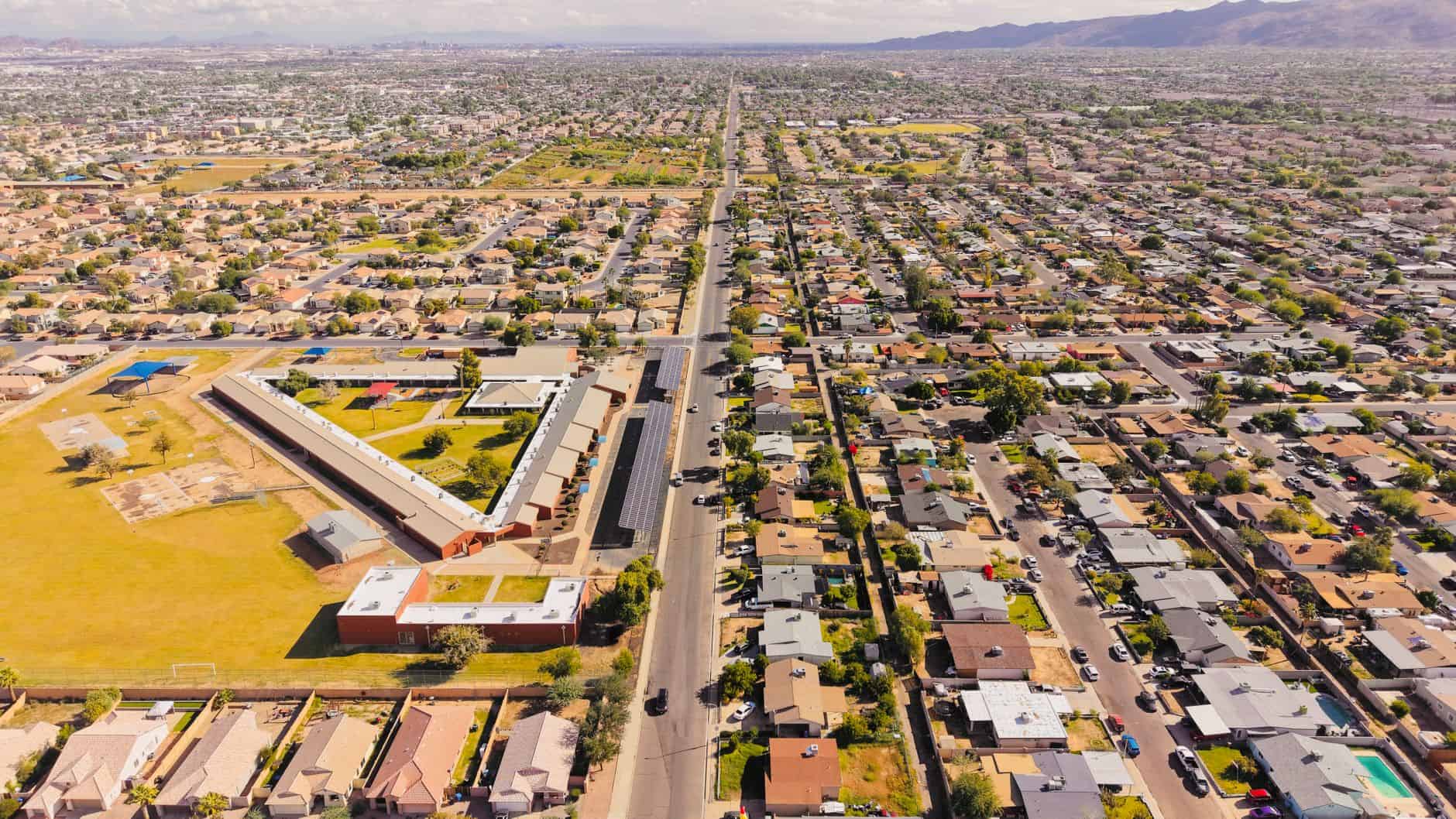
- Phoenix/Scottsdale Phoenix is the platonic ideal of Sun Belt sprawl. The metro covers 14,000+ square miles. The Valley Metro light rail covers a corridor from Mesa to downtown to the airport, but the things tourists go to Phoenix for — Scottsdale’s Old Town, Sedona (90 minutes away), Camelback Mountain, the Desert Botanical Garden — are not rail accessible. Rent the car. This is a non-negotiable.
- Houston Houston has a light rail system that’s fine for the Medical Center and some midtown corridors. What it doesn’t do is connect the sprawl. The Space Center is 30+ miles from downtown. The Museum District is manageable. Getting to the Galleria, River Oaks, or anything outside central Houston requires driving. Car is mandatory for a full Houston experience.
- Dallas DART covers more of Dallas than most people realize, with rail going to Uptown, the Arts District, Deep Ellum, and Love Field Airport. The gap: Dallas’s highway-oriented development means that attractions are separated by distances that make pure car-free travel frustrating. Fort Worth is 30 miles and a separate rail trip away. Rent the car, or commit to a very corridor-limited visit.
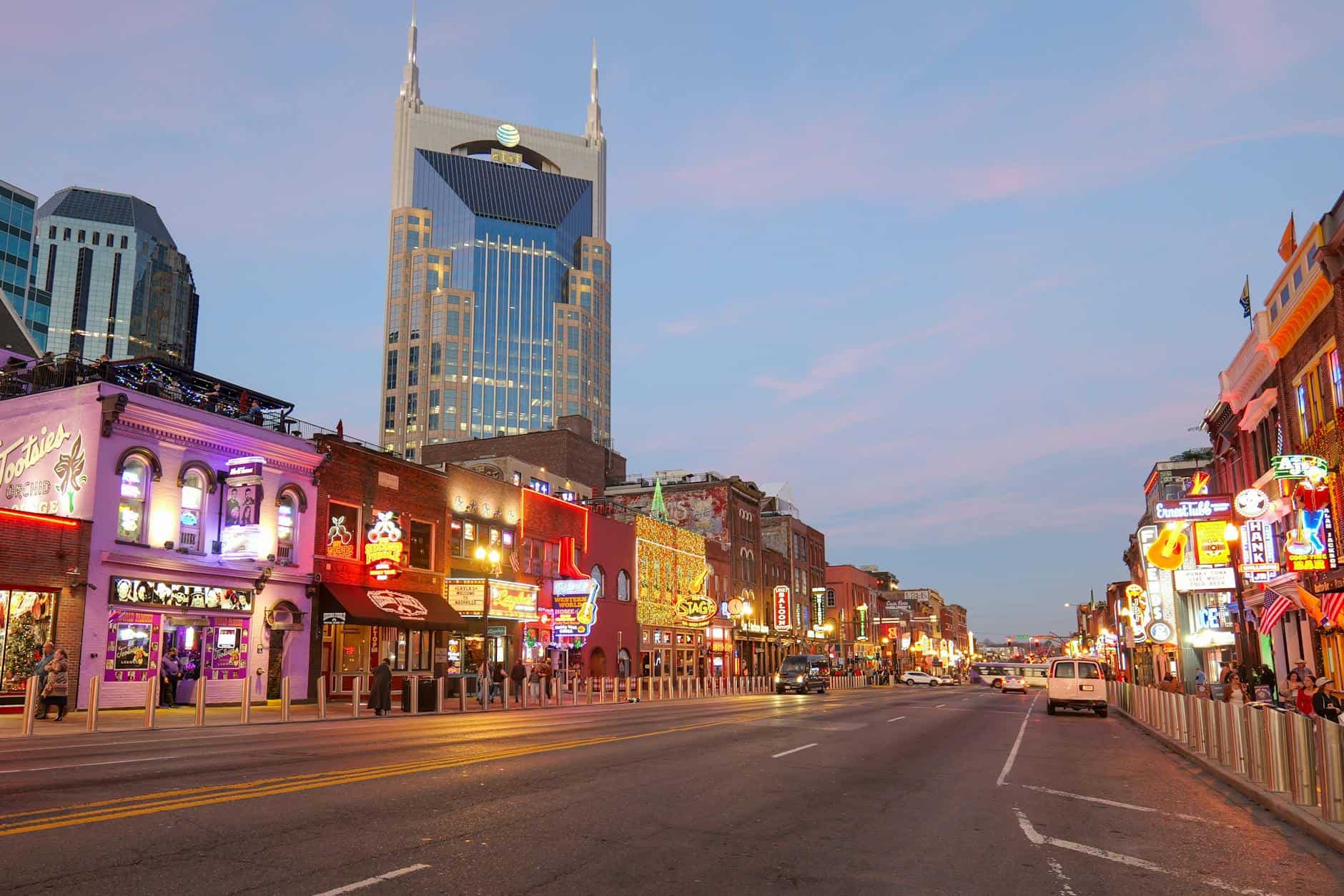
- Nashville Nashville has essentially no functional public transit for tourists. Broadway is walkable within a few blocks. Everything else — 12 South, East Nashville, the Parthenon, RCA Studio B in the suburb, distilleries outside the core — requires driving or Ubering. Uber is relatively cheap and the city is navigable, but you’ll be paying for every trip. There is no meaningful transit option from the airport.
- Las Vegas The Strip is walkable for about 4 miles, and the Deuce bus covers it. But “Las Vegas” in any broader sense — Henderson, the valley, Red Rock Canyon, Hoover Dam — is car country. The airport is 5 minutes from the Strip by Uber ($12–$18). If you’re doing the Strip experience, you don’t need a car. If you want anything else, you do.
The Car-Free Travel Toolkit

Regardless of your destination, these tools help:
- Transit App (free): Aggregates real-time transit directions for most US cities in one interface. Better than Google Maps for transit granularity.
- Walk Score (walkscore.com): Look up your specific hotel’s address to get neighborhood-level walkability data before you book.
- Citymapper: Available in NYC, SF, Chicago, DC, Boston, Seattle — excellent real-time routing with walking integrations.
- Hotel location matters more than star rating. A 3-star hotel in a walkable neighborhood is more valuable for a car-free trip than a 4-star hotel in a suburban office park. Filter for neighborhood, not just amenities.
- Book accommodations on or near major transit lines. A hotel one block from a Metro station changes the entire trip math.
The most underrated thing a travel planner can do is ask: “What does getting around actually cost here?” The answer shapes budget, itinerary, and experience more than almost any other variable.