The Freedom Trail Is Not Boston. Jamaica Plain, Roslindale, and East Boston Are, and They’re Nothing Alike
We may earn money or products from the companies mentioned in this post. This means if you click on the link and purchase the item, I will receive a small commission at no extra cost to you ... you're just helping re-supply our family's travel fund.
Most visitors to Boston experience a fairly narrow slice of the city: the Freedom Trail, Beacon Hill, maybe a trip to Fenway Park. The neighborhoods where the majority of Boston’s population actually lives, works, and raises families sit outside that tourist core entirely, and three of them in particular — Jamaica Plain, Roslindale, and East Boston — illustrate just how differently the same city can feel depending on which T stop you get off at.
Jamaica Plain Gentrified First and Hardest
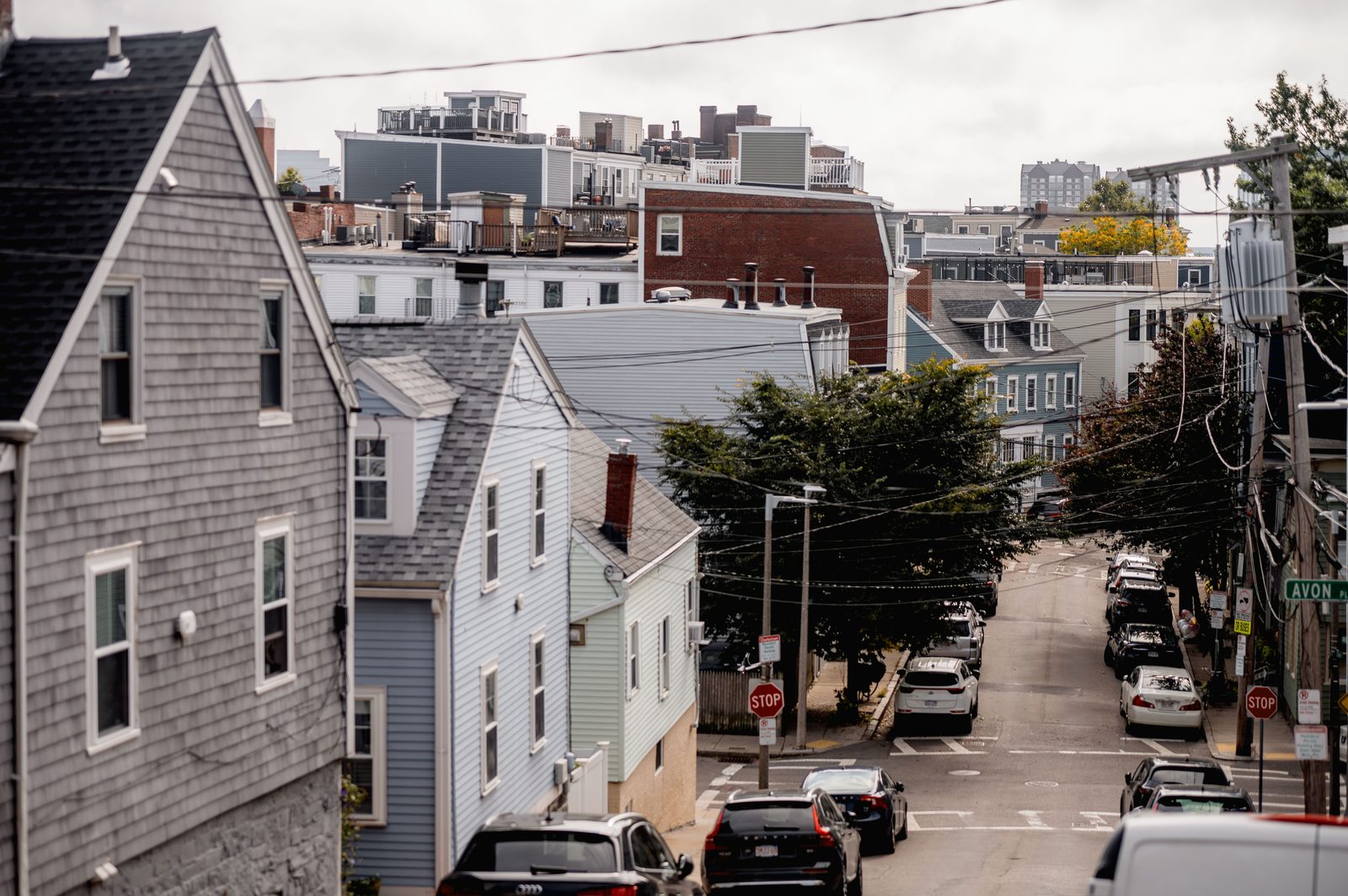
Jamaica Plain, anchored by Jamaica Pond and the Arnold Arboretum, was historically a working-class and immigrant neighborhood that began gentrifying noticeably earlier than most of Boston’s other outer neighborhoods, drawing young professionals and artists throughout the 1990s and 2000s who were priced out of Cambridge and the Back Bay. That earlier start means Jamaica Plain’s transformation is now largely complete rather than ongoing: home prices there rank among the highest of Boston’s non-downtown neighborhoods, and the strip along Centre Street and South Street now features the kind of dense restaurant and boutique retail corridor typically associated with much more central urban neighborhoods.
Roslindale Is What Jamaica Plain Used to Be, Priced for What It’s Becoming
Roslindale, immediately adjacent to Jamaica Plain, has followed a similar but delayed trajectory, retaining more of a village-like, family-oriented character built around Roslindale Square and its well-regarded farmers market. Real estate comparisons between the two neighborhoods, according to local real estate market analysis, consistently describe Roslindale as the more affordable option for buyers priced out of Jamaica Plain, though that gap has been narrowing steadily as more buyers specifically seek out Roslindale for exactly that reason, creating the familiar pattern where a neighborhood’s affordability becomes the very thing that erodes it.
East Boston Tells a Completely Different Story
East Boston, separated from the rest of the city by the harbor and connected via tunnel and the Blue Line, has a distinct identity shaped by successive waves of immigration, most recently a large Latino community, and by its proximity to Logan International Airport, which brings both economic activity and genuine noise and land-use constraints most other Boston neighborhoods don’t contend with. East Boston’s waterfront has attracted significant new luxury development over the past decade, creating a stark visual and economic split within the neighborhood itself: gleaming new harbor-view condo towers within blocks of considerably more modest, longtime immigrant-community housing stock, a juxtaposition that has made East Boston one of the more visibly unequal neighborhoods in the city in terms of new development versus existing community character.
- Jamaica Plain: earliest and most complete gentrification among the three, dense restaurant corridor
- Roslindale: village character, historically more affordable, gap narrowing quickly
- East Boston: immigrant community identity alongside new luxury waterfront development
The Triple-Decker Is the Common Thread
All three neighborhoods share Boston’s distinctive triple-decker housing stock, three-story wood-frame homes built primarily between 1870 and 1920 to house the waves of factory and dock workers who once powered the city’s industrial economy. These buildings, originally built as affordable multi-family housing, have become a central battleground in each neighborhood’s transformation: developers frequently convert triple-deckers into condos, sometimes combining or gutting units to create larger, more expensive single-family-style living spaces, a process that reduces the overall housing supply even as individual unit prices climb, a dynamic housing researchers have specifically flagged as a contributor to Boston’s broader affordability crisis.
Why Visitors Rarely See Any of This
Boston’s tourism infrastructure, concentrated almost entirely around the Freedom Trail, the North End, and the Seaport District, gives visitors little reason to ever ride the Orange Line to Jamaica Plain or the Blue Line to East Boston, which means most people’s mental image of Boston remains frozen at the colonial-era historical core the city markets most aggressively to out-of-towners. Residents of these outer neighborhoods sometimes describe a mild but persistent frustration with this gap, feeling that the “real” contemporary Boston, its immigration story, its housing pressures, its neighborhood-level cultural distinctiveness, gets almost entirely overshadowed by a downtown historical narrative that, while accurate, represents a small and increasingly museum-like fraction of what the city actually is today.
Dorchester and Roxbury Complicate the Picture Further
Beyond Jamaica Plain, Roslindale, and East Boston, neighborhoods like Dorchester and Roxbury add further texture to how differently Boston’s outer neighborhoods have evolved relative to the tourist-facing downtown core. Dorchester, Boston’s largest neighborhood by both population and geographic area, contains its own internal diversity, from the historically Irish and increasingly Vietnamese and Cape Verdean communities near its commercial strips to the newer luxury development creeping in along its waterfront edges near the UMass Boston campus. Roxbury, historically the center of Boston’s Black community and civil rights history, has seen a slower, more contested pace of new investment, with community advocates frequently raising concerns about displacement risk as development pressure from adjacent, already-gentrified neighborhoods pushes outward.
Together, these neighborhoods illustrate a pattern that repeats across many older American cities: a historic downtown core preserved and marketed almost as a museum piece for visitors, while the actual, lived-in city unfolds in a patchwork of neighborhoods each negotiating its own relationship with investment, displacement, and identity largely outside the tourist gaze entirely. A visitor who spends even a single afternoon riding the Orange or Red Line out past the historical core comes away with a considerably more complete, and more complicated, sense of what Boston actually is today.
Real estate brokers working across these neighborhoods often note that buyers researching Boston from out of state initially fixate almost entirely on Beacon Hill, the Back Bay, and the Seaport, the same neighborhoods dominating tourism marketing, before eventually discovering that the city’s more attainable and, in many cases, more architecturally interesting housing stock sits in exactly the neighborhoods visitors never see on a typical weekend trip. That discovery process, often taking months of local research a tourist would never undertake, is part of why Jamaica Plain, Roslindale, and East Boston have each experienced steady rather than explosive price growth, driven by a slower-building wave of informed local and relocating buyers rather than the kind of instant, visibility-driven demand spike that hits neighborhoods featured heavily in national travel coverage.