San Antonio’s River Walk Exists Because of a 1921 Flood That Killed 50 People. Almost Nobody Floating Past the Margaritas Knows That.
We may earn money or products from the companies mentioned in this post. This means if you click on the link and purchase the item, I will receive a small commission at no extra cost to you ... you're just helping re-supply our family's travel fund.
The San Antonio River Walk draws roughly visitors expecting a scenic, festive stretch of restaurants and river barges, and it delivers exactly that. What most visitors don’t realize is that the entire structure exists because of a catastrophic 1921 flood that killed at least 50 people and devastated downtown San Antonio, prompting a flood control response that architect Robert H.H. Hugman eventually transformed into the pedestrian and commercial destination that defines the city’s tourism identity today (KSAT).
From Flood Control Project to Tourist Destination
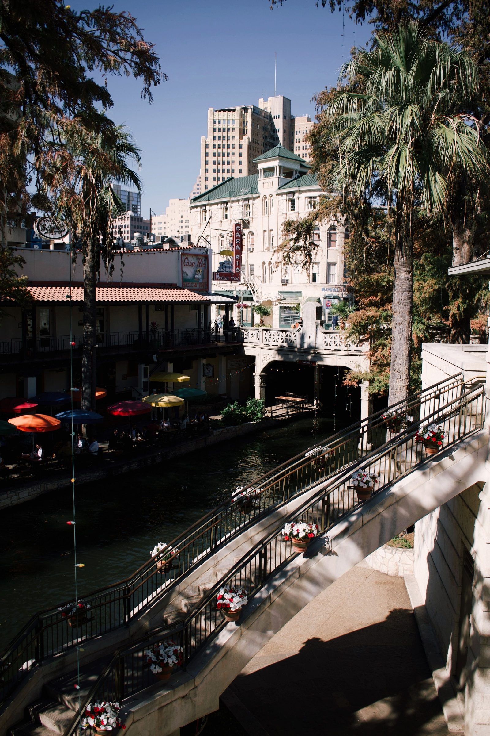
After the 1921 flood, San Antonio’s initial instinct was straightforward engineering: build a dam and control the river’s flow to prevent future flooding, a plan that at one point seriously considered simply paving over the river bend through downtown entirely. Hugman, a young local architect, proposed an alternative vision in the early 1930s — combining flood control infrastructure with a landscaped, pedestrian-friendly commercial district along the river’s banks — that eventually won support and was built primarily through Works Progress Administration labor and funding during the Depression, giving San Antonio both flood protection and, eventually, one of the most recognizable tourist attractions in Texas (Texas State Historical Association).
The Engineering Most Visitors Never Notice
- A dam and floodgate system built as part of the original 1930s project can divert floodwater away from the River Walk’s commercial bend entirely during major storm events, a feature that has protected downtown through numerous subsequent flood events
- The American Society of Civil Engineers has recognized the San Antonio River Walk and Flood Control System as a historic engineering landmark specifically for this dual-purpose design
- The river’s water level and flow through the tourist district are actively managed, not a natural, unaltered stretch of river, contrary to how effortlessly natural it appears to visitors
- Extensions completed decades later, including the Museum Reach and Mission Reach segments, expanded the walkable river corridor well beyond Hugman’s original downtown loop toward the city’s historic Spanish missions
Why the Expectation and the Reality Diverge for First-Time Visitors
Visitors arriving with images of a sprawling riverside promenade are sometimes surprised by how compact the original, most commercially dense stretch of the River Walk actually is — a horseshoe bend that takes well under an hour to walk end to end at a casual pace, considerably smaller than the extended, multi-mile system implied by tourism marketing that includes the newer Museum Reach and Mission Reach extensions. The core downtown loop, while smaller than expected, compensates with a genuinely dense concentration of restaurants, bars, and river barge tours, meaning the mismatch tends to be about scale and river-walking distance rather than a shortfall in things to actually do.
What the Extensions Actually Offer Beyond the Tourist Core
The Museum Reach, extending north from the original loop, connects to the San Antonio Museum of Art and the Pearl District, a former brewery complex reborn as a food hall and residential development, offering a quieter, less commercially saturated river-walking experience than the downtown core. The Mission Reach extends south toward San Antonio’s UNESCO World Heritage-listed Spanish colonial missions, giving visitors willing to walk or bike considerably farther a genuinely different, more historically substantive river experience than the margarita-and-mariachi atmosphere that dominates the downtown stretch most tourists never venture beyond.
What San Antonio Learned From Its Own Success
The River Walk’s transformation from flood infrastructure into the anchor of San Antonio’s tourism economy has made it a frequently studied case for other cities considering similar dual-purpose waterfront redevelopment projects, with San Antonio officials and urban planners from other cities citing it directly as precedent for combining flood mitigation with commercial and pedestrian infrastructure rather than treating the two goals as separate projects. That success has also shaped San Antonio’s more recent extensions, with the Museum Reach and Mission Reach both explicitly designed from the outset to serve flood management and recreational or tourism purposes simultaneously, following the model Hugman pioneered in the 1930s.
Practical Visiting Notes
- River barge tours depart regularly from multiple points along the downtown loop and offer a helpful orientation for first-time visitors
- The Pearl District, accessible via the Museum Reach extension, offers a distinctly different, less touristy dining and shopping experience than the downtown core
- Water levels and river operations are occasionally adjusted for maintenance, which can briefly affect barge tour availability
The Bottom Line for Anyone Planning a Visit
The margaritas and river barges are real, and so is the flood control system running underneath the whole experience. Knowing the River Walk started as a disaster response, not a theme park concept, changes how the whole downtown loop reads.