These States Will Kill Your Car (and Maybe You) If You Drive Them Wrong in Winter — The Routes to Avoid
We may earn money or products from the companies mentioned in this post. This means if you click on the link and purchase the item, I will receive a small commission at no extra cost to you ... you're just helping re-supply our family's travel fund.
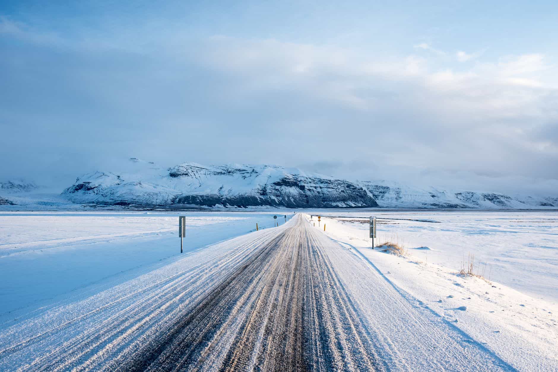
In January 2024, Wyoming’s Interstate 80 was closed for three consecutive days between Laramie and Rawlins due to a combination of high winds, blowing snow, and white-out conditions. Semis were jackknifed. Passenger vehicles were stranded. Temperatures dropped to -25°F with wind chills.
The people who knew this stretch of road stayed home. The people who didn’t know drove into it.
Winter driving in America has a significant difference between “inconvenient” and “life-threatening,” and that difference is geography. A snowstorm in Richmond, Virginia is inconvenient. A snowstorm on Wyoming’s high desert corridor in a northwest wind is a different category of situation.
This is your guide to the routes where the second category applies.
Montana and Wyoming: The Two States That Will Test Everything You Think You Know About Driving
These two states account for a disproportionate share of weather-related highway fatalities in the United States. The combination of factors is unique:
- High elevation (most of Wyoming and significant portions of Montana sit above 5,000 feet)
- Extreme wind speeds — southeastern Wyoming regularly records gusts of 60–80 mph in winter
- Low population density meaning longer emergency response times
- Long stretches of highway with no services and no shelter
The specific routes to respect:
- Wyoming I-80 between Laramie and Rawlins This 100-mile stretch is arguably the single most frequently closed major Interstate in the United States due to weather. It sits at elevations around 7,000 feet and funnels wind off the Laramie Range with nothing to slow it. WYDOT (Wyoming Department of Transportation) has a real-time travel advisory map at wyoroad.info. Check it before you start. If it says anything above “Normal” for this corridor, reconsider.
- Wyoming US-287 / WY-789 through the Great Basin The route connecting Lander, Riverton, and Rawlins through the center of the state. Less traveled than I-80, which means less plowing frequency. This road has stranded drivers for 18+ hours in bad conditions with no cellular service.
- Montana US-2 across the Hi-Line The east-west corridor across northern Montana is desolate in ways that Interstate drivers are unprepared for. There are segments with no services for 40+ miles and cellular dead zones. A breakdown in a blizzard here is an emergency, not an inconvenience.
Colorado’s Mountain Passes: The Ones That Look Fine Until They’re Not
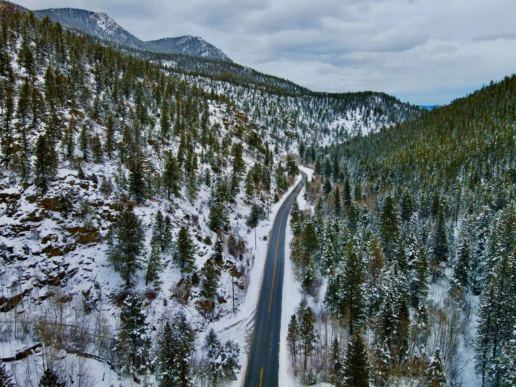
Colorado manages its mountain passes better than most states — CDOT is well-funded and aggressive about road treatment. But the passes themselves are genuinely dangerous, and several have claimed lives in recent years.
- Vail Pass (I-70) The most-traveled mountain corridor in Colorado and one of the most dangerous in bad conditions. Vail Pass sits at 10,666 feet. It closes entirely several times each winter during severe conditions. In bad weather, it generates multi-hour backups as chain law enforcement slows traffic. If I-70 is showing delays on Vail Pass, the standard advice is: wait. It always clears. Trying to push through has caused serious accidents.
- Wolf Creek Pass (US-160) This one is different from the busy I-70 corridor — it’s a two-lane highway that’s genuinely technical in winter, with tight curves, limited guardrails in sections, and drops of several hundred feet on the outside. It gets more snow than Vail Pass and with far fewer travelers, meaning plowing is less frequent. Wolf Creek ski area is here for a reason — it’s one of the snowiest places in Colorado.
- Loveland Pass (US-6) An alternative to the Eisenhower Tunnel when it’s closed, but it’s technically more demanding — 11,990 feet, switchbacks, and genuine avalanche terrain. If the tunnel is closed and you’re being routed over Loveland, assess the conditions carefully before committing.
The Upper Midwest: Where the Cold Itself Becomes the Hazard
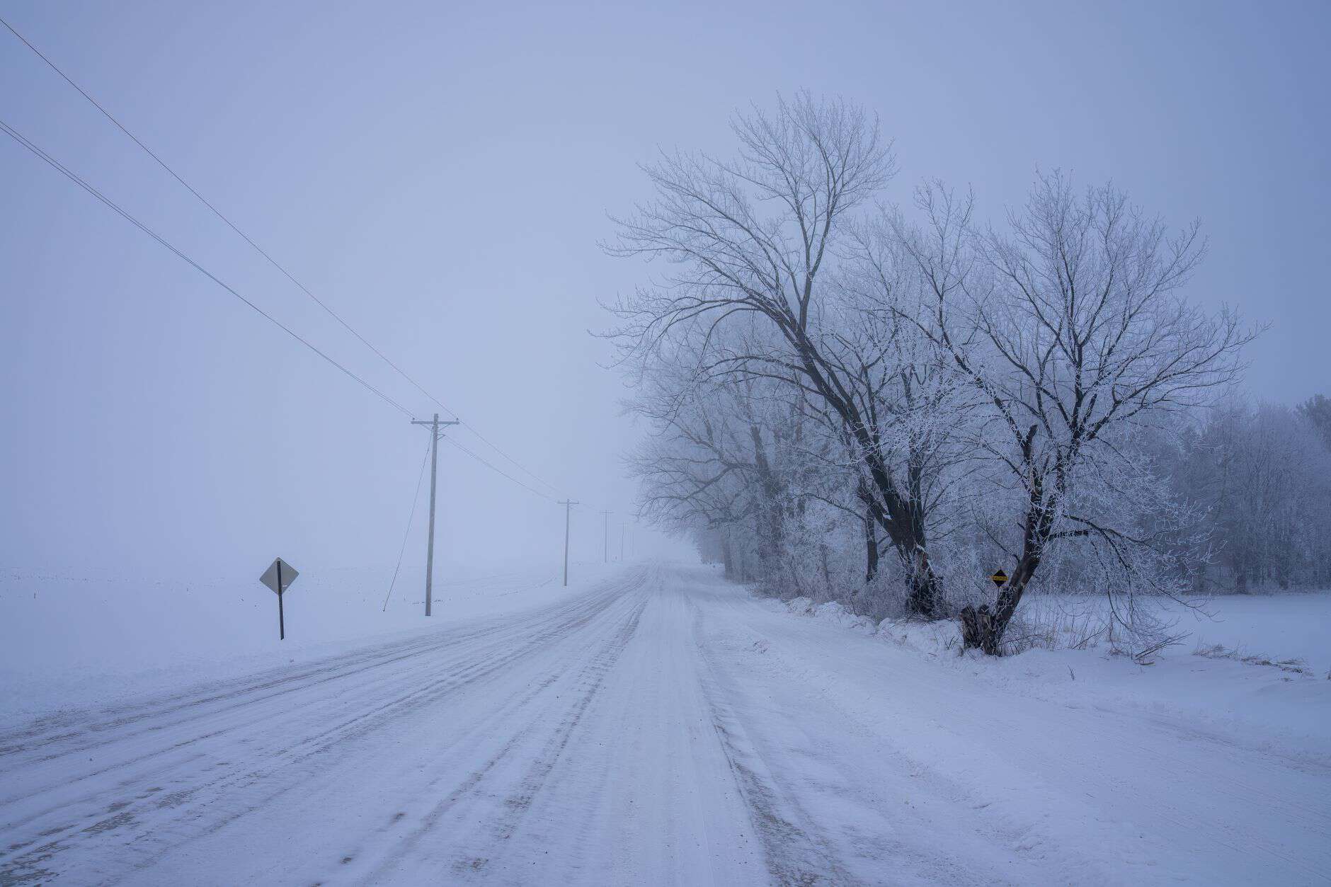
Minnesota, North Dakota, South Dakota, and the Upper Peninsula of Michigan have a different kind of winter driving danger. It’s not necessarily the mountain terrain — it’s the combination of extreme cold, flat open geography that allows wind to build across hundreds of unobstructed miles, and the specific physics of black ice on flat prairie roads.
- North Dakota US-2 and US-83 Black ice is endemic to this region. Roads that look clear can be continuously glazed from overnight refreezing. Temperatures below -20°F make ordinary car failures (dead battery, flat tire) into potentially fatal events. If your car dies on a rural North Dakota highway at -30°F in a wind chill and your phone has no signal, the window for a safe outcome is measured in minutes to a few hours depending on your clothing.
- Minnesota I-35 north of Duluth and MN-1 across the Arrowhead Lake Superior creates a micro-climate effect that generates heavy snow events with surprising speed. The North Shore of Lake Superior is famous for its beauty and equally famous for the speed with which a clear day becomes a white-out near shore.
The I-80 Corridor: The Most Consistently Dangerous Interstate in Winter
I-80 runs from San Francisco to Teaneck, New Jersey, and several segments of it deserve specific attention:
- I-80 through the Sierra Nevada (California-Nevada border) This stretch crosses Donner Summit at 7,239 feet. It is named Donner Summit for reason you are already familiar with. Caltrans closes it during the most severe storms. The chain control requirements are enforced aggressively. If conditions are bad, this road closes — you cannot power through with a good attitude and all-season tires.
- I-80 across Utah’s salt flats Ice, wind, limited visibility from blowing snow in open terrain. The salt flat sections have almost nothing to stop your car from continuing in any direction if you lose control.
- I-80 through central Nebraska Endless straight highway, open terrain, blizzard winds with no windbreaks. The conditions that shut down Wyoming I-80 often extend into Nebraska.
Pacific Northwest Mountain Routes: Rain Turns to Ice Faster Than You Expect
Oregon and Washington have drivers who sometimes lack respect for winter mountain conditions because the Willamette Valley and Puget Sound lowlands are mild. The passes are not mild.
- Washington US-2 Stevens Pass US-2 is a two-lane highway that traverses the Cascades and provides a northern alternative to I-90. Stevens Pass is avalanche terrain. In 2014, the Oso landslide — not on this pass but in the region — reminded the Pacific Northwest what mountain slopes can do. WSDOT regularly closes Stevens Pass during severe events.
- Oregon US-26 through the Coast Range The Coast Range between Portland and Cannon Beach is much lower elevation than the Cascades, but it is notorious for turning from rain to ice with almost no warning, particularly at night. Locals have been surprised by this many times. The road has limited lighting, tight curves, and a hard shoulder that disappears in places.
What to Have in Your Car Before You Drive Any of These Routes

This is not a comprehensive survival guide. This is the minimum:
- Sleeping bag or heavy blankets If your car dies in -30°F, you need to survive inside it until help comes. A sleeping bag rated to -20°F can keep you alive for hours. Your car’s heater cannot be relied upon if the engine dies or you’re blocking the exhaust with a snowdrift.
- Jumper cables or a portable jump starter Cold kills batteries. Jump starters (small lithium packs) are now $40–$70 at any auto parts store and are worth every dollar.
- Sand or kitty litter for traction A small bag of coarse sand or kitty litter under your rear wheels when stuck has saved thousands of drivers from multi-hour waits for a tow truck.
- Phone charger / extra battery pack You cannot call for help on a dead phone.
- Food and water for 24 hours Protein bars, crackers. If you’re stranded overnight on a closed highway, this matters.
- Ice scraper, snow brush, small shovel The shovel is for digging out from a ditch or clearing your exhaust pipe if snowed in.
- Chains or traction cables if required by your route California and Oregon chain control is enforced by law on several passes. Renting chains costs $60–$100 at gas stations near the pass; buying them beforehand costs $30–$50.
The single most important preparation for any of these routes: check the state DOT road conditions website before you leave. Wyoming’s wyoroad.info, Colorado’s cotrip.org, Montana’s mdt.mt.gov, and Washington’s wsdot.com all provide real-time camera feeds, road closure information, and travel advisories. These websites exist because people have driven into conditions they didn’t know about and needed help. Use them.