Congaree Became a National Park in 2003. 6 Ways to Explore Its Old-Growth Floodplain Forest in Late Fall
We may earn money or products from the companies mentioned in this post. This means if you click on the link and purchase the item, I will receive a small commission at no extra cost to you ... you're just helping re-supply our family's travel fund.
Congaree, in central South Carolina, became a national park in 2003. Before that, it was protected as Congaree Swamp National Monument, established in 1976. Today Congaree National Park protects the largest intact expanse of old-growth bottomland hardwood forest remaining in the southeastern United States, with some of the tallest trees in eastern North America.
Late fall is a good time to visit. Mosquitoes, a major nuisance in summer, are fewer, temperatures are mild, and the changing leaves add color to the forest. Entry to the park is free, according to the National Park Service, and the park is about 20 miles southeast of Columbia. The six options below cover the main ways to experience the forest, from an easy boardwalk to a paddle on Cedar Creek.
Why Congaree National Park Is Unusual
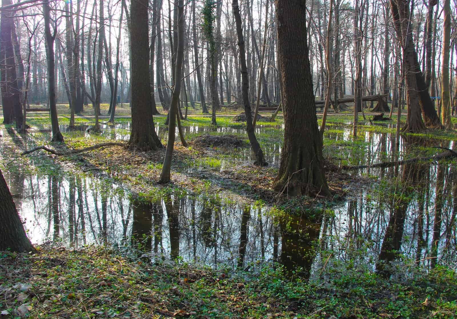
Many visitors expect a swamp, but Congaree is technically a floodplain forest. The Congaree and Wateree rivers flood the area several times a year, bringing nutrients that feed the giant trees. The forest is not permanently underwater; instead, it floods and drains in cycles.
The National Park Service describes Congaree’s canopy as one of the tallest temperate deciduous forest canopies in the world. Champion trees in the park include loblolly pines, bald cypress, sweetgum, and cherrybark oaks. Some loblolly pines here rise more than 160 feet.
6 Ways to Explore Congaree in Late Fall
1. Walk the Boardwalk Loop
The Boardwalk Loop is the park’s signature trail, a 2.6-mile loop that starts near the Harry Hampton Visitor Center. Most of it runs on an elevated boardwalk, with a section on a low boardwalk that can flood. The trail passes through old-growth forest, past giant trees and bald cypress knees, and reaches Weston Lake, an old river channel.
The boardwalk is flat and accessible, making it a good option for families and visitors with limited mobility. Allow about an hour to an hour and a half.
2. Hike the Weston Lake Loop Trail
The Weston Lake Loop Trail is a 4.4-mile loop that extends beyond the boardwalk. It follows Cedar Creek and passes Weston Lake, with views of the forest and wildlife. The trail is mostly flat but can be muddy, especially after rain.
This is a good option for hikers who want to go deeper into the forest. Watch for wildlife, including deer, wild turkeys, and barred owls.
3. Paddle Cedar Creek
Cedar Creek flows through the park, and paddling it is one of the best ways to see the forest. The Cedar Creek Canoe Trail offers a marked route through the park. Paddlers can launch from the South Cedar Creek canoe landing or Bannister’s Bridge.
In late fall, water levels can vary. Check with the park for current conditions. Paddlers can bring their own boats or rent from local outfitters. The park also offers ranger-led canoe tours at certain times of the year. Check the park website for schedules.
4. Hike the Kingsnake Trail
The Kingsnake Trail is a longer, quieter trail on the east side of the park. It is about 11.7 miles out and back, through bottomland forest along Cedar Creek. The trail is known for birdwatching, with species such as woodpeckers and warblers.
This trail sees fewer visitors than the boardwalk, making it a good choice for those seeking solitude.
5. Visit the Harry Hampton Visitor Center
The Harry Hampton Visitor Center is the starting point for most visits. It has exhibits on the park’s history, ecology, and wildlife, as well as a short film. Rangers can answer questions, provide maps, and share updates on trail conditions.
The visitor center also has a gift shop and restrooms. Check the park website for current hours.
6. Join a Ranger-Led Program
Congaree offers ranger-led programs, including guided walks and night programs such as the Owl Prowl, which explores the forest after dark. Programs vary by season, so check the park website for schedules.
Ranger programs are a great way to learn about the park’s ecology, history, and wildlife.
Planning Your Visit
A few tips for visiting Congaree in late fall:
- Check flood conditions. The park floods several times a year, and some trails may be closed or underwater.
- Wear waterproof shoes or boots, especially on trails beyond the boardwalk.
- Bring insect repellent. Mosquitoes are fewer in fall but can still be present.
- Bring water and snacks. There are no food services in the park.
- Leave no trace. Pack out all trash.
Camping
Congaree has two campgrounds: Longleaf Campground, with drive-in sites, and Bluff Campground, a hike-in site. Backcountry camping is also allowed with a free permit. Check the park website for reservations and rules.
Getting There
Congaree National Park is about 20 miles southeast of Columbia, South Carolina. The main entrance is off Old Bluff Road. Columbia Metropolitan Airport is the closest major airport.
Where to Stay
Most visitors stay in Columbia, which has many hotels, restaurants, and attractions. The city is a good base for exploring the park and other sites in central South Carolina.
How Congaree Was Saved
The forest at Congaree survived largely because of its location. The frequent floods made logging difficult, and some parts of the floodplain were logged in the late 1800s and early 1900s, but large stands of old-growth trees remained. By the 1950s and 1960s, rising timber prices put the remaining forest at risk.
Local residents, conservation groups, and scientists pushed for protection. Their efforts led Congress to establish Congaree Swamp National Monument in 1976. The area grew over the following decades, and in 2003 Congress redesignated it as Congaree National Park. The park has also been recognized internationally: it is a designated International Biosphere Reserve and a Wilderness Area covers much of it.
Understanding the Floods
Flooding is the force that shapes Congaree. Several times a year, the Congaree River rises and spills into the floodplain, covering trails, low boardwalk sections, and campsites. The water can stay for days or weeks. Floods are most common in winter and spring, but they can happen at any time after heavy rain upstream.
For visitors, this means conditions can change quickly. A trail that was dry last week may be under water today. The park posts updates on trail and campground conditions on its website and social media, and rangers at the visitor center can tell you what is open. When the low boardwalk floods, part of the Boardwalk Loop may be closed, while the elevated sections often remain usable.
Floods also bring a different kind of beauty. Standing water reflects the trunks of tall trees, and the forest takes on a still, mirror-like quality. If you visit during a flood, ask a ranger which areas are safe to see.
Wildlife to Watch For in Late Fall
Late fall and early winter are good seasons for wildlife viewing at Congaree. With leaves dropping, the forest opens up, making it easier to spot animals. Look for:
- Barred owls, which call during the day as well as at night.
- Woodpeckers, including the large pileated woodpecker.
- White-tailed deer moving through the bottomlands.
- Wild turkeys foraging on the forest floor.
- River otters in Cedar Creek, especially for quiet paddlers.
- Feral hogs, which the park manages because they damage the forest. Keep your distance.
Birders also come for winter songbirds and waterfowl. Bring binoculars and move slowly to see more.
What to Wear in Late Fall
Late fall weather in central South Carolina is usually mild, with cool mornings and comfortable afternoons, but cold snaps happen. Dress in layers you can add or remove. Waterproof boots are useful for any trail beyond the boardwalk. Long pants and long sleeves help with any remaining insects and with brush along narrower trails. In wet periods, a change of socks in the car is a small comfort after a muddy hike.
Accessibility
The elevated section of the Boardwalk Loop is one of the more accessible ways to see old-growth forest in the national park system. It is flat and wide, with some benches along the way. The Harry Hampton Visitor Center is also accessible. Trails beyond the boardwalk are natural surfaces and may be muddy, uneven, or flooded.
A Sample Late-Fall Day at Congaree
A relaxed one-day plan starts at the Harry Hampton Visitor Center in the morning, where you can check trail and flood conditions and pick up a map. Walk the Boardwalk Loop first, taking your time at Weston Lake. If conditions are dry and you have energy, continue onto the Weston Lake Loop Trail for a longer walk along Cedar Creek. Eat a packed lunch at the picnic area near the visitor center, since there is no food service in the park. In the afternoon, paddle a section of Cedar Creek with a rental or a guided outfitter, or head to the quieter Kingsnake Trail for birding. If a ranger-led evening program is scheduled, stay for it before driving back to Columbia.
Why Congaree Is Worth Visiting
Congaree is one of the lesser-known national parks, but it offers a rare chance to see an ancient forest that has survived logging and development. Walking among its giant trees, especially in the quiet of late fall, is a reminder of what much of the Southeast once looked like.