Utah’s Highway 12 Runs Along a Ridge With Drop-Offs on Both Sides. Here’s What Driving the Hogback Is Really Like
We may earn money or products from the companies mentioned in this post. This means if you click on the link and purchase the item, I will receive a small commission at no extra cost to you ... you're just helping re-supply our family's travel fund.
Between the small towns of Escalante and Boulder in southern Utah, Scenic Byway 12 climbs onto a narrow sandstone ridge called the Hogback, where the land falls away steeply on both sides of the two-lane road. Driving the Hogback on Highway 12 is really like driving a paved bridge with no rails: the road itself is good, but there is little shoulder and the drops are close enough to make many drivers grip the wheel. In good weather and at sensible speeds, it is thrilling rather than hair-raising.
According to Salt Lake Magazine, the Hogback is Scenic Byway 12’s most awe-inspiring feature, with pavement that snakes along a narrow fin with drops of about 400 feet on each side, overlooking the deep canyon carved by Calf Creek. The most exposed section is short, roughly a mile or so, but it feels longer the first time you drive it.
Highway 12 is a designated All-American Road, one of the highest designations for scenic routes in the United States. Here is what the Hogback drive is really like and how to approach it.
What driving the Hogback on Highway 12 is really like
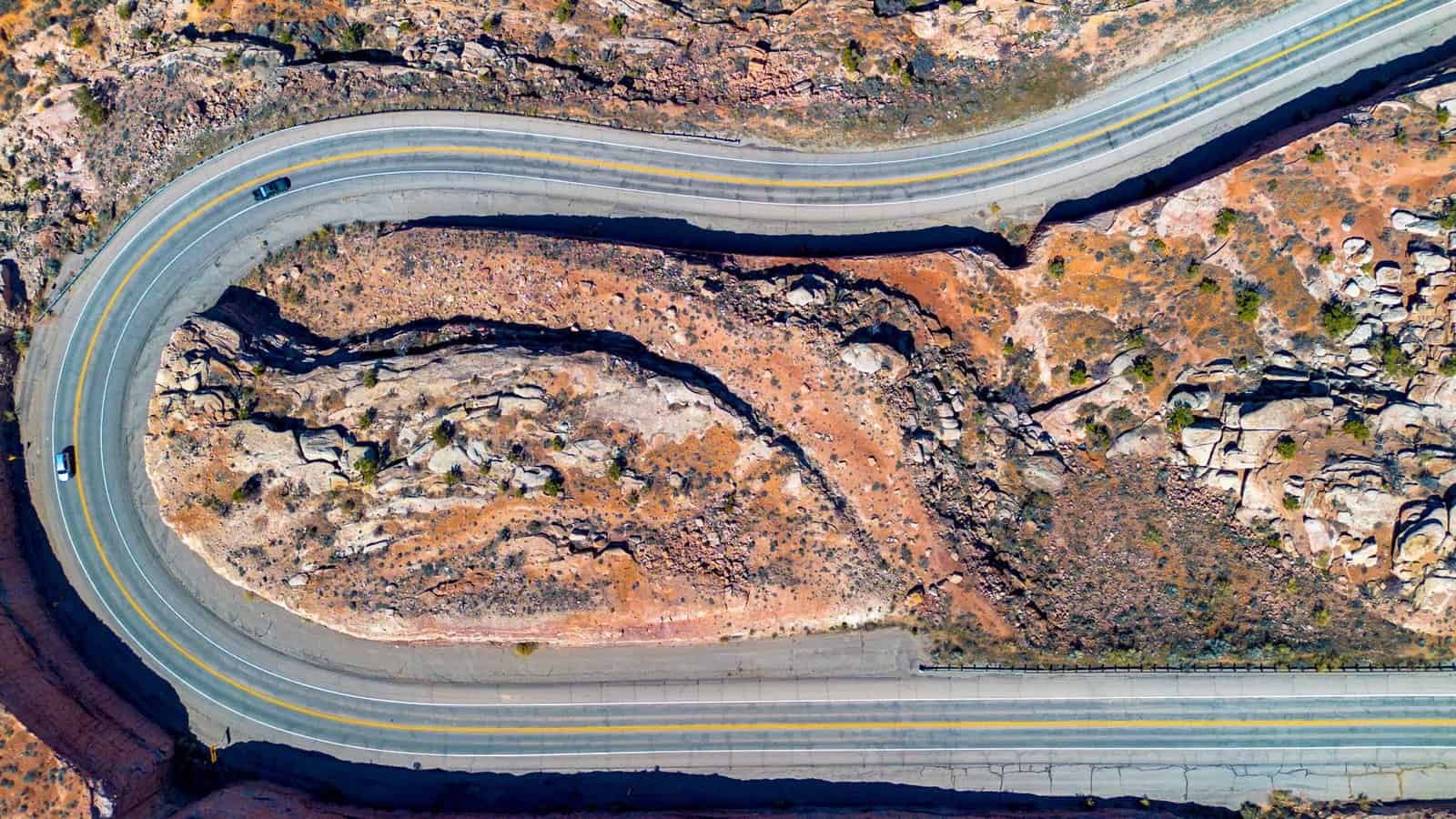
The Hogback sits north of the Lower Calf Creek Falls trailhead and south of Boulder. Coming from Escalante, the road winds through slickrock country, dips into the Escalante River canyon, and then climbs. As it gains the ridge, the land on both sides drops away, and suddenly you are driving along the spine of a sandstone fin.
The road itself
The Hogback is paved, two lanes wide, and maintained by the Utah Department of Transportation. Lanes are standard width, but shoulders are narrow or missing in places. Guardrails exist on some sections but not all. The road curves and rises along the ridge, so you often cannot see far ahead.
The feeling
For many drivers, the Hogback’s exposure is the most striking part. When you look to the side, you see steep slopes and cliffs plunging toward canyons. Some drivers describe a sense of vertigo. Passengers usually have a better view than drivers, who should keep their eyes on the road.
The best way to describe it is intense but manageable. The road does not require special skills in good conditions, but it does demand attention and a slow, steady pace.
Speed and traffic
Drive at or below the posted speed limit, and slow down for curves. Watch for oncoming traffic, including RVs, trucks, and trailers, which take up more of the lane. Do not cross the center line, and do not stop on the ridge except in designated pullouts.
If a car is following closely, let it pass when it is safe, using a pullout. Do not let other drivers pressure you into going faster than you are comfortable with.
Wind
The Hogback is exposed to wind, which can be strong at times. Gusts can push high-profile vehicles like RVs and vans. Hold the wheel firmly and slow down on windy days.
Winter conditions
In winter, the Hogback can be icy or snowy, especially after storms. The ridge’s exposure means it can be windier and icier than nearby stretches. Check road conditions with UDOT before you drive, and avoid the Hogback during storms or if ice is reported. If you are uncomfortable, wait for conditions to improve.
Tips for driving the Hogback
- Drive in daylight. You will see the road and its edges better, and you will enjoy the views.
- Keep your eyes on the road. Let passengers take in the views.
- Use pullouts. There are a few pullouts near the Hogback where you can stop safely for photos.
- Do not tailgate. Leave space between you and the car ahead.
- Watch for cyclists. Highway 12 is popular with cyclists, who may be on the road.
- Check your vehicle. Make sure brakes, tires, and fuel are in good shape. Services are limited along the byway.
Driving it in each direction
Many travelers say the Hogback feels different depending on direction:
- Escalante to Boulder (northbound): You climb onto the ridge after the Calf Creek area, with views ahead toward Boulder Mountain.
- Boulder to Escalante (southbound): You descend off the ridge toward the Calf Creek canyon and Escalante River.
Either way, the exposed stretch is short, but it is the part people remember.
Calf Creek Falls
Two hikes near the Hogback are among the best on the byway:
- Lower Calf Creek Falls: The trailhead is south of the Hogback, with paved parking and restrooms. Salt Lake Magazine describes the hike as about six miles round trip and relatively flat, leading to a 126-foot waterfall pouring into a blue-green pool.
- Upper Calf Creek Falls: The trailhead is north of the Hogback. The route is shorter, about two miles round trip, but includes a steep slickrock descent. It leads to pools and a waterfall.
Both hikes are in Grand Staircase-Escalante National Monument. Bring water, and check conditions in summer heat or winter ice.
Boulder and Escalante
The Hogback links two small towns that make good bases:
- Escalante: A small town with lodging, restaurants, and outfitters, and access to Escalante Petrified Forest State Park and slot canyons.
- Boulder: A tiny town at the base of Boulder Mountain, known as one of the last communities in the continental United States to get mail by mule, until the 1940s. Boulder has a small number of restaurants and lodges, some seasonal. Anasazi State Park Museum, with an ancestral Puebloan village site, is in town.
North of Boulder, Highway 12 climbs over Boulder Mountain toward Torrey and Capitol Reef National Park.
Other highlights of Scenic Byway 12
Scenic Byway 12 runs about 123 miles between U.S. 89 near Panguitch and State Route 24 near Torrey. Along the way, it passes:
- Red Canyon: Red rock formations and tunnels near the byway’s western end.
- Bryce Canyon National Park: Just off the byway.
- Kodachrome Basin State Park: Colorful sandstone spires.
- Grand Staircase-Escalante National Monument: Vast canyon country.
- Head of the Rocks Overlook: A sweeping view of slickrock country east of Escalante.
- Boulder Mountain: Forested high country with views of Capitol Reef.
Is the Hogback dangerous?
In good weather, at sensible speeds, the Hogback is a well-maintained road that thousands of drivers travel without incident. The danger comes from speeding, distraction, bad weather, and stopping in unsafe places. Nervous drivers can take comfort that the exposed stretch is short, the road is paved, and you can drive it as slowly as you need.
If you have a strong fear of heights, consider letting another driver take the wheel or driving it in the direction that feels better to you.
A sample day on Highway 12
Start in Escalante in the morning and drive east past Head of the Rocks Overlook. Hike Lower Calf Creek Falls, then drive the Hogback toward Boulder. Have lunch in Boulder and visit Anasazi State Park Museum. In the afternoon, drive over Boulder Mountain toward Torrey, stopping at viewpoints.
How the Hogback compares with other scary roads
Drivers sometimes compare the Hogback with other famous Western roads, such as Colorado’s Million Dollar Highway or the switchbacks of the Moki Dugway in Utah. The Hogback is different in a few ways. It is paved, not gravel, and it does not have hairpin switchbacks. Its exposure is unusual because the drop-offs are on both sides at once, rather than on just one. And the most exposed part is short, so the intense feeling passes quickly.
For many drivers, that makes the Hogback more manageable than its reputation suggests. It is a road that looks dramatic in photos and feels dramatic in person, but it does not require special driving skills in good weather.
Driving the Hogback at different times of day
Morning and late-afternoon light are often best for views and photos, with long shadows across the slickrock and canyons. Midday light can be harsh, but traffic tends to be steady throughout the day in busy seasons. Avoid driving the Hogback after dark if you have not driven it before. Without light, the drop-offs are invisible, and wildlife such as deer can appear suddenly on the road.
Cyclists and the Hogback
Highway 12 attracts road cyclists, and some ride the Hogback. When passing cyclists on the ridge, slow down, give as much room as you safely can, and wait for a clear stretch with good visibility before passing. Cyclists should ride predictably, wear bright clothing, and be aware that narrow shoulders leave little room for error.
Fuel and services
Fill up in Escalante or Torrey before the drive. Services in Boulder are limited, especially in winter, and stations can keep short hours.
The bottom line
Utah’s Highway 12 really does run along a narrow ridge with drop-offs on both sides at the Hogback, between Escalante and Boulder. Driving it is intense but manageable: the road is paved and well maintained, but shoulders are narrow, guardrails are limited, and the drops are steep. Drive slowly, keep your eyes on the road, avoid it in ice and storms, and use pullouts for photos. It is one of the most memorable stretches of road in the West.