The Palouse in Washington State Might Be the Most Photographed Farmland in America. Almost Nobody Can Say Where It Is.
We may earn money or products from the companies mentioned in this post. This means if you click on the link and purchase the item, I will receive a small commission at no extra cost to you ... you're just helping re-supply our family's travel fund.
The rolling wheat hills of the Palouse, spanning southeastern Washington and parts of northern Idaho, have become one of the most reproduced agricultural landscapes in photography, appearing in calendars, screensavers, and photography competitions for decades, yet surveys of the images circulating online consistently show that a substantial share of people who share them have no idea the region is called the Palouse or where, specifically, it sits on a map of the Pacific Northwest they might otherwise think they know reasonably well.
What Actually Created the Landscape
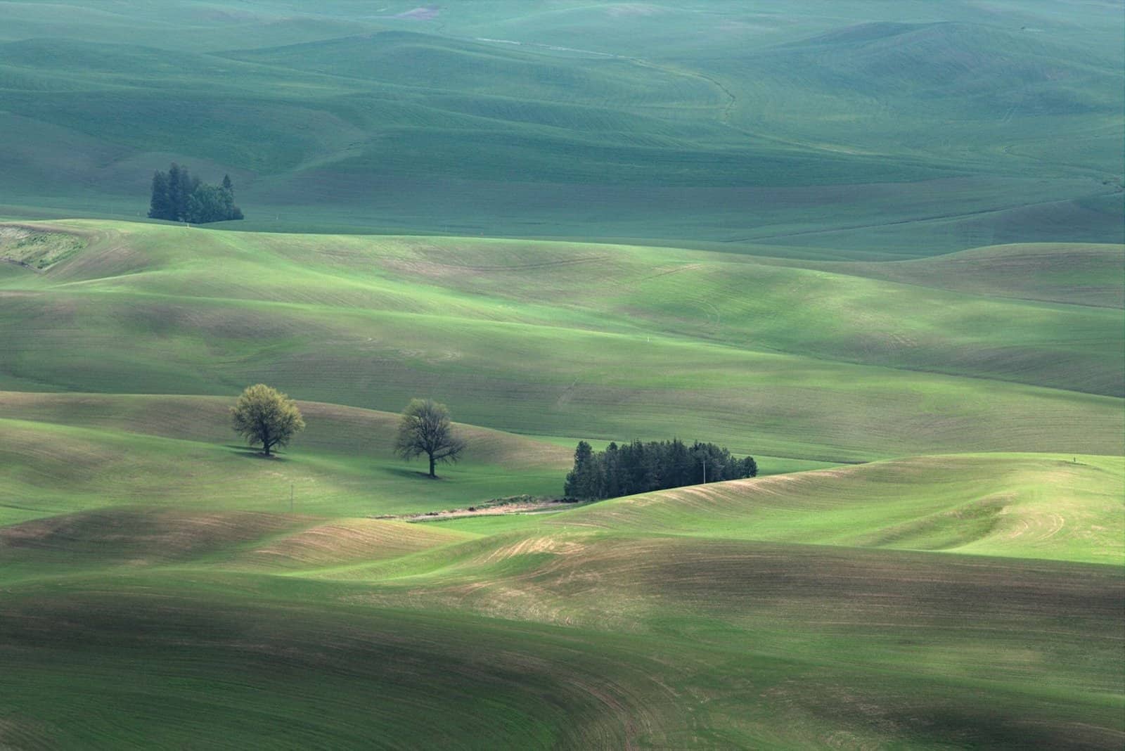
The Palouse’s distinctive rolling hills formed from wind-deposited loess soil, some of the most fertile agricultural soil found anywhere in the world, built up over tens of thousands of years as glacial-era winds carried fine silt across the region and deposited it in the dune-like formations still clearly visible today from Steptoe Butte, the highest point in the immediate area and the preferred vantage point for most of the widely circulated photographs that made the region famous without a name attached.
Pullman, Washington, home to Washington State University, and Moscow, Idaho, home to the University of Idaho, sit just eight miles apart in the middle of the Palouse, an unusual arrangement of two major public research universities from two different states sharing essentially one combined college-town economy in the middle of wheat and lentil country that otherwise has very little urban infrastructure of any kind for a hundred miles in most directions.
Why the Region Stays So Unfamiliar to Outsiders
The Practical Reasons It Never Became a Destination
- The nearest major airport with significant commercial service sits well over an hour away in Spokane
- The region has almost no large-scale tourism infrastructure built specifically around the wheat hills themselves
- Steptoe Butte State Park, the main photography viewpoint, has minimal signage and no formal visitor center
- Wheat, barley, and lentil farming remain the dominant economic activity, not tourism of any kind
Local farmers, many representing multi-generational operations that have worked the same acreage for well over a century, have generally welcomed the trickle of photographers and tourists without particularly courting them, since the region’s actual economic engine, wheat, barley, and lentil production across some of the most productive dryland farming acreage in the entire country, doesn’t depend on visitor spending the way most scenic American landscapes with comparable name recognition typically do.
That indifference to tourism development has, somewhat paradoxically, preserved exactly what makes the Palouse so photogenic in the first place: a genuinely working agricultural landscape with no gift shops, no paved overlooks beyond Steptoe Butte’s modest gravel access road, and no attempt whatsoever to package the scenery into an easily consumable visitor experience, leaving it looking essentially the way it has for most of a century of continuous, unbroken cultivation by the same farming families.
What a Visit There Actually Requires
Travelers who do make the deliberate trip, rather than simply reposting someone else’s photo, typically drive through on the way between Seattle and Spokane or as a detour from a larger Pacific Northwest road trip, timing their visit for late June through early August when the wheat has turned gold and the light at Steptoe Butte during the hour before sunset produces the specific combination of shadow and color that made the region an accidental photography landmark in the first place.
Local tourism officials in Whitman County have occasionally discussed building out more formal infrastructure around the photography traffic, but most proposals have stalled, partly due to limited local tax base and partly due to a genuine ambivalence among residents about whether turning the wheat hills into a formal attraction would ultimately preserve or undermine the working landscape that makes them worth photographing at all.
What This Means Going Forward
The broader pattern here reflects something researchers and local officials increasingly track closely: the gap between how a place or trend is perceived from the outside and how it actually functions day to day for the people living inside it or making decisions about it. That gap rarely closes on its own, and it tends to widen further whenever outside attention, whether from tourism, media coverage, or social platforms, arrives faster than the underlying infrastructure or community capacity can absorb it.
What tends to happen next depends heavily on decisions made by the people closest to the situation, whether that means local governments, longtime residents, or the businesses that have to adapt fastest, and those decisions rarely get the same national attention as the initial trend or story that put the place on the map in the first place, even though they matter considerably more to how things actually turn out over the following decade.
The Longer-Term Trajectory
Longtime observers of this pattern note that the early years after a place or trend gains attention are rarely the ones that determine its lasting character. The more decisive period tends to arrive several years later, once the initial wave of interest either sustains itself through genuine infrastructure investment or fades as attention moves elsewhere, leaving behind whatever changes already took root during the busier years.
That delayed reckoning is precisely why comparisons across a full decade, rather than a single before-and-after snapshot, tend to produce a more accurate picture of what actually changed and what merely appeared to change while the cameras and headlines were still pointed in that direction.
Why This Keeps Getting Overlooked
Part of the reason this dynamic receives less attention than it probably deserves is structural: the initial story, whether a viral moment, a policy change, or a shift in travel patterns, is simply more compelling to cover than the slower, less dramatic process of adjustment that follows it over subsequent years, which rarely fits into a single headline or a short video.
That mismatch between what gets covered and what actually matters most to the people living through the change is a recurring feature of how places, trends, and communities get discussed publicly, and it tends to leave a persistent gap between popular perception and the more complicated reality on the ground.