We may earn money or products from the companies mentioned in this post. This means if you click on the link and purchase the item, I will receive a small commission at no extra cost to you ... you're just helping re-supply our family's travel fund.
For all the talk about convenience and connectivity, large parts of the United States still feel almost off the grid. In these places, roads thin out, cell signals disappear, and rescue is measured in hours or days instead of minutes. Hikers, rafters, and bush pilots know that a twisted ankle or broken propeller can turn quickly into a serious situation. These wild pockets are mesmerizing, but they quietly remind anyone who enters that comfort depends on planning, judgment, and a bit of luck.
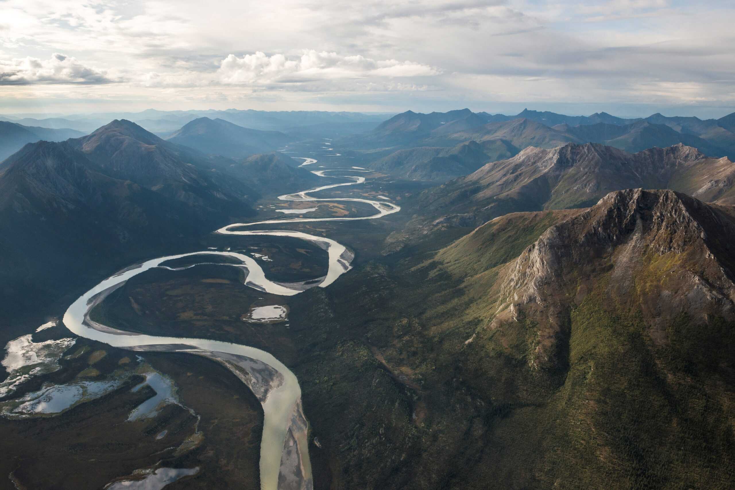
Gates Of The Arctic National Park, Alaska

In Alaska’s Brooks Range, Gates of the Arctic has no roads, official trails, or developed facilities at all. Access usually happens by bush plane or long overland approaches from the Dalton Highway, and once on the ground, visitors navigate trackless valleys and cold rivers on their own. Weather shifts fast, satellite devices are the only reliable lifeline, and a simple gear failure can leave a group days away from outside help.
Arctic National Wildlife Refuge, Alaska
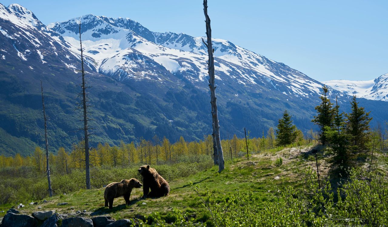
The Arctic National Wildlife Refuge stretches across nearly 20 million acres with no internal roads, marked trails, or visitor centers, only scattered villages on the edges. Most visitors charter small planes that land on gravel bars or tundra strips, then travel for days by raft or on foot. Flight delays from fog or wind can strand groups, and any medical emergency competes with distance, weather, and limited aviation resources long before a hospital enters the picture.
Wrangell St. Elias National Park Backcountry, Alaska
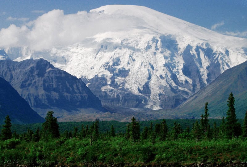
America’s largest national park rises from tidewater to 18,000-foot peaks, stitched with glaciers, crevasses, and abandoned mining roads that fade into raw ice and rock. A few gravel roads reach small pockets, but much of Wrangell–St. Elias still requires bush flights and glacier landings just to begin a trip. Once dropped off, parties live completely on what they brought, knowing that storms, swollen rivers, or aircraft availability can push any rescue well beyond a single long day.
Frank Church River Of No Return Wilderness, Idaho
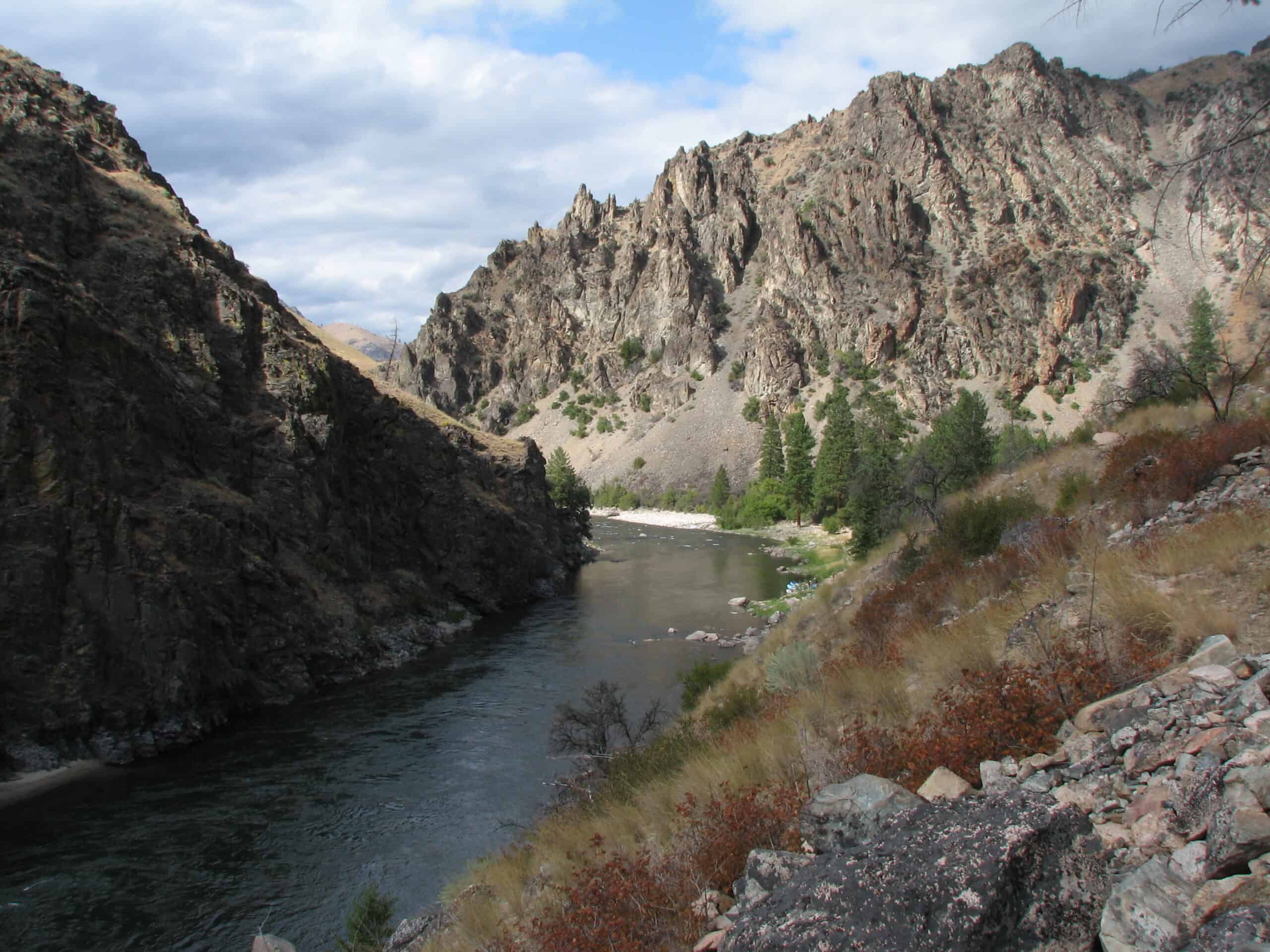
In central Idaho, the Frank Church–River of No Return Wilderness forms the largest contiguous wilderness unit in the lower 48, with 2.3 million acres of steep ridges and deep canyons. Jetboats and small planes still slip through a few corridors, but most of the terrain remains trail-thin and roadless. Rafters, hunters, and backpackers accept that injury or equipment failure along the Salmon River or its side canyons often means long waits, improvised camps, and limited communication before help arrives.
The Maze District, Canyonlands National Park, Utah
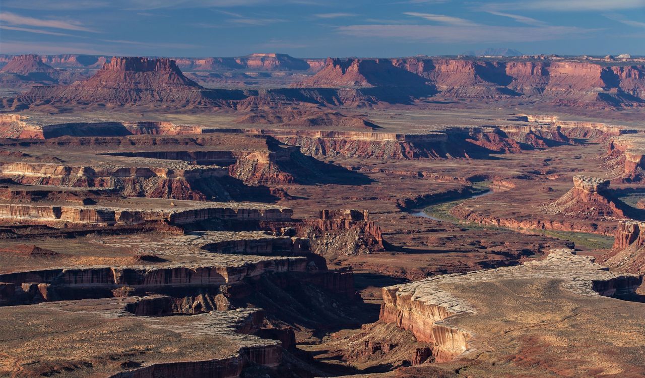
The Maze is repeatedly described as the most remote, least accessible corner of Canyonlands, with rough four-wheel-drive tracks, steep switchbacks, and scarce water sources. Navigation weaves through sandstone fins and canyons that look unnervingly similar, making it easy to misjudge distances or miss critical springs. National Park Service guidance explicitly warns visitors to be fully self-sufficient and prepared for self-rescue, because a simple wrong turn or broken axle can turn time in the desert into an extended survival problem.
Big Bend Desert Backcountry, Texas
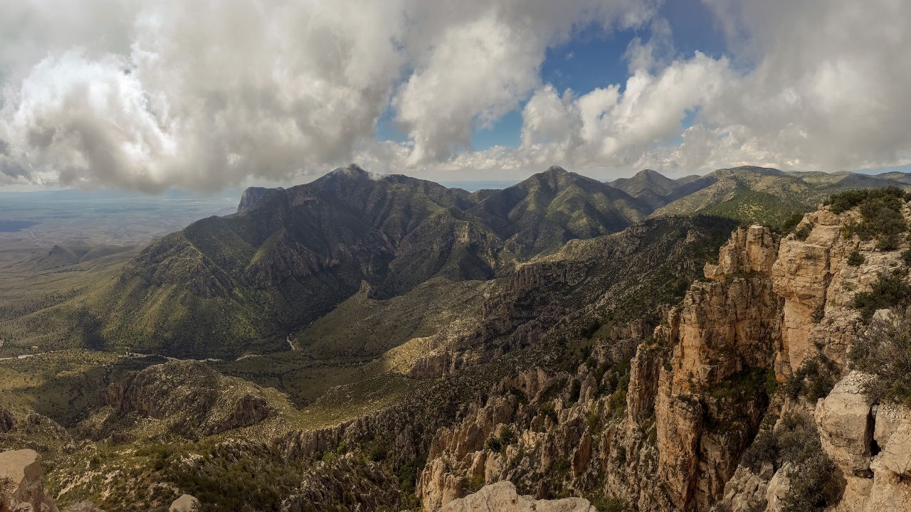
Big Bend sits far from major cities, with limited fuel, services, and medical facilities even before anyone leaves pavement. Official backcountry guidance stresses that desert zones demand detailed itineraries, self-sufficiency, and strong backpacking skills. Heat, flash floods, and vast, empty basins mean that a lost trail or dry water cache can quickly become dangerous. Rangers and local hospitals exist, but distance and rough roads create long gaps between an accident and hands-on medical care.
Death Valley Backcountry Roads, California Nevada
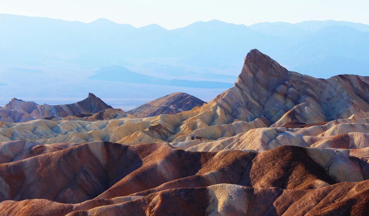
Away from the popular overlooks, Death Valley’s backcountry roads cut into canyons and basins with no cell reception and few other vehicles in sight. Park documents warn that most areas lack signage, water, and any form of reliable communication, and that towing on remote dirt roads is extremely expensive. A simple mechanical failure can leave travelers sitting in brutal heat, counting supplies, and hoping another truck appears before dehydration turns serious.
Lost Coast Trail, King Range, California
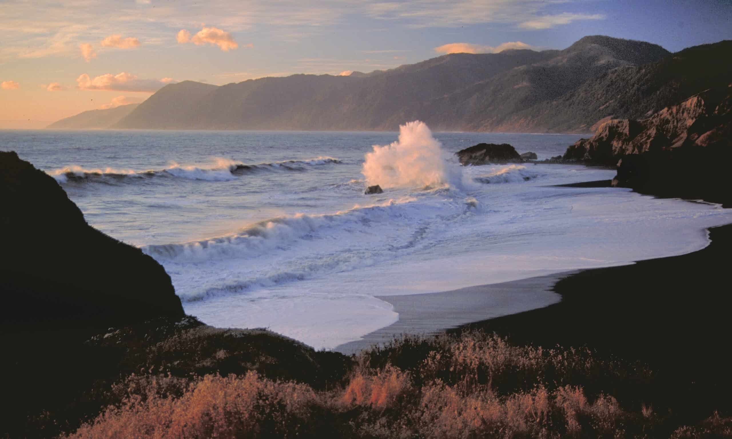
Along northern California’s Lost Coast, cliffs forced Highway 1 inland, leaving a 25-mile stretch of surf, tide, and fog with no road paralleling the shore. Backpackers must time sections around high tides that can pin them against bluffs, and rescue operations require helicopters or complex coastal responses. Recent incidents have shown how a single slip on wet rock can trigger multi-agency rescues, with limited local resources and long delays even when help finally appears over the waves.
Pasayten Wilderness, Washington

On the Canadian border, the Pasayten Wilderness offers hundreds of miles of rugged trails and off-trail routes, with some stretches of long-distance paths running 150 miles between easy resupply points. Fires, storms, and eroded paths regularly reshape the landscape, making maps feel more like suggestions than guarantees. Backpackers who roll an ankle or lose their way may face days of slow progress toward the nearest trailhead, with only occasional glimpses of other hikers and no quick exit.