Oklahoma Had a National Park Until 1976. Here’s What Happened to It
We may earn money or products from the companies mentioned in this post. This means if you click on the link and purchase the item, I will receive a small commission at no extra cost to you ... you're just helping re-supply our family's travel fund.
Oklahoma had a national park until 1976. It was called Platt National Park, it sat on the edge of the small town of Sulphur in south-central Oklahoma, and it was one of the oldest and smallest national parks in the country. Today the same land is part of Chickasaw National Recreation Area, and most people driving past have no idea it once shared a title with Yellowstone and Yosemite.
Here is what happened. On March 17, 1976, Congress combined Platt National Park with the neighboring Arbuckle Recreation Area and additional land, abolished Platt as a separate park, and renamed the whole unit Chickasaw National Recreation Area. The park did not close, shrink, or lose its protections. It got bigger and changed its name and category. The springs, creeks, swimming holes, and 1930s stonework that made Platt famous are still there and still free to visit.
The story behind that change, and what the original park protected, says a lot about how the National Park System grew and how the Chickasaw Nation fits into it.
Here’s What Happened to It
The park began on July 1, 1902, as the Sulphur Springs Reservation, created to protect 32 freshwater and mineral springs in what was then the Chickasaw Nation in Indian Territory. The Chickasaw, who had been forcibly relocated from the Southeast in the 1830s, sold the original 640 acres to the federal government. Settlers and tribal members had long valued the springs, believing the mineral water had healing properties.
On June 29, 1906, Congress redesignated the reservation as Platt National Park, named for Orville H. Platt, a Connecticut senator who had introduced the legislation creating the reservation and had died the year before. It became the seventh national park in the United States and the smallest. For decades, it was Oklahoma’s only national park.
By the 1960s and 1970s, the National Park Service and Congress had begun to define national parks more strictly, favoring large landscapes of national significance. Platt, a small park built around springs and recreation, did not fit that model neatly. Meanwhile, the Bureau of Reclamation built Lake of the Arbuckles nearby in 1966, and the Arbuckle Recreation Area was created around it.
In 1976, Congress merged the two areas, added land, and created Chickasaw National Recreation Area, named to honor the Chickasaw Nation. Platt National Park was abolished as a separate unit. The new recreation area now covers just under 10,000 acres, most of it occupied by Lake of the Arbuckles and the prairie and woodland around it. Gateway Arch National Park later took Platt’s place as the smallest national park.
Why Platt Was So Popular
It is hard to imagine now, but Platt National Park once drew huge crowds. Records cited by historians show that in 1914, Platt had more visitors than either Yellowstone or Yosemite. That makes sense when you consider how people traveled at the time. Sulphur was reachable by train from much of Oklahoma and Texas, and families came to drink the mineral water, picnic by the creeks, and swim in cool spring-fed pools during hot summers.
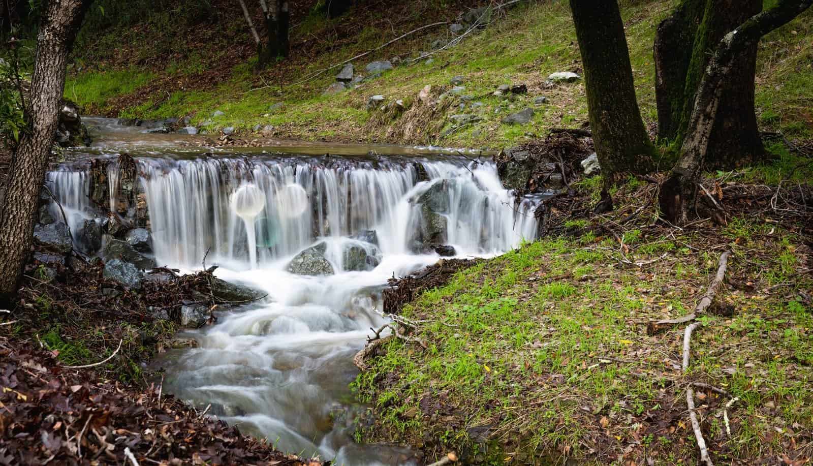
The springs produce about 5 million gallons of cool, clear water a day. Some, like Bromide Spring and Pavilion Springs, carried strong mineral flavors that visitors believed cured ailments. Others, like Antelope and Buffalo springs, feed Travertine Creek, which tumbles over small travertine falls into swimming holes.
The CCC Stonework You Can Still See
The Civilian Conservation Corps worked in the park from 1933 to 1940, and its legacy shapes the place today. Crews built stone pavilions over the springs, bridges, trails, campgrounds, and a bison pasture, using native limestone and a rustic style that blends into the landscape. The CCC-era built environment was designated a National Historic Landmark in 2011.
One of the most photographed structures is older. The Lincoln Bridge, a limestone bridge built in 1909 to mark the 100th anniversary of Abraham Lincoln’s birth, was featured on a U.S. quarter in 2011 as part of the America the Beautiful series. Walking the Travertine District today, you pass pavilions, stone walls, and footbridges that look much as they did when the CCC finished them.
What to See in the Travertine District
The original Platt area, now called the Travertine District, runs about three miles along Travertine Creek and is less than a mile wide. It is the part of the recreation area that feels most like the old national park.
- Travertine Creek: clear water flowing over limestone ledges and small falls, with swimming holes popular in summer.
- Little Niagara: a broad, low waterfall and swimming area on Travertine Creek, one of the park’s classic spots.
- Antelope and Buffalo springs: the sources of Travertine Creek at the east end of the district, reachable by trail.
- Pavilion and Bromide springs: historic mineral springs with CCC-built shelters.
- The Travertine Nature Center: exhibits on the area’s plants, animals, and geology.
- Lincoln Bridge: the 1909 limestone bridge near the park’s entrance from Sulphur.
- Walking and biking trails along the creek bottomland.
Lake of the Arbuckles and the Rest of the Recreation Area
Most of today’s acreage surrounds Lake of the Arbuckles, a reservoir of about 2,350 acres with 36 miles of shoreline. It supplies water to Ardmore, about 30 miles southwest, and it is known for clear water and good bass fishing. The lake has campgrounds, boat ramps, picnic areas, and trails.
Veterans Lake, a small 67-acre lake near Sulphur, was traded to the recreation area by the city in 1983 and has a paved trail around its shore and fishing docks. Together, the lakes and the Travertine District give the recreation area a mix of quiet nature walks and water recreation that the original national park could not offer on its own.
Wildlife and Nature in the Old Park
The Travertine District sits where the eastern forests meet the southern plains, so plants and animals from both regions overlap. Look for white-tailed deer along the creek, armadillos in the leaf litter, and a long list of birds, including pileated woodpeckers and, in winter, waterfowl on the lakes. The park has kept a small bison herd in a pasture near the Travertine District in years past, a nod to the CCC-era bison enclosure. Ask at the nature center what you are likely to see during your visit.
Why Chickasaw National Recreation Area Is Free
Unlike many national park units, Chickasaw National Recreation Area does not charge an entrance fee. That traces back to the original agreement under which the Chickasaw transferred the springs to the federal government. Some campgrounds and activities do charge fees.
It also explains the name. The 1976 legislation honored the Chickasaw Nation, whose land the springs were on. The Chickasaw Nation is headquartered nearby in Ada and runs the Chickasaw Cultural Center just outside Sulphur, a large campus with exhibits, a traditional village, and programs on Chickasaw history and culture. Visiting both in the same trip adds depth to the story.
Storm Damage and Recovery
In April 2024, a tornado struck Sulphur and caused heavy damage in parts of the recreation area, from Lake of the Arbuckles into the Travertine District. The park has worked on cleanup and repairs since then. Before you visit, check the park’s alerts for closed trails, campgrounds, or roads, since conditions in some areas may still be changing.
When to Visit
Summer is the busiest season, when families come to swim in Travertine Creek and boat on Lake of the Arbuckles. Late fall and winter are much quieter. The creek stays clear year-round, trails are cooler, and the oaks and other hardwoods in the creek bottoms take on fall color in late October and November.
- Spring: wildflowers, flowing creeks, and mild weather.
- Summer: swimming and boating, with the biggest crowds.
- Fall: color in the woods, cooler hiking, and fewer people.
- Winter: quiet trails, with occasional cold snaps and ice.
Getting There
Sulphur is about 90 minutes south of Oklahoma City and about two hours north of Dallas-Fort Worth via Interstate 35. Take the exit for Highway 7 and head east toward Sulphur. The Travertine District begins on the southern edge of town.
Where to Stay
The recreation area has several campgrounds, including sites near the Travertine District and around Lake of the Arbuckles. Sulphur has small motels, inns, and the Artesian Hotel, a resort that revives the town’s mineral-spa history. Davis and Ardmore, nearby, have more chain options.
A Day in the Old National Park
- Morning: start at the Travertine Nature Center for exhibits and trail maps.
- Late morning: walk the creekside trail to Antelope and Buffalo springs.
- Midday: picnic near Little Niagara.
- Afternoon: tour the CCC pavilions at the mineral springs and cross the Lincoln Bridge.
- Late afternoon: visit the Chickasaw Cultural Center, or drive to Lake of the Arbuckles for sunset.
The Bottom Line
Platt National Park did not disappear in 1976. It was absorbed into a larger, renamed park that still protects the same springs, creeks, and historic stonework. Oklahoma lost the title of “national park,” but it kept the place. Visit the Travertine District, drink in the history, and see the park that once outdrew Yellowstone.