These Roads Have Killed People. Here’s What You Need to Know Before You Drive Them
We may earn money or products from the companies mentioned in this post. This means if you click on the link and purchase the item, I will receive a small commission at no extra cost to you ... you're just helping re-supply our family's travel fund.
Every road trip has stretches that require your full attention. Every state has at least one stretch that requires more than that.
Knowing where these roads are — and understanding why they’re dangerous — is not meant to scare you off. Most of these roads are scenic, important, and perfectly safe when driven correctly. The people who get into trouble are almost always the people who didn’t know what they were getting into.
This is what you need to know before you drive them.
Why Road Danger Is More Predictable Than You Think
Road fatality data is public and specific. Most dangerous stretches have identifiable causes:
Speed differential
— When some drivers go 80 and others go 60 on the same road, the gap creates accidents. This is the leading cause of freeway fatalities in most states.Wildlife crossings
— Deer, elk, moose, and even bears crossing at dawn and dusk cause thousands of accidents annually in rural states. Most are avoidable with awareness.Weather transitions
— Mountain passes where weather changes rapidly, fog zones on coastal routes, and plains stretches where crosswinds hit without warning account for a significant portion of accidents on scenic routes.Driver distraction and fatigue
— Long, straight, featureless stretches (Great Plains, Nevada desert) induce a hypnotic state called highway hypnosis that causes lane drifting and reduced reaction time.Lack of guardrails on mountain roads
— Many of America’s most scenic drives were built in the 1920s–1940s with no guardrails on precipitous drops. These roads remain exactly as they were built.
The Northeast and Mid-Atlantic’s Most Treacherous Routes
Maine — U.S. Route 1 through the fog coast
— The primary coastal route experiences dense sea fog that can drop visibility to under 100 feet with no warning. Locals know to slow dramatically. Tourists accustomed to highway speeds do not. Dawn and late evening are the highest-risk windows.Vermont — Route 108 through Smugglers Notch
— A narrow mountain pass with a maximum vehicle width of 10 feet and a height restriction of 10’2″. Closed to RVs, buses, and commercial vehicles. The hairpin turns with zero guardrails above 100-foot drops have claimed cars whose drivers underestimated the pass. Absolutely beautiful. Absolutely serious.New Hampshire — Route 302 through Crawford Notch
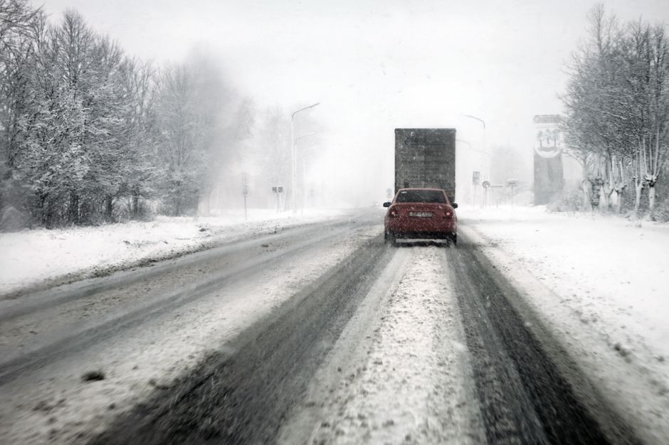
— The Presidential Range creates its own weather systems. Conditions on Route 302 can go from clear to whiteout in under 15 minutes at any time of year, including July. Mount Washington has recorded the highest wind speed ever measured on the earth’s surface (231 mph) and its weather patterns extend to roads around it.New York — I-87 (New York State Thruway) in winter
— Lake-effect snow from Lake Ontario dumps enormous snow totals on the highway between Syracuse and Albany with almost no warning. The flat terrain gives drivers no visual cues that conditions are about to become dangerous. Watch the NYSDOT road conditions site before any winter drive.Pennsylvania — I-76 (Pennsylvania Turnpike) through the Alleghenies
— Steep grades through mountain tunnels create fog traps that reduce visibility to near zero. Commercial truck traffic is heavy. The Allegheny and Kittatinny tunnels are particularly prone to sudden fog. Always use headlights regardless of conditions.Maryland — U.S. 340 through Harpers Ferry
— A river road through a mountain gap where West Virginia, Virginia, and Maryland meet. The combination of sharp curves, heavy commuter traffic, and seasonal fog from the Shenandoah and Potomac rivers makes this a consistently high-accident corridor.
The South’s Most Notorious Stretches
Florida — I-4 (Orlando corridor)
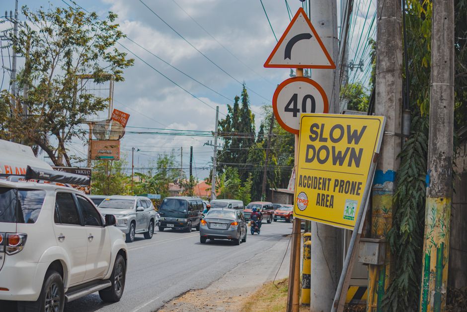
— Consistently rated the deadliest interstate per mile in the United States. The combination of heavy tourist traffic unfamiliar with the road, massive construction projects, and Florida’s culture of extremely fast driving creates a permanently dangerous condition. The I-4 corridor between Tampa and Daytona Beach has averaged over 1.3 deaths per mile in recent years. Stay right, match traffic speed, and leave more following distance than feels necessary.Texas — I-35 through Austin
— The most congested single interstate in America passes through the middle of the fastest-growing city in the country. 300,000 vehicles per day. Constant construction. Drivers doing 80 mph next to drivers doing 45 mph in a merge zone. The Austin stretch of I-35 records thousands of accidents annually. Give maximum following distance and avoid rush hour.Louisiana — I-10 over the Atchafalaya Basin
— An 18-mile twin bridge over the swamp between Baton Rouge and Lafayette. The longest bridge over water in America. Frequently foggy. Crosswind advisories during storm systems. The concrete barrier between opposing lanes leaves zero room for error.Tennessee — I-24 through Monteagle Mountain
— The descent from the Cumberland Plateau into the Chattanooga valley has a 6% grade for 5 miles that has produced some of the most dramatic runaway-truck accidents in American highway history. Truck runaway ramps are placed throughout. Cars descending on wet roads should use a lower gear.Georgia — I-285 (the Perimeter around Atlanta)
— Locals call it “the Perimeter” and drive it like a NASCAR qualifier. The interchange at I-85 and I-285 is called Spaghetti Junction and is one of the most complex highway interchanges in the country. GPS needs to be set before you enter it, not during.North Carolina — NC 181 through Linville Gorge
— A two-lane mountain road with 15% grades, blind curves, and a 2,000-foot drop into the gorge on one side. Absolutely no guardrails on significant sections. Extraordinarily beautiful. Requires full attention and a lower gear on descent.West Virginia — Route 60 through the New River Gorge
— The Midland Trail winds along the New River through narrow gorge sections where the road is barely wider than two cars. The river floods the road seasonally and the signs warning of this are not exaggerating.
The Midwest’s Deadliest Highways

Nebraska and Wyoming — I-80 in winter
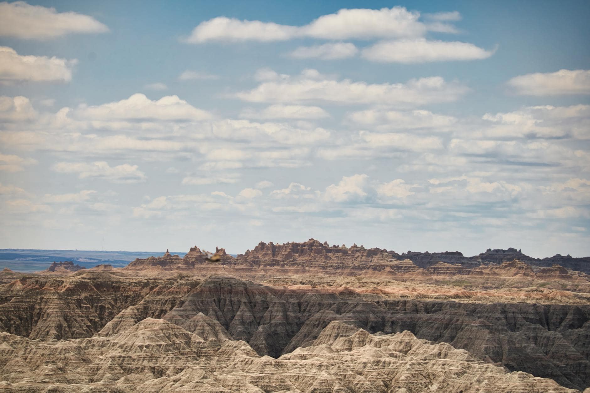
— The central route across the Great Plains is completely exposed to Arctic blasts that can drop temperatures to -40°F with 60 mph crosswinds and zero visibility blizzards. Wyoming’s Department of Transportation closes I-80 more than any other interstate in the country. Never drive this route in winter without checking road conditions first and carrying a winter emergency kit.South Dakota — I-90 between Rapid City and the Badlands
— The combination of fog from temperature inversions, winter whiteout conditions, and enormous wildlife (bison and pronghorn cross the interstate regularly) makes this stretch require constant vigilance. The bison can weigh over a ton and appear on the road with essentially no warning.Minnesota — U.S. 2 across the Iron Range
— Two-lane highway through the northern Minnesota forest with heavy logging truck traffic, moose crossings at dawn and dusk, and winter conditions that can be severe with little notice. Moose are particularly dangerous because they are tall enough that a collision takes out your windshield rather than your bumper.Kansas — U.S. 83 during severe weather season
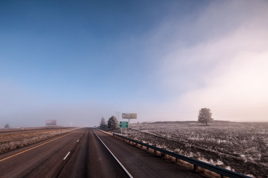
— The Great Plains are beautiful and flat and completely exposed. Tornado season (April through June) makes U.S. 83 through the state a road that requires a weather radar app open and working. The terrain gives zero shelter from approaching storms but also zero concealment — you can see a tornado from 20 miles. The key is knowing when to pull off and shelter versus when to drive perpendicular to the storm’s path.
The Mountain West: Where Altitude Makes Everything Harder

Colorado — US 550 (Million Dollar Highway)
— The 25-mile stretch between Ouray and Silverton is one of the most scenic drives in America and one of the most legitimately terrifying. No guardrails on outside lanes above 1,000-foot drops. Carved from cliff faces in the 1920s. The road is too narrow to have placed guardrails when built and has never been retrofitted. Drive slowly. Do not hug the center line on curves. Accept that other drivers may do exactly that.Montana — U.S. 2 east of Glacier
— Open plains driving with sudden extreme crosswinds as you exit the mountain shadow, frequent whiteouts in winter, and elk and deer crossings throughout. The absence of any visual drama on this stretch causes exactly the kind of inattention that leads to accidents.Nevada — U.S. 95 through the desert
— Extremely long, straight, featureless highway through the Nevada desert inducing highway hypnosis. Two-lane with few passing zones. Commercial truck traffic. Extreme heat in summer causes tire failures more frequently than any other state. Stop every 90 minutes minimum, check tire pressure in the morning before the heat builds, and carry extra water.Utah — Utah 12 over the Hogback
— Listed in the road trip piece as one of the most scenic roads in the U.S. Also genuinely dangerous: a ridge road with no guardrails and drop-offs of hundreds of feet on both sides in a section just wide enough for two cars. Wind gusts above the ridge can push a vehicle laterally. Drive it during calm conditions only.Idaho — U.S. 12 through Lochsa Canyon
— 162 miles of wild river canyon road with no cell service, no services for 75 miles in stretches, and cliffs above and a Class IV river below. Beautiful beyond description. Check your fuel and tire condition before entering this stretch.Arizona — SR 89A through Oak Creek Canyon
— The descent from Flagstaff to Sedona involves 11 miles of hairpin switchbacks with a 2,000-foot elevation drop. RVs and trailers face weight restrictions. The road is frequently wet with runoff from the canyon walls and ices in winter. Going down requires engine braking, not extended brake use.
The Pacific States: Where Beauty and Danger Overlap
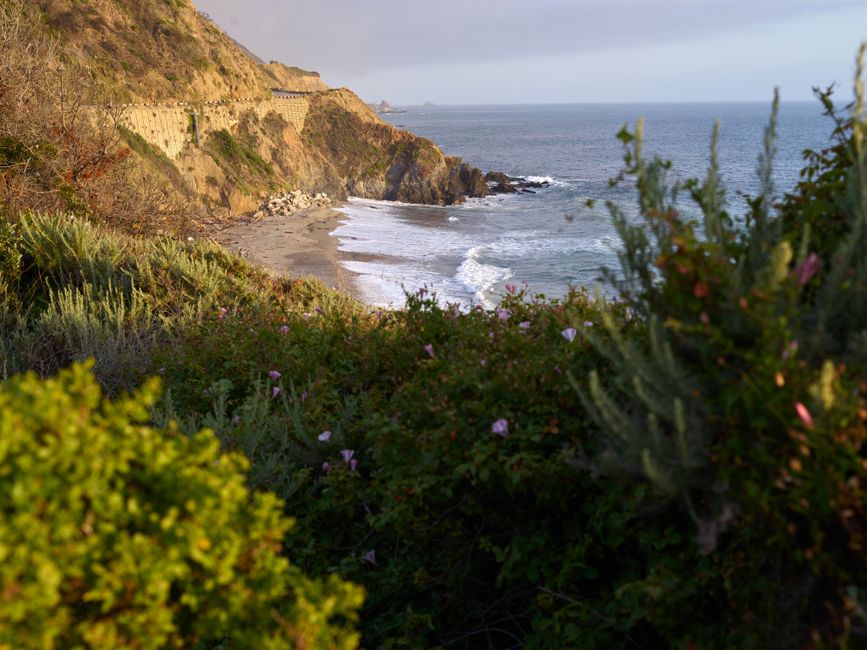
California — Pacific Coast Highway (SR 1) through Big Sur
— The most scenic drive in California is also one where mudslides close the road for months, where fog reduces visibility to 50 feet on the cliff-side sections, and where the narrow lanes leave no margin for a distracted driver. PCH through Big Sur requires full attention and checking CalTrans road conditions before you drive it (multiple sections have been closed for years due to landslides).Oregon — U.S. 101 in fog season
— Late spring and summer morning fog along the Oregon coast can be complete whiteout at road level. Locals know to use fog lights and halve their speed. Coastal pullouts have zero visibility in heavy fog. If you can’t see the painted centerline, pull off and wait 30 minutes.Washington — U.S. 2 over Stevens Pass
— A mountain highway through a snowbelt that receives over 400 inches of snow annually. Avalanche closures are common. The stretch between Index and Leavenworth on the east side is particularly prone to rockfall after rainstorms. Check WSDOT conditions before every winter drive.Alaska — The Dalton Highway
— 414 miles of gravel road to Prudhoe Bay, traversing the Brooks Range and the Arctic Slope. Commercial truck traffic has right-of-way. Cell service essentially nonexistent. One flat tire 200 miles from the nearest town can become a survival situation. Requires a specific type of preparedness that most travelers underestimate. Rent a vehicle with the right tires, carry two spare tires, bring a satellite communicator.
The Universal Rules for Driving Any Dangerous Road

These apply everywhere on this list.
- Check conditions before you go — WSDOT, CDOT, WYDOT, and CalTrans all have excellent real-time road condition apps and websites. Check them the morning you drive.
- Fuel up before entering any remote route — never enter a stretch without services on less than a half tank
- Tell someone your route and expected arrival time — on remote roads, this is the difference between being found in 4 hours and being found in 4 days
- On mountain descents, use engine braking (lower gear) rather than riding the brakes — overheated brakes fail completely
- Wildlife is most active from 30 minutes before sunset to 2 hours after sunset and again at dawn — reduce speed and scan both road edges during these windows
- If weather turns severe and you have any doubt, pull over and wait it out — no destination is worth a preventable accident
- Put the phone down completely — not on a mount, not for maps. If you need to check something, pull over first.
The roads that are most dangerous are often the most beautiful. Drive them slowly. Drive them attentively. Drive them having done your homework. Then drive them again.