We may earn money or products from the companies mentioned in this post. This means if you click on the link and purchase the item, I will receive a small commission at no extra cost to you ... you're just helping re-supply our family's travel fund.
Some places become famous for beauty, headlines, or bragging rights, and that fame can blur what makes them dangerous. In 2026, the deadliest travel mistakes are often not about thrill seeking at all. They come from treating heat, altitude, unstable geology, conflict zones, and fragile communities like ordinary destinations. The most sobering patterns are quiet ones: systems that fail, warning signs that get ignored, and landscapes that look calm right before they turn unforgiving. That is why caution now starts with respecting context, not chasing iconic names.
Darien Gap, Panama-Colombia

The Darien Gap still carries the kind of danger that does not show up on a postcard map. UNICEF reported more than 30,000 children crossing in the first four months of 2024 and warned the route had become a prolonged humanitarian crisis, while the U.N. human rights office described constant threats including sexual violence, trafficking, robbery, extortion, and disappearances. Even when crossings dropped sharply in early 2025, the route remained deadly because the worst risk often came from criminal control and abuse, not just jungle terrain, rivers, and isolation. For many migrants, the crossing is less a hike than a corridor of predation.
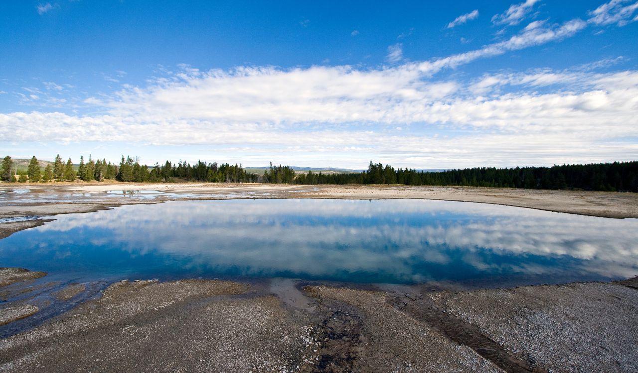
Death Valley National Park, United States
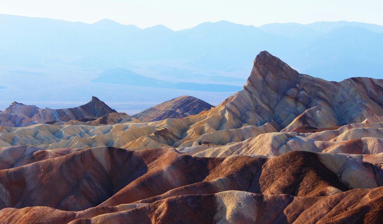
Death Valley feels familiar to many Americans, which is exactly why it gets underestimated. The National Park Service warns it is the hottest place in the world, with summer temperatures reaching 130°F and nights staying near 90°F, and it explicitly tells visitors not to hike lower elevations in hot weather because dehydration and heat illness can escalate fast. It also lists heat stroke signs such as confusion and disorientation, which captures the real danger here: a simple roadside stop can turn into a medical emergency before help arrives. The park’s own guidance reads like emergency medicine for a reason.
Danakil Depression, Ethiopia
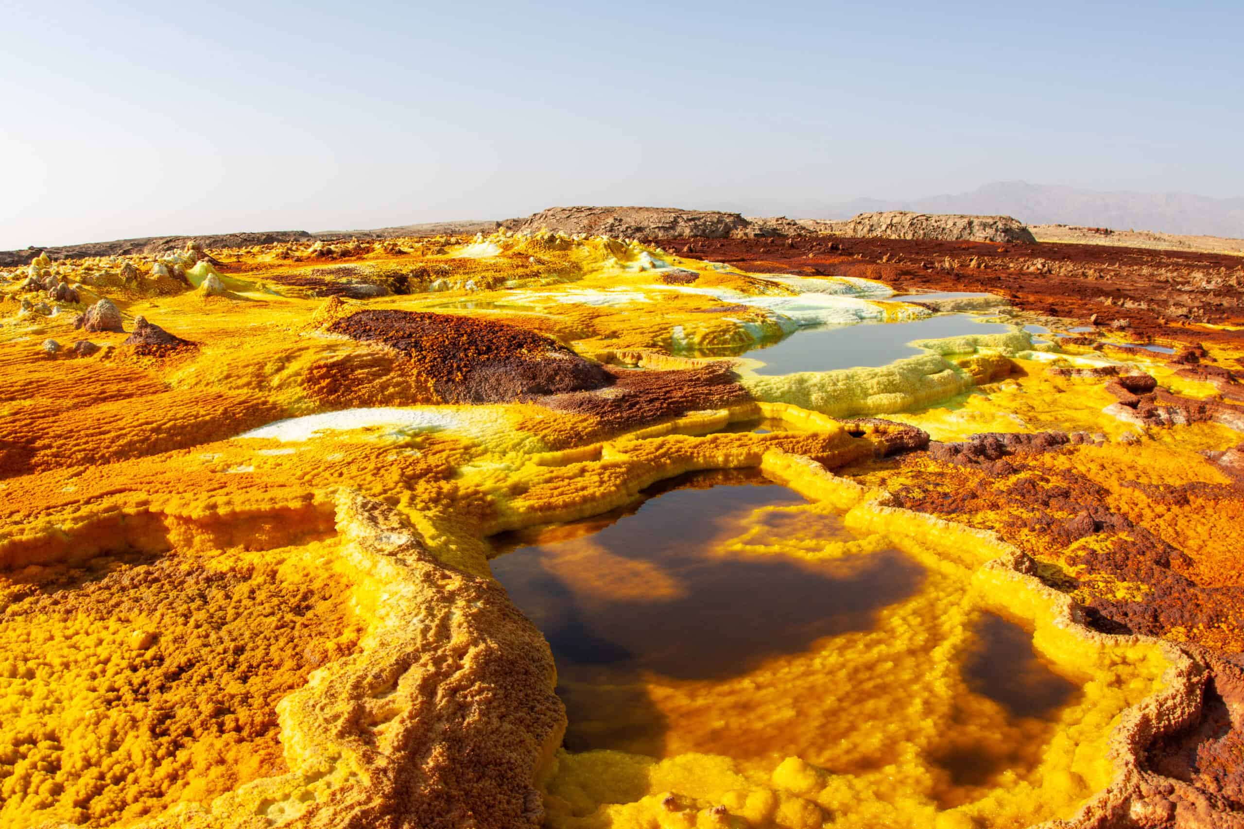
The Danakil Depression looks almost unreal, but the danger there is brutally physical. ESA describes it as one of the lowest, hottest, and driest places on Earth, with temperatures that can climb above 50°C and rainfall that often evaporates quickly, while NASA notes active volcanoes, molten lava near the surface, and acid ponds with pH levels around 0.2. Researchers in the area have at times needed gas masks because of toxic fumes, which makes clear this is not just a remote landscape but an extreme heat and chemical environment. Even the colors that attract photographers come from corrosive, unstable chemistry.
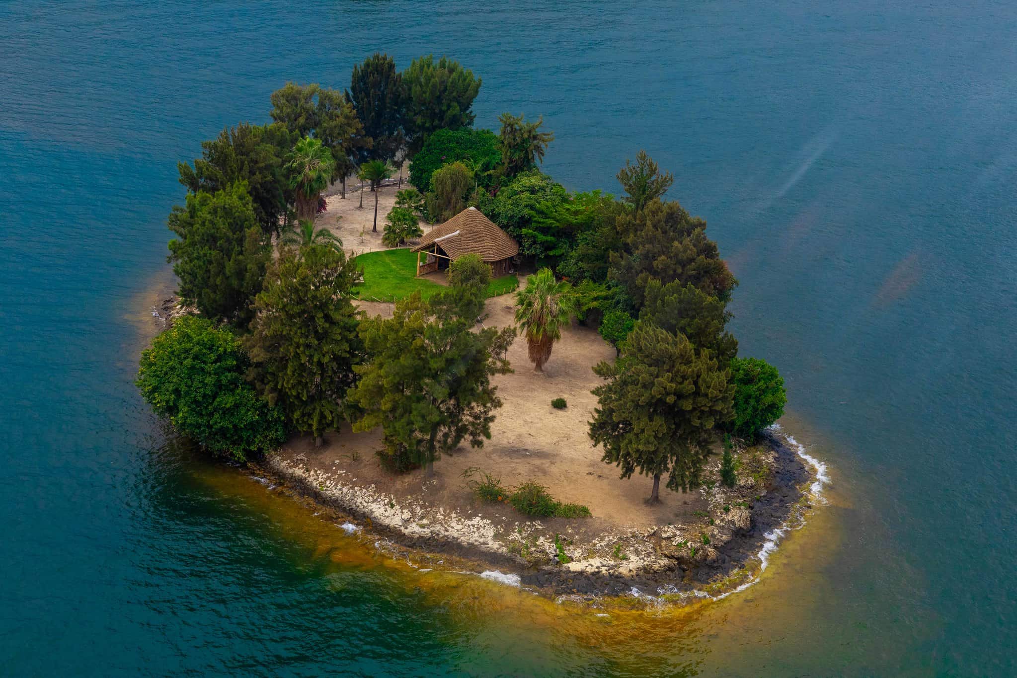
Lake Kivu, Rwanda and the DRC
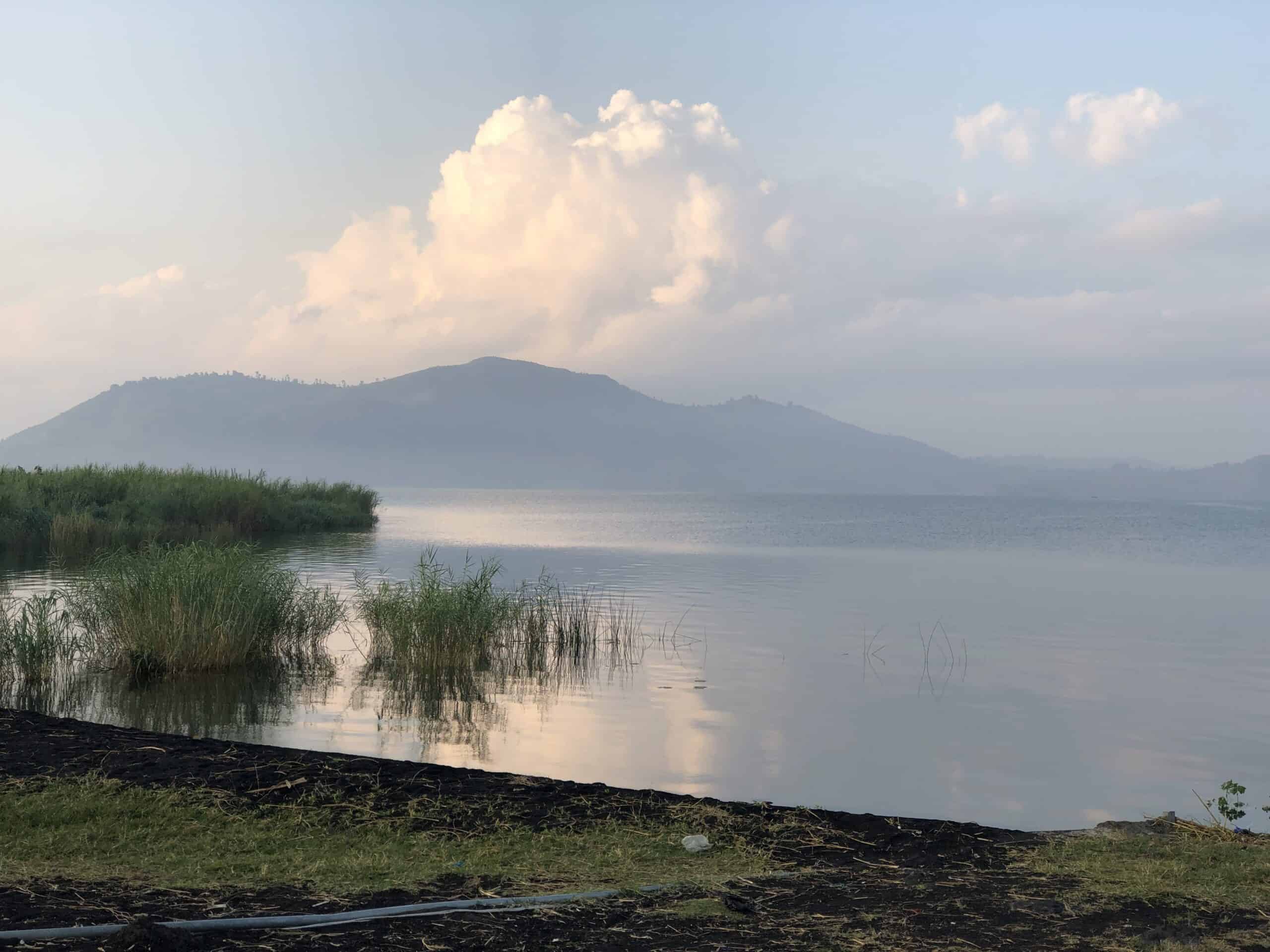
Lake Kivu is beautiful enough to disarm people, and that is part of what makes its risk so unsettling. Nature describes the lake as holding vast dissolved carbon dioxide and methane, along with toxic hydrogen sulfide, and says it has the potential for a rare limnic eruption, while Britannica notes that dense populations live along its shores, including Goma and Gisenyi, and that deep waters contain major methane reserves. It does not look dangerous in ordinary weather, yet the hazard sits deep below the surface, tied to geology rather than visible storms. That mismatch between beauty and geology is exactly what makes it so easy to misread.
Mount Everest, Nepal and Tibet
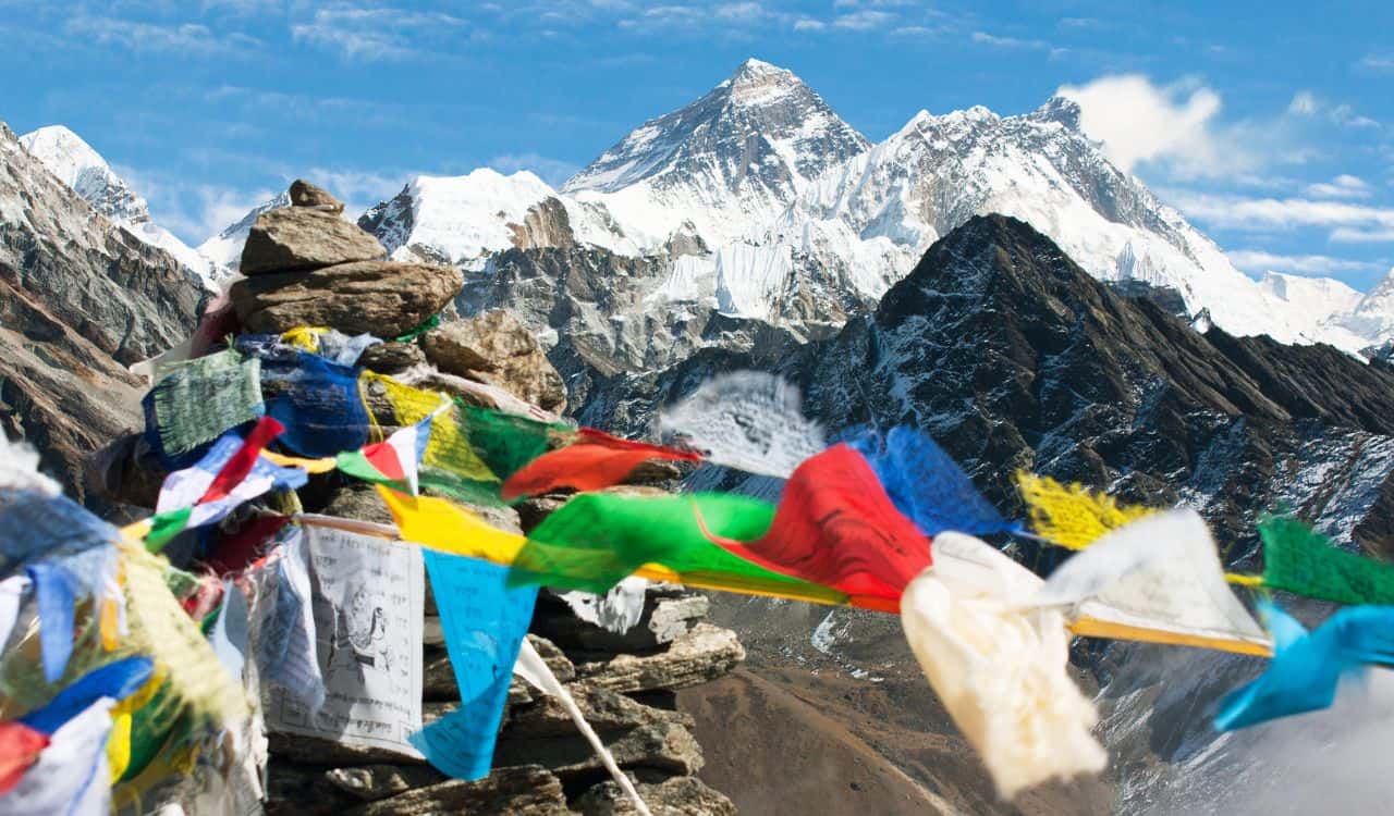
Mount Everest is often framed as an achievement story, but the mountain still behaves like an extreme hazard zone. The CDC notes that high altitude brings hypoxia, cold, low humidity, and intense ultraviolet exposure, and even around 3,050 meters the body faces a major drop in available oxygen, while Britannica reports that avalanches, altitude sickness, and falls continue to kill climbers, with many deaths occurring above 8,000 meters. The summit image gets the headlines, but the real danger builds through exhaustion, exposure, crowding, and thin air long before the final ridge. Reputation does not lower altitude risk.
Mount Merapi, Indonesia
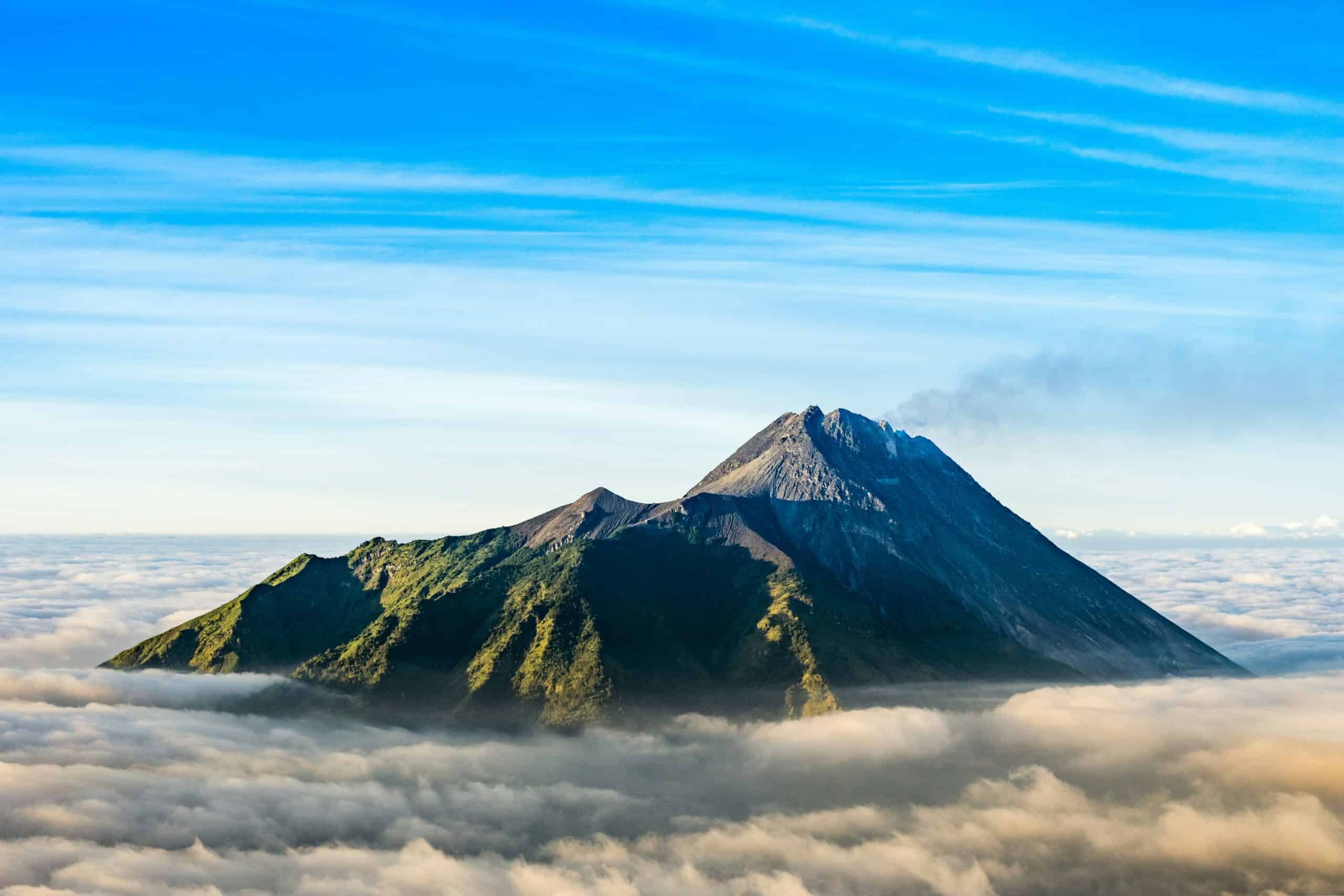
Merapi is one of those volcanoes that stays dangerous even when daily life continues around it. In the Smithsonian and USGS weekly volcanic report for Feb. 5-11, 2026, Indonesia’s monitoring agency said Merapi’s eruption on Java was continuing and documented pyroclastic flows and lava avalanches descending the flanks on multiple days, with some avalanches traveling as far as 1.8 kilometers. That kind of activity is a reminder that a volcano does not need a giant eruption column to be lethal, because fast-moving flows and unstable slopes can kill close to the crater. Merapi punishes hesitation and curiosity alike near active drainages.
Whakaari White Island, New Zealand
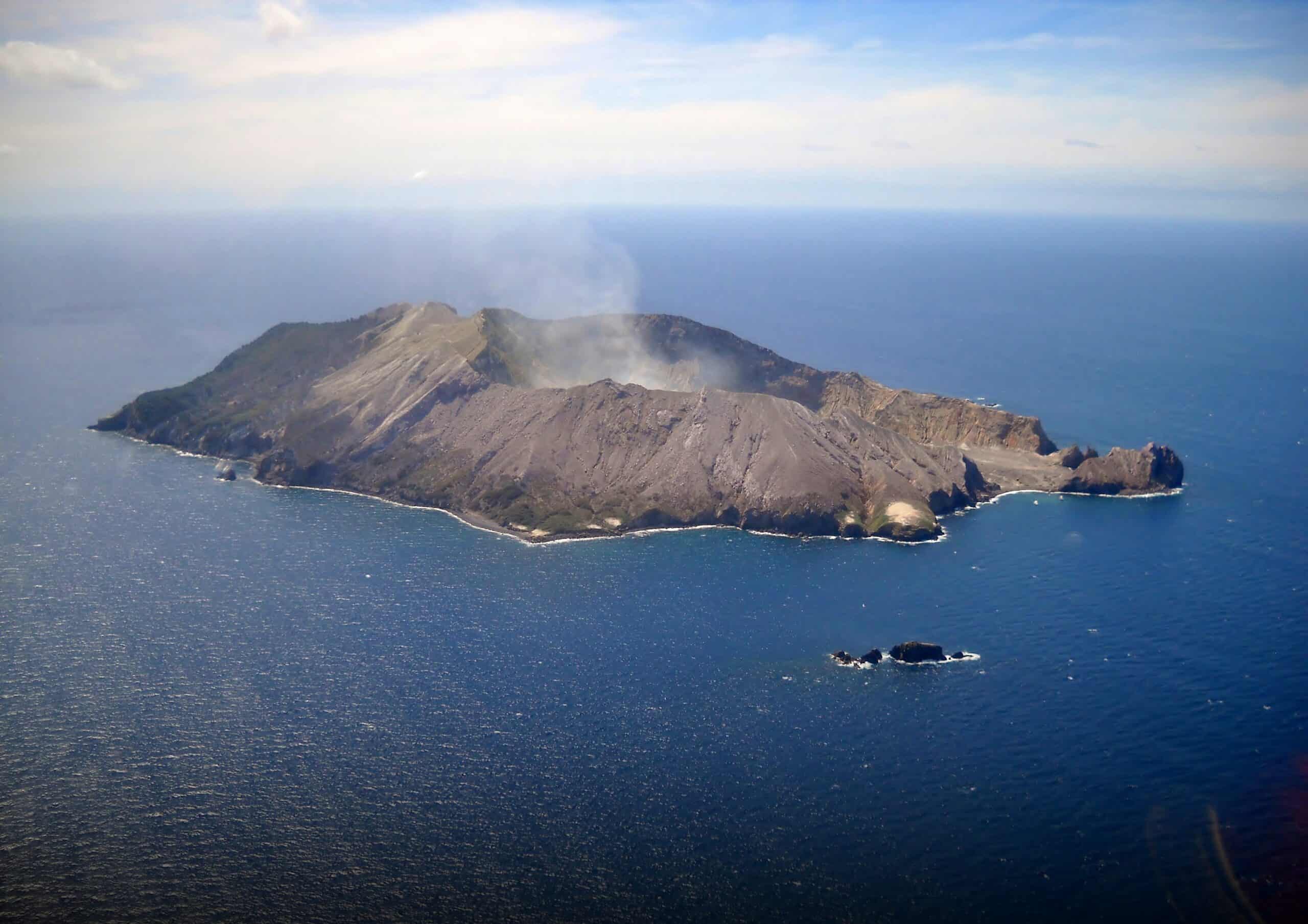
Whakaari, also called White Island, remains a stark example of how volatile crater tourism can be. GeoNet classifies it at Alert Level 2 with moderate to heightened unrest, warns that eruptions can occur at any level, and lists hazards that include explosions, volcanic gases, ash, landslides, and fast-moving hot ash clouds; GeoNet’s recent bulletin also said steam and gas emissions were continuing at the volcano. That ongoing unrest matters because GeoNet’s records also include the fatal 2019 eruption, a reminder that scenic volcanic islands can turn deadly with very little warning. Alert levels help, but they do not erase eruption risk.
North Sentinel Island, India

North Sentinel Island is dangerous in ways that go beyond wilderness risk, and the danger runs in both directions. Indian government policy protects the island and surrounding waters as a tribal reserve, and Britannica explains that entry limits exist partly because isolated groups such as the Sentinelese are highly vulnerable to outside diseases; AP also reported in 2025 that an American visitor was arrested after trying to make contact on the off-limits island. The risk is legal, ethical, and physical all at once, which makes reckless contact attempts dangerous for outsiders and devastating for the people being approached.
Sudan
Sudan remains one of the clearest places where armed conflict makes ordinary travel assumptions meaningless. The U.S. State Department lists Sudan at Level 4 Do Not Travel, citing unrest, crime, kidnapping, terrorism, landmines, and health threats, and says the U.S. Embassy in Khartoum suspended operations in April 2023 because of the conflict; the advisory was reissued in Oct. 2025. When an alert also states that routine and emergency consular services are unavailable, the danger is no longer theoretical, because even basic backup disappears when conditions collapse. Even aid logistics can break down fast.
Haiti
Haiti is still described through beach imagery in older travel memories, but current conditions make that picture dangerously outdated. The U.S. State Department says not to travel because of kidnapping, crime, terrorist activity, civil unrest, and limited health care, and it describes widespread kidnappings, firearm violence, and attacks near Port-au-Prince’s airport, with U.S. commercial flights not operating there at the time of the advisory. What makes the situation especially hard is how many risks stack together at once, from roadblocks and airport-area violence to shortages in medicine, electricity, and emergency response.
Yemen
Yemen combines armed conflict with public health strain in a way that compounds risk instead of merely adding to it. The U.S. State Department keeps Yemen at Level 4 Do Not Travel and says the U.S. Embassy in Sana’a has been suspended since 2015, leaving no routine or emergency consular services, while WHO reported in Dec. 2024 that Yemen had the world’s highest cholera burden, with 249,900 suspected cases and 861 associated deaths that year. In places like this, danger is not only the visible violence but the collapse of systems, transport, and care that usually keep people alive. Routine problems can become deadly quickly.