We may earn money or products from the companies mentioned in this post. This means if you click on the link and purchase the item, I will receive a small commission at no extra cost to you ... you're just helping re-supply our family's travel fund.
Some American trails are famous because they feel like a rite of passage, yet the same features that draw crowds can also magnify risk. Steep exposure, sudden storms, thin air, flash floods, and brutal heat turn small mistakes into irreversible moments. Travelers often describe the same pattern: a trail that looks manageable at the trailhead, then changes personality a few miles in. Rangers and rescue teams back that up with blunt warnings about wet rock, runaway water, and overconfidence. These routes are not off-limits, but they demand respect, timing, and sober decision-making.
Angels Landing, Zion National Park
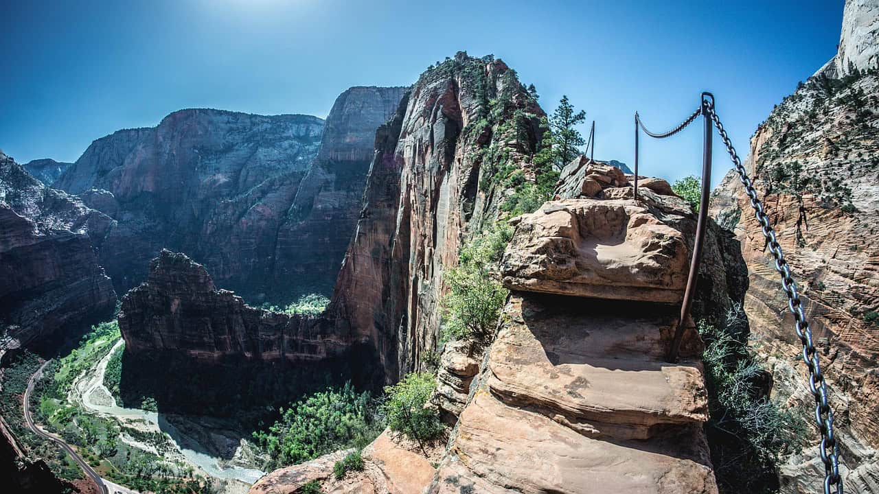
On paper it is a short summit push, but the final half-mile narrows to a knife-edge fin with steep drop-offs, no guardrails, and a single chain line where hikers queue shoulder to shoulder. Zion notes that, since 1930, most deadly accidents have happened on the chained section, and the permit system exists partly to reduce crowd crush, impatience, and risky passing at chokepoints. Travelers who turn back often mention the same triggers: gusty wind, slick sandstone after a shower, cold hands on the chain, and the moment a casual photo stop turns into a tense, hands-and-knees move. Narrow trail leaves little room for error when hikers pass fast.
Half Dome Cables, Yosemite National Park

The cables look like a handrail, yet the granite angle, the polished surface, and the long gaps between boards punish tired legs after an all-day climb from the valley floor. Yosemite warns that nearly all fatal falls from the cables have happened when the rock was wet, when rain, hail, or spray turns the dome into glass and the cables into cold, slick wire. Travelers describe the danger as compounding at the end: crowd delays on the planks, shaky calves, and a fast-moving storm that makes the descent feel far more precarious than the ascent, even for prepared hikers. Wet gloves, fast passing, and fear can turn the queue into a hazard quickly.
Mist Trail to Vernal Fall, Yosemite National Park
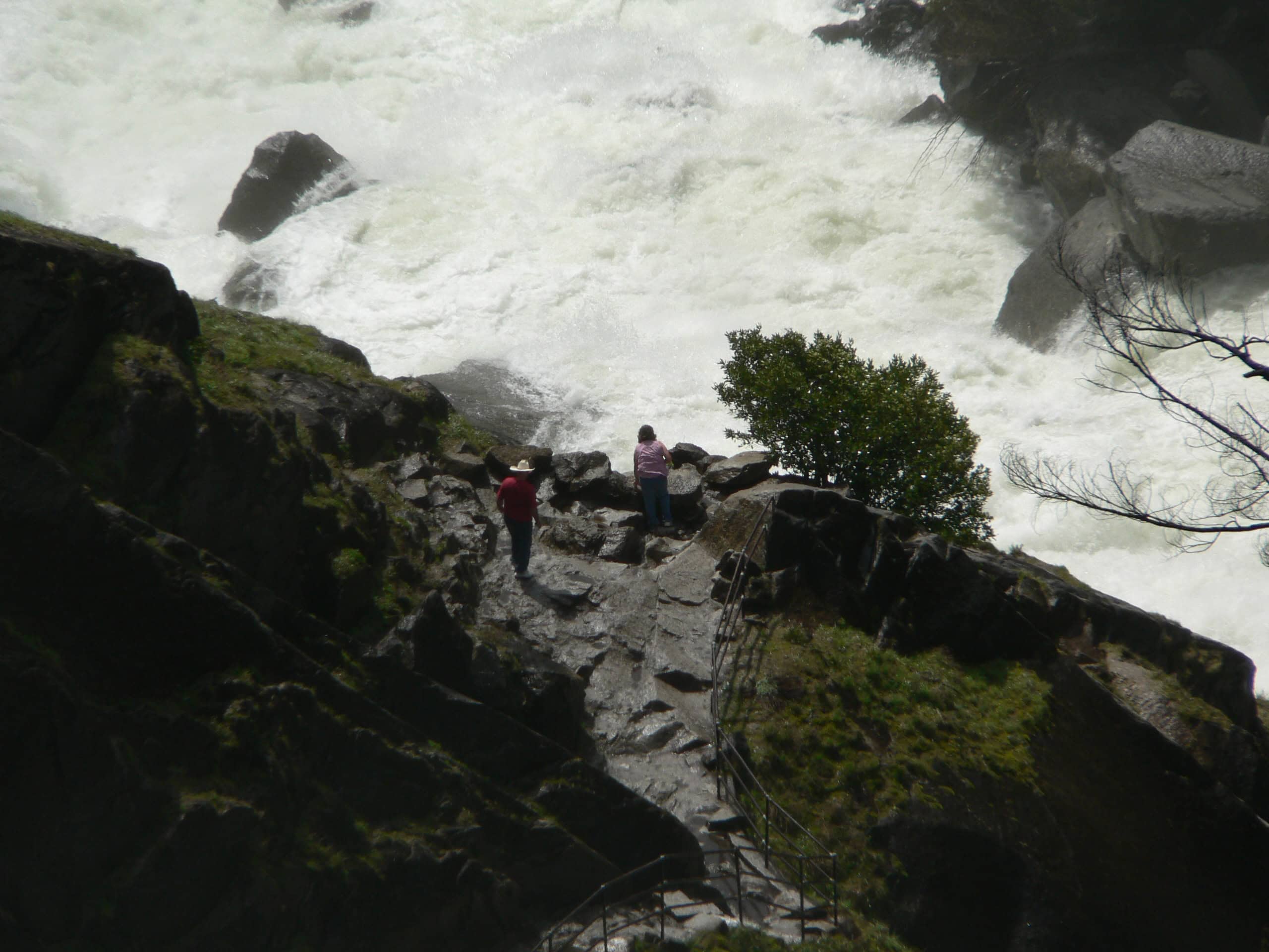
This waterfall route is wildly popular, which makes its hazard feel deceptively ordinary, especially on hot afternoons when the spray looks refreshing and crowds bunch on narrow steps. NPS has documented fatal incidents after visitors were swept over Vernal Fall, and posted warnings stress that wet granite stays slippery in both sun and shade, even when it looks dry from a distance. Travelers often point to the same pinch points: slick stair treads near the railings, polished slabs at the edge of the flow, and crowded pauses where one distracted step, a phone glance, or a slipped sandal can change everything when footwear lacks grip in spray.
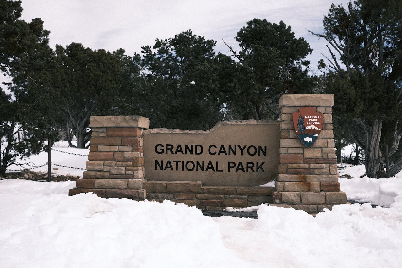
Rim-to-Rim Corridor, Grand Canyon National Park
The canyon rewards endurance, but heat and distance turn it into a physiological trap where the climb out can be harder than the descent, and rescue access is limited by terrain. Grand Canyon rangers warn that exposed inner-canyon temperatures can exceed 120°F and advise avoiding strenuous hiking from 10 a.m. to 4 p.m., when sun, rock, and reflected heat stack up. Travelers often describe the same cascade: a late start, fast dehydration, salt imbalance, and fatigue on steep switchbacks where shade disappears, water sources are far apart, and a small wobble becomes a medical emergency. Heat illness starts subtly, then turns urgent on climbs up.
The Narrows, Zion National Park

The Narrows feels playful at first, then the canyon walls tighten and the river becomes the trail, leaving little room to regroup once water levels rise and the current stiffens. Zion’s safety guidance stresses that flash floods can occur even when they are not expected, and cold water paired with winter air can push hikers toward hypothermia during long, slow exits. Travelers describe the fear arriving quietly: footing vanishes on algae-slick rock, walking sticks stop biting, packs get soaked, and the route back suddenly depends on reading the current, the weather, and narrow escape ledges in spring, when snowmelt and storms spike flows too.
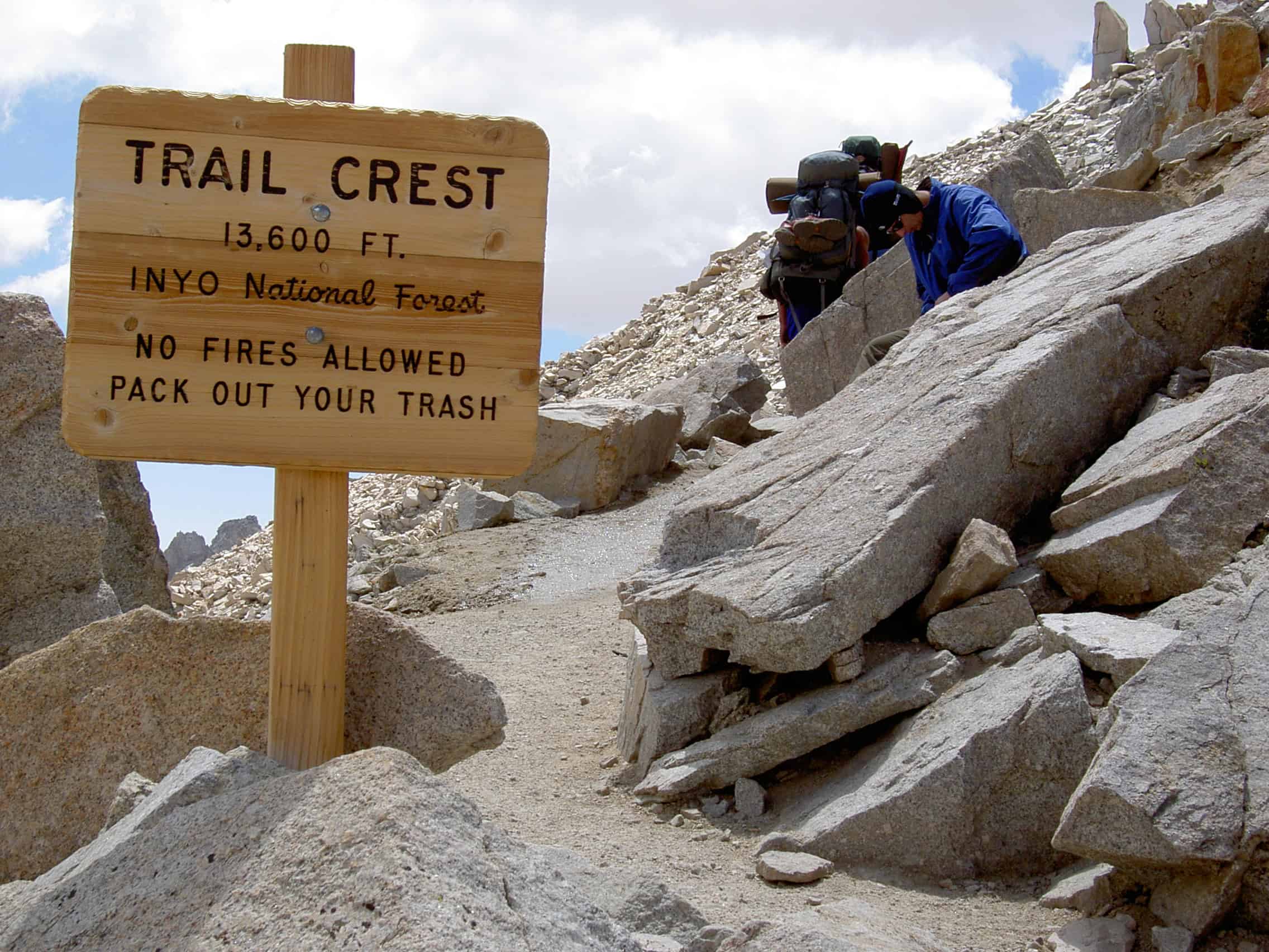
Mount Whitney Trail, California
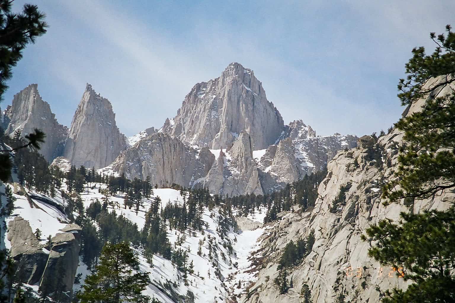
Whitney’s main route is considered non-technical in summer, but altitude, exposure, and fast shifts in Sierra weather make it unforgiving, even for strong hikers chasing a single-day summit. Sequoia and Kings Canyon notes the trailhead sits around 8,360 feet and the summit reaches 14,505 feet, and it warns that ice axes and crampons are needed in spring and early summer. Recent winter fatalities have renewed rescue warnings about splitting from partners and pushing into icy upper sections, where thin air, darkness, and fatigue can erase judgment and traction in a single decision near steep drop-offs as freeze-thaw leaves hidden ice on stones.
Mount Washington Routes, New Hampshire
Mount Washington’s reputation is built on weather that changes faster than plans, with wind, rime ice, and whiteout conditions that can arrive in any season above treeline. Rescue reports frequently describe hikers caught in full winter conditions, including high winds and dangerous wind chills that can trigger hypothermia and disorientation within hours, even on well-marked routes. Travelers who underestimate the Presidential Range often describe the same collapse of certainty: visibility shrinks, cairns disappear under snow, phone batteries fade in the cold, and the trail becomes a guessing game on exposed ridges and maps get soaked in fog.
Kalalau Trail, Kauai, Hawaii
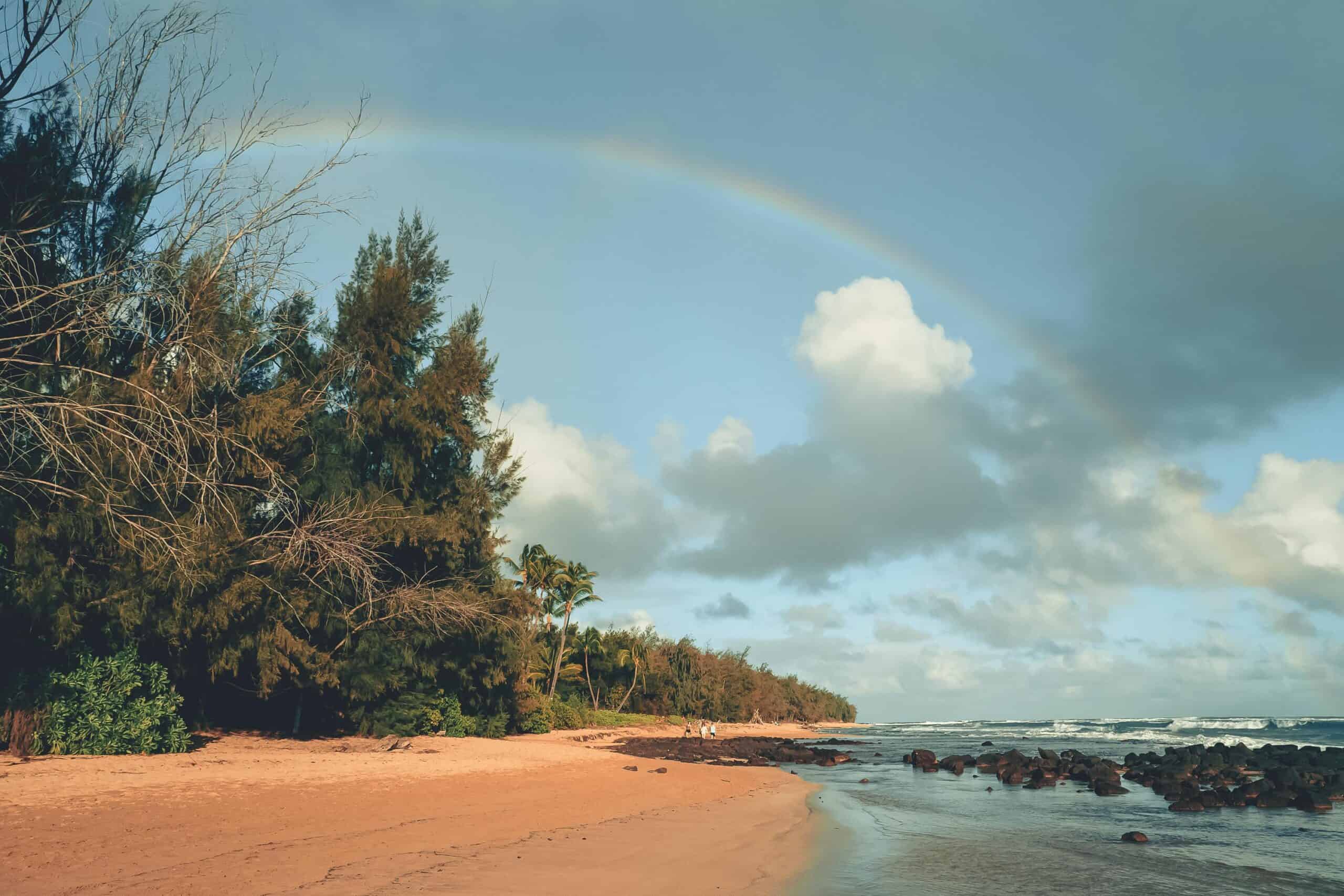
Kalalau’s beauty is paired with remoteness, cliff exposure, and stream crossings that can turn impassable after sudden rain on the Na Pali Coast, trapping parties between swollen channels. In April 2025, flooding stranded dozens of hikers overnight along the route, underscoring how quickly calm weather can flip into a backcountry emergency with no easy road exit. Travelers describe the risk as cumulative: slick red dirt on narrow ledges, limited cell service, steep drop-offs in places, and long rescue timelines that turn a fall, a swollen stream, or a medical issue into a serious situation and hikers may wait long for a rescue window to open.
Knife Edge, Mount Katahdin, Baxter State Park
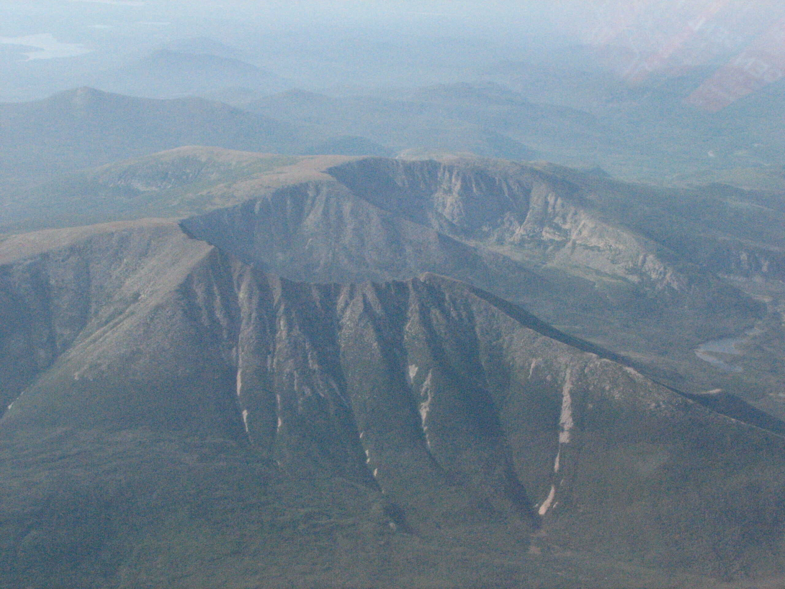
Knife Edge is a famed ridge traverse, but Baxter State Park calls it completely exposed and warns that serious injuries and deaths have occurred when high winds, fog, or storms arrive unexpectedly. Once the ridge commitment begins, leaving it can be harder than continuing, and lightning or sudden gusts can erase safe footing on the boulder spine, narrow notches, and steep downclimbs. Travelers who cross it on calm days describe a steady rhythm of handholds and focus, while those caught in weather describe a thin line between progress and retreat, where every step demands attention and every delay feels costly as clouds race in over the ridge.