We may earn money or products from the companies mentioned in this post. This means if you click on the link and purchase the item, I will receive a small commission at no extra cost to you ... you're just helping re-supply our family's travel fund.
Despite satellites mapping nearly every coastline and drones surveying the most remote valleys, parts of our planet still resist complete understanding. Some remain physically inaccessible, others scientifically puzzling, and a few culturally off-limits. These ten destinations span deserts, oceans, ice sheets, and underground worlds. Each one combines measurable facts; distances, depths, temperatures, timelines with enduring uncertainty, proving that even in 2026, Earth continues to guard extraordinary secrets.
1) North Sentinel Island
Roughly 60 km west of South Andaman, this 59 sq km island is home to an estimated 50–200 Sentinelese people who have resisted outside contact for thousands of years. India enforces a 5-nautical-mile exclusion zone to protect both visitors and the tribe. Dense forest covers most of the land, and coral reefs ring its shores. With no confirmed census, written language record, or modern infrastructure, daily life here remains almost entirely undocumented.
2) Door to Hell
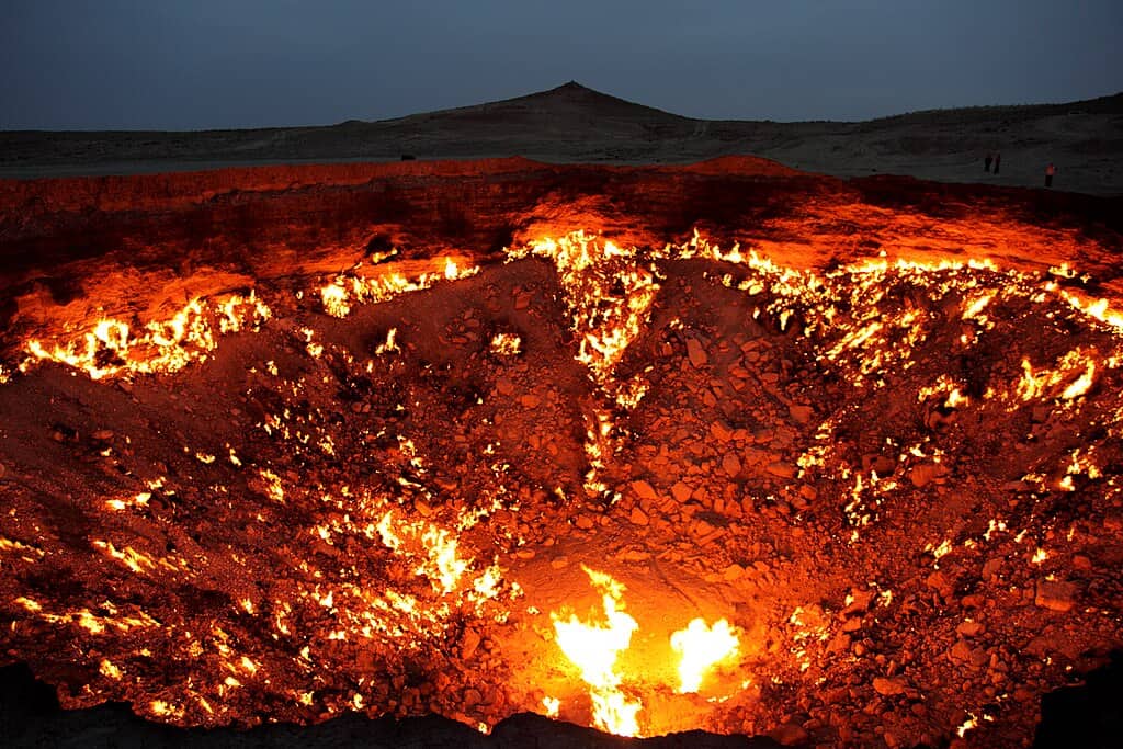
In Turkmenistan’s Karakum Desert, this gas crater measures about 70 meters across and 20 meters deep. Ignited in 1971 after a drilling collapse, it has burned continuously for more than 50 years. Temperatures inside can exceed 1,000°C, fueled by vast methane reserves beneath shifting sands. Scientists still debate how long it can sustain combustion. Visible for kilometers at night, the fiery pit remains both a geological accident and an unresolved energy puzzle.
3) Richat Structure
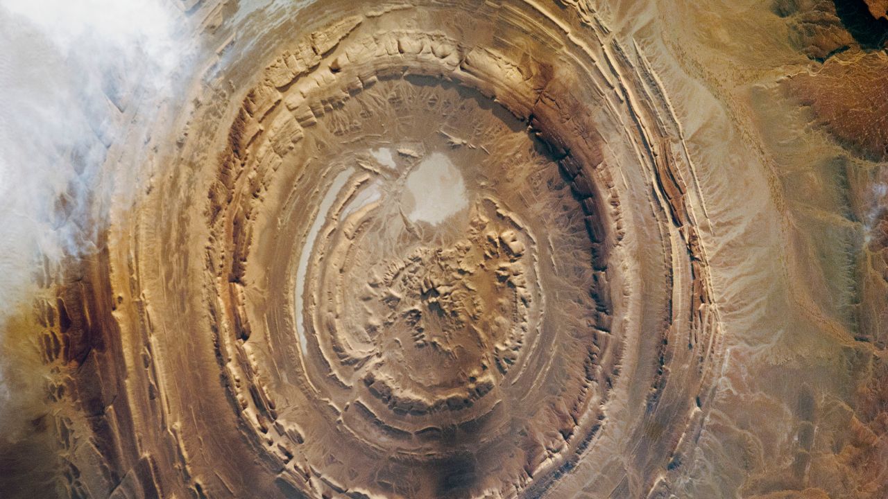
Spanning nearly 40 km in diameter in western Mauritania, this concentric formation is clearly visible from space. Once misidentified as an impact crater, it is now believed to be a deeply eroded geological dome formed over 100 million years ago. Wind and time carved its layered rings into a giant “eye” in the Sahara. Yet the exact sequence of uplift and erosion remains debated, keeping geologists intrigued by its precise origin story.
4) Derinkuyu Underground City
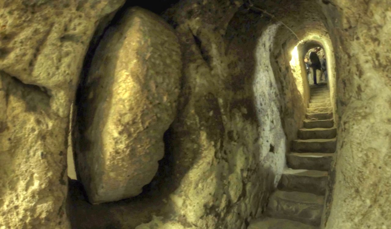
Discovered in 1963, Derinkuyu descends about 60 meters below ground and once sheltered up to 20,000 people along with livestock and food stores. Located in Turkey’s Cappadocia region, it contains 8 accessible levels, ventilation shafts, wells, and stone doors weighing hundreds of kilograms. Thought to date back at least 1,000 years, possibly earlier, its full extent is still not excavated. Engineers continue to study how ancient builders stabilized such depth in soft volcanic rock.
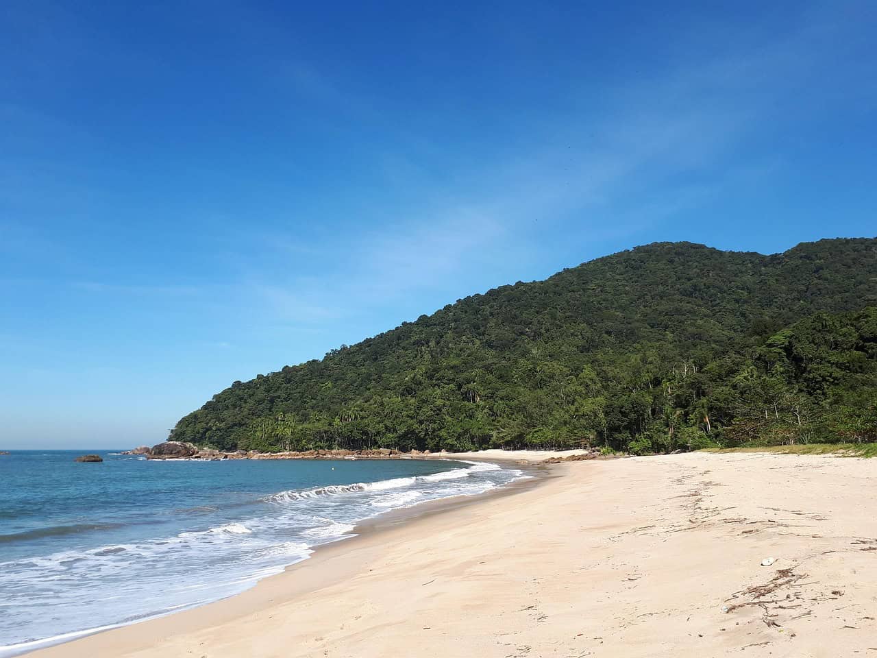
5) Socotra
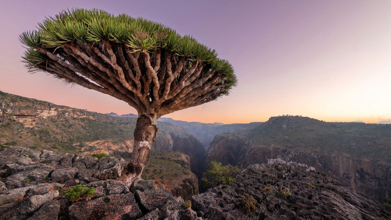
Situated about 380 km south of mainland Yemen, Socotra covers roughly 3,800 sq km and hosts more than 700 endemic species. The iconic dragon’s blood tree, with its umbrella canopy, evolved in isolation over millions of years. Annual rainfall averages less than 200 mm in many areas, creating harsh conditions. Political instability has limited research expeditions, meaning portions of its biodiversity remain undocumented despite its UNESCO recognition.
6) Movile Cave
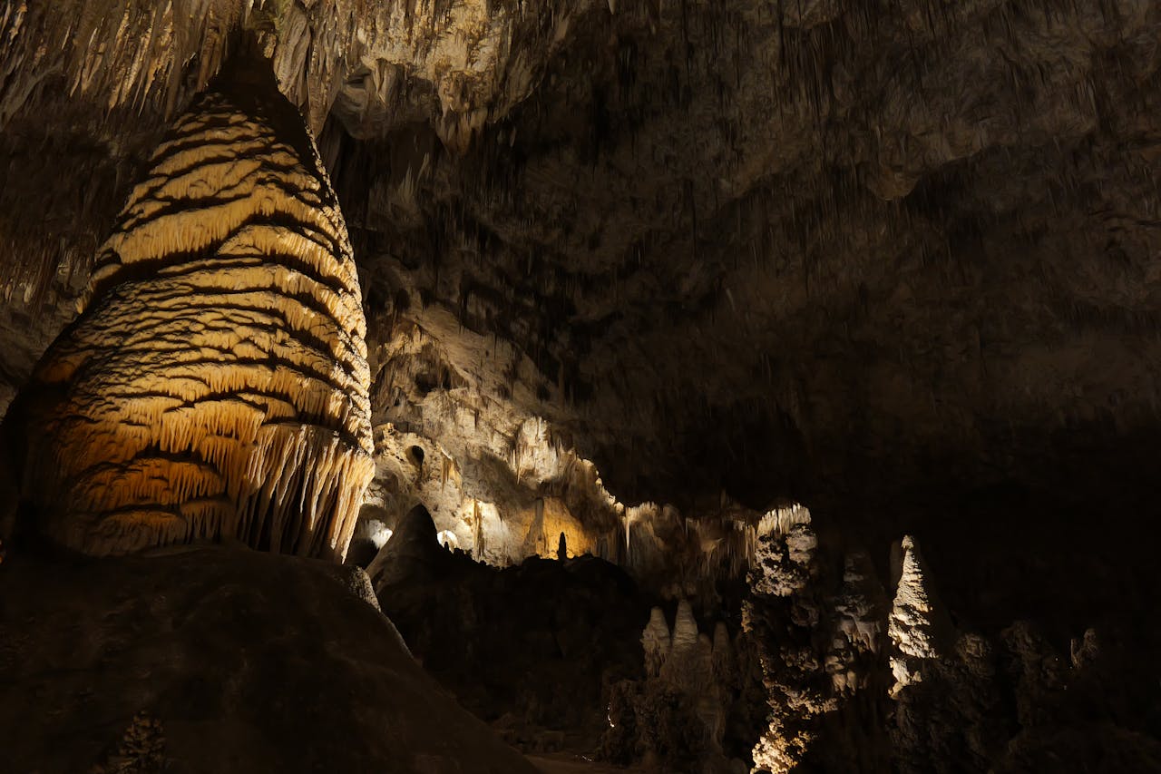
Sealed off for an estimated 5.5 million years, Movile Cave in southeastern Romania supports over 50 species, many found nowhere else. Oxygen levels hover around 10%, compared to 21% in normal air, while hydrogen sulfide fills its chambers. Instead of sunlight, bacteria rely on chemosynthesis to form the base of the food chain. Discovered in 1986 during construction work, much of its microbial diversity remains under active scientific investigation.
7) Antarctica
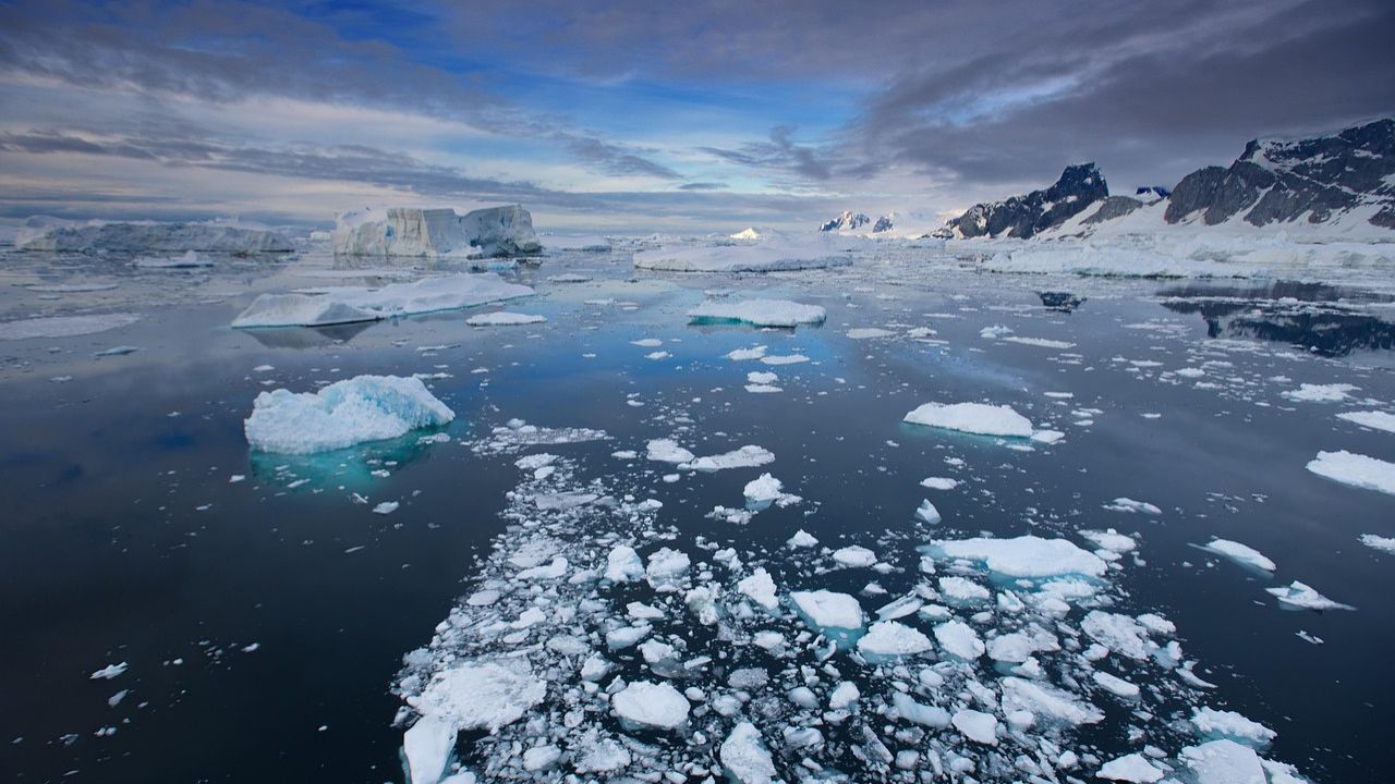
Covering nearly 14 million sq km, Antarctica is the coldest and driest continent on Earth. Around 98% of its surface is buried beneath ice averaging 1.9 km thick, with some areas exceeding 4 km. It stores close to 70% of the planet’s fresh water. Beneath that frozen shell lie more than 400 subglacial lakes, including Lake Vostok under 3.7 km of ice. Winter temperatures can plunge below −60°C, and vast interior zones remain physically unexplored despite decades of scientific missions.
8) Yonaguni Monument
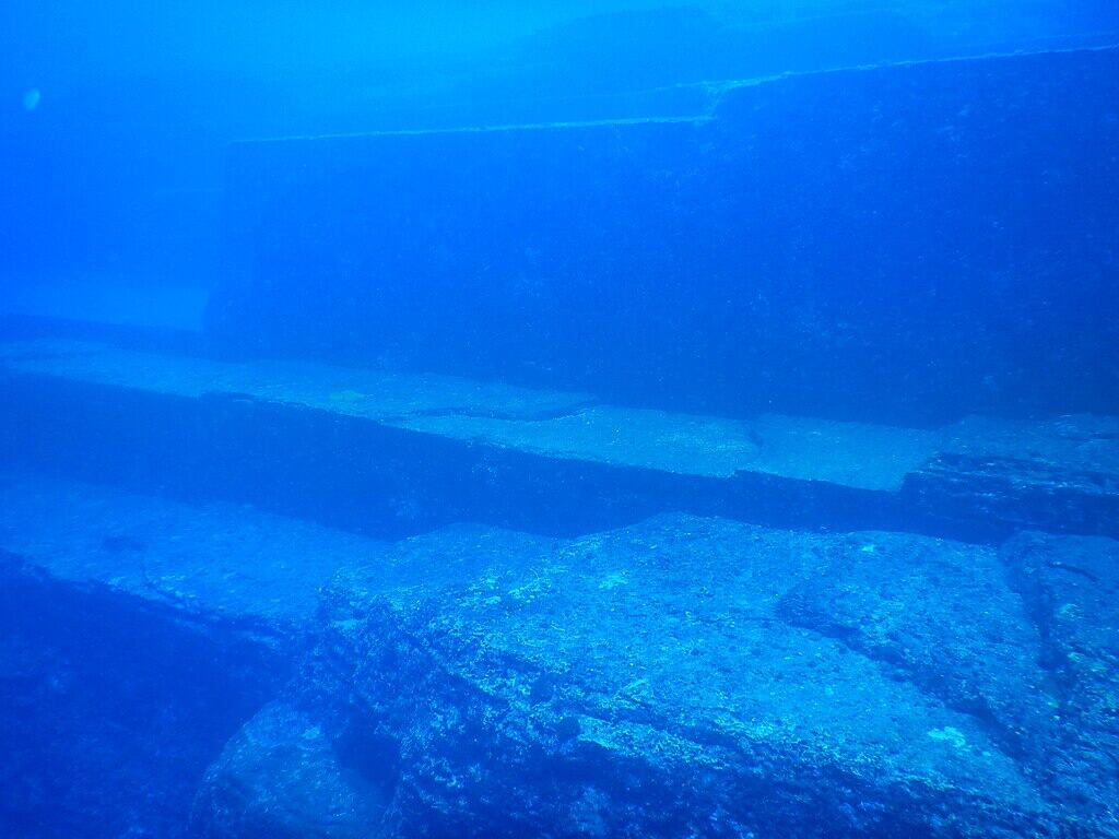
About 25 meters below sea level near Japan’s Ryukyu Islands, the Yonaguni Monument stretches roughly 150 meters in length. Discovered in 1986, it features terraces, stair-like formations, and sharp edges that appear strikingly geometric. Some researchers argue tectonic activity shaped the sandstone naturally, while others suggest human involvement dating back over 10,000 years. Powerful currents and limited excavation access keep definitive conclusions out of reach, sustaining debate decades later.
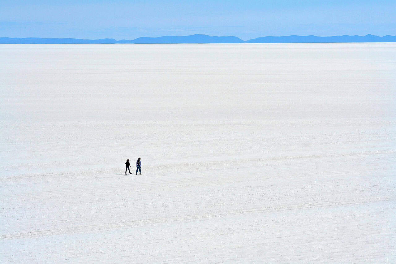
9) Salar de Uyuni
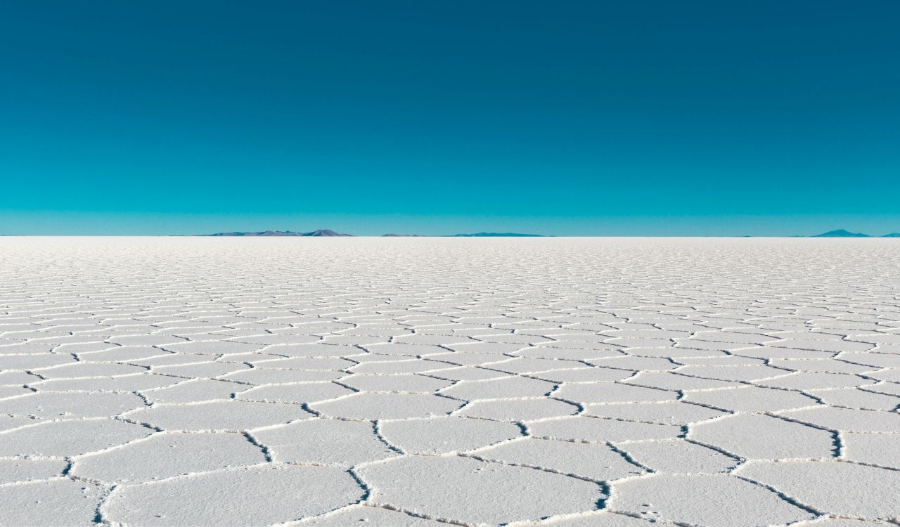
Spanning more than 10,000 sq km at an elevation of 3,656 meters, Salar de Uyuni is the largest salt flat on Earth. Formed from ancient lakes over 30,000 years ago, it contains an estimated 7–10 million tons of lithium beneath its crust. During the rainy season, a thin water layer turns it into a vast mirror reflecting the sky. Scientists continue examining extremophile microbes thriving in high salinity and intense UV radiation.
10) Lake Hillier
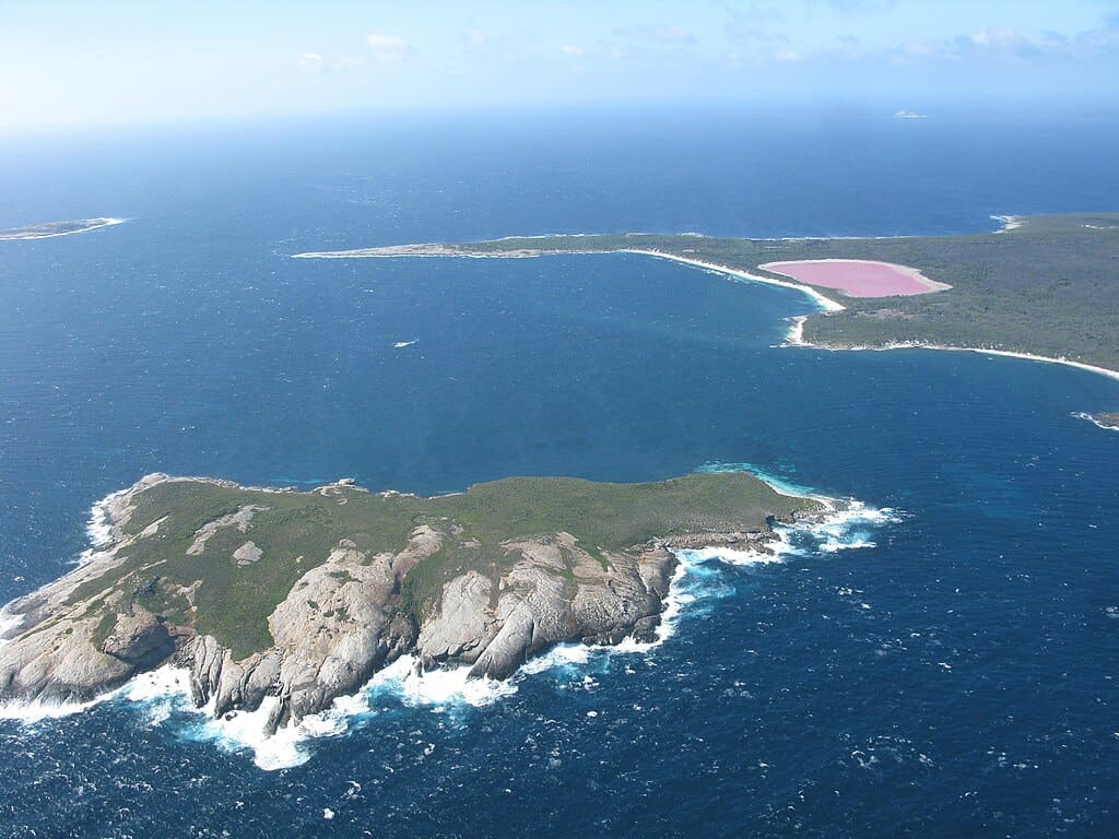
Lake Hillier measures about 600 meters long and sits on Middle Island off Western Australia’s southern coast. Its bubblegum-pink color remains stable year-round, even when water samples are removed. Salinity levels exceed 30%, creating ideal conditions for halophilic algae and bacteria believed to produce the pigment. Despite laboratory analysis confirming biological causes, researchers still study how environmental balance maintains such vivid coloration in this isolated ecosystem.