The Talimena Scenic Drive Runs 54 Miles Along a Mountain Ridge. These 8 Stops Make the Drive
We may earn money or products from the companies mentioned in this post. This means if you click on the link and purchase the item, I will receive a small commission at no extra cost to you ... you're just helping re-supply our family's travel fund.
The best Talimena Scenic Drive stops are spread across 54 miles along the crests of Winding Stair and Rich Mountains in the Ouachita National Forest, running from near Talihina in southeastern Oklahoma to Mena, Arkansas. You can drive the whole thing in about an hour and ten minutes without stopping. That would be a waste.
About 36 of those miles sit in Oklahoma, and the road is signed as Oklahoma Highway 1 before it becomes Arkansas Highway 88 across the line. The Forest Service and both states treat it as a National Scenic Byway, and the payoff is in the pullouts. The right Talimena Scenic Drive stops turn a quick ridge run into a full day of overlooks, short hikes, and history.
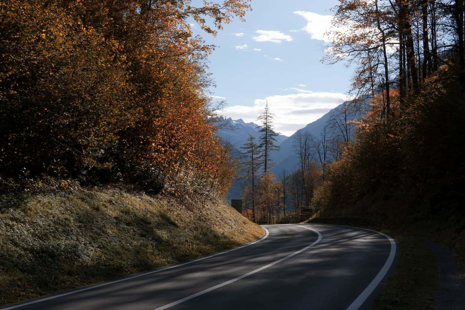
Late fall is a strong time to go. The Ouachitas are an east-west range, unusual in North America, so the road rides a long spine with views north and south across folded ridges of oak and hickory. Color usually runs late October into early November, and after the leaves drop, the views open up even wider.
The 8 Talimena Scenic Drive Stops Worth Making
1. Talihina Visitor Information Station
Start at the western end, where the byway begins at the junction of U.S. 271 and Oklahoma Highway 1, about eight miles east of Talihina. The visitor station has maps, restrooms, and information on current conditions. Grab a byway guide here. Mile markers along the road key to the guide’s descriptions of each overlook.
Talihina itself is a small town that serves as the Choctaw Nation’s health care hub, with a large Choctaw Nation hospital. It is your last easy chance for gas and food on the Oklahoma side.
2. Robert S. Kerr Memorial Arboretum and Nature Center
A few miles in, the Kerr Arboretum offers short interpretive trails through different forest communities on the mountain. The loops are under a mile or so each, mostly gentle, and signed with explanations of trees, soils, and plants. It is a good leg-stretch and helps you read the landscape for the rest of the drive.
The area is named for Robert S. Kerr, the Oklahoma governor and U.S. senator. The surrounding botanical area protects old-growth patches that escaped heavy logging.
3. Horsethief Springs
Horsethief Springs is a stone spring box and picnic area built by the Civilian Conservation Corps in the 1930s. Local legend says outlaws and horse thieves used the spring as a watering spot while moving stolen stock through the mountains. Whether every story is true matters less than the setting: a shaded, quiet stop with CCC stonework you can still put your hands on.
Trails from here connect into the longer hiking network on Winding Stair Mountain.
4. Winding Stair Campground and the Ouachita National Recreation Trail
The Winding Stair area is where the drive meets the Ouachita National Recreation Trail, a long-distance path of roughly 223 miles that runs from near Talihina east to Pinnacle Mountain State Park outside Little Rock. You do not need to commit to a backpacking trip. A short out-and-back walk of a mile or two from a byway crossing gives you a feel for the ridge forest away from the road.
The campground has sites with views, but services are seasonal. Check with the Forest Service before you plan to stay in late fall.
5. Emerald Vista
Emerald Vista is one of the best-known overlooks on the Oklahoma side. A short walk from the parking area leads to a wide view south across the Holson Valley and layers of ridges. On clear November mornings, valley fog fills the low ground and the ridges float above it.
Picnic tables and restrooms make it a good lunch stop. Bring a layer. Wind on the crest can make it feel ten degrees colder than in Talihina.
6. The Oklahoma-Arkansas State Line
The highway number changes at the state line, and there is a marker and pullout. It is a fun photo stop and a reminder of how arbitrary the line is up here. The ridge, the forest, and the views do not change.
Shortly past the line, the Arkansas section climbs Rich Mountain, among the highest points in the state at roughly 2,600 feet.
7. Queen Wilhelmina State Park
Queen Wilhelmina State Park sits atop Rich Mountain a few miles into Arkansas, about 20 miles from Mena. The original lodge opened in 1898, built by a railroad company with Dutch investors and named for the young queen of the Netherlands. Today’s lodge is a later rebuild but keeps the mountaintop setting.
The park has overlooks, trails, a restaurant, and lodge rooms, making it the obvious overnight stop if you want sunset and sunrise on the ridge. Lodge rates are usually moderate, but fall weekends book early.
8. Mena Visitor Information Station and Downtown Mena
The drive ends at the visitor station near Mena, a small Arkansas town with a restored Kansas City Southern railroad depot downtown. Mena has the gas, restaurants, and motels the ridge lacks.
If you started early in Talihina, you can eat lunch or an early dinner in Mena and drive back the way you came. The views look different in the other direction and in different light.
Why the Ouachitas Run East to West
Most mountain ranges in the United States run roughly north to south. The Ouachitas are a rare exception. Hundreds of millions of years ago, colliding landmasses pushed sedimentary rock into long folds that run east to west across western Arkansas and southeastern Oklahoma. Erosion wore those folds down into the ridges and valleys you see today.
That orientation is why the Talimena Scenic Drive can stay on a crest for so long. Instead of climbing over a range, the road follows one ridge after another, with views falling away on both sides. It is also why the south-facing and north-facing slopes look so different. South slopes get more sun and grow drier oak and pine forests, while north slopes stay cooler and support more varied hardwoods. In fall, that split shows up as bands of color along the mountainsides.
Where to Stay and Eat Along the Byway
Services are sparse on the crest itself, so plan around the two ends and the lodge.
- Talihina has a few motels, cabins, and cafes, and it is the most convenient base on the Oklahoma side.
- Queen Wilhelmina State Park’s lodge offers rooms and a restaurant on top of Rich Mountain, with sunset views that make it worth booking ahead.
- Mena has the most choice, with chain and independent motels, local restaurants, and grocery stores.
- Cabins scattered through the surrounding hills are popular with fall visitors and often require two-night minimums on weekends.
Pack a picnic regardless. Overlooks like Emerald Vista make better lunch spots than anything you will find on the road, and there is little between the visitor stations to buy food.
When to Drive and What to Watch For
Fall color on the Talimena typically peaks in late October to early November, though weather can shift it. After leaf drop, clearer air makes winter one of the better seasons for long views, with fewer cars.
- Ice and snow can close or slow the road in winter. Check road conditions before you go.
- The road has steep grades and sharp curves. Use lower gears on descents.
- Large RVs and trailers can make the drive, but some pullouts are tight.
- Cell service is spotty along the crest.
- Fog is common on cool mornings. Slow down and use low beams.
The History Along the Ridge
The road itself is younger than many visitors assume. The Talimena Scenic Drive opened in 1969 and was dedicated in 1970, built specifically as a scenic parkway rather than as a route between towns. That explains the generous overlooks and the way the road hugs the crest instead of taking the quickest line.
The land has a much longer story. This was Choctaw Nation territory after the forced removals of the 1830s, and the Choctaw Nation remains a major presence in the region today. Civilian Conservation Corps crews worked in the Ouachita National Forest during the 1930s, leaving stone structures like the spring box at Horsethief Springs. Interpretive signs at several pullouts explain the geology, forest management, and history of the people who lived on and around these mountains.
If you have time, the Choctaw Nation’s capitol museum at Tuskahoma, northwest of Talihina, adds context to the drive. It sits in the 1884 council house and covers Choctaw history from removal to the present.
How to Plan Your Day on the Byway
Give yourself at least half a day one way, a full day if you want to hike. A simple plan:
- Morning: start in Talihina, stop at the visitor station, Kerr Arboretum, and Horsethief Springs.
- Midday: picnic at Emerald Vista and cross the state line.
- Afternoon: tour Queen Wilhelmina State Park, then roll into Mena.
- Evening: stay at the lodge or in Mena, and drive back west the next morning.
Those 54 miles go fast if you let them. The point of the Talimena is to slow down, pull over, and look out across a mountain range that most travelers never realize runs through Oklahoma.