Most Visitors Do the Pacific Coast Highway Wrong. Here’s the Version That Actually Works
We may earn money or products from the companies mentioned in this post. This means if you click on the link and purchase the item, I will receive a small commission at no extra cost to you ... you're just helping re-supply our family's travel fund.
The usual Pacific Coast Highway road trip goes like this: fly into San Francisco or Los Angeles, rent a convertible, and try to cover 450 miles of California Highway 1 in a couple of days. By the second afternoon you are staring at fog, stuck behind a slow RV, and watching the sun set while you still have two hours to drive on a cliff-edge road with no lights. It is a beautiful route, and most people do it in a way that makes it stressful and a little disappointing.
Here is the version that actually works. It uses a direction, a timeline, and a handful of stops that fit the way the road really behaves, and it leaves out the parts that cost time without adding much. You can follow it as written or use it as a template for your own trip.
The Pacific Coast Highway Road Trip That Actually Works
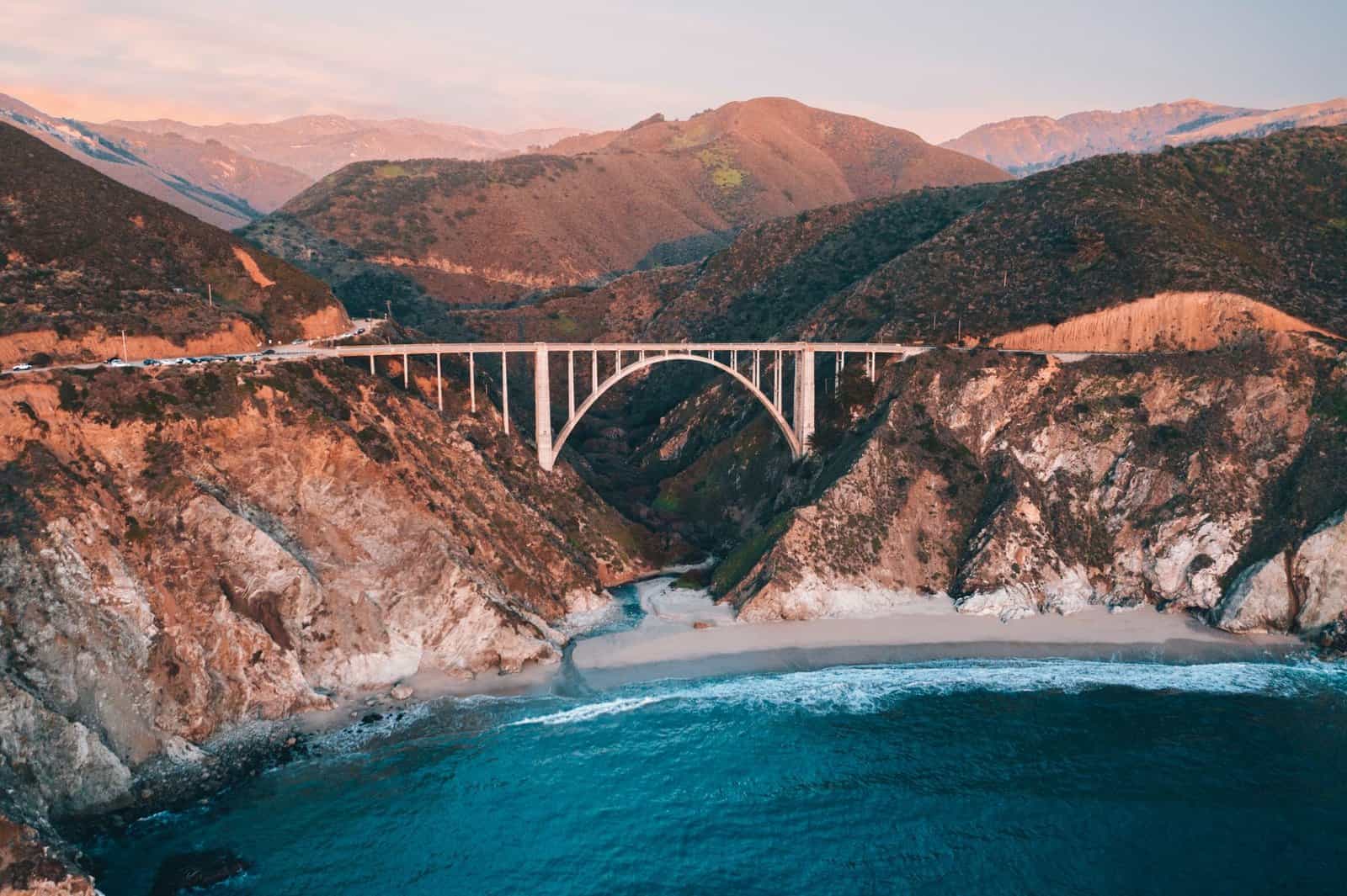
The core idea is simple: stop treating the drive as a transit problem and treat it as a series of short sections. Highway 1 is slow by design. It is a two-lane road with sharp curves, frequent pull-offs, and long stretches where the speed limit is 45 mph or lower. A section that looks like 90 minutes on a map takes three hours once you add photo stops and slow traffic.
So plan on four to five days for San Francisco to Los Angeles, and divide the drive into three parts:
- San Francisco to Monterey (about 120 miles): beach towns, farm stands, and Santa Cruz.
- Monterey to Cambria or San Simeon (about 100 miles): the headline stretch, with Carmel, Big Sur, and the elephant seals.
- Cambria to Santa Barbara or Los Angeles (about 200 miles): small coastal cities, wine country, and Malibu.
If you only have two or three days, do the middle section well and skip the rest. A day and a half on Monterey to San Simeon beats a rushed attempt at the whole coast.
Choose Your Direction: North to South Wins
Most travelers start in San Francisco and head south, and that direction has an advantage. Driving south puts you in the right lane, which is the ocean side. That means you can pull into the turnouts easily without crossing traffic, and you get unobstructed views from the driver’s seat. Northbound drivers must cross the oncoming lane to reach the turnouts, which is less safe on blind curves.
You can still go south to north, especially if you fly into Los Angeles, but if you do, be careful with left turns across traffic, and use only the turnouts you can reach safely.
Mistakes That Make the Drive Worse
Trying to do it in a day or two
San Francisco to Los Angeles is possible in about six hours on Highway 101 or I-5 but takes at least two full days on Highway 1 if you want to stop. Pushing through the Big Sur section in the late afternoon means driving in fading light with the sun in your eyes, and some stretches have no guardrails.
Driving the road after dark
Highway 1 through Big Sur is dark, curvy, and sometimes foggy. There are few streetlights, and wildlife, fallen rocks, and cyclists can appear suddenly. Try to finish the Big Sur section by sunset, and never schedule a long drive at night through the cliffs.
Skipping the road conditions check
Highway 1 has been closed repeatedly by landslides and storm damage over the past decade, including the Mud Creek slide in 2017 and later closures that cut off sections for months. Closures can change quickly, so check the Caltrans QuickMap and the California Highway 1 status page before you leave and the morning of each travel day. If a section is closed, you can reroute via Highway 101 and rejoin the coast farther south.
Booking only the famous towns
Carmel and Monterey get most of the attention, and rooms there can run $250 to $500 a night in summer. Staying in less famous towns like Santa Cruz, Pacific Grove, Cambria, or Morro Bay can lower costs and put you closer to quieter beaches.
Ignoring fog
The coast is often wrapped in marine layer in summer, particularly in the morning. That does not mean the drive is ruined, but it does mean you should plan for a view that opens up in the afternoon. September and October are often the clearest months.
Stops That Are Worth the Time
You do not have to see everything. These are stops that tend to justify the detour:
- Santa Cruz and Capitola: beaches, the boardwalk, and a more relaxed vibe than the Bay Area.
- Point Lobos State Natural Reserve, near Carmel: tide pools, cypress trees, and wildlife. Parking is limited, so arrive early.
- Bixby Creek Bridge: the iconic photo spot, with turnouts on the north side.
- McWay Falls at Julia Pfeiffer Burns State Park: an 80-foot waterfall dropping onto the beach.
- Pfeiffer Beach: known for a rock arch and purple-tinted sand, reached by a narrow road. Check access and fees before going.
- Piedras Blancas elephant seal rookery: free viewing from a boardwalk, with different activity by season.
- Hearst Castle in San Simeon: tour tickets typically start around $30 to $40 per adult. Book ahead in summer.
- Morro Bay and Pismo Beach: easy places to stretch your legs and eat clam chowder or fish tacos.
What to Skip or Shorten
Some famous stops cost more time than they give back. The 17-Mile Drive in Pebble Beach has a toll, generally around $11 to $12 per car at the time of writing, and it can be a slow-moving line of cars. It is pretty, but you can see similar scenery at Point Lobos or on the free roads in Carmel. Santa Monica and Malibu can have heavy traffic, particularly on weekends, so plan to arrive on a weekday or early in the morning.
Wine tasting can also stretch a day. If you enjoy it, pick one area, such as Paso Robles or the Santa Ynez Valley, and give it a half day rather than trying to fit in several.
Plan Your Fuel and Food
Gas stations are sparse in Big Sur and the prices are high, so fill up in Carmel or Cambria. Cell service drops out in places, so download offline maps. Restaurants in Big Sur are limited and often crowded at lunch. Nepenthe, with its famous terrace, is a popular stop, but you can also pack a picnic from a market in Carmel or Cambria. Plan on spending $20 to $35 per person for a casual meal in the area, and more at the better-known spots.
A Sample Five-Day Itinerary
- Day 1: San Francisco to Santa Cruz. Leave late morning after the commute. Stop at Half Moon Bay, a pumpkin patch in season, or a beach. Overnight in Santa Cruz.
- Day 2: Santa Cruz to Carmel. Drive past Moss Landing and Monterey. Visit the Monterey Bay Aquarium, which usually costs around $50 to $60 per adult, or walk Cannery Row. Overnight in Carmel or Pacific Grove.
- Day 3: Carmel to Cambria. Start early at Point Lobos, then cross Bixby Bridge, stop at McWay Falls, and have lunch near Nepenthe. Reach Piedras Blancas before sunset and overnight in Cambria.
- Day 4: Cambria to Santa Barbara. Visit Hearst Castle in the morning, then drive south through Morro Bay and Pismo Beach. Overnight in Santa Barbara or Ojai.
- Day 5: Santa Barbara to Los Angeles. Drive the Malibu stretch on a weekday if possible and end at Santa Monica.
How to Handle Big Sur Specifically
Big Sur is about 90 miles of coastline with almost no towns, and it is the part of the drive people most want to do and most often do badly. Treat it as a destination rather than a connector. Start from Carmel in the morning, when the light is soft and the road is lightly trafficked, and plan on at least five hours for the 90 miles including stops. Use the turnouts for photographs rather than stopping in the lane, and give faster drivers a chance to pass by pulling over. Keep an eye on your fuel gauge, because the next reliable pump may be an hour away, and prices in the middle of the stretch can be a dollar or more per gallon above the rest of the state.
Lodging inside Big Sur is expensive and books out months in advance in summer, often at $300 to $600 a night for a modest room, so many travelers choose to stay in Carmel or Cambria and drive the stretch as a long day. That is perfectly reasonable, and it avoids the stress of finding a room.
Timing, Cost, and Car Tips
- Best months: September and October for clear weather, April and May for green hills and wildflowers.
- Avoid summer weekends and holiday weekends when possible.
- Car choice: a convertible is fun but the temperatures can be cool and windy. A regular sedan with good brakes is fine.
- Costs: Rental cars, fuel, lodging, and food add up. Many travelers budget $250 to $400 per day per couple.
- Allow a buffer day. A landslide or slow traffic can eat your schedule.
The Takeaway
The Pacific Coast Highway road trip works best when you slow down. Drive from north to south, split the route into sections, protect the Monterey to San Simeon stretch, check closures, and finish driving before dark. Done that way, the road becomes the destination, not a stressful race against the sunset.