We may earn money or products from the companies mentioned in this post. This means if you click on the link and purchase the item, I will receive a small commission at no extra cost to you ... you're just helping re-supply our family's travel fund.
Bouvet Island, A White Speck in the Southern Ocean
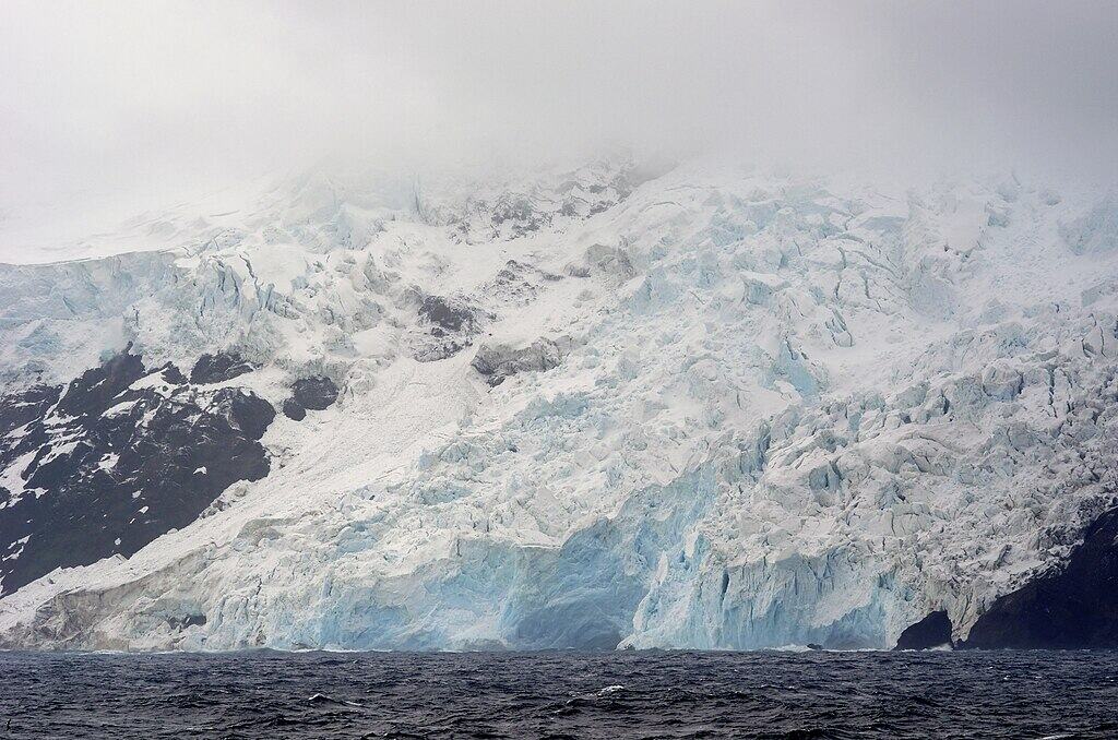
Bouvet Island sits so far from ordinary routes that even landing there is a challenge, with steep cliffs, ice, and dense fog guarding most approaches. Norway’s Polar Institute describes it as one of the world’s most isolated islands, and says about 89 percent of it is covered by glaciers, leaving only narrow margins for wildlife and brief research landings. The island is only 49 square kilometers, almost entirely ice covered, and its protected nature reserve status has kept the human footprint exceptionally light even as polar science has gradually filled in the map and landings still hinge on permits, weather, sea state, and timing on shore.
Heard and McDonald Islands, Where Fire Meets Ice
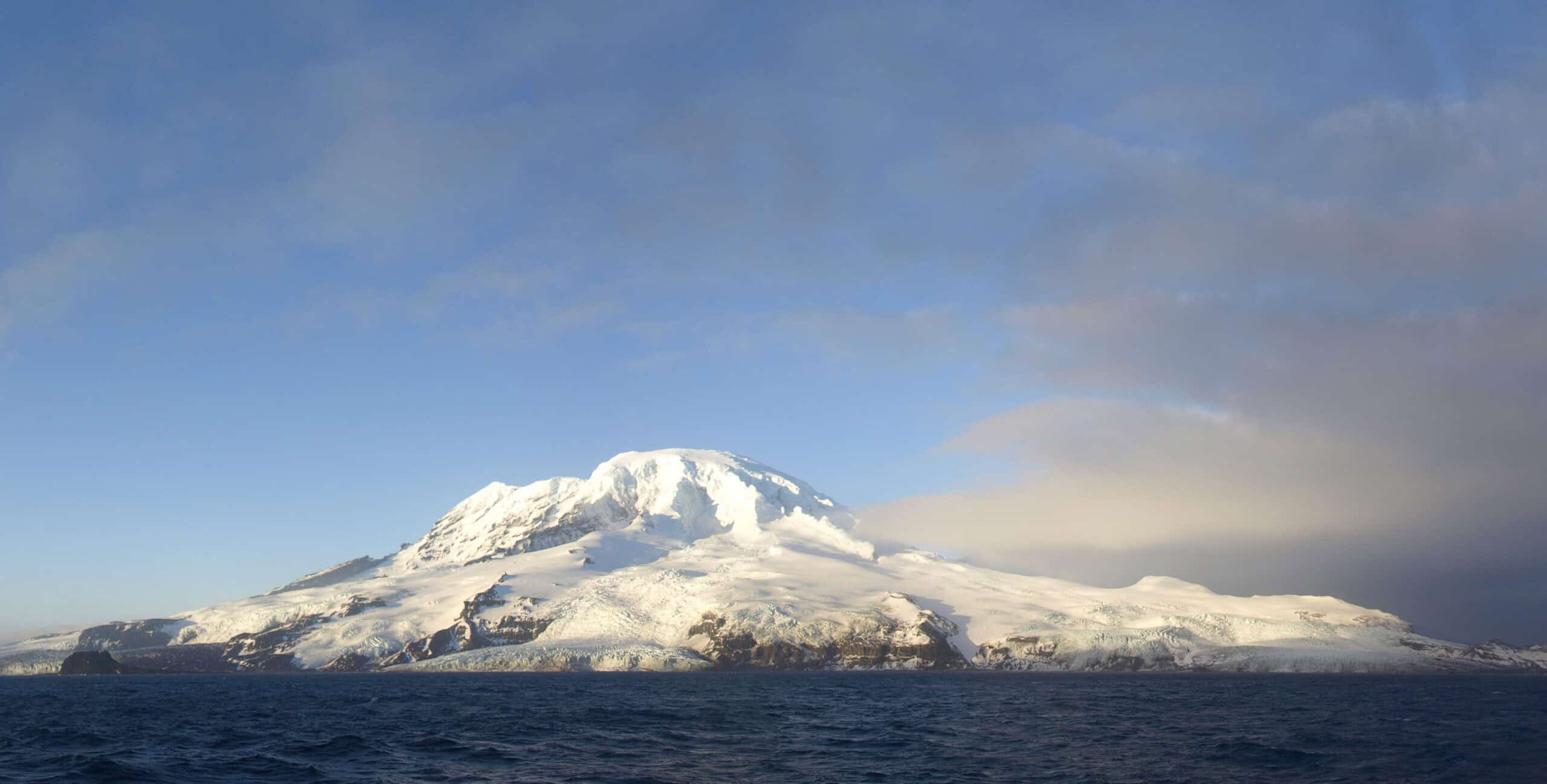
Far south in the Indian Ocean, Heard and McDonald Islands remain one of the planet’s rare island systems with almost no human alteration, a detail UNESCO highlights as central to their value. The islands are volcanic, glaciated, and remote, with UNESCO noting Heard Island’s active Big Ben volcano and the group’s importance for studying geomorphic change, glacier retreat, and intact ecological processes. Human access is limited and tightly managed, so most traces come from scientific work and monitoring rather than settlement, roads, or the steady traffic that changed so many other islands and change often appears in data before boot arrivals.
Kerguelen Islands, The Desolation Archipelago Still Watching
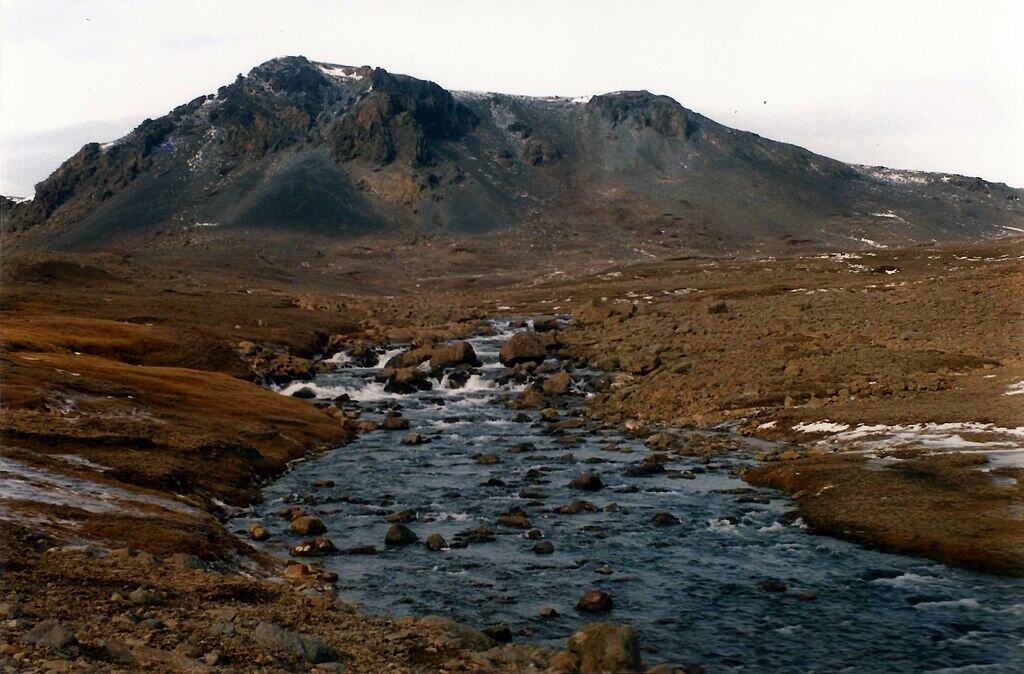
The Kerguelen Islands earned the nickname Desolation Island for good reason, spread across a windswept archipelago in the southern Indian Ocean with glaciers, dark rock, and long empty coastlines. Britannica describes the main island plus nearly 300 islets, while UNESCO includes Kerguelen in the French Austral Lands and Seas, a protected region whose distance from human centers has helped preserve major seabird and marine mammal habitats. Even when research teams rotate through, the scale of the place and the weather keep most of the landscape feeling untouched, quiet, and difficult to approach on its own terms and quiet returns after visits.
Gough and Inaccessible Islands, A South Atlantic Wild Zone
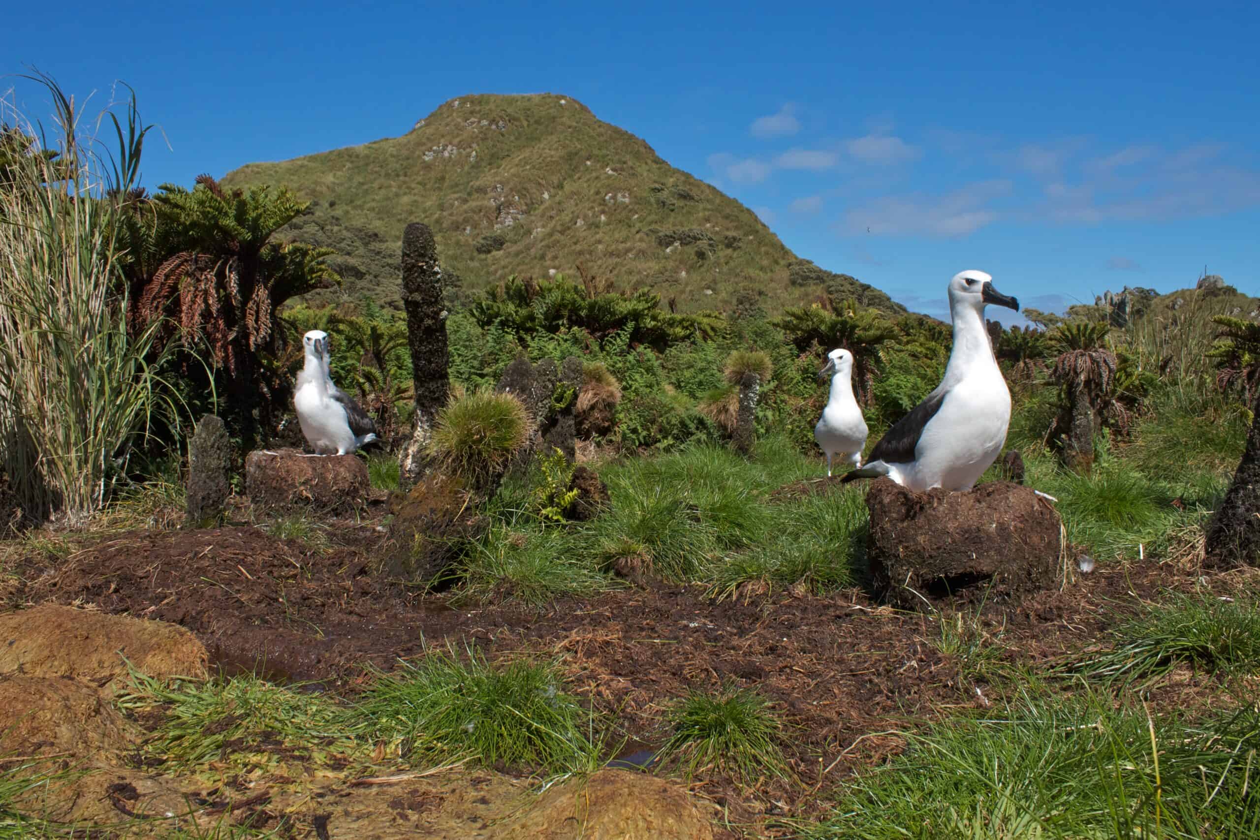
Gough and Inaccessible Islands sit deep in the South Atlantic, and UNESCO describes them as one of the least disturbed major cool temperate island ecosystems on Earth. Their isolation matters because it protects continuity: vast seabird colonies, native plant communities, and ecological relationships that vanished elsewhere after ports, predators, and roads arrived. Today, visits are mostly tied to research or conservation operations, so the human mark remains small, while the islands continue to serve as a rare baseline for how oceanic ecosystems function when distance still does most of the guarding while maps trace where few people travel.
Henderson Island, A Coral Atoll Kept Alive by Distance
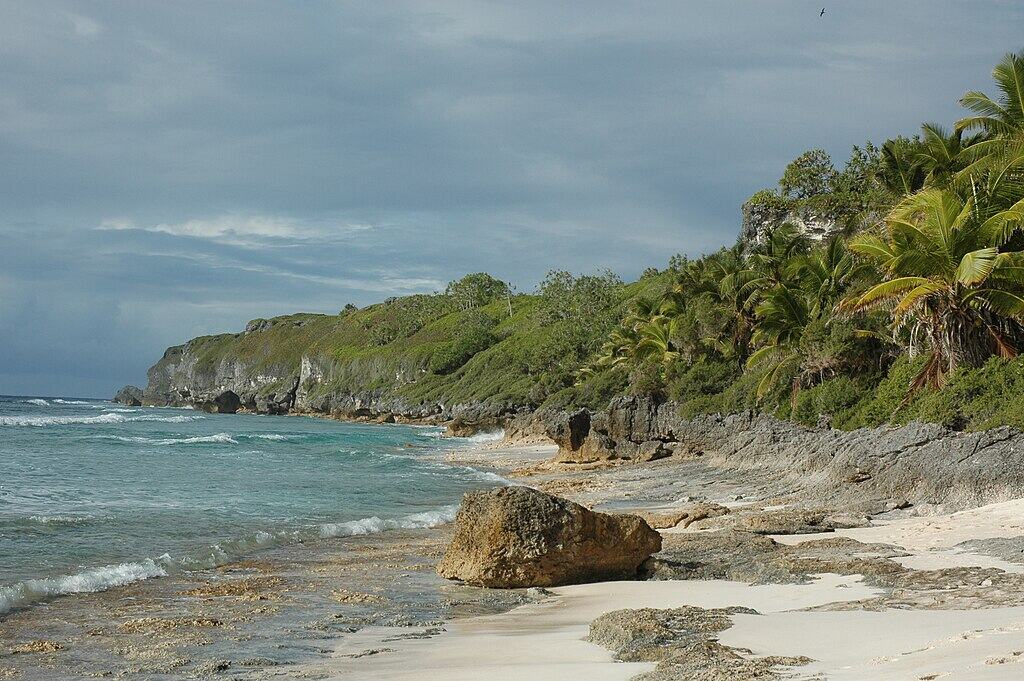
Henderson Island, part of the Pitcairn group, is remote even by Pacific standards, with UNESCO noting no major land mass within a 5,000 kilometer radius of the island. That distance helped preserve a near pristine elevated coral atoll ecosystem, and UNESCO also notes its value for studying island evolution, natural selection, and species found nowhere else. Access requires a license through Pitcairn authorities, and the island’s limited fresh water and poor agricultural conditions have kept it uninhabited, leaving science and careful management to shape most modern contact so even a licensed landing can feel brief against the island’s limits.
Surtsey, Iceland’s Protected Newborn Island
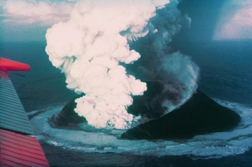
Surtsey rose from volcanic eruptions off Iceland between 1963 and 1967, and UNESCO calls it a pristine natural laboratory because it was protected from the start. Scientists have followed how life colonizes new land, recording the arrival of microbes, plants, birds, and invertebrates while strict rules sharply limit shore landings and other disturbance. Its isolation is unusual because it is partly legal, not just geographic: the world agreed that one young island should stay mostly free of ordinary traffic so natural succession could unfold in real time and that rule-bound distance has preserved one of Earth’s clearest records of succession.
McMurdo Dry Valleys, Antarctica’s Bare Earth Window
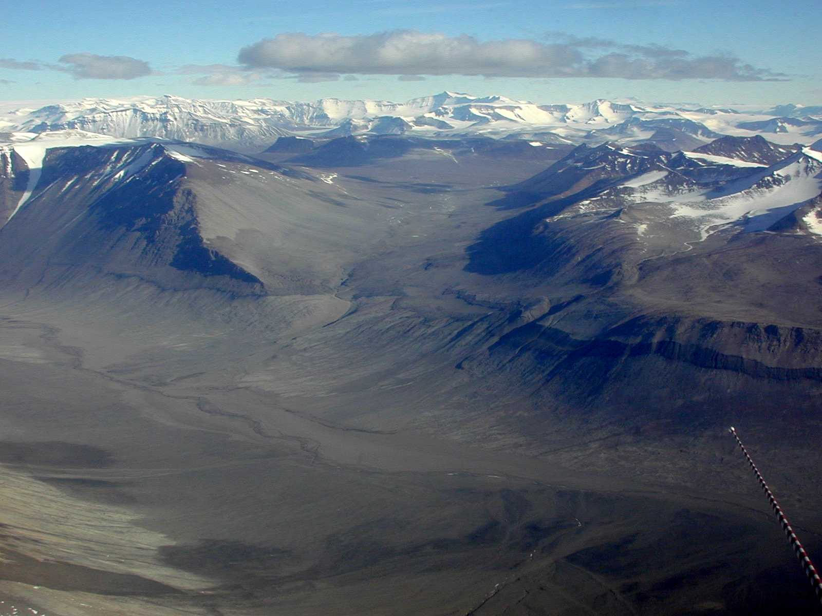
The McMurdo Dry Valleys look almost unreal within Antarctica because they are one of the few regions not buried beneath thick ice and snow. NASA describes summer meltwater streams feeding lakes on valley floors, while the U.S. National Science Foundation points to decades of meteorology and ecosystem records that now anchor climate research during unusual warming events. Instead of a blank white expanse, these valleys expose bare rock, wind shaped ground, and fragile microbial systems, making them one of the clearest places where sparse human presence supports careful observation instead of heavy impact as field crews leave only light traces.
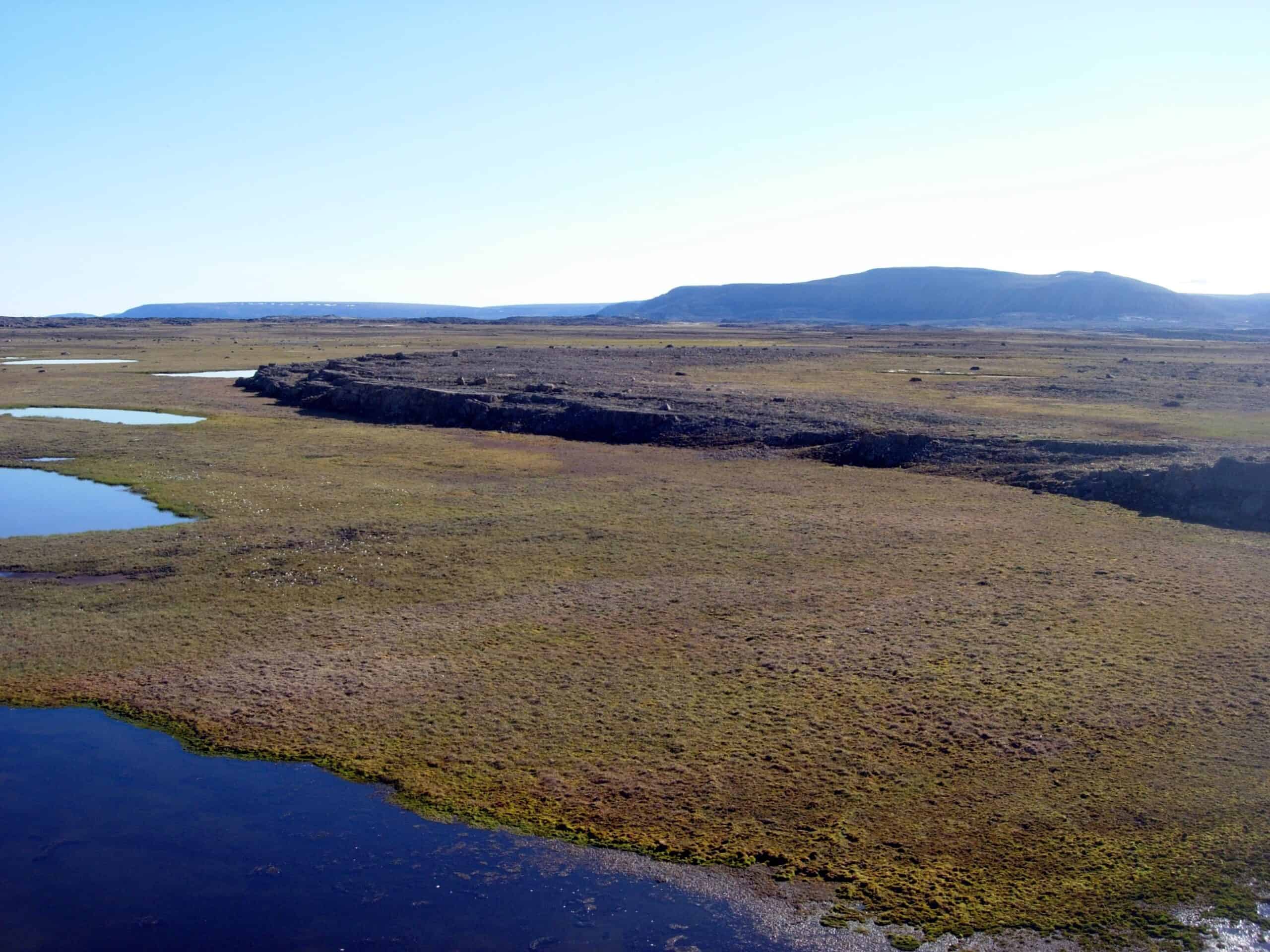
Quttinirpaaq, Canada’s Land at the Top of the World
Quttinirpaaq National Park on Ellesmere Island carries a name meaning land at the top of the world, and Parks Canada identifies it as the country’s northernmost national park. Parks Canada’s management plan also calls it one of Canada’s most remote and least visited national parks, noting there are no roads into the park and long distances from nearby communities and air access points. That remoteness has helped preserve Arctic tundra, glaciers, wildlife, and archaeological sites, while cooperative management with Inuit communities now guides how new visitation and research are handled and every trip follows strict Arctic logistics and rules.
Putorana Plateau, Siberia’s Isolated Canyon and Waterfall Realm
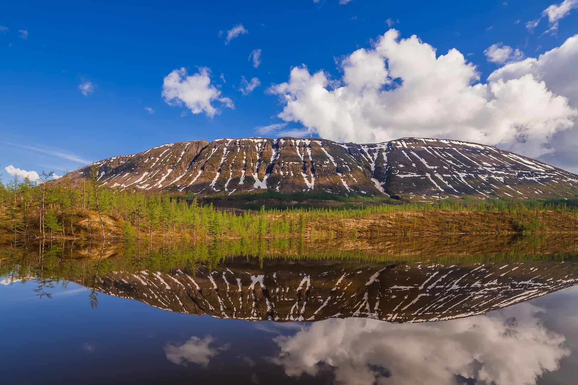
UNESCO’s record for the Putorana Plateau reads like a geography of distance, describing an isolated mountain range in northern Central Siberia about 100 kilometers north of the Arctic Circle. The site includes pristine taiga, tundra, arctic desert systems, and untouched cold water lakes and rivers, while UNESCO also highlights deep canyons, layered basalt, and thousands of waterfalls across a vast landscape. Human infrastructure remains minimal in much of the protected area, which is exactly why the plateau still functions as a rare full scale reference for subarctic and arctic ecological processes and helps researchers track long shifts now.
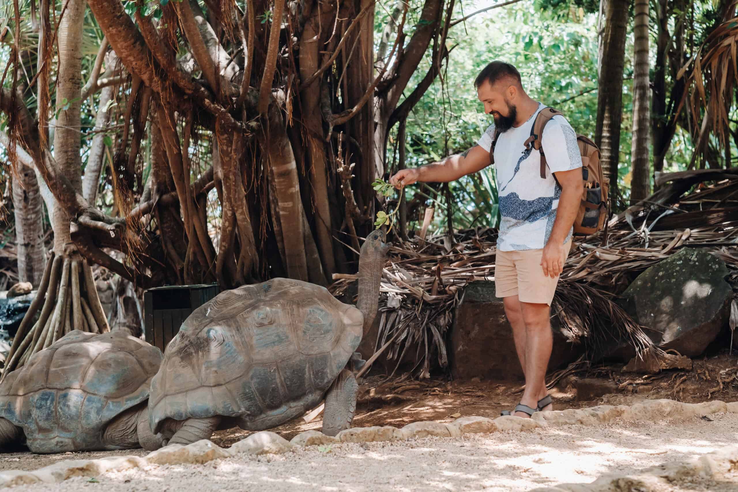
Aldabra Atoll, A Remote Stronghold of Giant Tortoises
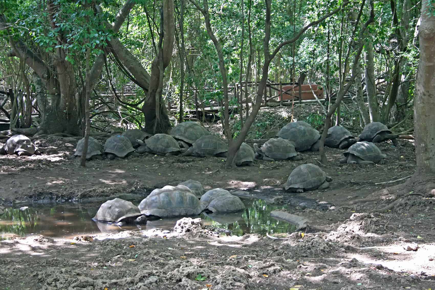
Aldabra Atoll is one of the strongest examples of isolation protecting life rather than shutting it out. UNESCO says its remoteness and inaccessibility kept it largely untouched for most of its history, preserving a raised coral atoll ecosystem with a self sustaining giant tortoise population, rich reef habitats, seabirds, and mangroves. The same distance that preserved Aldabra also makes protection hard, so access and tourism are tightly controlled, and each research visit carries the weight of both discovery and restraint in a place that.
Point Nemo and Devon Island, Two Modern Frontiers of Distance
Point Nemo, identified by NOAA as the oceanic point farthest from land, sits about 2,688 kilometers from the nearest islands and shows how remoteness can exist with no shoreline at all. On land, Devon Island in Nunavut offers another version of distance: Britannica describes a vast High Arctic island, and the Haughton Mars Project uses its crater terrain as a planetary analog research site. Both places are better mapped than ever, yet each still feels beyond routine human movement, where access depends on planning, weather, and a willingness to work with the limits of Earth itself and access still depends on logistics, not roads or airstrips.