We may earn money or products from the companies mentioned in this post. This means if you click on the link and purchase the item, I will receive a small commission at no extra cost to you ... you're just helping re-supply our family's travel fund.
Vacation risk in the United States is rarely about one thing. In some places it is heat that turns a short hike into a medical emergency. In others it is water that looks calm until a rip current pulls hard, or a canyon that stays dry until a storm miles away sends a sudden wall of runoff. Park rangers, meteorologists, and volcanologists track these patterns every season. Their warnings point to a handful of destinations where beauty is real, but the margin for error is thin.
Death Valley National Park, California and Nevada
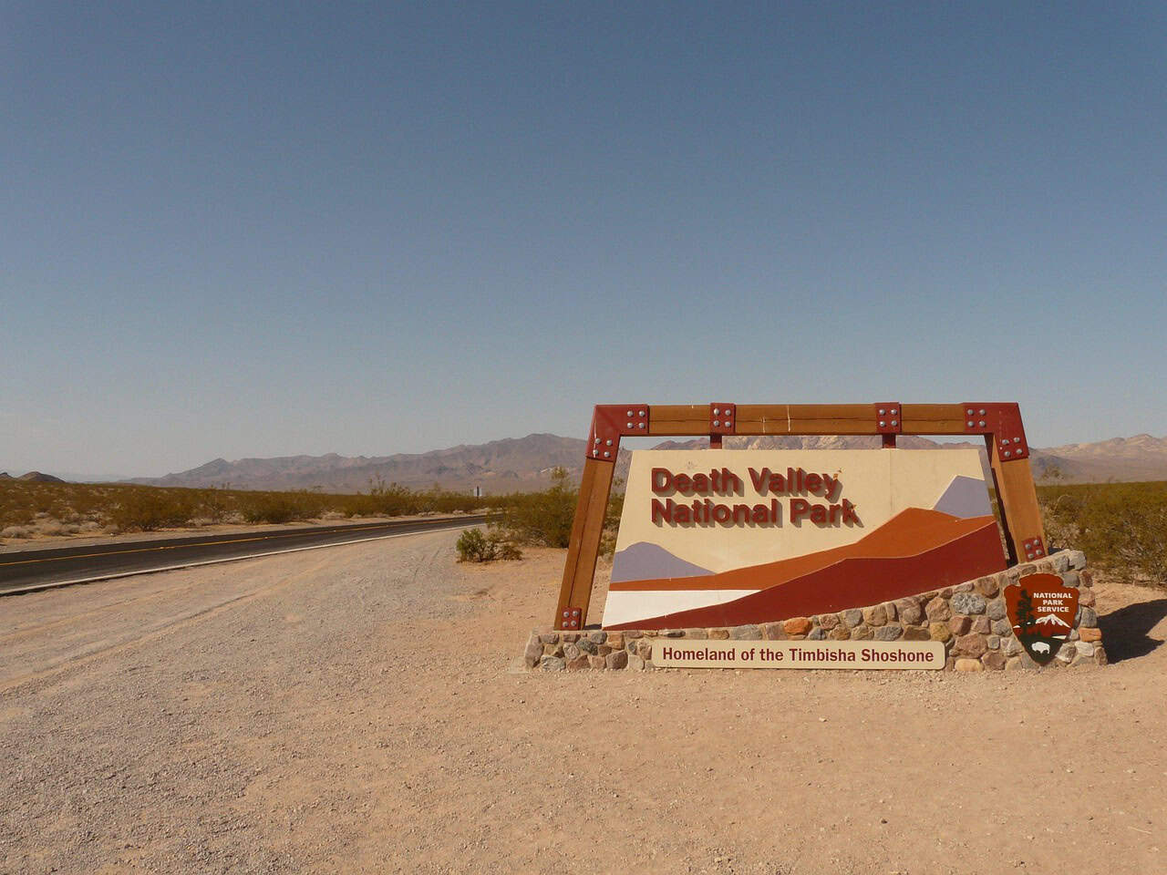
Death Valley is a heat trap where summer temperatures can top 120°F even in the shade, and rescue is never a sure thing when bodies start to fail. The National Park Service recorded 128°F at Furnace Creek on July 6, 2024, and later reported a heat-related visitor death, while national reporting notes the park’s long-running reputation for record heat. Even short roadside walks can spike core temperature, cars can overheat, and sweat loss can outpace notice, especially from June through Sept., so rangers push early starts, air-conditioned breaks, salty snacks, staying close to a vehicle, and conservative turn-around times as well over bravado.
Source notes:
Grand Canyon National Park, Arizona
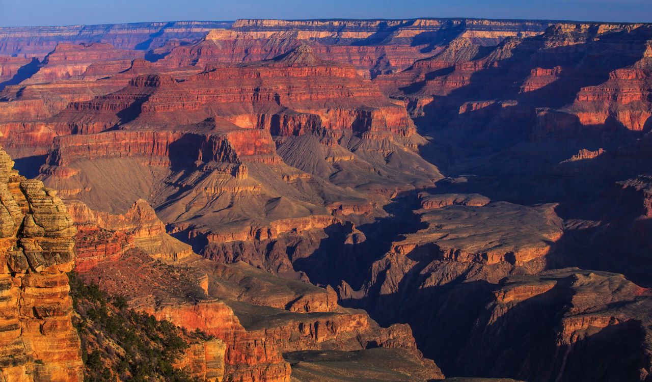
At the Grand Canyon, danger often arrives as confidence: hikers drop below the rim in cooler morning air, then face a long, steeper climb back through reflected heat and dry wind. Park rangers warn that summer temperatures on exposed inner-canyon trails can exceed 120°F in the shade, and they strongly advise avoiding the 10 a.m. to 4 p.m. window when heat illness and hyponatremia can escalate quickly. Medical calls and rescues are routine in peak season, and water sources are limited, so experts stress pacing, electrolytes, shaded rest stops, and turning around early before the canyon starts feeling endless, and sticking to maintained trails.
Source notes:
Yellowstone National Park, Wyoming, Montana, and Idaho
Yellowstone’s greatest visitor hazard is not wildlife but the thermal basins, where thin crust can hide scalding water, unstable ground, and acidic mud that looks solid until it collapses near geysers and hot pools. The National Park Service notes that more than 20 people have died from burns after entering or falling into hot springs, which is why staying on boardwalks is treated as a life rule, not a suggestion. Many incidents start with a shortcut for a photo, or a closer look, then end in seconds, so rangers emphasize controlled pacing, holding hands with kids, letting crowds pass, and treating every steam plume as a warning, not scenery.
Source notes:
Zion National Park, Utah
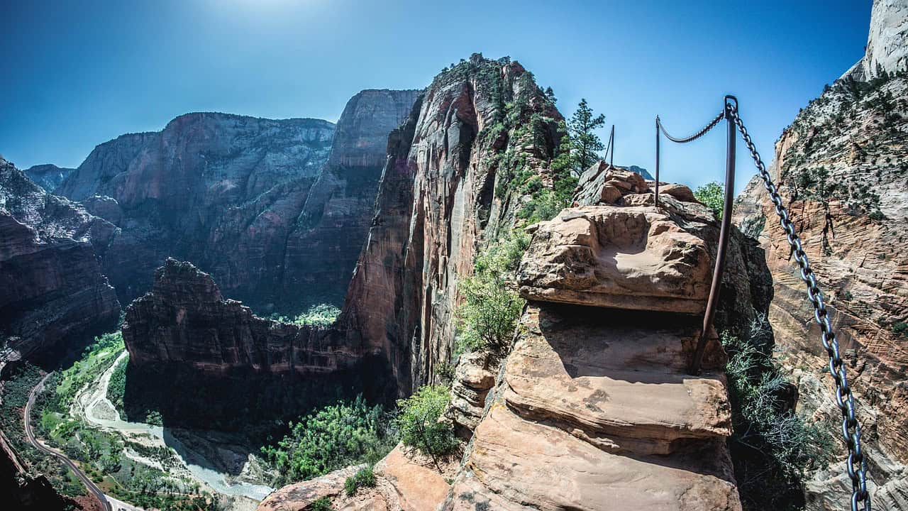
Zion’s Narrows looks gentle when the Virgin River runs clear, but the canyon is a long stone funnel, with walls that pinch tight and hide escape routes, all at once, and storms miles upstream can turn ankle-deep water into a sudden, chest-high surge. The National Park Service posts daily flash flood potential forecasts for slot canyons, ranging from not expected to expected, because floods can arrive with little warning even when skies are blue in the main canyon. With limited exits, slick rock, and cold water that can trigger hypothermia, experts treat weather checks, permit guidance, and early turnarounds as nonnegotiable parts of the hike.
Source notes:
Florida Panhandle Beaches and the Northern Gulf Coast
Along the northern Gulf Coast, from Florida’s Panhandle beaches into coastal Alabama, the most dangerous days can look postcard-perfect. The National Weather Service calls rip currents the number-one weather-related killer at these beaches and reports 213 rip-current fatalities since 2002 in the Tallahassee and Mobile forecast areas, a toll built from fast undertows and tired swimmers. Lifeguards and meteorologists note that rip currents drive most rescues and can often cause over 100 U.S. drowning deaths a year, so they treat red flags as hard limits, favor guarded zones, and teach escape by floating, signaling, and moving parallel to shore.
Source notes:
New Smyrna Beach, Florida
New Smyrna Beach sits in Volusia County, the stretch Florida Museum scientists label the Shark Bite Capital of the World, and the numbers reflect heavy surf culture in shallow coastal water. ISAF data show 94 confirmed unprovoked bites in Volusia County from 2012 to 2021, with spikes during busy beach years, and the museum notes that small coastal requiem sharks like blacktips and spinners are often suspected in Florida bites. The risk stays low compared with drowning, but the mix of surfers, baitfish, and murkier breaks means local warnings, flag system, and spacing away from fishing lines, inlets, and dawn-or-dusk sessions matter in summer.
Source notes:
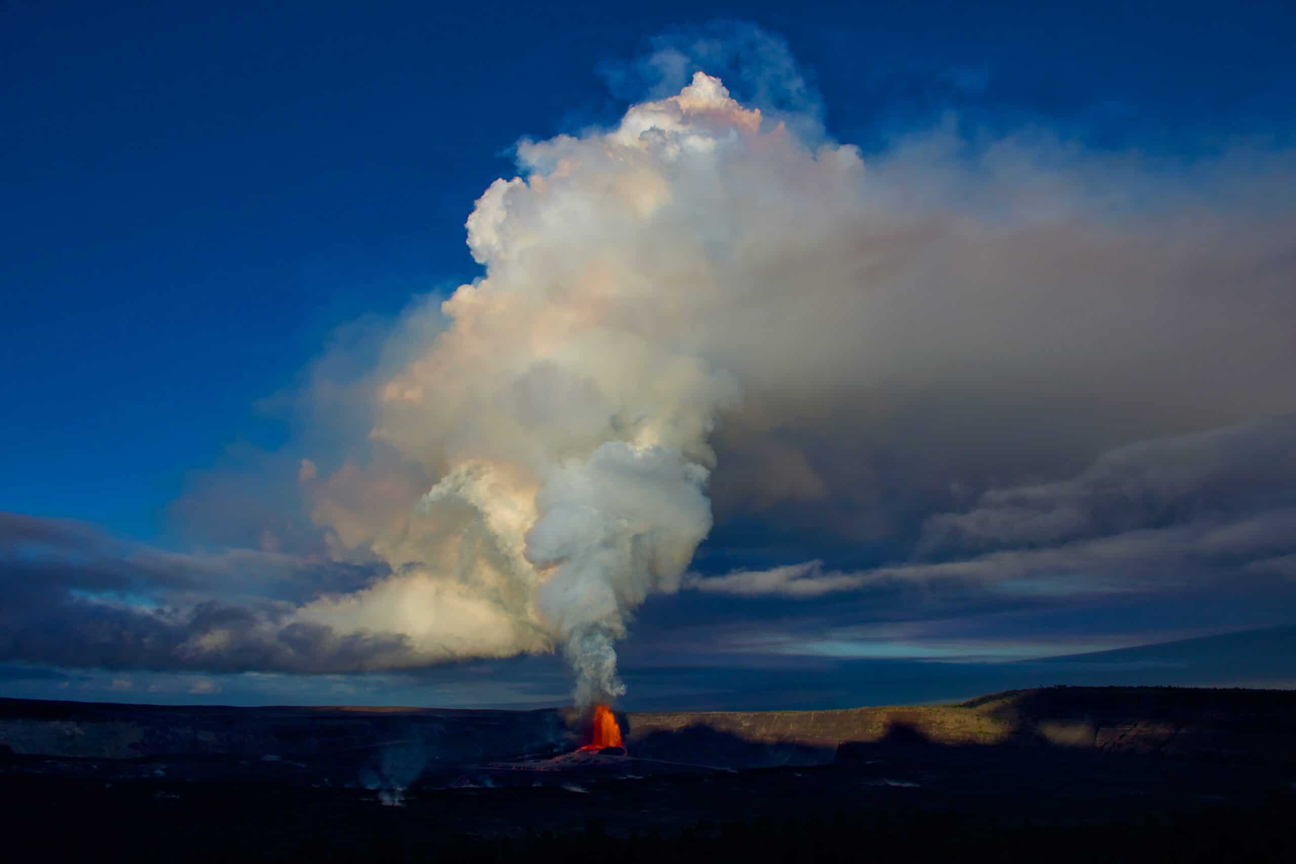
Hawaiʻi Volcanoes National Park, Hawaiʻi
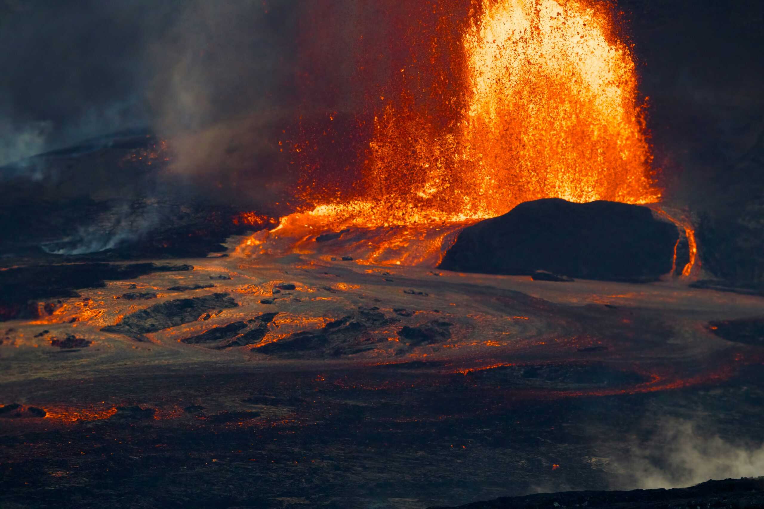
Hawaiʻi Volcanoes National Park can feel calm until Kīlauea shifts, and USGS updates note episodic eruptive activity since Dec. 23, 2024, centered around Halema‘uma‘u, often with lava fountains and pauses. Even when lava stays in closed areas, the park warns that volcanic gases like sulfur dioxide can create vog, a haze of particles and acids that can irritate lungs and eyes, especially when wind traps it near communities and viewpoints. Rangers and scientists treat closures, air-quality alerts, and distance from fissures as the real itinerary, because volcanic glass, unstable ground, and sudden cracks can turn a scenic pullout into a hazard.
Source notes: