We may earn money or products from the companies mentioned in this post. This means if you click on the link and purchase the item, I will receive a small commission at no extra cost to you ... you're just helping re-supply our family's travel fund.
A sweep of laser light over a green canopy has a way of changing history overnight. In Mexico’s Balamkú reserve, archaeologists used LiDAR data and hard, humid fieldwork to confirm a sprawling Maya center that had vanished into vines and wetlands for more than 1,000 years. The ruins, now called Ocomtún, show plazas, pyramidal towers, stone columns, and a ballcourt, suggesting a city that mattered during the Late Classic era. Each new mapped wall reframes how people organized power, water, ritual, and survival in the jungle.
Laser Found What Eyes Couldn’t
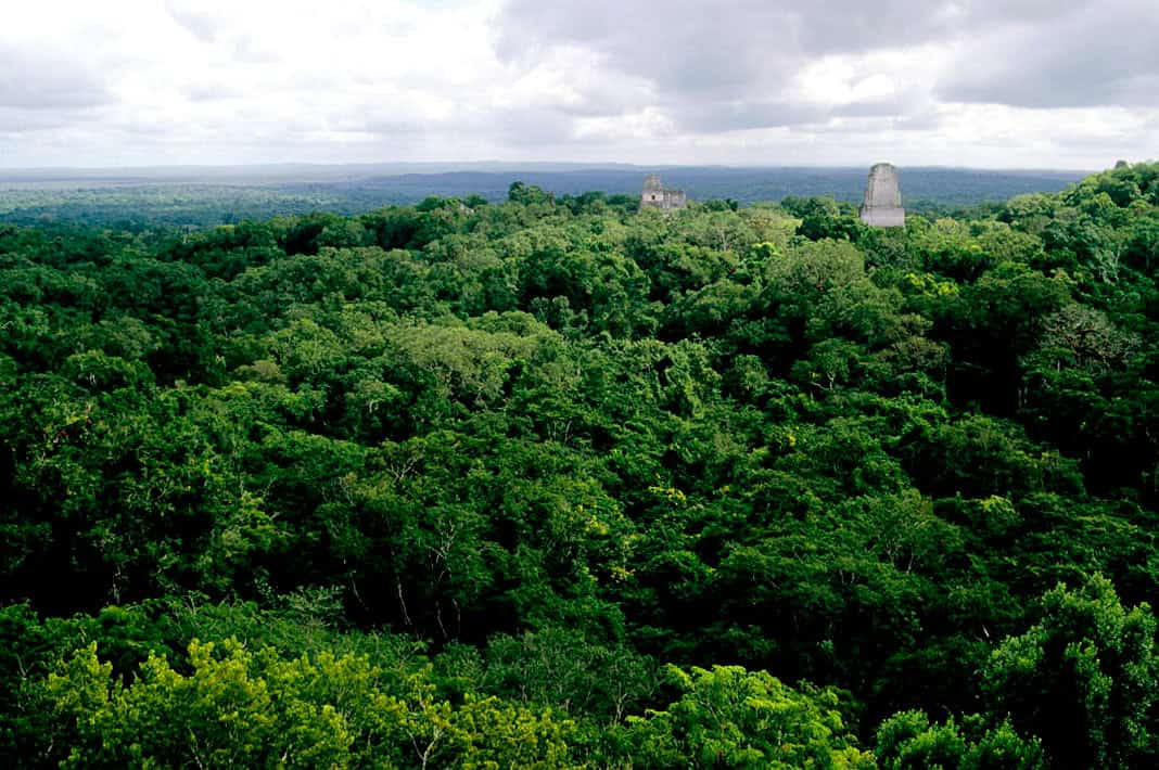
Researchers first spotted the city through airborne LiDAR scans, then followed those digital contours into the Balamkú ecological reserve, where jungle canopy erases straight lines and makes distance feel elastic. Reuters reported the search ran from March to June, covering a largely unexplored stretch said to be larger than Luxembourg, before the data guided ground teams to the monumental nucleus. That shift from pixels to masonry matters, because it turns rumor into coordinates, and lets archaeologists compare street plans, building clusters, and water access against nearby Classic centers in the Central Lowlands closely.
A Name Built From What Survived
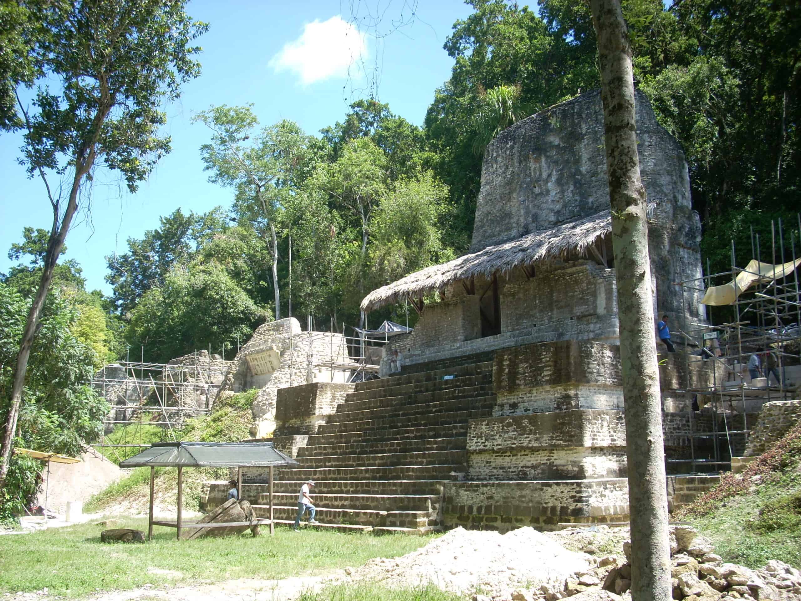
The team named the place Ocomtún, a Yucatec Maya phrase translated as stone column, after the many cylindrical posts scattered through the monumental core. Investigators suggest the columns once framed entrances to upper rooms, a practical architectural solution that also signals status, ceremony, and controlled access in an otherwise flat landscape. The name is simple, but it anchors the discovery in what survives: stone set to direct movement, mark thresholds, and hint at multi-story buildings whose timber, plaster, and paint have long since returned to the forest floor, leaving only the columns to speak over 1,000 years.
A City Perched Above The Wetlands
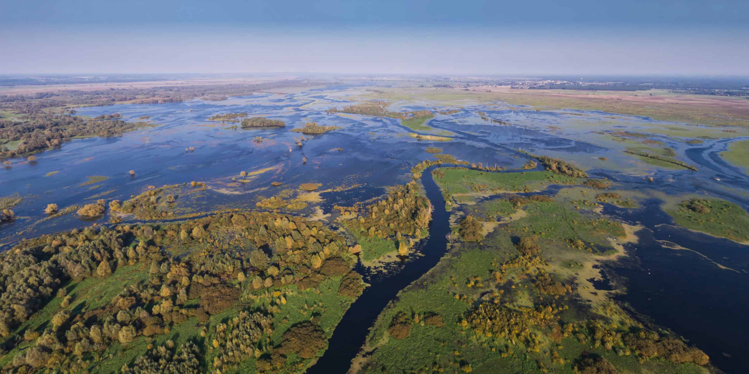
Ocomtún sits on a peninsula of higher ground ringed by extensive wetlands, a placement that reads like an engineering decision as much as a defensive one. INAH descriptions quoted by reporters emphasize a monumental nucleus of about 123 acres, with large buildings rising from terrain that can flood, dry, and flood again across seasons. In that setting, every raised platform, drainage cut, and chosen causeway becomes a clue to how Maya communities negotiated water, farmland, mosquitoes, and supply lines while keeping ceremonial space above the reach of marshy ground when rains turned trails into sudden rivers in minutes too.
Towers That Turned Space Into Power
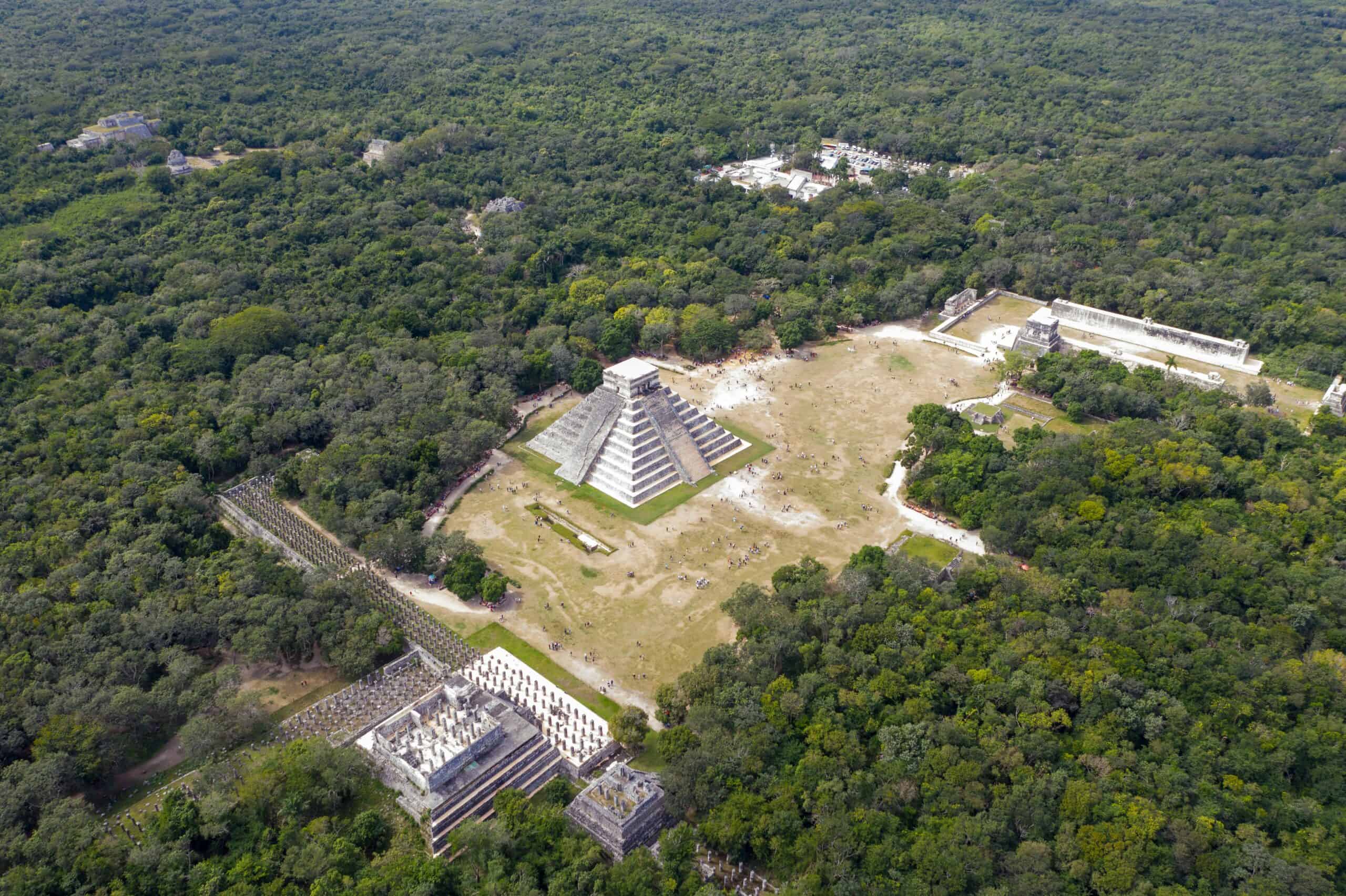
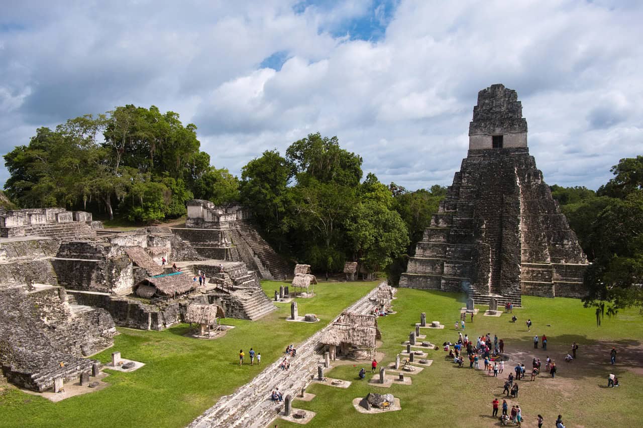
Several pyramidal structures rise more than 50 feet, and Popular Mechanics notes one pyramid that climbs about 82 feet above the natural terrain, making the skyline legible even through the canopy in LiDAR relief. Archaeology Magazine adds that one pyramid-shaped building stands about 50 feet tall, consistent with a Late Classic civic core built to be seen, climbed, and remembered. Height here is not only spectacle; it is a public language of power, where staircases, terraces, and summit platforms turned gatherings into theater and rulers into silhouettes against tropical light even when daily life stayed low in deep shade.
Plazas Designed For Crowds And Control
In the southeast, researchers mapped three plazas edged by imposing buildings and patio groups, a layout that suggests ceremonies staged for crowds as well as daily movement between households. Between two main plazas, Ivan Šprajc described low, elongated structures arranged almost in concentric circles, an unusual geometry that reads like planned space rather than organic sprawl. The circles hint at coordinated labor and shared intention, whether for markets, meetings, processions, or rituals that needed a clear center and a controlled edge in a wetland world. The pattern helps explain why the site reads as civic not rural.
A Ballcourt With More Than Sports At Stake
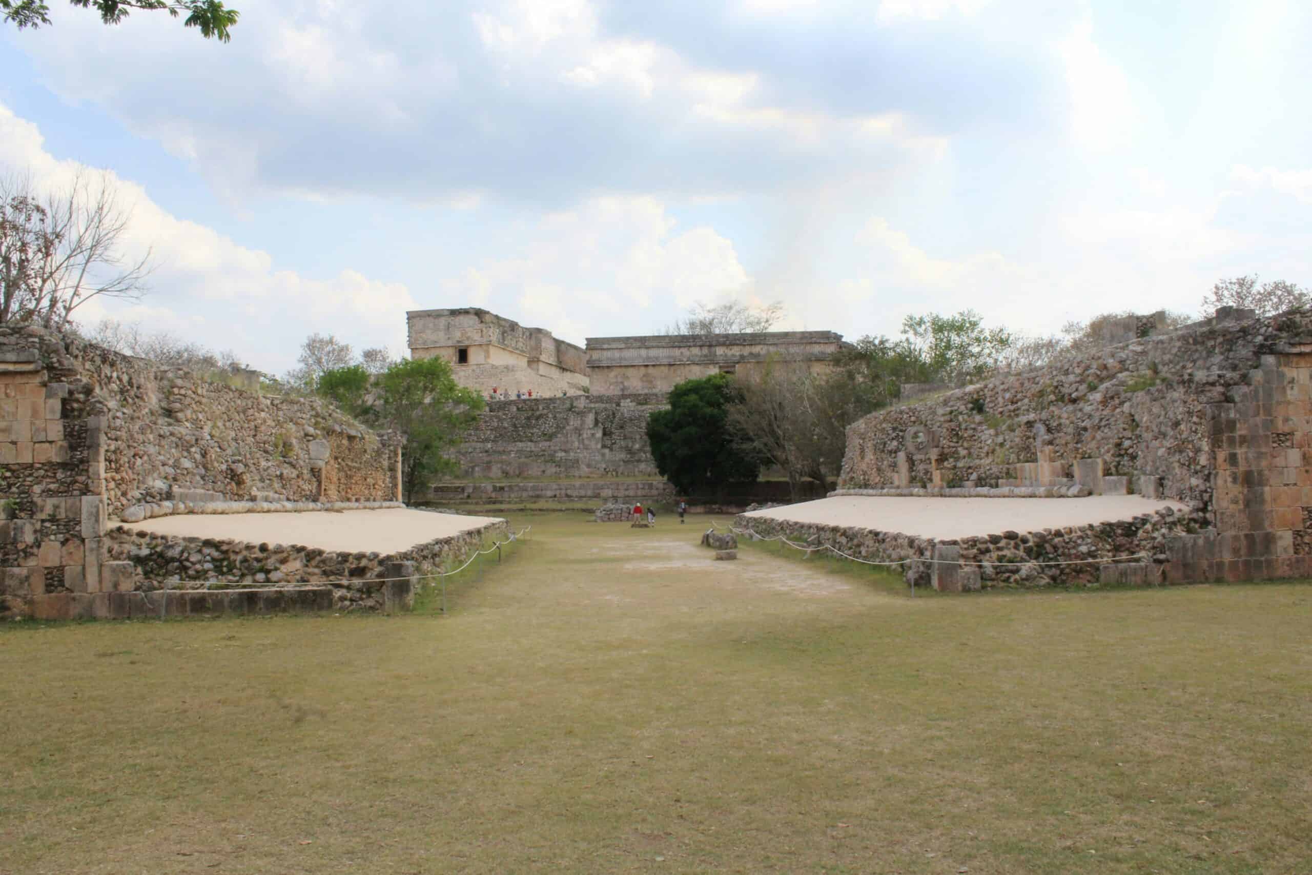
A ballgame court appears in the mapped core, a reminder that Maya cities built sport, ritual, and politics into the same public calendar. The rubber-ball game carried symbolic weight across Mesoamerica, so a court is rarely just recreation; it signals trained players, spectators, and leaders who used spectacle to bind alliances and settle rivalries. At Ocomtún, the court sits beside plazas and tall platforms, placing competition in the middle of civic life, where stories, wagers, and ceremonies could move as quickly as the ball itself across worn stone. It suggests a community large enough for festivals and specialists here.
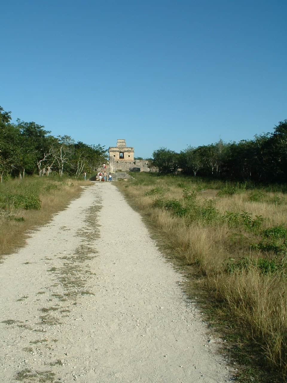
Causeways That Kept The City Moving
A causeway is reported to link the southeastern complex to the northwest sector where most construction clusters, implying planned circulation across marshy ground rather than casual footpaths. Popular Mechanics adds that structures extend toward the La Rigueña River, including stairways, monolithic columns, and central altars, plus spaces interpreted as potential markets or community ritual areas. Together, those details sketch a city wired for exchange: goods moving in, offerings moving upward, and people moving along routes that stayed usable when wetlands rose and travel turned slow even as politics tightened elsewhere.