New River Gorge Became America’s 63rd National Park in 2020. 8 Ways to See It After the Leaves Fall
We may earn money or products from the companies mentioned in this post. This means if you click on the link and purchase the item, I will receive a small commission at no extra cost to you ... you're just helping re-supply our family's travel fund.
New River Gorge National Park and Preserve in southern West Virginia became America’s 63rd national park on December 27, 2020, when the designation was signed into law as part of a federal spending package. The area had been protected as the New River Gorge National River since 1978, but the 2020 change put it in the same category as Yellowstone and the Great Smoky Mountains. Visitor numbers have climbed since.
Most of those visitors come in summer for whitewater or in October for fall color and Bridge Day. After the leaves drop in November, the gorge gets quieter, and the views get sharper. Bare trees reveal rock walls, old mining ruins, and river bends that summer foliage hides. Here are eight ways to see the park in late fall and winter.
8 Ways to See New River Gorge National Park After the Leaves Fall
A quick orientation first. The park protects about 53 miles of the New River as it cuts through the Appalachian Plateau, with the gorge reaching depths of roughly 1,000 feet in places. Most of the land is technically a national preserve, where hunting is allowed, while a smaller core is the national park itself. Entry is free. The main hub is the town of Fayetteville, near the northern end of the gorge.
1. Canyon Rim Visitor Center and the Bridge Overlook
Start at the Canyon Rim Visitor Center, just north of the New River Gorge Bridge on US 19. It is the park’s main visitor center and stays open year-round, though hours shrink in winter. Exhibits explain the gorge’s geology, its coal mining past, and the communities that once lined the river.
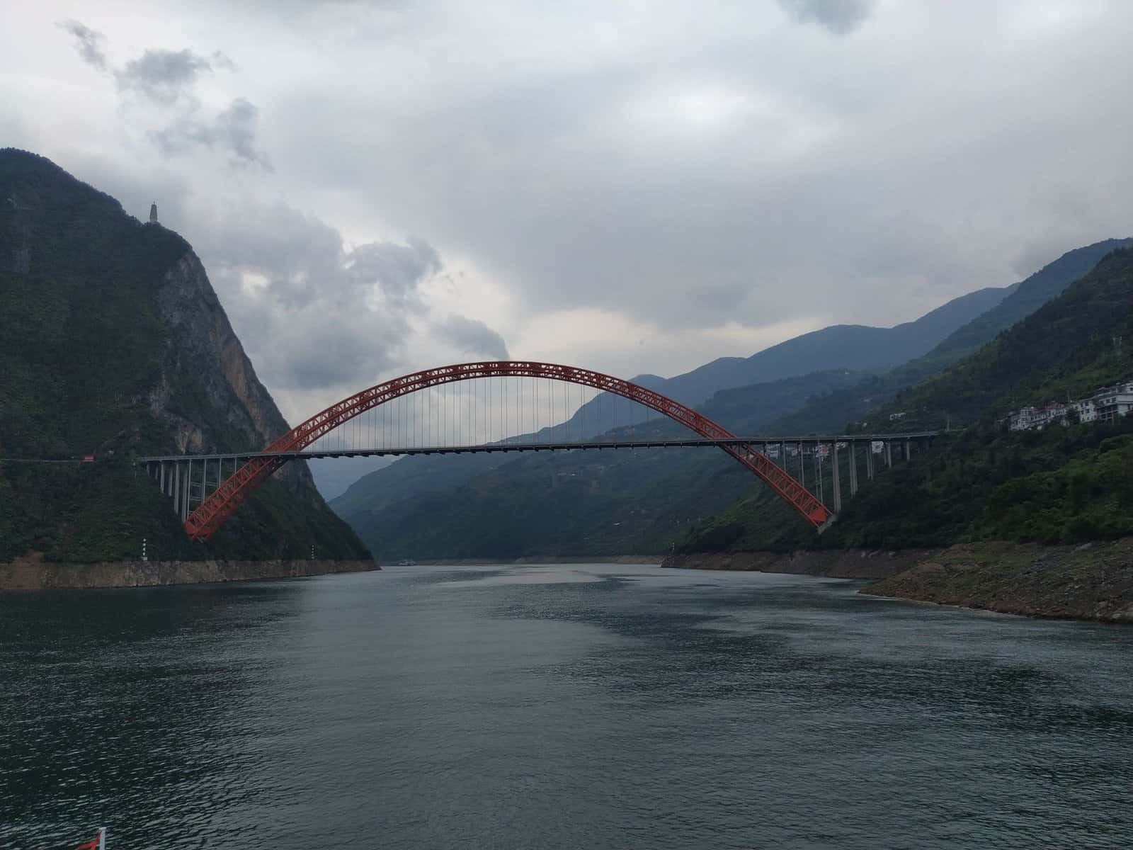
Behind the building, a boardwalk and stairway lead down to overlooks facing the bridge. The New River Gorge Bridge opened in 1977. It stretches 3,030 feet long and stands 876 feet above the river, and it was once the longest single-span steel arch bridge in the world. With the leaves gone, you see the full arch and the gorge walls below it. The lower overlook involves a long staircase, so take your time on the climb back.
2. Fayette Station Road
Before the bridge existed, crossing the gorge took close to 45 minutes on a narrow, winding road. That road still exists. Fayette Station Road drops from the rim near Fayetteville to the river, crosses a small bridge at the bottom, and climbs back up the other side.
The drive is one-way in places and has tight switchbacks, so go slowly. In late fall, it is one of the best ways to understand the scale of the gorge. You look straight up at the steel arch from the river. Pull-offs along the way have signs about the mining towns that once stood here. The road can close in snow or ice, so check conditions with the park before you go.
3. Long Point Trail
Long Point Trail is the classic hike for a bridge view. It runs about 3.2 miles round trip from a trailhead off Gatewood Road near Fayetteville, mostly through flat forest, and ends at a rock outcrop with a direct, side-on view of the bridge.
This is a moderate trail with a short descent near the end. It is one of the most popular hikes in the park, and parking fills quickly on warm weekends. In winter, arrive early in the day. The rock point can be icy after freezing rain, so watch your footing near the edge, where there are no railings.
4. Endless Wall Trail
Endless Wall Trail follows the rim of the gorge along a long line of sandstone cliffs. The trail runs about 2.4 miles one way between two trailheads, with Diamond Point as the highlight. From there, you get a wide view upstream and downstream, with climbers often visible on the cliffs below.
Leaf-off season is perfect for this trail. Summer foliage blocks many rim views, but in November and December you can see the river through the trees for long stretches. The terrain is mostly gentle, with a few rocky sections and ladders near Diamond Point. Bring layers, because the rim can be windy.
5. Grandview
Grandview sits at the southern end of the park, near Beckley. It is the place to see the gorge’s most dramatic river bend. The Main Overlook is a short walk from the parking area and looks down about 1,400 feet to the river as it loops around a ridge.
Grandview also has trails along the rim, including the Grandview Rim Trail and the Castle Rock Trail. In late fall, the area is quiet and the overlooks are clearer. The road into Grandview may close beyond a certain point in winter, so check current access. On a cold, clear morning, mist sometimes fills the gorge below, which makes for striking photos.
6. Thurmond
Thurmond was once one of the busiest rail towns in the region, a stop on the Chesapeake and Ohio Railway where coal from mines along the gorge moved out to market. At its peak in the early 1900s, it had banks, hotels, and a lively commercial strip. As coal declined, the town emptied.
Today, Thurmond is a small cluster of historic buildings along the tracks. The restored depot serves as a seasonal visitor center, typically closed in winter, but you can walk the streets and read interpretive signs year-round. Freight trains still roll through, so stay off the tracks. Amtrak’s Cardinal line also makes a flag stop here. The drive in follows a narrow road along Dunloup Creek and is part of the experience.
7. Sandstone Falls
Sandstone Falls is at the southern end of the park, where the New River spills over a wide ledge of sandstone. It is the largest waterfall on the New River, stretching across the full width of the river. Boardwalks on small islands let you get close to the cascades.
The drive along River Road from Hinton to the falls is scenic and largely flat, following the river through farmland and woods. The Sandstone Visitor Center near Interstate 64 is open year-round with winter hours. In late fall, higher water often makes the falls louder and more impressive. The boardwalks can be slick in the cold, so move carefully.
8. Glade Creek Grist Mill at Babcock State Park
Just outside the national park boundary, Babcock State Park is home to the Glade Creek Grist Mill, one of the most photographed spots in West Virginia. The mill was built in 1976 using parts from several older mills across the state. It sits beside a rushing creek and is a working mill that grinds cornmeal in season.
The mill is a short drive from the park’s southern end. It looks especially good in winter, when snow dusts the roof and the creek runs hard. Babcock also has trails, cabins, and a campground, which makes it a good base for exploring the southern part of the gorge.
Planning a Late-Fall Trip to New River Gorge National Park
Winter visits take a bit more planning than summer ones. Some facilities close for the season, and weather can change roads quickly. A few tips help:
- Check the park’s alerts before you go. Fayette Station Road and some secondary roads close in snow or ice.
- Bring traction devices for icy trails, especially Long Point and the rim trails.
- Expect fewer services. Some outfitters and restaurants in Fayetteville cut hours in winter.
- Remember hunting season. Hunting is allowed in the preserve portions of the park, so wear bright colors on trails during fall seasons.
Daylight is short in December, with sunset before 5:30 p.m. Plan hikes so you finish well before dark, since rim trails get dark fast under the trees.
Why Late Fall Is a Smart Time to Go
Visitation at New River Gorge spikes in summer and early fall. Bridge Day, held on the third Saturday of October, closes the bridge to traffic and brings tens of thousands of spectators to watch BASE jumpers and rappellers. After that, crowds drop off.
That leaves November through early March as the quiet season. You get easier parking, open trails, and long views through bare trees. The trade-off is colder weather and some closures, but for many visitors, the clearer views are worth it. The gorge’s rock walls, river bends, and old mining remains stand out far more in winter than they do behind a wall of green.
Where to Stay and Eat
Fayetteville is the best base. It is a small town with restaurants, coffee shops, and outdoor outfitters, just minutes from the Canyon Rim Visitor Center. Lodging includes cabins, motels, inns, and vacation rentals around town.
Beckley, about 30 minutes south, has more chain hotels and is closer to Grandview. Hinton works well for Sandstone Falls and the southern river. Many visitors split a long weekend between the north and south ends of the park, since the drive between them takes about an hour.
The Gorge’s Coal Mining Past
Much of what makes New River Gorge interesting in winter is history that summer leaves hide. From the late 1800s into the mid-1900s, coal mining towns lined the river. Companies built homes, stores, and coke ovens along the rail line. When mining declined, many towns disappeared, leaving foundations, ruins, and rusting equipment in the woods.
Several trails pass old mining sites. Kaymoor, below Fayetteville, was a mining town where a steep trail leads to ruins of coke ovens and mine buildings. The Kaymoor Miners Trail is strenuous, with hundreds of steps, but it shows just how hard life was in the gorge. With the leaves down, you can see more of the old structures from the trail and the rim.
That history is part of why New River Gorge feels different from many national parks. It is not untouched wilderness. It is a landscape that was mined, settled, and then reclaimed by forest, and winter is when you can read that story most clearly.