Kauai’s Waimea Canyon Is 3,600 Feet Deep. 7 Lookouts and Trails Worth Your Time
We may earn money or products from the companies mentioned in this post. This means if you click on the link and purchase the item, I will receive a small commission at no extra cost to you ... you're just helping re-supply our family's travel fund.
Waimea Canyon on Kauai’s west side is about 10 miles long, roughly a mile wide, and more than 3,600 feet deep. Its walls are layered in red, rust, orange, green, and brown, the exposed edges of ancient lava flows cut by rivers and collapsed along faults over millions of years. Because of its size and colors, Waimea Canyon Kauai is often called the Grand Canyon of the Pacific, a nickname frequently credited to Mark Twain, though historians have never found it in his writings.
The canyon is in Waimea Canyon State Park, and the road beyond it climbs into Kokee State Park, where the land rises to about 4,000 feet and the canyon gives way to cliffs that drop to the Napali Coast. Two connected roads make the trip possible: Waimea Canyon Drive, Highway 550, which starts near the town of Waimea, and Kokee Road, Highway 552, which joins it from Kekaha. Together they climb about 18 miles from sea level to the end of the road.
You can see the main viewpoints in a half day, but the canyon rewards a full day. Here are seven lookouts and trails worth your time, listed in the order you reach them driving up.
7 Lookouts and Trails in Waimea Canyon Kauai
1. Waimea Canyon Lookout
Waimea Canyon Lookout, at about 3,400 feet, is the main viewpoint and the one most people picture when they think of the canyon. A short paved path leads from the parking lot to a railed overlook with a sweeping view across and down the canyon. On clear days, you can see layers of red rock, deep green valleys, and the thin silver line of a waterfall on the far wall.
This lookout has restrooms and the most parking, and it is the most crowded stop by mid-morning. Arrive before 9 a.m. for clear views and fewer tour buses. Clouds often build in the canyon by late morning.
Non-resident visitors pay a per-person entrance fee and a per-vehicle parking fee at the state park lookouts in Waimea Canyon and Kokee. Hawaii residents with ID are exempt. Check the Hawaii Division of State Parks website for current fees and how to pay.
2. Puu Ka Pele Lookout
Puu Ka Pele Lookout, a short drive farther up the road, offers a different angle on the canyon and a good view of Waipoo Falls, a two-tiered waterfall that drops about 800 feet. It is a smaller pullout, and it can be skipped by tour groups, which makes it a quieter stop.
The name refers to Pele, the Hawaiian goddess of fire and volcanoes. In Hawaiian tradition, Pele traveled across the islands looking for a home, and many places on Kauai are linked to her story.
Parking is limited, so pull fully off the road and watch for oncoming traffic.
3. Puu Hinahina Lookout
Puu Hinahina Lookout, at about 3,500 feet, has two viewpoints. One looks back down the length of Waimea Canyon toward the ocean, a long, layered view especially pretty in late afternoon. The other, a short walk away, faces west toward the island of Niihau, about 17 miles off Kauai’s coast.
Niihau is privately owned and largely closed to outsiders, home to a small Native Hawaiian community that speaks Hawaiian as a first language. On clear days, you can see its low, dry profile on the horizon. The lookout also has restrooms.
4. The Iliau Nature Loop
The Iliau Nature Loop, a short trail of about a third of a mile near the 9-mile marker on Kokee Road, is an easy way to step into the canyon landscape. The trail is named for the iliau, a rare plant related to the silversword that grows only on Kauai. Signs along the path identify native plants.
The loop has a canyon view and connects to the Kukui Trail, a steep route that drops about 2,000 feet to the canyon floor and the Waimea River. The Kukui Trail is a serious, strenuous hike, especially on the climb back out. The nature loop, by contrast, takes about 15 minutes and is fine for families.
5. The Canyon Trail to Waipoo Falls
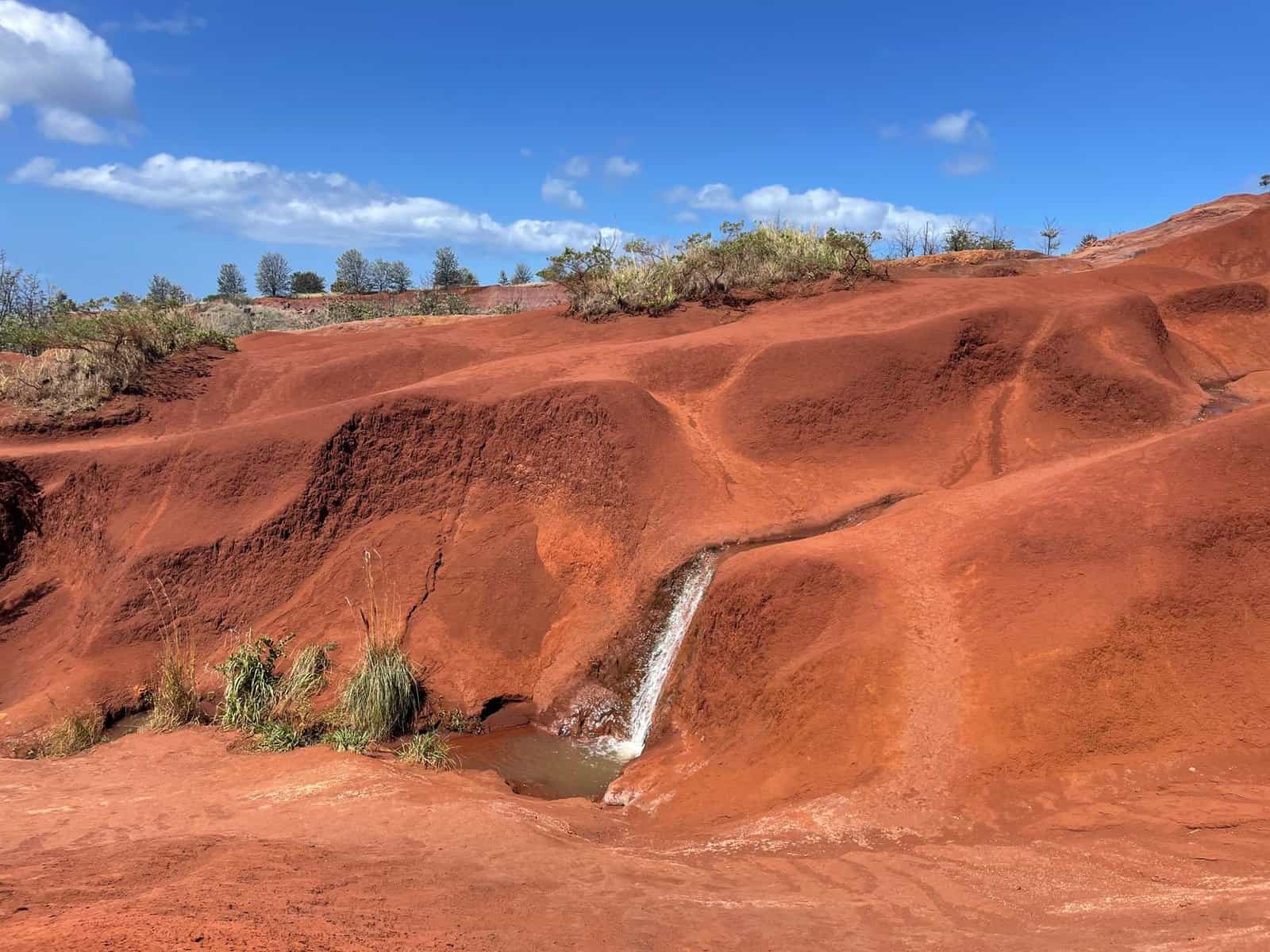
The Canyon Trail, which starts in Kokee State Park off Halemanu Road, is the most popular hike in the canyon area. The round trip to the top of Waipoo Falls is about 3.6 miles. The trail follows the rim through forest and then across open, red-dirt ridges with dramatic canyon views before reaching a small pool above the falls.
Expect red mud that stains shoes and clothes, steep sections, and slick footing after rain. Halemanu Road can be rough, and some rental cars are not suited to it, so many hikers park along Kokee Road and walk in. Do not get close to the edge above the falls. Plan on two to three hours.
6. Kalalau Lookout
Kalalau Lookout, at about 4,000 feet in Kokee State Park, is one of the most spectacular viewpoints in Hawaii. It looks down into Kalalau Valley, a deep, green amphitheater framed by fluted cliffs that drop to the Napali Coast and the Pacific.
Clouds and fog frequently fill the valley. If you arrive and see only white, wait 10 or 20 minutes; the clouds often move and open for brief views. Mornings are usually clearest. The lookout has restrooms and a parking area.
The valley below is reachable only by the Kalalau Trail, an 11-mile backcountry route along the Napali Coast that starts on the island’s north shore and requires a permit beyond the first miles.
7. Puu o Kila Lookout
Puu o Kila Lookout, at the very end of the road about a mile beyond Kalalau Lookout, offers a similar view of Kalalau Valley from a slightly different angle. It is also the start of the Pihea Trail, which follows the ridge along the edge of the valley and continues into the Alakai Swamp, one of the wettest places on Earth.
The Pihea Trail is muddy and can be slippery, but even the first half-mile along the ridge gives wide views. Parking is limited. The road beyond was never completed, so this is the end of the line.
How Waimea Canyon Formed
Kauai is the oldest of the main Hawaiian Islands, formed by a volcano that rose from the ocean floor millions of years ago. Over time, the volcano’s summit collapsed, and faulting created a deep depression on the west side of the island. Rivers draining Mount Waialeale, one of the rainiest spots on Earth, carved the canyon deeper, cutting through layers of lava flows.
Those layers show in the canyon walls as bands of color. Iron in the volcanic rock oxidizes into red and orange, while vegetation adds greens. Waterfalls appear after heavy rain, especially on the canyon’s western walls.
The History Below the Canyon
The town of Waimea, at the canyon’s mouth, has a long history. Captain James Cook made his first landing in the Hawaiian Islands at Waimea in January 1778, an event marked by a statue in town. Russian traders built a fort near the river in the early 1800s, and its ruins remain at Russian Fort Elizabeth State Historical Park.
Native Hawaiians lived in the canyon and farmed taro along the river for centuries. Remains of terraces and house sites can still be found in the valley.
Planning Your Drive
- Start early. Clouds build by late morning, especially at Kalalau Lookout.
- Fill up on gas in Waimea or Kekaha before heading up. There is no gas station on the canyon road.
- Bring water, snacks, a light jacket, and sturdy shoes. Temperatures at 4,000 feet can be 10 to 15 degrees cooler than at the beach.
- Plan on at least half a day, or a full day with hiking.
- Drive carefully. The road is narrow and winding, with steep drop-offs.
When to Go
The canyon is open year-round. Winter, from November through March, brings more rain, which feeds waterfalls but can make trails muddy and roads slippery. Summer is drier. In any season, mornings are clearest.
Storms can close trails and roads. Check the Hawaii Division of State Parks website for closures before you go.
Kokee State Park and Museum
At the top of the road, Kokee State Park has a lodge, a restaurant, cabins, a campground, and the Kokee Natural History Museum. The museum has exhibits on native plants, birds, and geology, and staff can recommend trails. Wild chickens roam the grounds, as they do across Kauai.
Kokee’s forest is home to native birds like the apapane and the elepaio. Look and listen for them along trails.
Safety Tips
- Stay behind railings at lookouts.
- Do not hike in heavy rain; trails become slippery and flash floods can occur.
- Wear shoes with good traction.
- Bring rain gear.
- Tell someone your plans if you hike longer trails.
Combining the Canyon With Other West Side Stops
- Waimea town: historic buildings, shave ice, and the Captain Cook statue.
- Polihale State Park: a long, remote beach at the end of the road on the west side, reachable by a rough dirt road.
- Kekaha Beach: a long, sandy beach for sunset.
- Hanapepe: a historic town with art galleries and a swinging bridge.
The Bottom Line
Waimea Canyon is more than 3,600 feet deep, and its lookouts and trails offer some of the best views in Hawaii. Start early, stop at Waimea Canyon Lookout, hike to Waipoo Falls, and finish at Kalalau Lookout for the Napali Coast.