We may earn money or products from the companies mentioned in this post. This means if you click on the link and purchase the item, I will receive a small commission at no extra cost to you ... you're just helping re-supply our family's travel fund.
Some beaches look calm until the water starts moving like machinery. Rip currents, heavy shorebreak, fast-changing sandbars, sharks, and stingers can turn a postcard shoreline into a place where locals watch conditions before anyone wades in. Many of the world’s riskiest beaches are not bad. They are powerful, remote, or shaped by wildlife and weather that do not negotiate. The safest day usually comes from reading flags and closures, choosing guarded swim zones, and treating the ocean as conditions, not scenery. When warnings go up, locals often switch to walking, tide pools, or viewpoints instead of forcing a swim.
Hanakāpīʻai Beach, Kauaʻi, Hawaiʻi
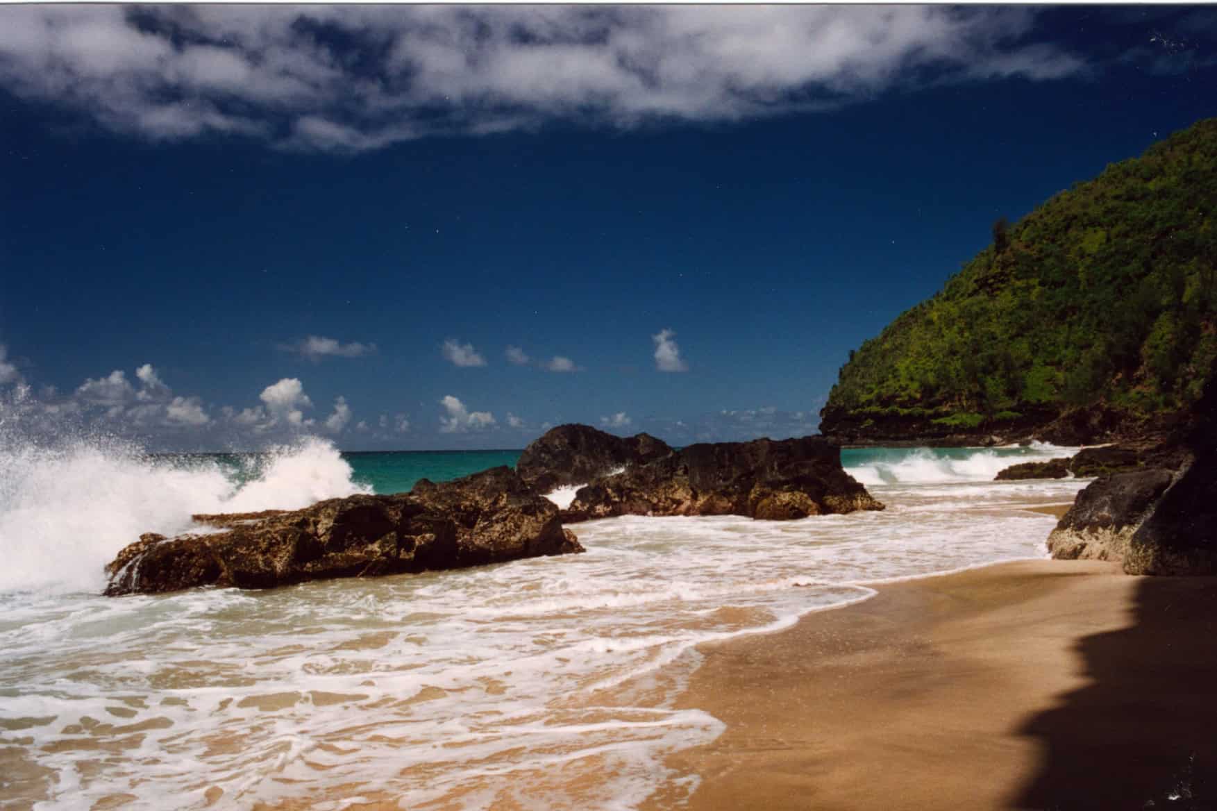
Hanakāpīʻai looks like a dream at the end of the Kalalau Trail, but the water is open, remote, and unforgiving. Strong currents and sudden shorebreak can build quickly along the Nā Pali coast, and there is no nearby road access to make rescues easy when conditions turn. Locals and rangers often treat it as a look-and-linger shoreline: enjoy the stream, the cliffs, and the view, then stay back when surf is up. Even ankle-deep wading can turn into a sideways tug, and the nearest help is a long hike away. Signs are there for a reason.
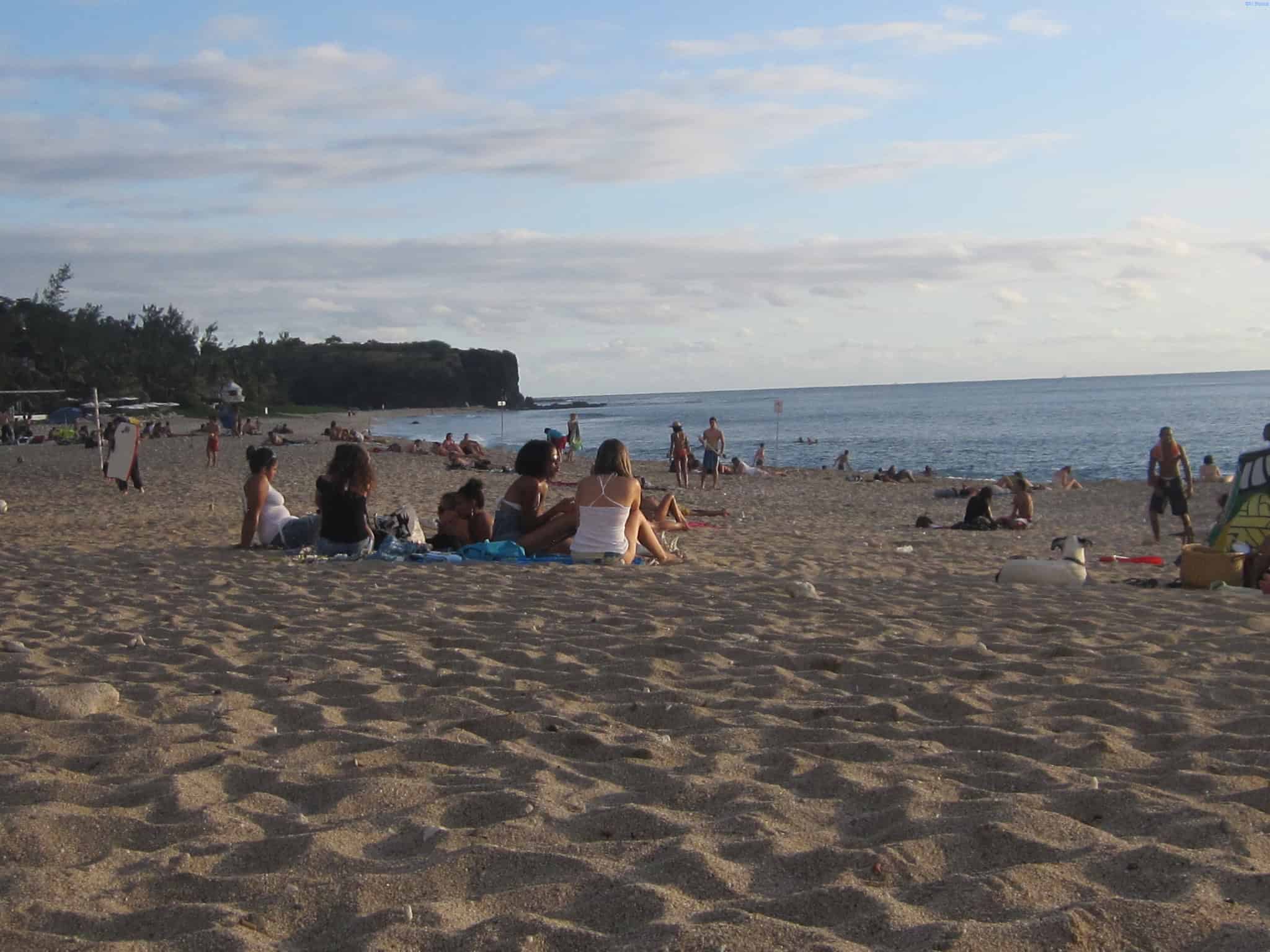
Sandy Beach Park, Oʻahu, Hawaiʻi
Sandy Beach is famous for heavy shorebreak that breaks directly onto shallow sand, the kind of wave that can slam bodies down before a swimmer has time to react. Even on sunny days, sets can arrive with surprising force, and injuries are often about impact, not distance from shore. Locals who know it well keep a cautious eye on the break, choose bodysurfing only when conditions are right, and leave the water to experts when the shorebreak starts detonating. The danger lives in the first few yards, where a strong set can roll someone before it even feels like swimming.
Cape Hatteras National Seashore, North Carolina
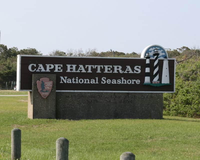
Cape Hatteras sits where currents and shifting sandbars create rip currents that can feel like a conveyor belt pulling straight out. The water may look smooth between breaking waves, yet that calm gap is often the rip itself, and strong swimmers can tire fast once they are beyond the bar. Locals and lifeguards emphasize flags, forecasts, and patience, because the safest choice on high-risk days is staying dry and letting the ocean keep its distance. Rips form near breaks in sandbars and around inlets, and chop plus distance makes the return feel endless. Even strong swimmers can burn out.
Indiana Dunes, Lake Michigan, Indiana
Lake Michigan can look gentle from the dunes, then flip quickly when wind builds waves and sets up dangerous currents. Rip currents and structural currents near piers can pull swimmers away from shore, and freshwater does not make the physics kinder. Locals watch beach hazard statements and pay attention to red flags, because the most dangerous days often feel like ordinary summer weather until a set arrives, visibility drops, and a simple swim turns into a rescue call. Currents can intensify near breakwalls and piers, and playful-looking surf can hide a pull that steadily separates swimmers from the beach.
New Smyrna Beach, Florida
New Smyrna Beach draws surfers and families, yet it sits in an area known for frequent shark bite incidents, especially when baitfish run close to shore. Most encounters are minor, but the pattern is enough that locals pay attention to water clarity, bird activity, and crowded sandbars where feet and fins overlap. The safer rhythm is choosing guarded stretches, avoiding murky conditions, and stepping out when schools of fish and feeding birds signal the food chain is active in the shallows. Locals also avoid wading when water is crowded, especially at dawn and dusk, because visibility drops and the odds of surprise contact rise.
Cape Cod National Seashore, Massachusetts
Along parts of the Outer Cape, great white shark activity is tied to thriving seal populations, which changes the swim calculus even on calm, clear days with glassy water. Cold water, fast weather shifts, and long stretches of beach can complicate response when something goes wrong, especially when fog and chop roll in, cell service is patchy, and the nearest help is miles down sand. When seals are close and advisories go up, many locals choose guarded sections, ponds, or bay beaches, and they treat closures and sightings as hard stops, not suggestions, because the risk is low-frequency but real.
Boa Viagem, Recife, Brazil
Boa Viagem is a beautiful urban shoreline, but its history of shark incidents has made swimming feel conditional, not automatic, even on bright, calm mornings when the sea looks friendly. Warnings and local habits steer people toward shallow areas at low tide and away from deeper channels where currents move and visibility drops, because those cuts can change hour to hour and turn a relaxed swim into a long fight back. The reef can create calmer pockets, yet it also funnels flow through gaps, so locals often enjoy the promenade and tide pools, keeping deeper water for rare, well-read days with clear signage and calm sets.
Boucan Canot and Roches Noires, Réunion Island
Réunion’s west-coast beaches became a case study in how quickly risk can reshape daily life, with swimming rules tightening after a series of attacks and the island rebuilding trust slowly. Netted swim zones and designated areas exist, but access can change with swell and visibility, and closures can happen even when weather looks inviting from the road and the sky is blue. Locals treat the ocean here as regulated space: they check official updates before leaving home, stay inside protected zones when open, and shift plans to lagoons, pools, or hikes when the sea offers no safe window. That planning keeps evenings easy.
75 Mile Beach, K’gari, Queensland, Australia
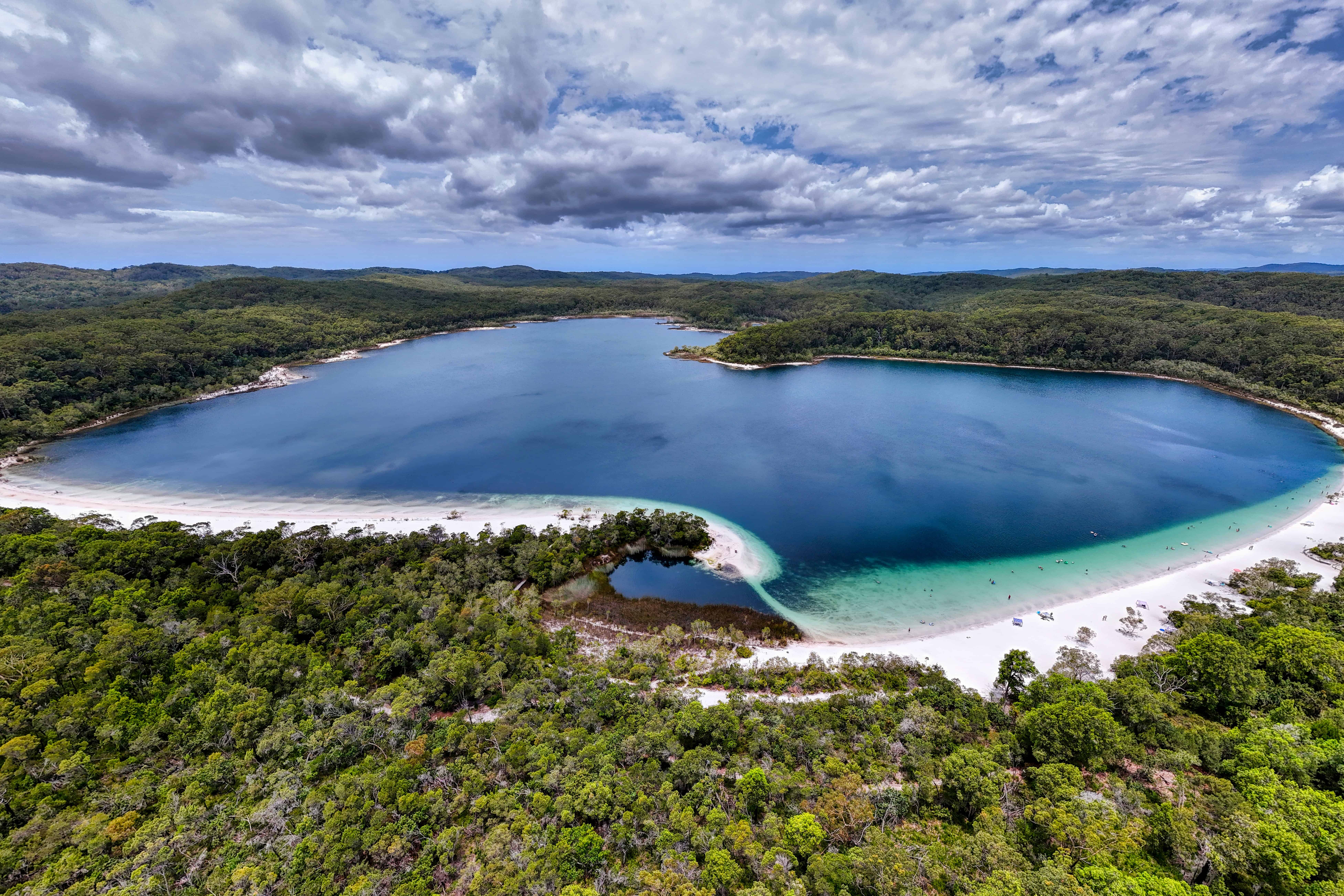
K’gari’s ocean beach is dramatic and exposed, with strong currents, rough surf, and long unpatrolled stretches where help is far away and conditions shift quickly with wind and tide. The shoreline is also used for 4WD travel, which adds risk near the waterline and makes distraction costly when waves surge up the sand, carve sudden gutters, and hide drop-offs in plain sight. Many locals steer swimming toward inland lakes and creeks, treating the ocean side as a place for views and walking, because lateral currents and quick deepening can turn a small misread into trouble fast, especially when swell rises.