We may earn money or products from the companies mentioned in this post. This means if you click on the link and purchase the item, I will receive a small commission at no extra cost to you ... you're just helping re-supply our family's travel fund.
Some places look like postcards that slipped out of a dream: black sand beaches, glowing canyons, pastel salt flats, and steaming basins that seem unreal. Yet beauty can work like a mask. A calm horizon can surge, a narrow river corridor can flood from distant rain, and a warm-looking pool can hide scalding heat. The safest travelers are rarely the boldest; they are the ones who notice signs, respect closures, and let local knowledge set the pace. Adventure has a way of rewarding patience.
Reynisfjara Black Sand Beach, Iceland
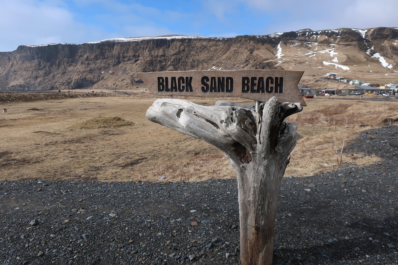
Iceland’s Reynisfjara looks like a film set: black sand, basalt columns, and sea stacks framed by mist, with volcanic grit that glitters when the sun breaks through. Yet it is a quick stop for tour buses, and that convenience hides the real hazard: sneaker waves that surge without warning, charge farther than the previous set, and then yank back with a cold North Atlantic undertow on a steep, slick shore. Rockfalls can also tumble from the cliffs, so the posted safety zones are not decoration; they are a reminder that this shoreline changes personality in moments, even when the horizon looks friendly from the parking lot.
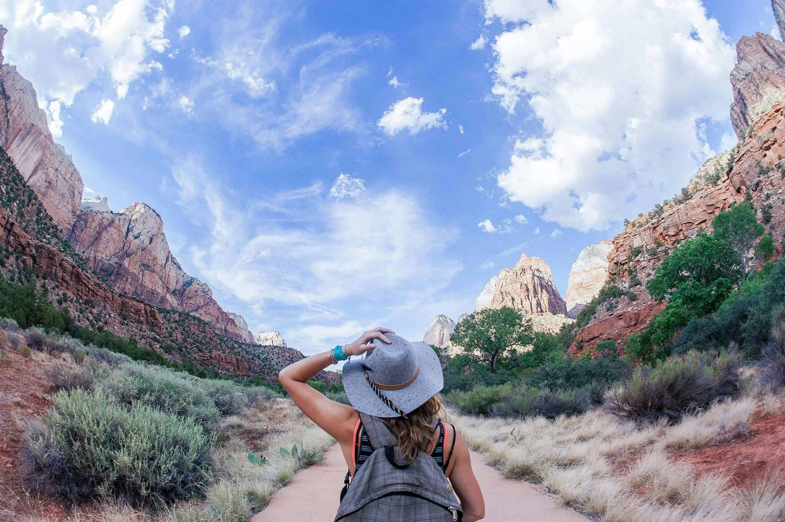
The Narrows, Zion National Park, Utah
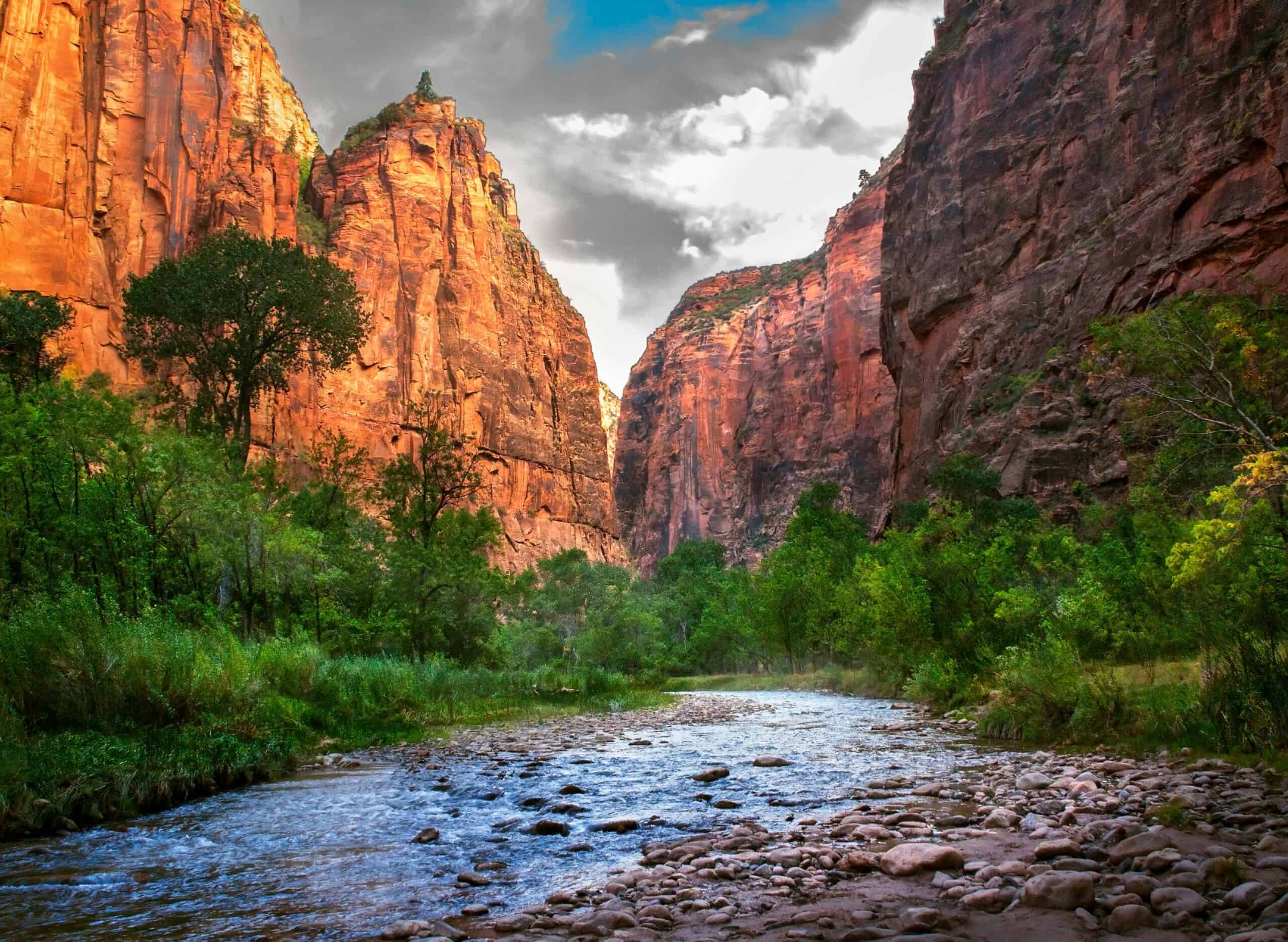
Zion National Park’s slot canyons feel like natural cathedrals, where polished Navajo sandstone glows peach, echoes soften voices, and the Virgin River threads a cool ribbon through shade. The hidden timer is water: flash floods can rip through narrow corridors after storms miles away, turning knee-high flow into a churning surge that hurls branches, reshapes sandbars, and cuts off the same bends that welcomed hikers minutes earlier. Because the sky above can stay blue while danger builds upstream, the park posts daily flood potential forecasts, especially during late-summer storm patterns, with little warning beyond roar.
Upper Geyser Basin, Yellowstone National Park, Wyoming
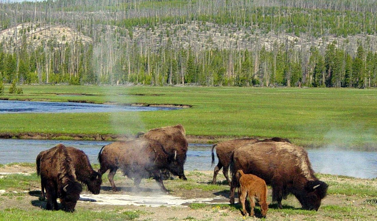
Yellowstone’s geyser basins look otherworldly: turquoise pools ringed in rust and jade, hissing steam, and the sweet-sour scent of sulfur drifting over white mineral crust. The hidden danger is often underfoot, because fragile crust can collapse near thermal edges, and scalding runoff may appear clear and harmless until heat radiates upward and algae-slick boardwalk planks turn footing uncertain. That is why staying on marked paths is enforced so tightly, and why swimming or soaking in thermal waters is illegal; the park notes more than 20 deaths from hot-spring burn injuries over time even in shallow-looking pools close.
Badwater Basin, Death Valley National Park, California
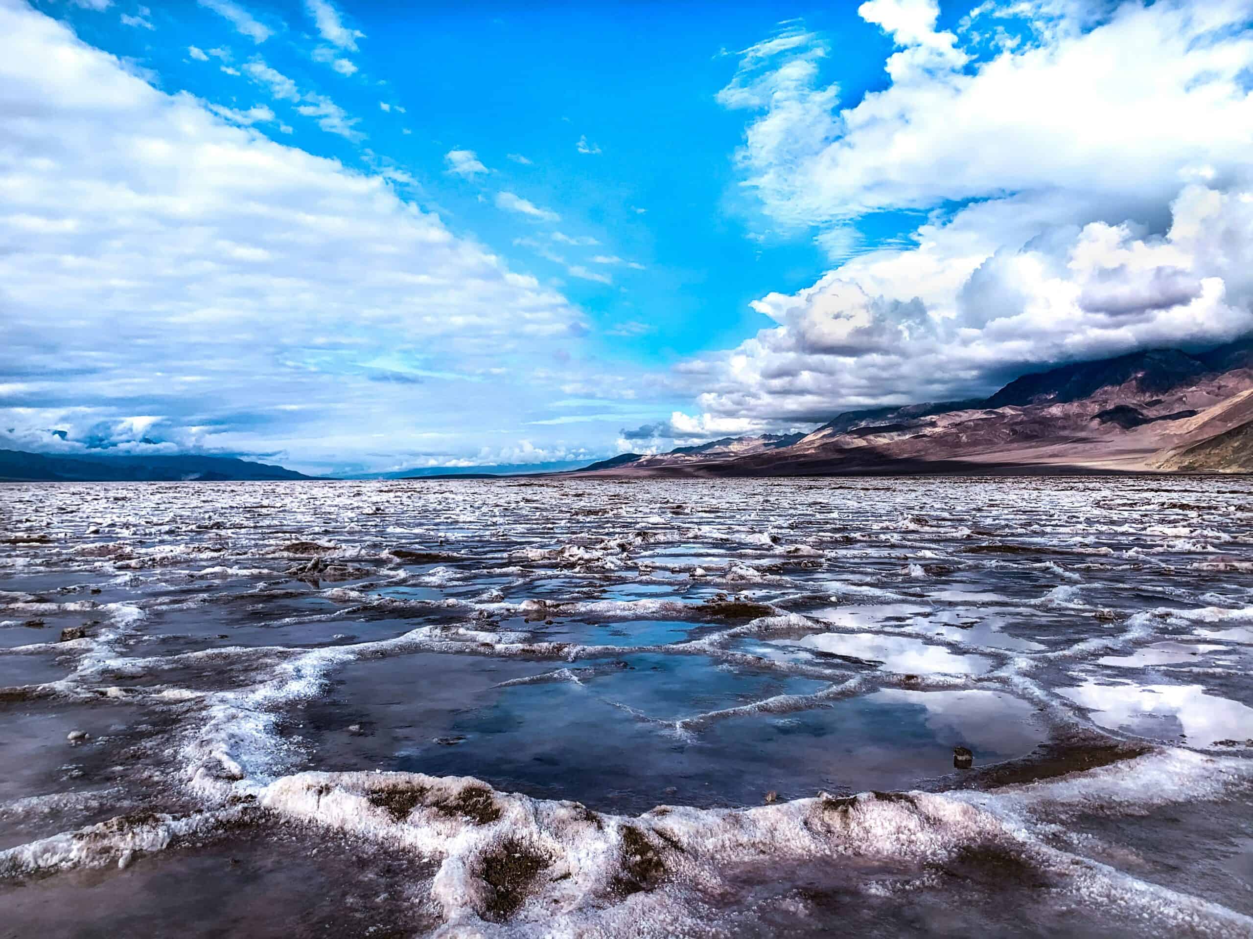
Death Valley can look serene at dawn, with salt flats glowing pale pink and mountain shadows sliding across the basin like silk. Then the heat arrives, and the desert’s calm turns deceptive: low elevations can become dangerously hot, sweat vanishes before it feels like effort, and dehydration builds quietly as the sun climbs toward midday. The park’s guidance is blunt about the basics, including avoiding hot-day hikes in the valley and drinking at least one gallon of water daily, because summer rescues and medical emergencies keep repeating the same lesson, with help far away, water scarce, and shade thinner than expected.
K’gari (Fraser Island), Queensland, Australia
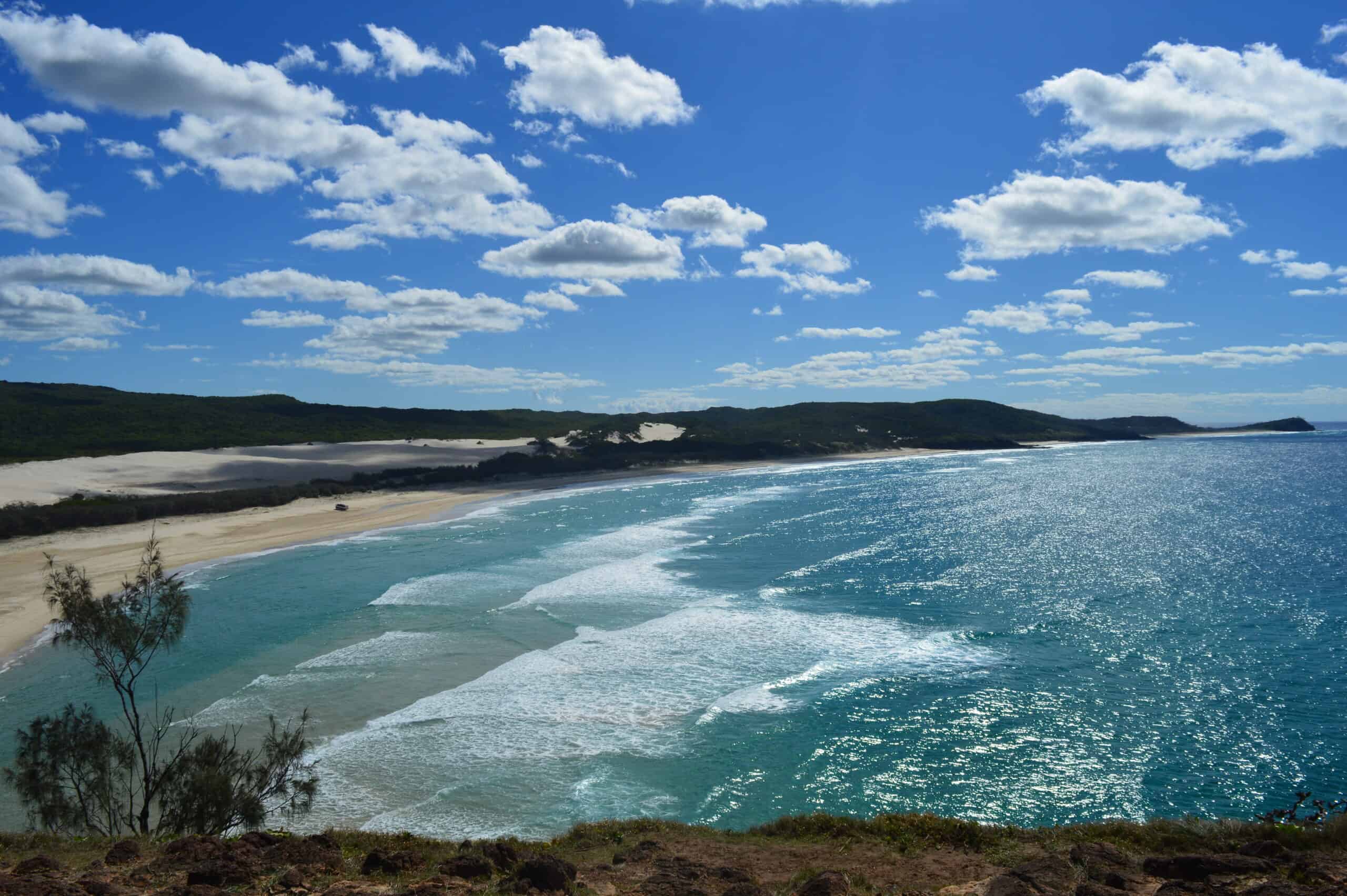
K’gari’s beaches and eucalyptus forests can feel untouched, with tea-colored creeks, shifting dunes, and a shoreline where four-wheel drives share the sand with fishing lines and walkers. The hidden risk is not only ocean conditions and tides, but also the island’s wongari, wild dingoes that move quietly through campgrounds, test bins, and can react fast when food, running, or isolation changes their behavior. Queensland parks officials push clear rules like group walking, keeping children close, and never feeding, because repeated handouts teach dingoes to associate people with meals, and that lesson can escalate trouble.
Lake Natron, Tanzania
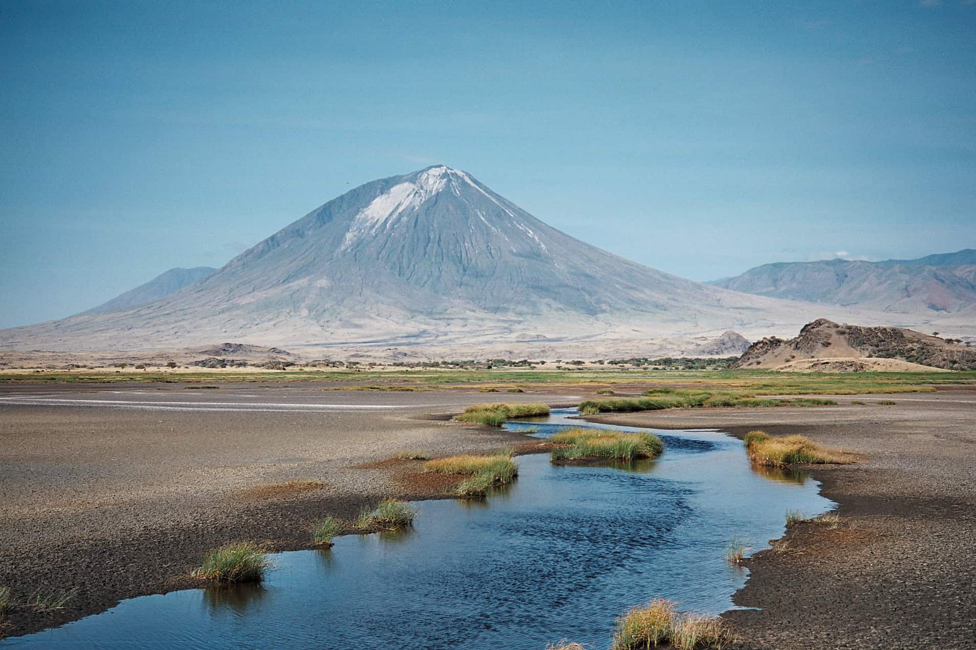
Lake Natron’s red-and-pink shallows can look unreal, a mirror of sky and salt on the East African Rift where vast flamingo colonies nest on seasonal islands. The spectacle is powered by harsh chemistry: evaporation concentrates natron-rich minerals, and the mud and water can turn caustic enough to sting skin and eyes, while the open flats radiate heat with almost no shade or quick rescue options. NASA notes mud temperatures around 50°C (122°F) and alkalinity that can climb with dry conditions, which helps deter predators but also makes the lake less forgiving as it gets more photogenic, under blazing midday sun with glare.
Danakil Depression, Ethiopia
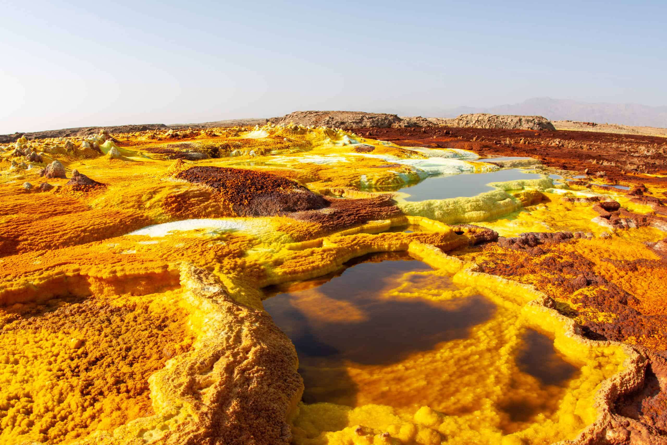
Ethiopia’s Danakil Depression can look like another planet: salt plains, neon mineral terraces, and bubbling pools that seem painted into the desert. That color palette comes from geothermal chemistry that can include acidic brines and sulfurous fumes, and the region’s remoteness means heat stress and disorientation become serious problems long before any clinic is within reach. Nearby volcanoes such as Erta Ale are famously active, and the combination of unstable ground, gas vents, and extreme temperatures makes the landscape mesmerizing, in the same way a live furnace is mesmerizing at night and noon alike.
Mount Washington, New Hampshire
Mount Washington’s summit can look gentle from the valleys, a smooth ridge above spruce forests with clouds spilling over the peaks like foam. Up close, the mountain sits in the path of major storm tracks, and its hidden hazard is speed: wind can jump to hurricane force, temperatures can plunge, and visibility can collapse into rime-coated whiteout before hikers realize the weather has turned. The observatory’s famous 231 mph wind gust record is not just trivia; it is a reminder that a postcard view can flip into a survival situation between tree line and the summit, as fog and wind rewrite routes in a minute.