We may earn money or products from the companies mentioned in this post. This means if you click on the link and purchase the item, I will receive a small commission at no extra cost to you ... you're just helping re-supply our family's travel fund.
For drivers who crave more than a straight highway and cruise control, America hides stretches of pavement that feel like roller coasters carved into mountains, cliffs, and wilderness. These roads demand attention, skill, and respect. Weather shifts quickly, elevations soar, and curves stack relentlessly. Yet for prepared thrill-seekers, they offer unforgettable drives shaped by raw geography and bold engineering. Below are eight dangerous U.S. roads, each detailed with the numbers and nuances you need to know before gripping the wheel.
1. Tail of the Dragon
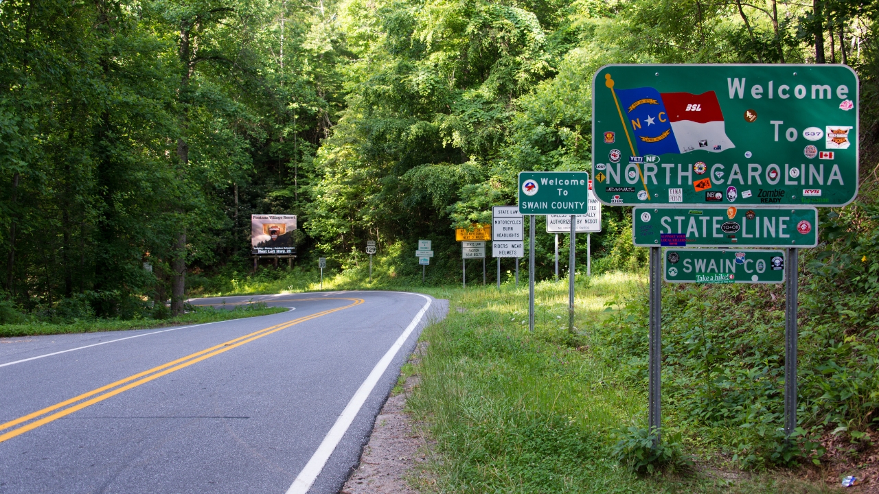
This legendary 11-mile stretch along U.S. 129 packs an astonishing 318 curves into a compact ribbon of asphalt. There are no intersecting roads or traffic lights, just relentless switchbacks slicing through dense forest near the Smoky Mountains.
Elevation changes are subtle but constant, and tight corners often arrive with little warning. Law enforcement is active, and annual crash counts routinely reach into the dozens. Motorcyclists dominate the traffic mix, especially on weekends. Dry pavement offers grip, but rain transforms the route into a slick technical challenge that rewards precision over speed.
2. Beartooth Highway
Climbing to 10,947 feet above sea level, Beartooth Highway stretches roughly 68 miles between Red Lodge and Cooke City. The road ascends rapidly, with multiple hairpin turns carved into alpine slopes and dramatic grade changes exceeding 8 percent in places.
Snow can fall even in July, and strong crosswinds sweep across exposed ridgelines. Guardrails are limited in certain segments, increasing the psychological intensity. The highway is typically open only from late May to mid-October. Thin air, sharp curves, and sudden weather shifts make this scenic drive as demanding as it is breathtaking.
3. Million Dollar Highway
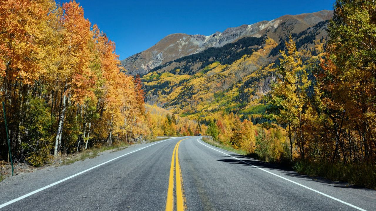
Spanning about 25 miles between Ouray and Silverton on U.S. 550, this mountain corridor is famous for its narrow lanes and dramatic drop-offs. Elevations climb above 11,000 feet, and several stretches lack protective guardrails entirely.
Winter brings heavy snowfall that can exceed 300 inches annually in surrounding peaks. Avalanches and ice create seasonal closures, while steep grades approach 7 percent. Even in summer, tight blind curves demand steady braking and disciplined steering. The scenery is spectacular, but drivers must stay fully alert on every mile of this exposed alpine route.
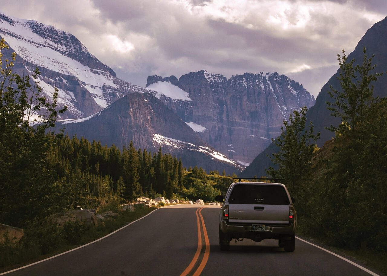
4. Going-to-the-Sun Road
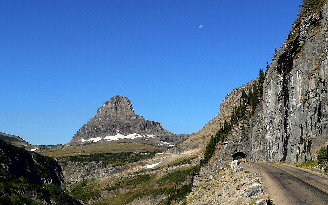
Carved across 50 miles inside Glacier National Park, this engineering marvel crests Logan Pass at 6,646 feet. Portions of the roadway cling to sheer cliffs, with narrow lanes and stone guardwalls separating vehicles from dramatic drops.
Heavy snowfall, sometimes exceeding 60 feet annually at higher elevations, restricts access to roughly June through September. Traffic congestion peaks during summer afternoons, increasing braking and cornering pressure. Wildlife crossings are frequent, adding unpredictability. Precision driving and patience are essential to safely enjoy one of America’s most visually intense mountain highways.
5. Hana Highway
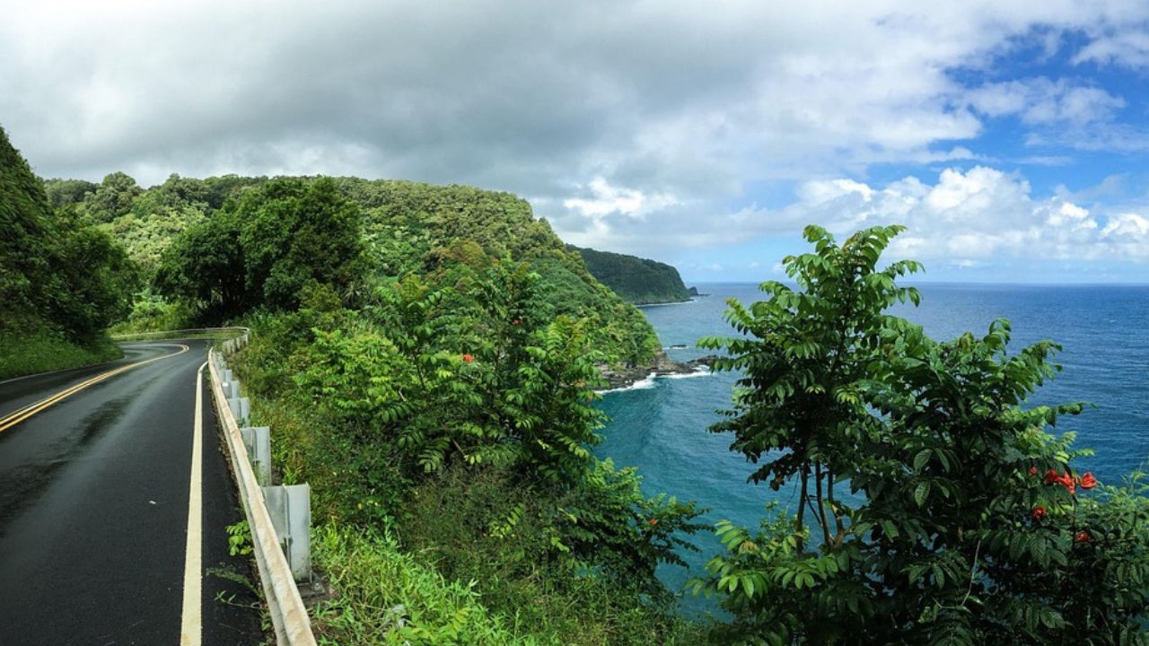
Often called the Road to Hana, this 64-mile coastal route on Maui includes more than 600 curves and 59 one-lane bridges. Many turns are blind, bordered by dense rainforest and steep ravines dropping toward the Pacific.
Rain showers can arrive suddenly, making pavement slick and reducing visibility. Speed limits frequently dip below 25 mph, yet impatient drivers sometimes push beyond safe margins. Limited shoulder space leaves little room for error. The journey can take 2 to 3 hours without stops, demanding steady focus despite the temptation of waterfalls and ocean vistas.
6. Dalton Highway
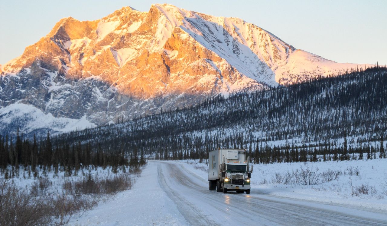
Stretching 414 miles from near Fairbanks toward Deadhorse, Dalton Highway cuts through remote Arctic wilderness. Roughly half the route remains gravel, and fuel stations are spaced more than 200 miles apart in certain sections.
Temperatures can plunge below −40°F in winter, while summer brings dust clouds and heavy truck traffic servicing oil fields. Frost heaves create uneven pavement, and wildlife sightings include moose and caribou. Mechanical preparation is critical, as roadside assistance is minimal. This is less a casual drive and more an expedition requiring planning and resilience.
7. Pacific Coast Highway
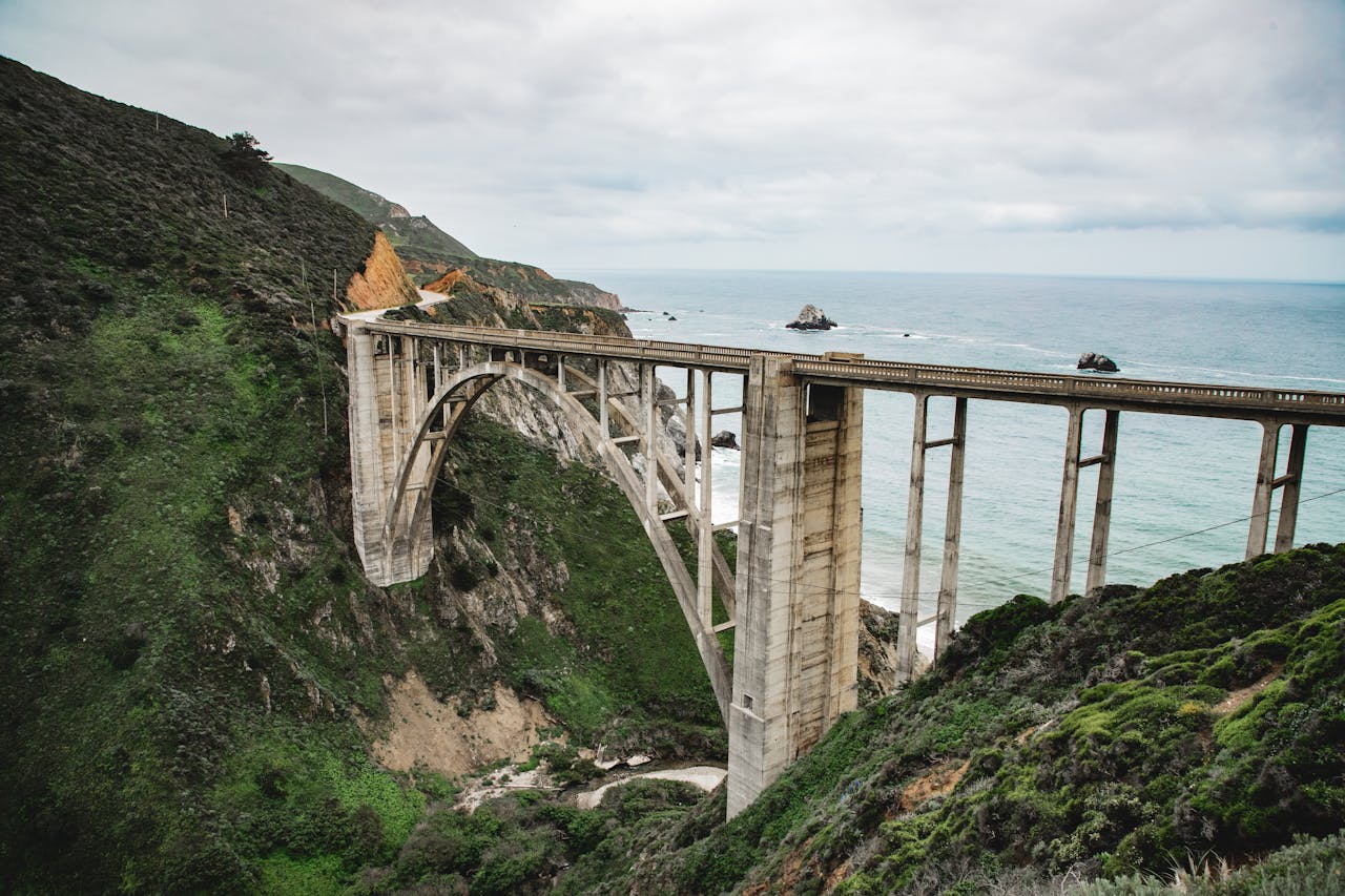
California’s State Route 1 spans over 650 miles, but the most dramatic section runs through Big Sur. Here, the road hugs cliffs towering hundreds of feet above the Pacific Ocean, with sharp bends and frequent elevation changes.
Fog can reduce visibility to under 100 feet in minutes, and landslides periodically close segments after heavy rain. Tourist traffic increases sudden stops and unpredictable lane shifts. Though lanes are paved and marked, the combination of exposure, weather, and curvature makes this coastal drive both exhilarating and demanding.
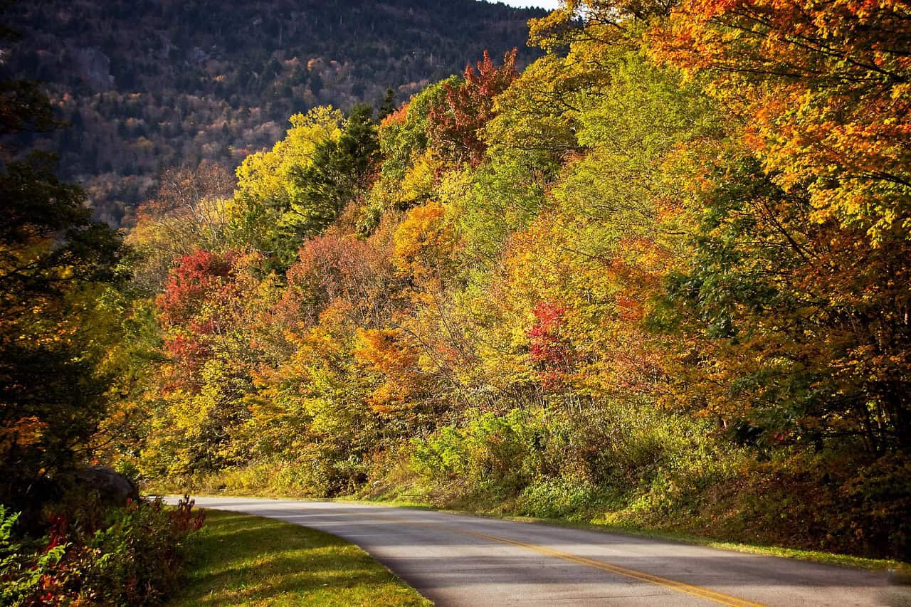
8. Blue Ridge Parkway
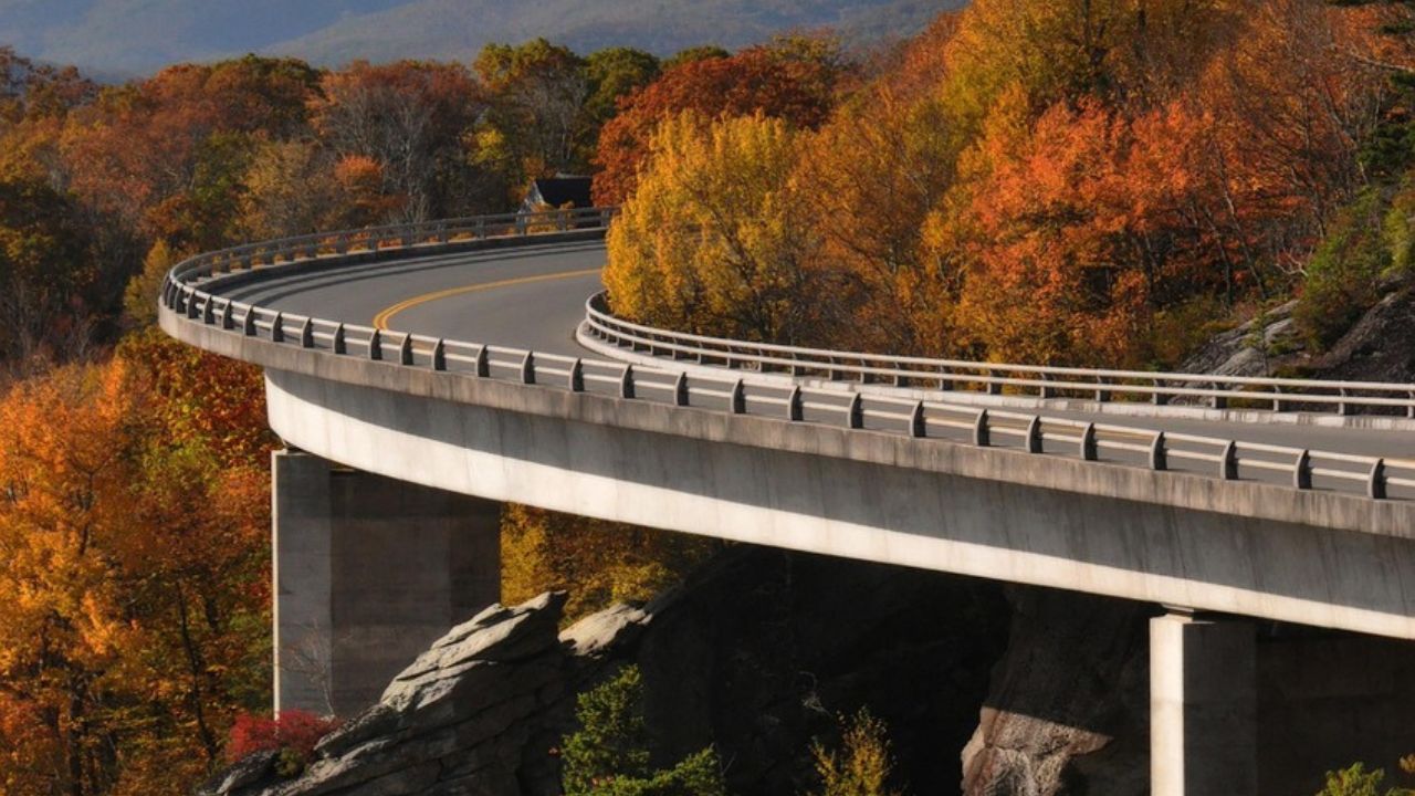
Running 469 miles between Virginia and North Carolina, the Blue Ridge Parkway rises above 6,000 feet at its highest point. The road features consistent curves, sweeping overlooks, and elevation shifts that require careful throttle control.
Fog frequently blankets higher sections, sometimes cutting visibility below 200 feet. Wildlife crossings and distracted sightseers add to the challenge, particularly during peak autumn foliage when traffic surges. While less extreme than alpine passes, the sustained curvature and mountain weather patterns ensure this scenic drive remains engaging for attentive drivers.