We may earn money or products from the companies mentioned in this post. This means if you click on the link and purchase the item, I will receive a small commission at no extra cost to you ... you're just helping re-supply our family's travel fund.
Some trails earn fame for views, but rescues often start with smaller things: a late start, a surprise storm, a jammed route, or heat that quietly drains decision-making. Across the United States, certain hikes have risks that hide in plain sight because the first mile feels friendly. Rangers and search teams see the same arc again and again: confidence rises, conditions shift, and turning back feels harder than pushing on. These seven routes are stunning, but each has a specific trap that can turn a normal outing into a call for help.
Angels Landing, Zion National Park (Utah)
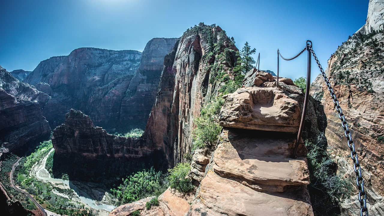
Angels Landing starts like a classic Zion climb, then narrows into the chain section where the path pinches to a slanted ridge and passing oncoming traffic becomes its own hazard. Exposure is obvious, but the subtler risk is decision pressure: crowds stack at choke points, wind gusts arrive mid-step, and polished sandstone turns tiny errors into big consequences. When someone freezes or drops pace, the line compresses, breaks get skipped, water runs low, and a tense retreat begins, with tired legs stepping backward on the same narrow rock that demanded focus on the way up, often while impatient hikers search for gaps.
The Narrows, Zion National Park (Utah)

The Narrows can feel friendly at first, but the river dictates everything: cold water numbs feet, current shoves knees sideways, and rounded stones roll under weight like loose marbles. Flash floods are the serious wildcard, because storms far upstream can raise the Virgin River fast, turning an easy wade into a powerful flow that steals balance and blocks the exit. Once packs soak through and footing breaks down, a minor sprain, lost trekking pole, or shivering body can trap a group in a corridor of sheer walls where detours are scarce and phone service often disappears, so the only safe answer is a quick, steady retreat.
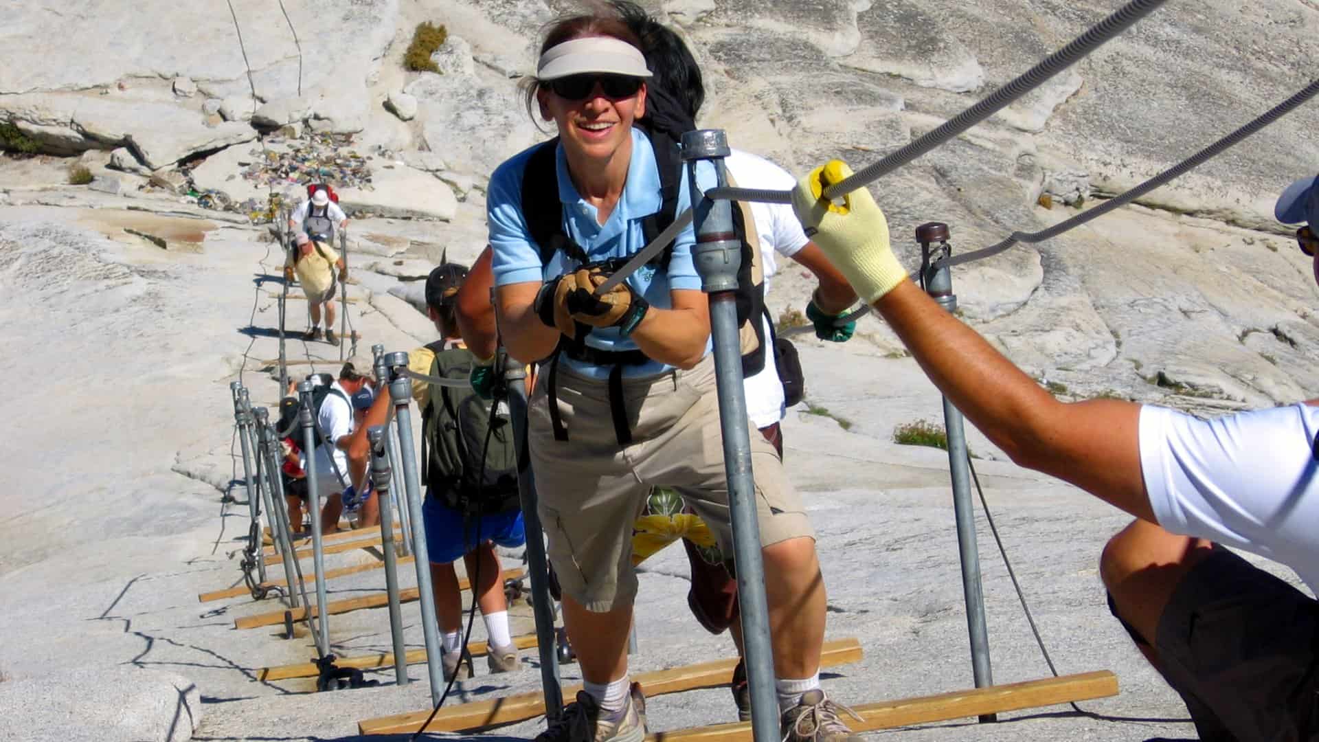
Half Dome Cables, Yosemite National Park (California)

Half Dome’s cable route punishes timing more than strength, since bottlenecks can lock hikers into long waits on steep granite while hands stay clenched and legs cool off between moves. When weather shifts, the risk climbs fast: mist or a short storm slicks the rock, gloves soak, and the ascent becomes a slow sequence of grips, foot placements, and careful spacing between strangers moving at different speeds. If daylight slips during the descent, fatigue and traffic compound, and the situation can pivot from a proud summit to a rescue call, not because the trail is long, but because exposure leaves little margin once energy drops.
South Kaibab to River Corridor, Grand Canyon (Arizona)
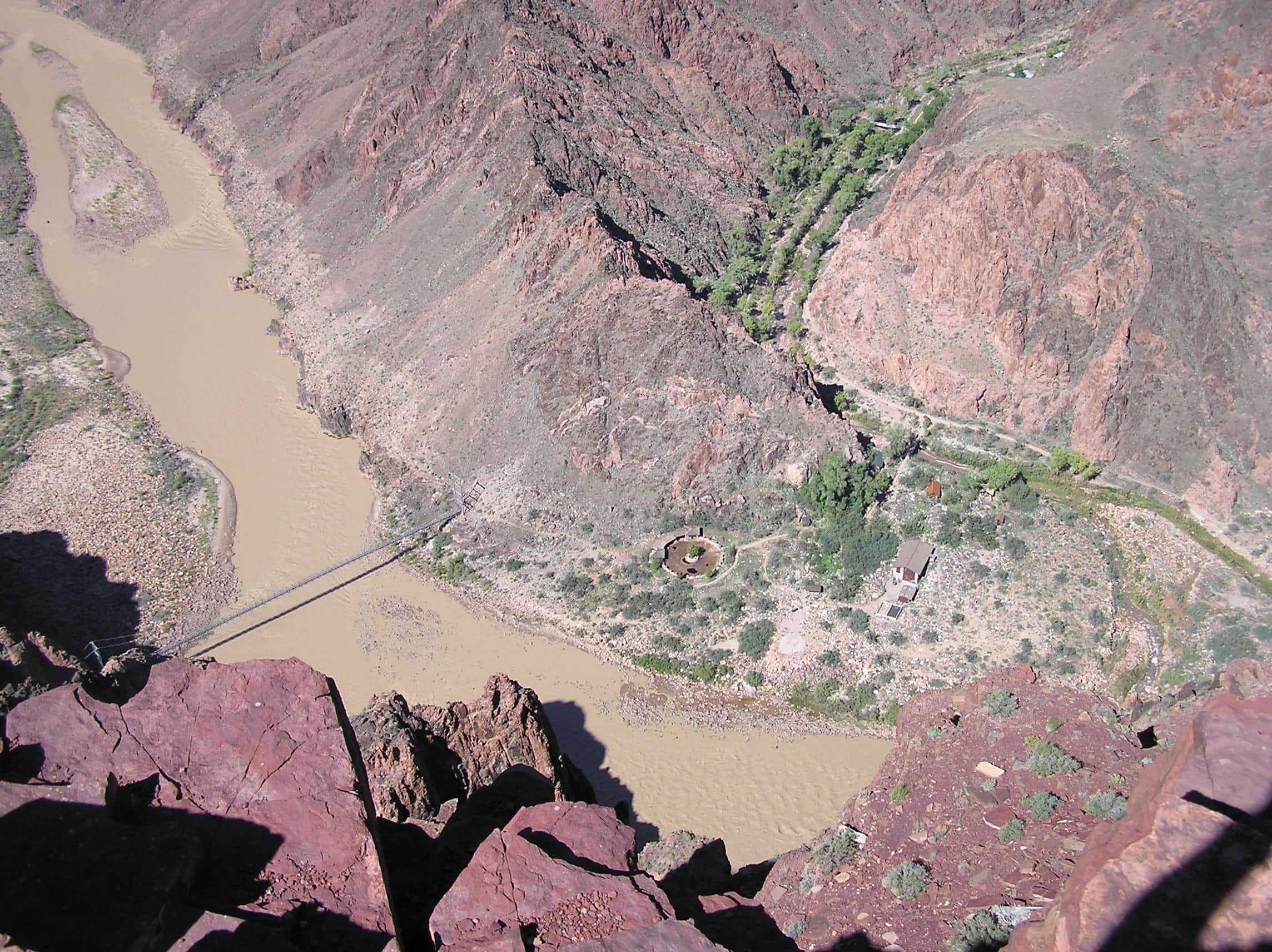
Grand Canyon corridor hikes lure hikers with fast downhill miles, but the return climb arrives with hotter air, harsher sun angles, and legs that suddenly feel hollow. Heat illness can build quietly below the rim, where sweat loss is easy to misread, salty dehydration dulls judgment, and nausea can show up before fear does. When a group pushes past a planned turnaround, pace collapses on the way out, cramps and dizziness appear, and the canyon’s scale becomes real, since narrow trails, distance, and limited quick access can stretch help into a long wait, especially when temperatures stay high into late afternoon.
Kalalau Trail, Nā Pali Coast (Hawai‘i)
Kalalau Trail pairs unreal scenery with unstable ground: narrow ledges, crumbly edges, and red dirt that turns slick after a brief squall, especially where the route tilts toward the ocean. Rising streams and rockfall add risk, because the path hugs steep slopes under loose cliffs, and wind can knock balance sideways right when traction is weakest. If a crossing swells or someone slips, the remoteness becomes the problem, with limited bailout points, storms that can linger, and a small injury turning into a stranded situation that requires outside help, sometimes long after daylight has faded and the trail has gone quiet.
Camelback Mountain Summit Routes, Phoenix (Arizona)
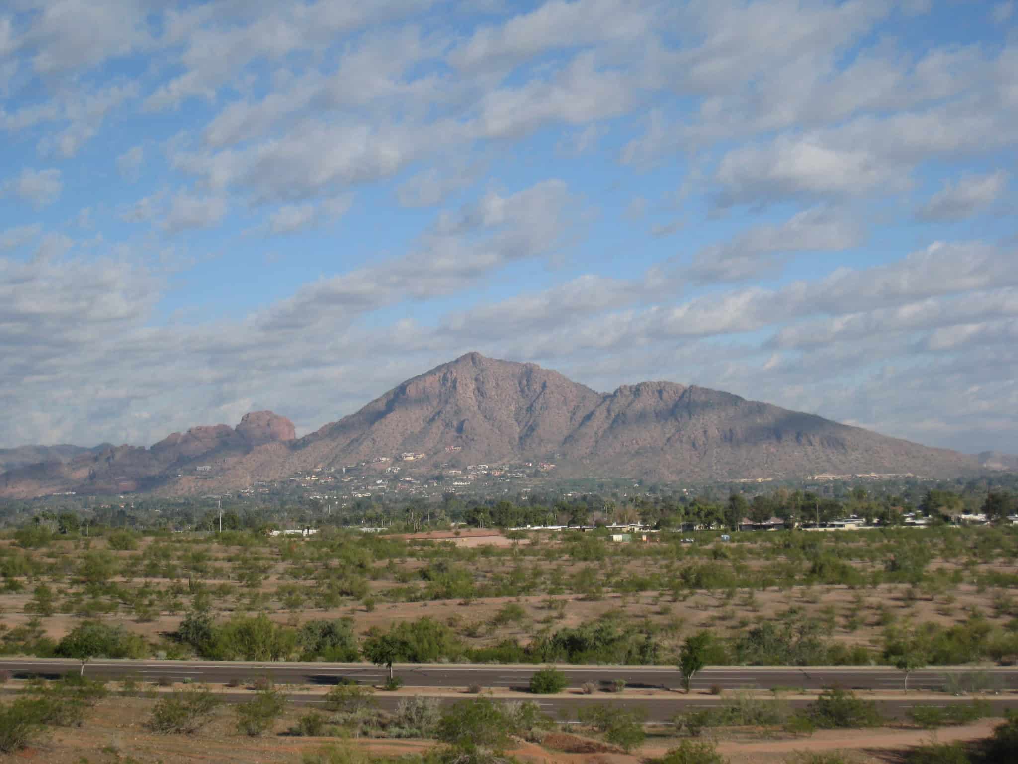
Camelback sits near busy streets, so it tempts casual planning, yet steep grades, exposed rock, and reflected heat make the mountain feel hotter than the city around it. Rescue calls spike during extreme temperatures when hikers start late, carry too little water, misjudge electrolyte needs, or slip on the descent once legs start shaking and calves cramp. When exhaustion sets in, shade feels scarce, decision-making frays, and a minor stumble can become a serious problem, because the safest descent may require crews to assist in harsh sun while the body cools slowly and the trail keeps drawing more hikers upward.
Precipice Trail, Acadia National Park (Maine)
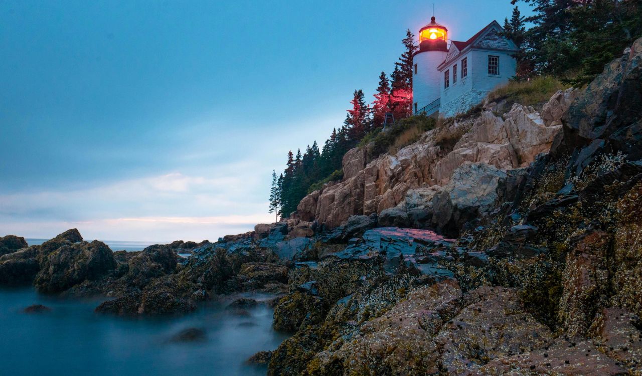
Precipice is short on mileage and heavy on consequence, climbing granite cliffs with iron rungs, ladder sections, and sustained exposure that keeps the drop in view for long stretches. Sea fog, drizzle, and damp rock can reduce traction, while congestion on the rungs forces awkward pauses where grip strength, breathing, and confidence all get tested at once. Because the route offers few easy exits once committed, one anxious moment can tighten movement and invite a slip, turning a scenic climb into a careful rescue effort that moves slowly and demands precision, even for experienced responders climbing the same rungs.