We may earn money or products from the companies mentioned in this post. This means if you click on the link and purchase the item, I will receive a small commission at no extra cost to you ... you're just helping re-supply our family's travel fund.
Some places reward comfort. Others demand endurance, flexibility, and humility. The destinations below are not about ticking landmarks off a list. They require long journeys, weather tolerance, cultural awareness, and serious planning. Infrastructure may be limited, climates extreme, and logistics unpredictable. Yet each location offers depth that casual sightseeing rarely provides. These are places where preparation matters, where patience is tested, and where the experience reshapes your understanding of distance, scale, and resilience.
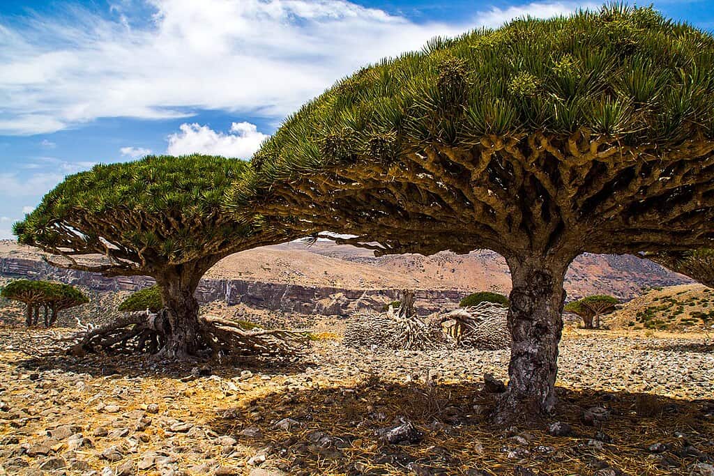
1. Socotra
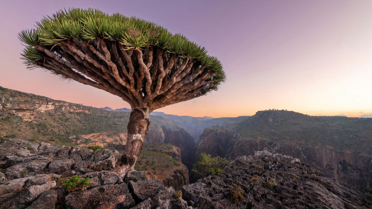
Located about 236 miles south of Yemen’s mainland, Socotra covers roughly 1,466 square miles and shelters nearly 700 endemic species. Around one-third of its plant life exists nowhere else. Summer temperatures average 30–35°C, while annual rainfall often remains below 8 inches. Infrastructure is basic beyond Hadibo, and power outages are common. Reaching the island typically requires limited regional flights and flexible timing. There are few paved roads and almost no luxury resorts, emphasizing simplicity over comfort.
2. Oymyakon
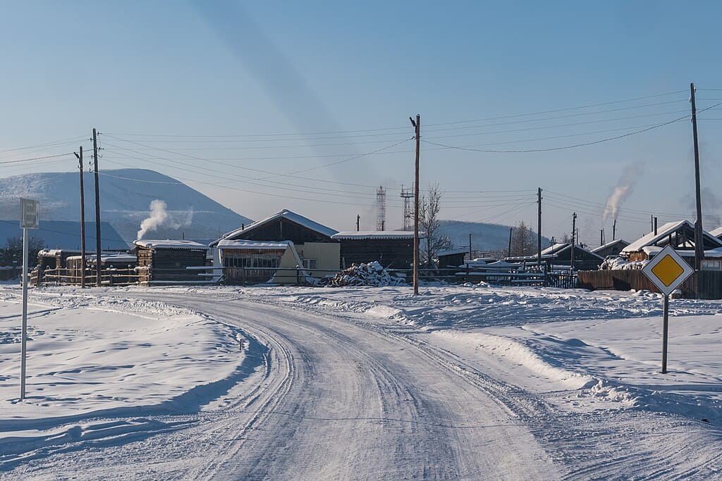
Oymyakon, in Russia’s Sakha Republic, recorded a temperature of −67.7°C and hosts fewer than 1,000 residents. January daylight can shrink to under 3 hours, while winter lasts nearly 7 months. The nearest major city, Yakutsk, sits about 578 miles away by road, a journey that can take up to 2 days in severe weather. Vehicles often run continuously to prevent freezing. There are no major hotels or tourist centers, and specialized cold-weather gear rated below −50°C is essential.
3. Danakil Depression
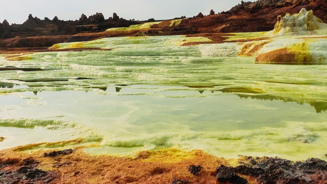
About 78 miles below sea level at its lowest points, the Danakil Depression stretches across nearly 52,500 square miles in northeastern Ethiopia. Average daytime highs often exceed 41°C, making it one of the hottest regions on Earth. The hydrothermal fields at Dallol shimmer in sulfuric colors, while Erta Ale volcano contains a persistent lava lake. Expeditions typically last 3–4 days and require guides, off-road vehicles, and extensive water supplies due to harsh, exposed terrain.
4. Svalbard
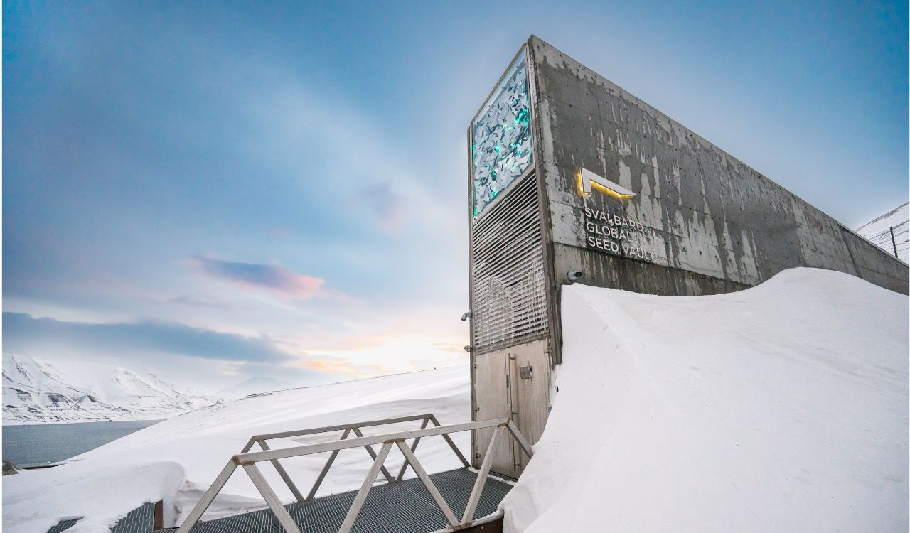
Situated above 78° north latitude, Svalbard covers roughly 23,550 square miles and houses about 2,900 residents. Polar bears are estimated to number over 3,000 across the archipelago. Winter darkness lasts nearly 4 months, and February temperatures average −16°C. Around 60% of the land is glacier-covered. Leaving Longyearbyen without protective equipment against wildlife is restricted by local regulations. Flights operate year-round, though Arctic weather frequently disrupts schedules and travel plans.
5. Papua New Guinea
Papua New Guinea spans approximately 178,700 square miles and is home to more than 10 million people speaking over 800 languages. Nearly 80% of the population lives in rural communities. Mountain peaks rise above 14,760 feet, while dense rainforest dominates large regions. Road networks connect only limited areas, making domestic flights essential for remote travel. Infrastructure outside Port Moresby can be minimal. Cultural festivals such as the Mount Hagen Show gather hundreds of tribes, preserving traditions across generations.
6. Ladakh
Ladakh sits at an average altitude above 9,840 feet, with Leh positioned around 11,480 feet above sea level. Visitors are advised to acclimatize for at least 48 hours to avoid altitude sickness. Winter temperatures can fall below −20°C, while annual rainfall averages under 4 inches, creating a stark high-altitude desert. Khardung La rises to 17,582 feet and remains seasonally accessible. The region spans roughly 22,780 square miles. Monasteries such as Hemis, founded in the 17th century, anchor Ladakh’s heritage.
7. Greenland
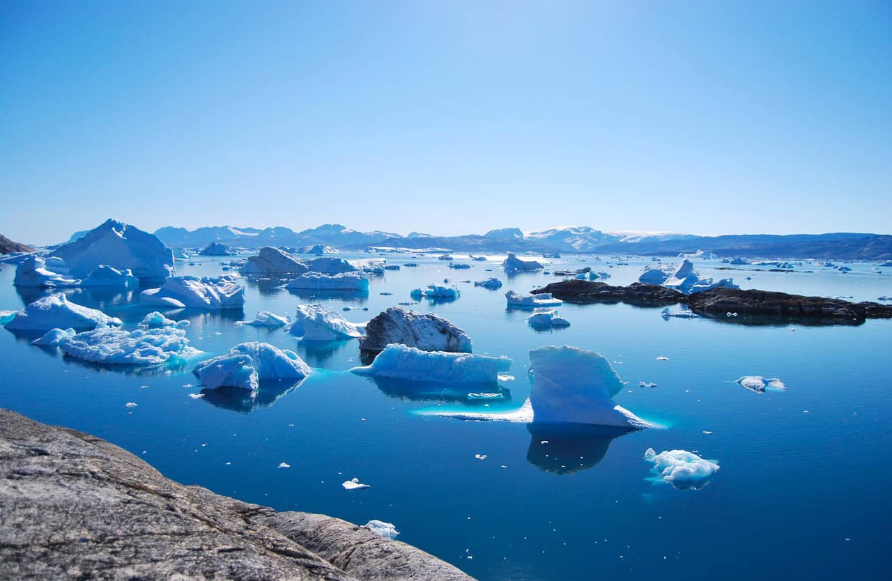
Greenland covers about 836,300 square miles, making it the world’s largest island, yet its population is only around 56,000. Nearly 80% of the landmass is covered by ice. There are no roads connecting major towns; transport depends on boats and small aircraft. Winter temperatures can drop below −30°C inland. Ilulissat Icefjord produces thousands of icebergs annually. Weather shifts quickly, and distances between settlements are vast, requiring careful planning and flexible travel schedules.
8. Timbuktu
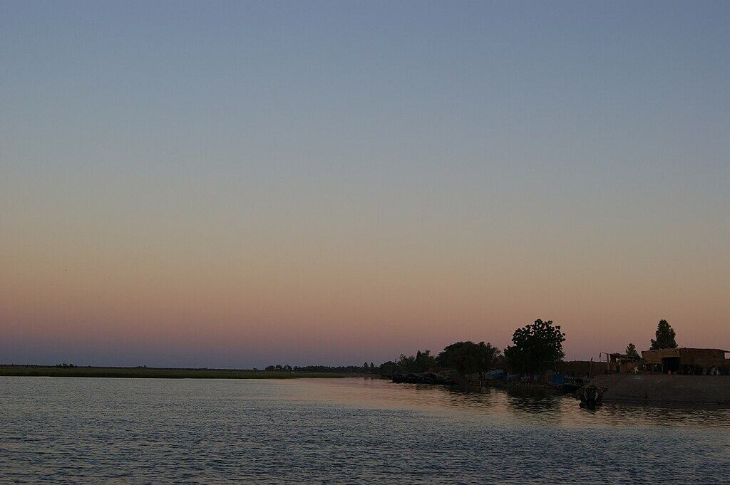
Founded in the 12th century, Timbuktu became a center of Islamic scholarship by the 14th century, housing tens of thousands of manuscripts. It lies at the southern edge of the Sahara Desert, where summer temperatures frequently exceed 40°C. The city’s population today is roughly 55,000. The Djinguereber Mosque, built in 1327, remains a UNESCO-listed landmark constructed from mud brick. Access can be complicated by regional security conditions, and infrastructure remains limited compared to major urban centers.
9. Bhutan
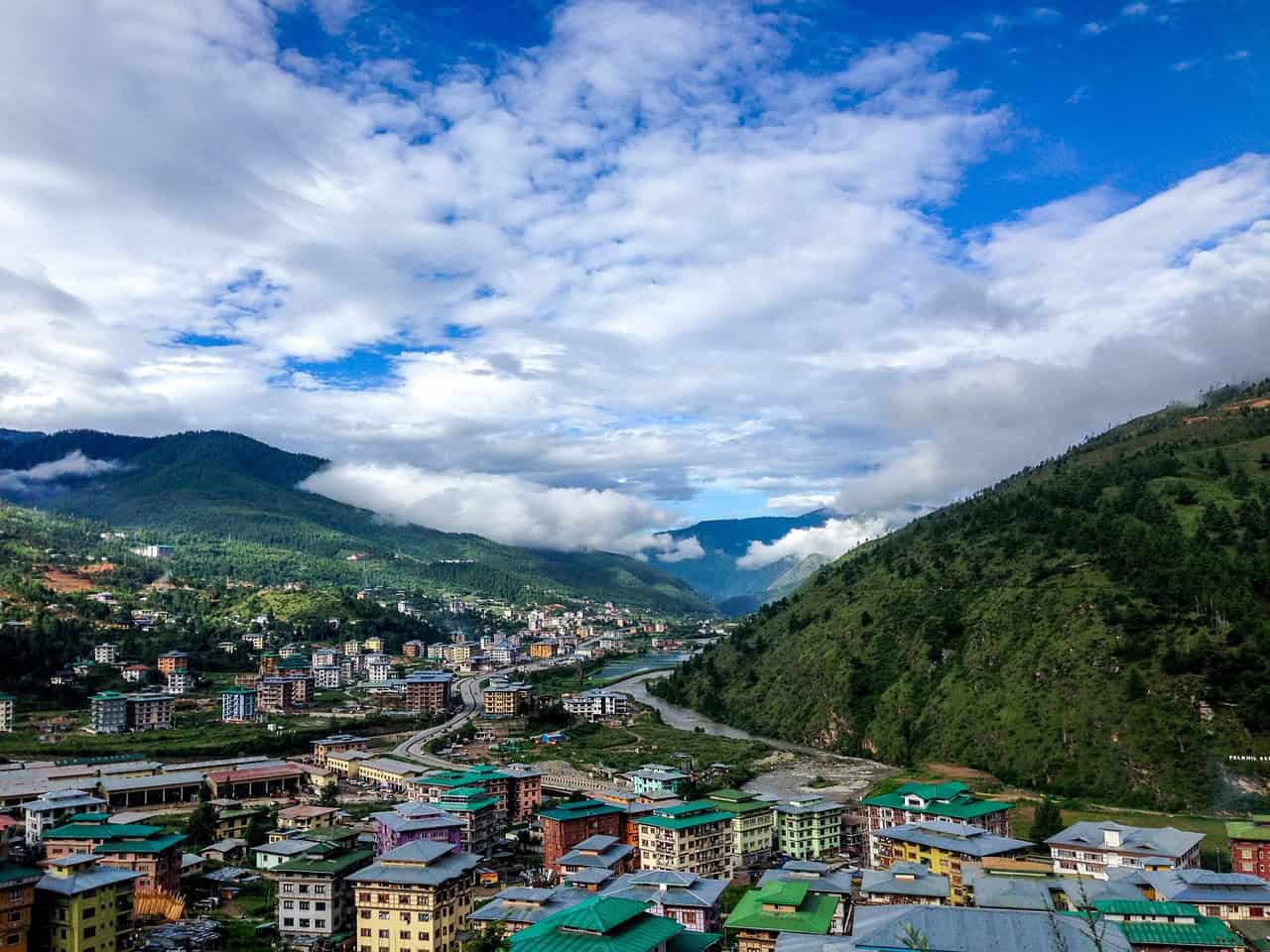
Bhutan spans approximately 14,824 square miles and maintains a population near 800,000. The country enforces a Sustainable Development Fee of about 100 USD per visitor per night to regulate tourism. Over 70% of the land is forested, preserving biodiversity across Himalayan valleys. Paro Airport sits at 7,333 feet and is known for its challenging mountain approach. Tiger’s Nest Monastery clings to cliffs at roughly 10,240 feet. Travel here emphasizes environmental responsibility and cultural preservation.
10. Faroe Islands
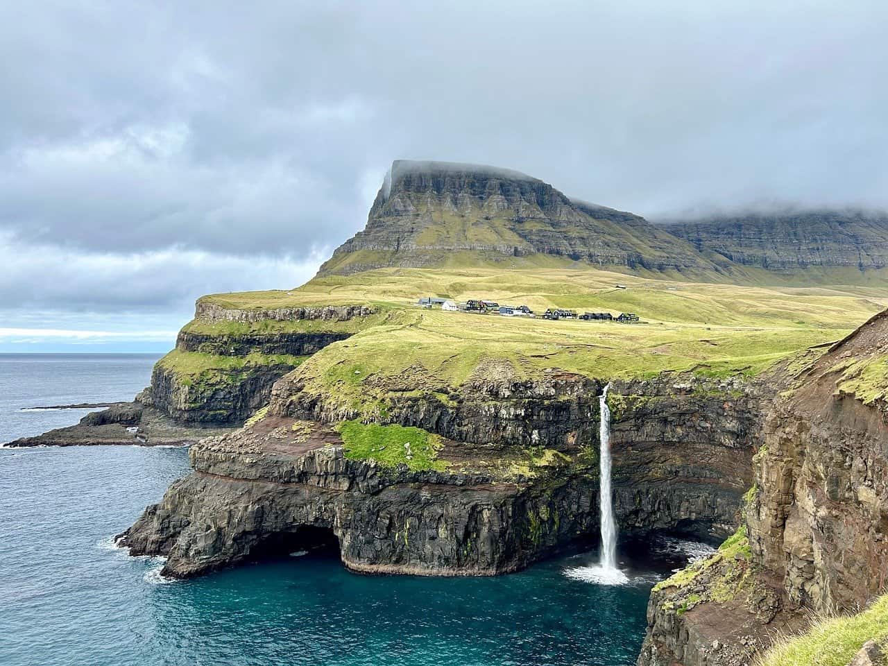
The Faroe Islands consist of 18 volcanic islands covering about 537 square miles, with a population near 54,000. Sheep outnumber residents almost 2 to 1. Average summer temperatures hover around 13°C, and fog can roll in within minutes. Subsea tunnels stretch more than 7 miles, linking remote communities. Cliffs rise sharply from the North Atlantic, some exceeding 2,300 feet in height. Weather changes rapidly, and outdoor plans often depend on wind speeds and ocean conditions.
11. Mongolia
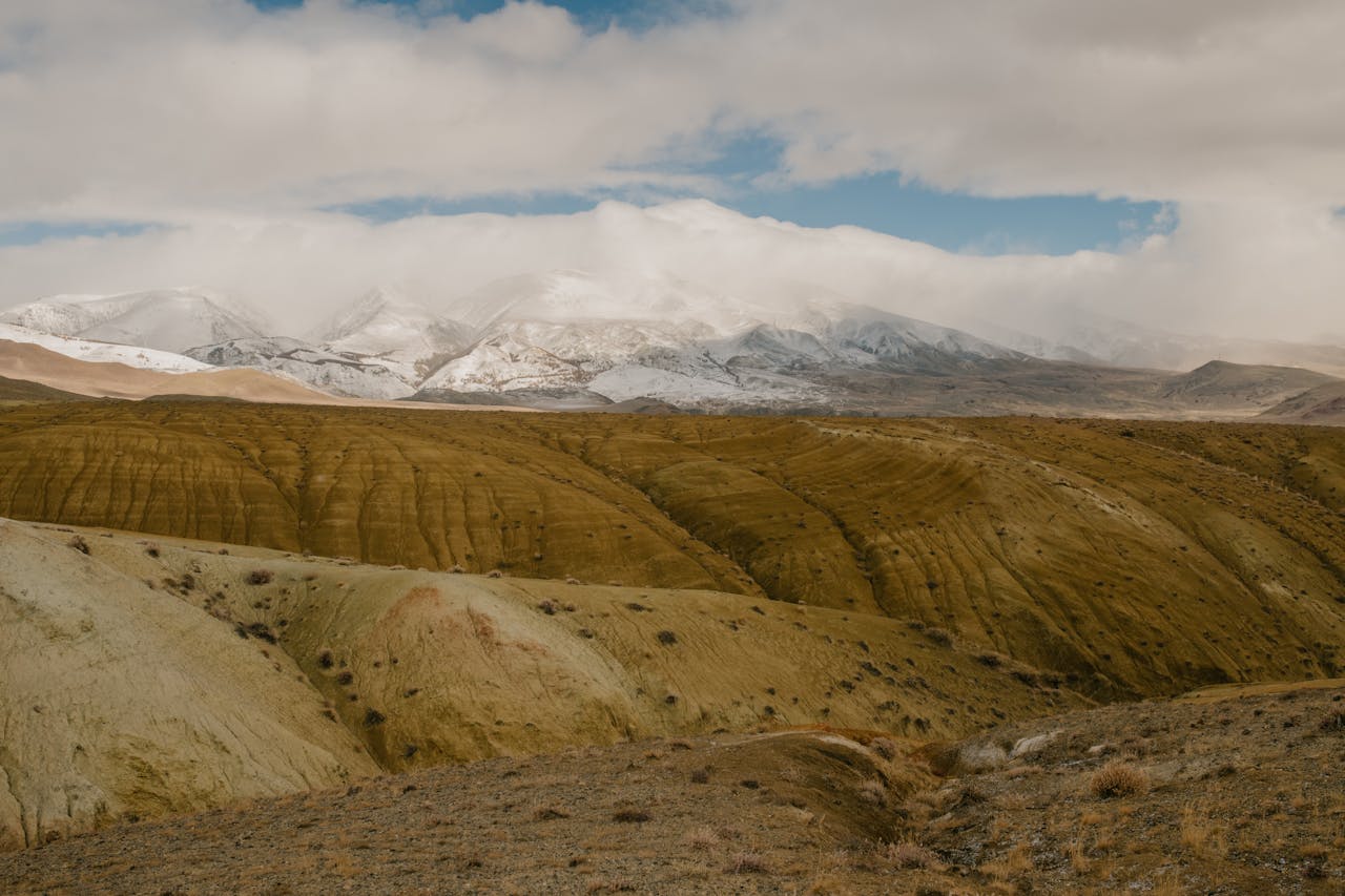
Mongolia stretches across roughly 603,900 square miles yet has a population of only about 3.4 million people, making it one of the least densely populated nations on Earth. Nearly one-third of citizens maintain nomadic or semi-nomadic lifestyles. Winter temperatures can fall below −30°C, while summers in the Gobi Desert exceed 35°C. Paved roads remain limited outside Ulaanbaatar. Distances between settlements can span hundreds of miles, requiring fuel planning, offline maps, and flexibility in vast, open terrain.
12. Iquitos
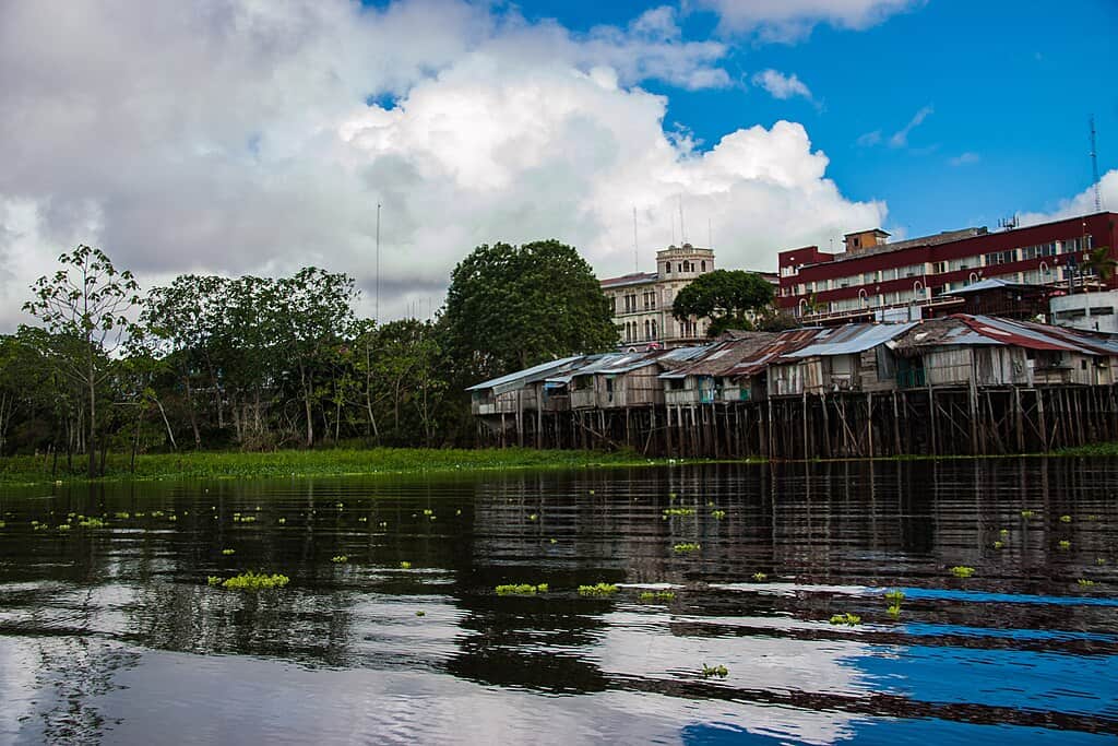
With a population exceeding 470,000, Iquitos is the largest city in the world unreachable by road. Located deep within the Amazon Basin, it sits over 2,240 miles upriver from the Atlantic Ocean. Humidity often surpasses 80%, and temperatures average 31–32°C year-round. Boats and small aircraft provide the primary access routes. Surrounding rainforest hosts tens of thousands of plant species and remarkable biodiversity. Logistics can shift with river levels, making schedules dependent on seasonal water conditions.
13. Easter Island
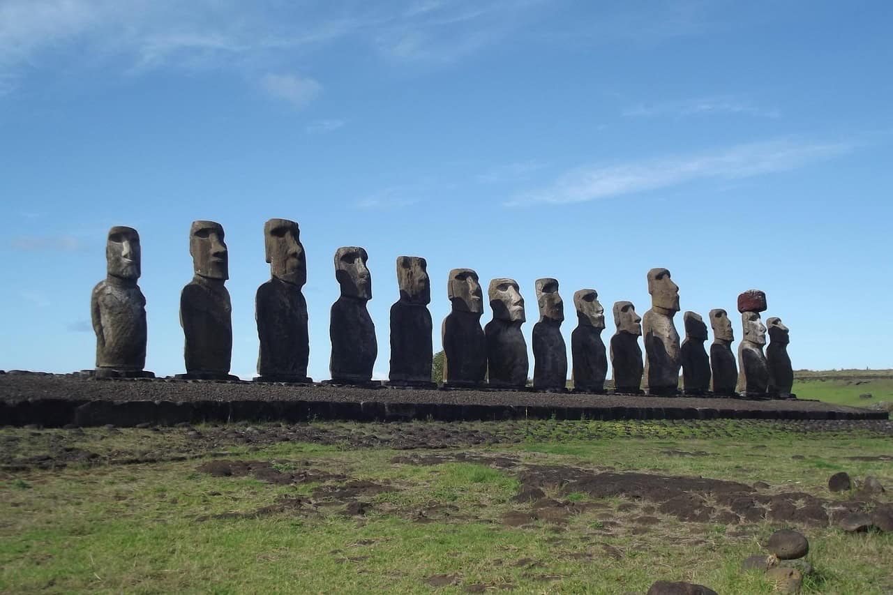
Situated about 2,175 miles west of mainland Chile, Easter Island covers just 63 square miles yet contains nearly 1,000 moai statues, some weighing more than 80 tons. The island’s population is around 8,000. Rano Kau volcano rises 1,063 feet above sea level, offering sweeping views of the Pacific. Flights are limited and often expensive due to isolation. Resources such as fresh water are finite, and tourism regulations aim to protect fragile archaeological sites.
14. Transnistria
Transnistria occupies roughly 1,607 square miles along the Dniester River and has a population near 465,000. It declared independence in 1990, though it remains largely unrecognized internationally. Soviet-era symbols, monuments, and architecture still dominate Tiraspol’s main avenues. Visitors typically receive short-term entry permits at border checkpoints. The local currency is distinct and rarely usable outside the territory. Political complexity requires awareness, patience, and respect for regional sensitivities.
15. Kamchatka Peninsula

The Kamchatka Peninsula extends about 780 miles and covers roughly 104,250 square miles, yet its population remains under 320,000. More than 300 volcanoes shape the landscape, including 29 considered active. Brown bears are commonly sighted during salmon runs in summer months. Many remote valleys are accessible only by helicopter due to limited road infrastructure. Weather shifts quickly along the Pacific coast, and expedition travel often depends on aviation windows and volcanic activity monitoring.
16. Madagascar
Madagascar spans about 226,658 square miles and hosts wildlife with nearly 90% endemism. More than 100 lemur species live here, along with thousands of plants found nowhere else. The population exceeds 29 million, yet infrastructure outside Antananarivo can be limited. Some national parks require 4×4 access over rough roads that slow travel to under 25 miles per hour. The Avenue of the Baobabs features trees estimated at over 800 years old. Distances are long, and journeys often take far longer than maps suggest.
17. Sahara Desert
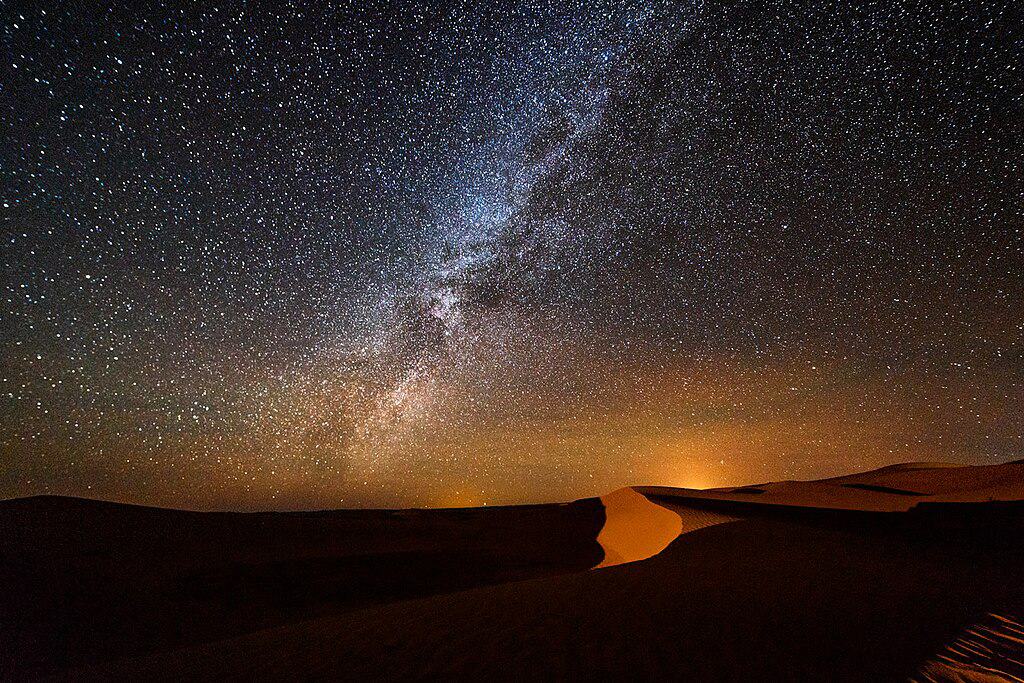
Covering approximately 3.6 million square miles, the Sahara is the largest hot desert on Earth. Summer temperatures regularly exceed 45°C, while nighttime can drop below 10°C. Annual rainfall in many regions averages under 100 mm. Sand dunes in areas like Erg Chebbi rise more than 490 feet high. Travel typically requires experienced guides, 4×4 vehicles, and careful water planning. Navigation depends on local knowledge, as shifting winds can quickly reshape familiar routes across vast terrain.
18. Antarctica
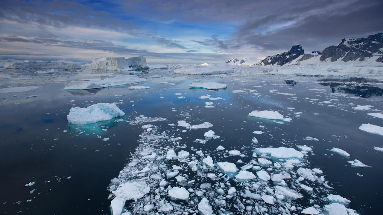
Antarctica spans roughly 5.4 million square miles and holds nearly 70% of the planet’s fresh water locked in ice. Winter temperatures can fall below −60°C inland, while coastal summer averages hover near 0°C. There are no permanent residents, only rotating research teams numbering about 1,000 in winter and up to 4,000 in summer. Tourism is tightly regulated under international treaty agreements. Landings depend entirely on sea ice conditions, wind speeds, and strict environmental protocols.
19. Afghanistan
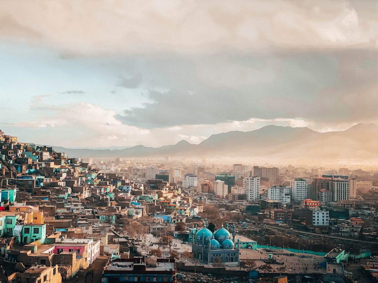
Afghanistan covers about 251,748 square miles and has a population near 40 million. The Hindu Kush mountain range rises above 23,000 feet, shaping both climate and culture. Summers in Kabul can exceed 30°C, while winters bring heavy snowfall to high passes. Historically positioned along the Silk Road, the country holds ancient cities and archaeological sites dating back over 2,000 years. Travel conditions vary significantly due to security realities, requiring thorough research and responsible decision-making.
20. North Sentinel Island
North Sentinel Island covers roughly 23 square miles in the Bay of Bengal and is home to one of the world’s most isolated Indigenous communities. The island is legally protected under Indian law, and approaching within 5 nautical miles is prohibited. Population estimates range between 50 and 150 people. Dense forest blankets most of the terrain, and there is no tourism infrastructure. Responsible travelers understand that true exploration sometimes means respecting boundaries and choosing not to visit.