We may earn money or products from the companies mentioned in this post. This means if you click on the link and purchase the item, I will receive a small commission at no extra cost to you ... you're just helping re-supply our family's travel fund.
Some places on Earth resist easy tourism. They are sealed by law, guarded by nature, or shaped by extreme climates that punish mistakes instantly. From islands cut off for thousands of years to deserts where thermometers shatter records, these destinations demand more than curiosity. They require permits, preparation, and often a willingness to accept real danger. Below are twenty locations where statistics, geography, and history combine to make travel rare, restricted, or profoundly risky.
1. North Sentinel Island
Floating in the Bay of Bengal about 50 km west of South Andaman, North Sentinel Island spans roughly 60 sq km of dense forest and reef. It is home to the Sentinelese, estimated to number between 50 and 150 people. Indian law enforces a 5 km exclusion zone, and entry without authorization is illegal. Attempts at contact have repeatedly been rejected, sometimes violently. With no harbor, no infrastructure, and complete isolation for thousands of years, it remains one of the planet’s most strictly protected human territories.
2. Ilha da Queimada Grande
Located about 35 km off Brazil’s coast, Ilha da Queimada Grande covers just 0.43 sq km, yet biologists estimate 2,000 to 4,000 golden lancehead vipers inhabit it. This critically endangered species evolved potent venom capable of rapidly immobilizing prey. The Brazilian Navy restricts access, allowing only controlled scientific visits. There are no permanent residents, no medical facilities, and steep rocky terrain throughout. Its extreme snake density, sometimes cited as one per square meter has earned it the nickname “Snake Island.”
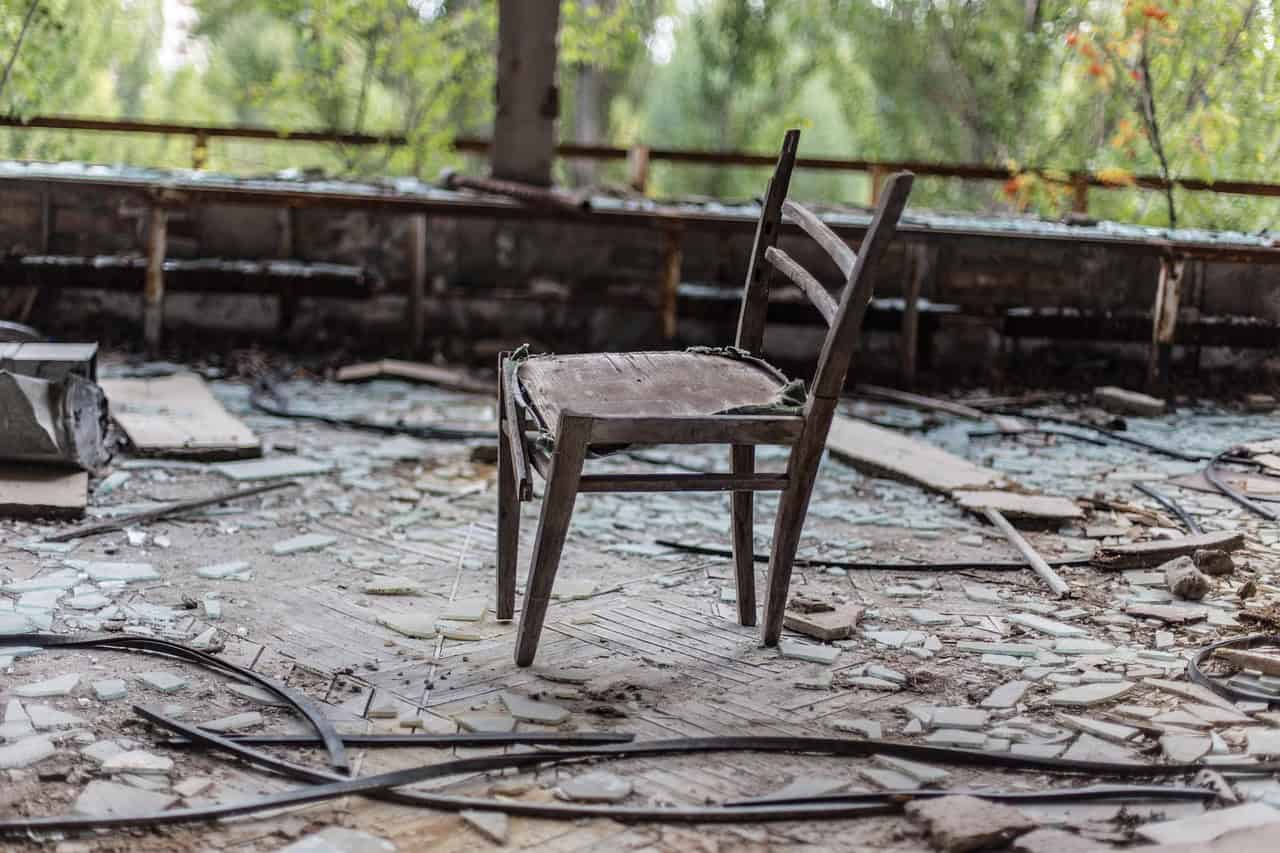
3. Chernobyl Exclusion Zone

Established after the 1986 explosion at Reactor No. 4 of the Chernobyl Nuclear Power Plant, this restricted area spans about 2,600 sq km. Radiation levels vary, with some hotspots still exceeding safe exposure limits decades later. The nearby city of Pripyat was evacuated in 36 hours, displacing nearly 50,000 residents. While guided tours now operate in limited corridors, much of the zone remains off-limits due to contamination, unstable buildings, and ongoing environmental monitoring.
4. Death Valley
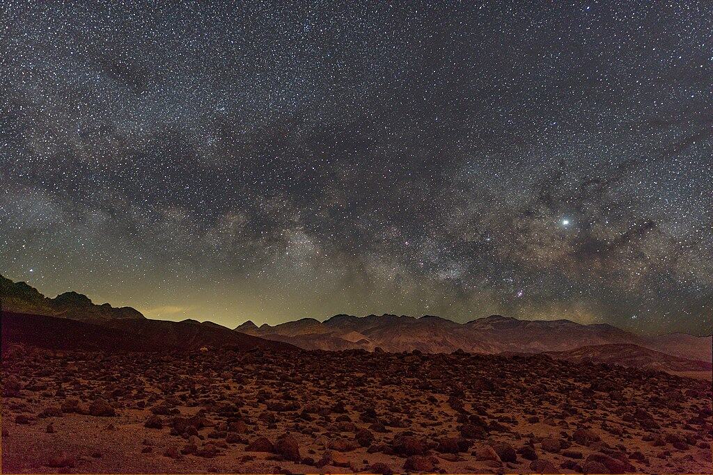
Covering over 13,600 sq km, Death Valley holds the record for one of the highest air temperatures ever recorded: 56.7°C in 1913. Summer averages often exceed 47°C, and annual rainfall is typically below 60 mm. The basin drops to 86 meters below sea level at Badwater. Each year, dozens of rescue operations respond to heat exhaustion, vehicle breakdowns, and dehydration. Vast distances between services and sudden flash floods make preparation essential, even for experienced desert travelers.
5. Mount Washington

Rising 1,917 meters above sea level, Mount Washington appears modest, yet it recorded a wind speed of 372 km/h in 1934, once a world record. Weather shifts can occur within minutes, with temperatures plunging below −40°C in winter. The summit observatory logs hurricane-force winds on more than 100 days annually. Despite roads and a cog railway, hypothermia remains a real threat. Its combination of altitude, exposure, and volatile climate has led to over 150 recorded fatalities.
6. Danakil Depression
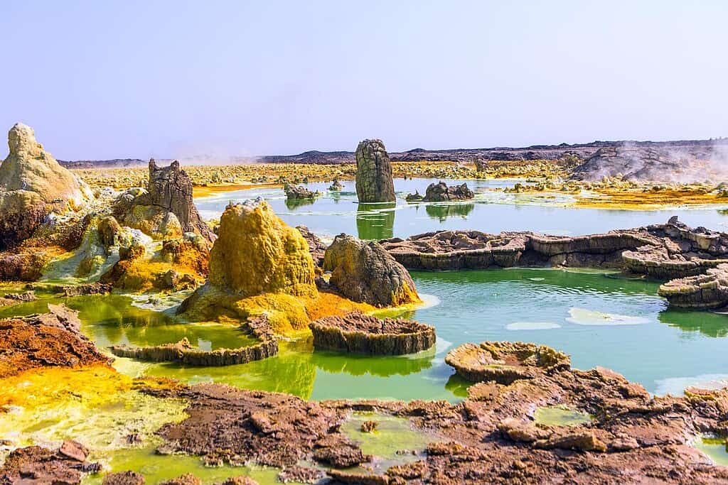
Situated about 125 meters below sea level, the Danakil Depression is one of the hottest inhabited regions on Earth, with average annual temperatures near 35°C. Summer highs frequently exceed 45°C. The area features sulfur springs, salt flats, and the Erta Ale lava lake, active for decades. Tectonic plates here are pulling apart at roughly 1–2 cm per year. Limited infrastructure, extreme heat, and remote desert conditions mean expeditions require armed escorts and carefully planned logistics.
7. Lake Natron
Stretching about 57 km long, Lake Natron is shallow yet chemically intense, with alkalinity levels reaching a pH of 10.5. Water temperatures can rise above 40°C. High evaporation leaves behind sodium carbonate deposits that can preserve animal remains. Yet the lake supports up to 2.5 million lesser flamingos during the breeding season. Sparse roads, blistering heat, and caustic mudflats deter casual visitors. Its stark red waters and mineral crusts create a landscape both hostile and strangely beautiful.
8. Oymyakon
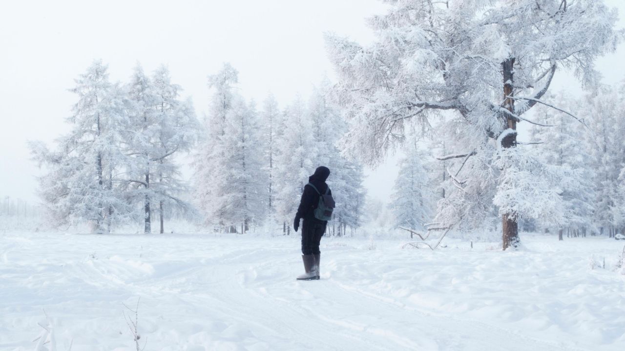
With a population of roughly 500 people, Oymyakon holds the record for one of the lowest officially recorded temperatures in a permanently inhabited place: −67.7°C in 1933. Winter averages hover near −50°C, and daylight can shrink to just 3 hours in December. Engines must run continuously to prevent freezing, and exposed skin can frostbite within minutes. Limited road access and vast distances from major cities make travel logistically challenging across this Siberian extreme.
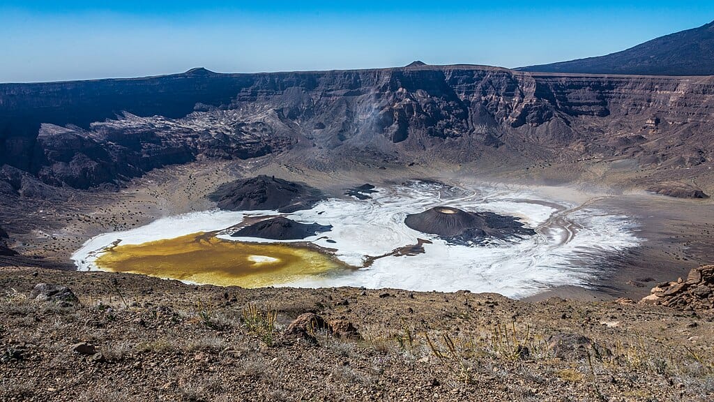
9. Darvaza Gas Crater
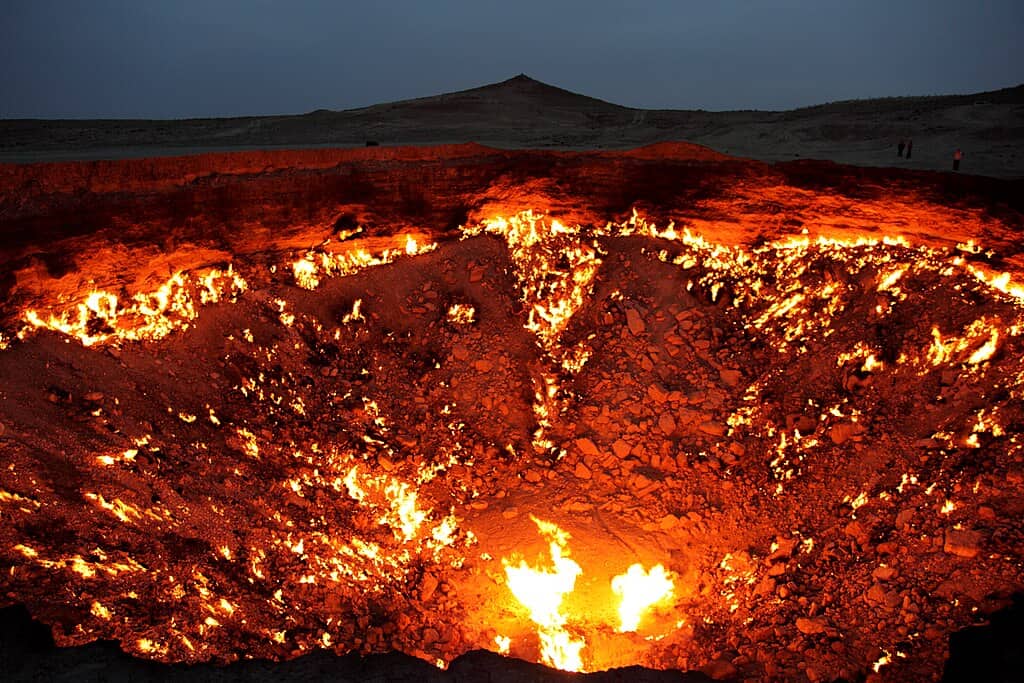
Commonly called the “Door to Hell,” this crater measures about 70 meters wide and 30 meters deep. It has burned continuously since 1971, when geologists ignited escaping methane to prevent spread. Temperatures near the rim can exceed 1,000°C within the flames. Located in the Karakum Desert, one of the driest regions in Central Asia, it sits hundreds of kilometers from major cities. Harsh desert winds and unstable edges make close approaches hazardous.
10. Bouvet Island
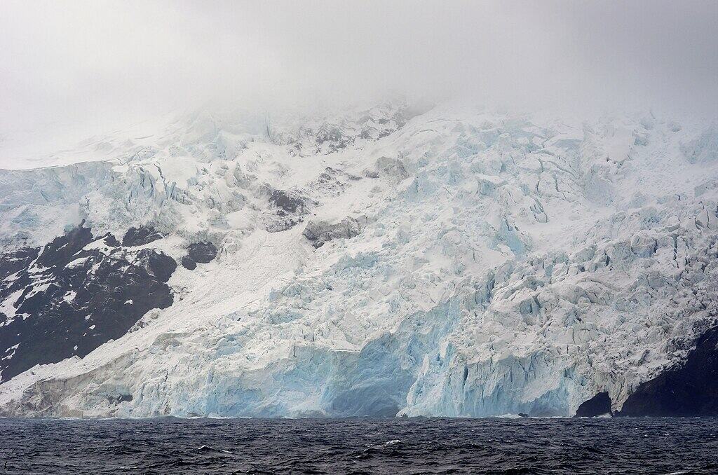
Bouvet Island lies roughly 1,600 km from Antarctica and 2,500 km from South Africa, making it one of the most remote islands on Earth. About 93 percent of its 49 sq km area is covered by glaciers. There is no permanent population, only occasional research visits. Steep cliffs and heavy seas complicate landings, and weather conditions shift rapidly. With no airstrip and limited shelter, access typically requires specialized polar vessels and favorable seasonal windows.
11. Mariana Trench
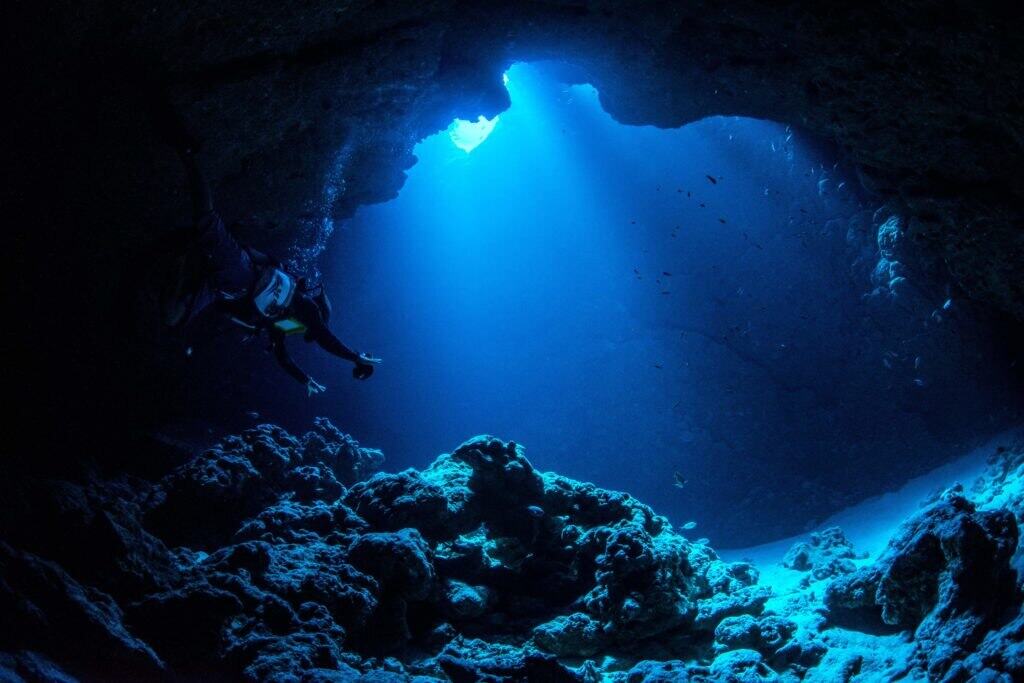
The Mariana Trench reaches nearly 10,984 meters at Challenger Deep, where water pressure exceeds 1,000 times that at sea level. Temperatures hover near 1–4°C in perpetual darkness. Only a handful of crewed descents have reached the bottom since 1960. Specialized submersibles must withstand immense compression forces. Located east of the Mariana Islands, the trench represents the deepest known point in Earth’s oceans, a realm more visited by robots than humans.
12. Socotra
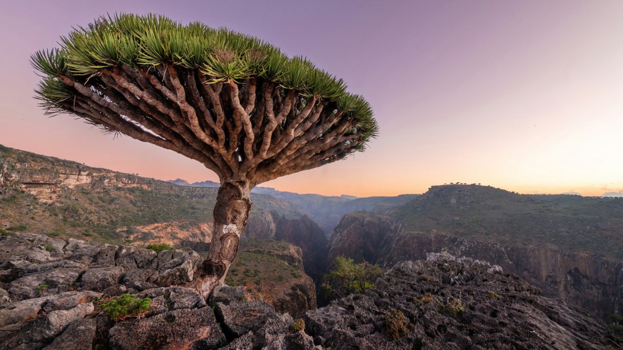
About 380 km south of mainland Yemen, Socotra spans 3,625 sq km and hosts over 700 species found nowhere else. The dragon’s blood tree, with its umbrella canopy, symbolizes this biodiversity. Limited flights and periodic regional instability reduce visitor numbers significantly compared to other island destinations. Infrastructure remains basic outside the main town of Hadiboh. Seasonal monsoon winds can isolate the island for months, reinforcing its reputation as one of the Indian Ocean’s most secluded habitats.
13. Mount Sinabung
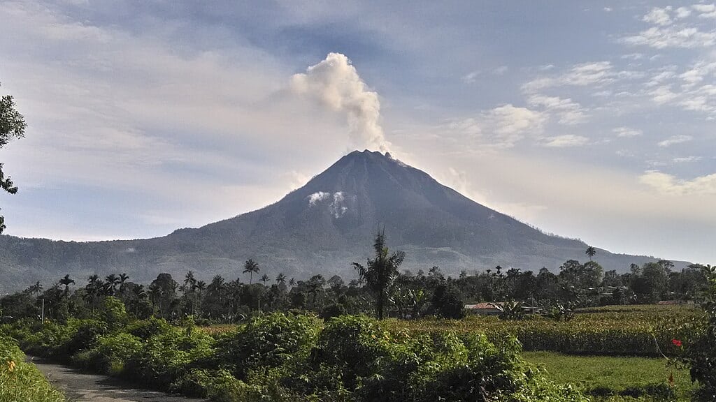
Rising 2,460 meters, Mount Sinabung reawakened in 2010 after nearly 400 years of dormancy. Since then, repeated eruptions have displaced more than 30,000 residents. Ash columns have soared up to 5 km high, disrupting air traffic and agriculture. A permanent exclusion zone of at least 3 to 5 km surrounds the summit. Pyroclastic flows and lava domes remain unpredictable. Despite fertile volcanic soils nearby, the mountain’s volatility makes it one of Indonesia’s most closely monitored peaks.
14. Pripyat
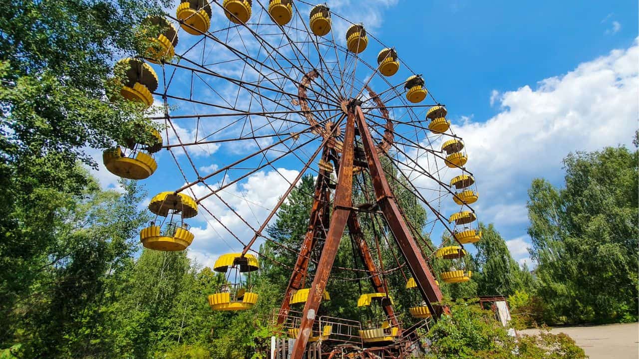
Founded in 1970 to house workers of the nearby nuclear plant, Pripyat once had nearly 49,000 residents. After the 1986 accident, evacuation occurred within hours, leaving apartments, schools, and amusement rides abandoned. Radiation levels today vary widely, with some areas relatively safe for short visits and others still restricted. Buildings have deteriorated for nearly four decades, increasing structural collapse risks. Entry is controlled, and overnight stays remain prohibited within the exclusion perimeter.
15. Gangkhar Puensum
At 7,570 meters, Gangkhar Puensum is considered the highest unclimbed mountain in the world. Located along the Bhutan–China border, it has never hosted a successful summit. Bhutan banned mountaineering above 6,000 meters in 2003, citing spiritual beliefs and environmental protection. Its remote valleys lack road access, and mapping inconsistencies have complicated expeditions. Snow, avalanches, and shifting border interpretations add further barriers, preserving its untouched status among Himalayan giants.
16. Area 51
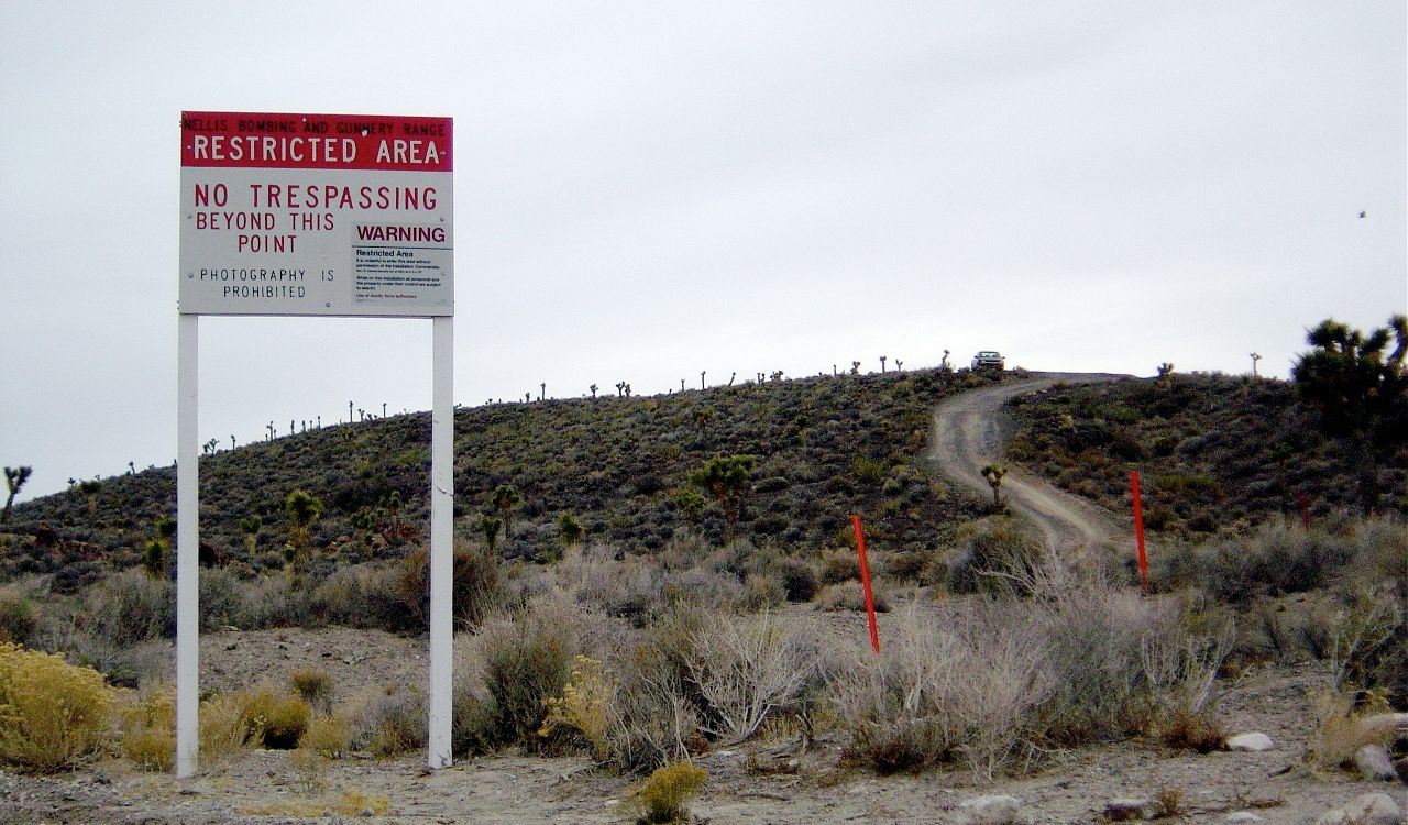
Situated within the Nevada Test and Training Range, Area 51 covers an undisclosed area of restricted desert. The nearest city, Las Vegas, lies about 130 km away. Surveillance systems, patrols, and warning signs enforce a strict no-trespassing policy. Originally linked to U-2 spy plane testing in the 1950s, the base remains classified. Civilian entry is prohibited, and even approaching boundary lines can result in fines or detention, reinforcing decades of secrecy.
17. Kerguelen Islands
Located in the southern Indian Ocean, the Kerguelen Islands sit over 3,300 km from Madagascar. The archipelago covers about 7,215 sq km yet hosts only a rotating scientific population of roughly 50 to 100 people. Fierce winds often exceed 100 km/h, and average temperatures rarely rise above 10°C. There is no commercial airport; access requires long sea voyages. Nicknamed the “Desolation Islands,” they remain among France’s most isolated overseas territories.
18. Bikini Atoll
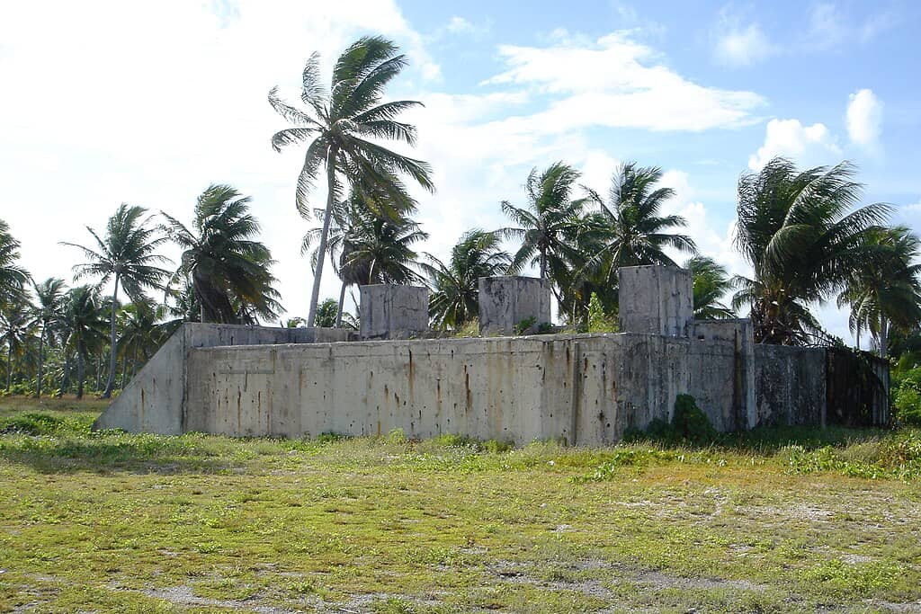
Between 1946 and 1958, 23 nuclear tests were conducted at Bikini Atoll, including the 1954 Castle Bravo detonation, which yielded 15 megatons. The atoll comprises 23 islands surrounding a 594 sq km lagoon. Although some areas have reopened to divers, radiation levels in certain soils and foods have exceeded safety thresholds. The original population of about 167 people was relocated. Ongoing environmental studies continue to assess long-term habitability.
19. Surtsey
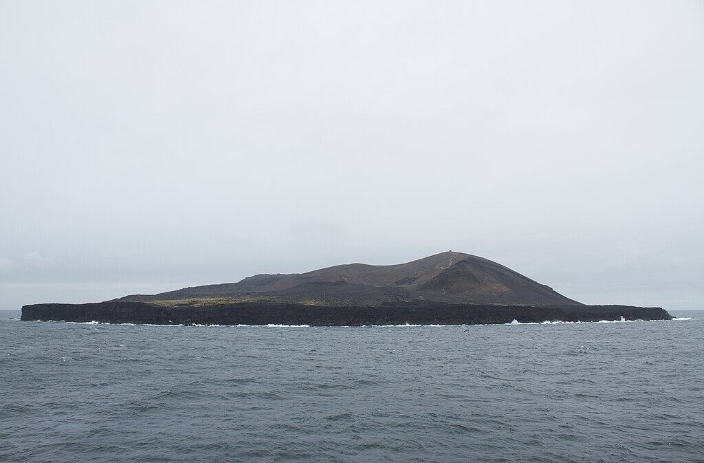
Surtsey emerged from the Atlantic Ocean in 1963 following a volcanic eruption that lasted nearly four years. Today it measures about 1.3 sq km, gradually shrinking due to erosion. Declared a UNESCO World Heritage Site, it is reserved primarily for scientific research. Only a small number of researchers receive permits annually. Strict biosecurity rules prevent outside seeds or organisms from disturbing its natural ecological development, making human footprints exceptionally rare.
20. Ijen Crater
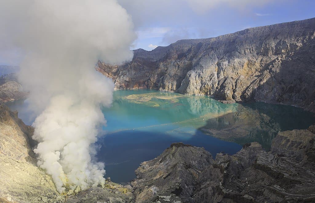
Ijen Crater rises about 2,386 meters above sea level and contains a turquoise acidic lake with a pH near 0.5. At night, ignited sulfuric gases create electric-blue flames that can reach 5 meters high. Local miners carry sulfur loads weighing 60 to 90 kg up steep paths daily. Toxic fumes require gas masks, and wind shifts can rapidly reduce visibility. Despite guided treks, its combination of chemical hazards and volcanic activity makes caution essential.