We may earn money or products from the companies mentioned in this post. This means if you click on the link and purchase the item, I will receive a small commission at no extra cost to you ... you're just helping re-supply our family's travel fund.
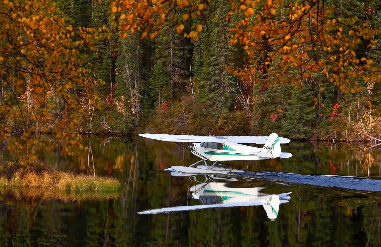
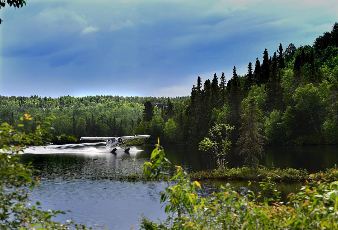
Seaplane travel strips flying down to its most elemental form. There is no runway buffer, no wide safety margin; only water, wind, and timing. These flights are unforgettable not because they are dangerous, but because they demand absolute precision in environments that constantly change. From tropical lagoons to icy fjords, the following seaplane routes are known for their visual beauty and their pulse-raising landings. Each trip blends geography, weather, and human skill in a way that often leaves passengers silent until the floats finally settle on the water.
1. Malé to Outer Atoll Resorts, Maldives
This route typically covers 30–120 miles over the open Indian Ocean, with flight times averaging 25–55 minutes. Seaplanes descend onto lagoons where wave heights can suddenly rise from 0.3 to 1 meter due to shifting trade winds reaching 20 knots. Pilots must land within narrow reef gaps while maintaining float clearance above coral shelves just 1–2 meters below the surface. Passengers often feel tension during descent as the aircraft skims low over glassy water that offers few depth cues. Despite the calm visuals, crosswinds and salt spray make every landing feel sharply precise.
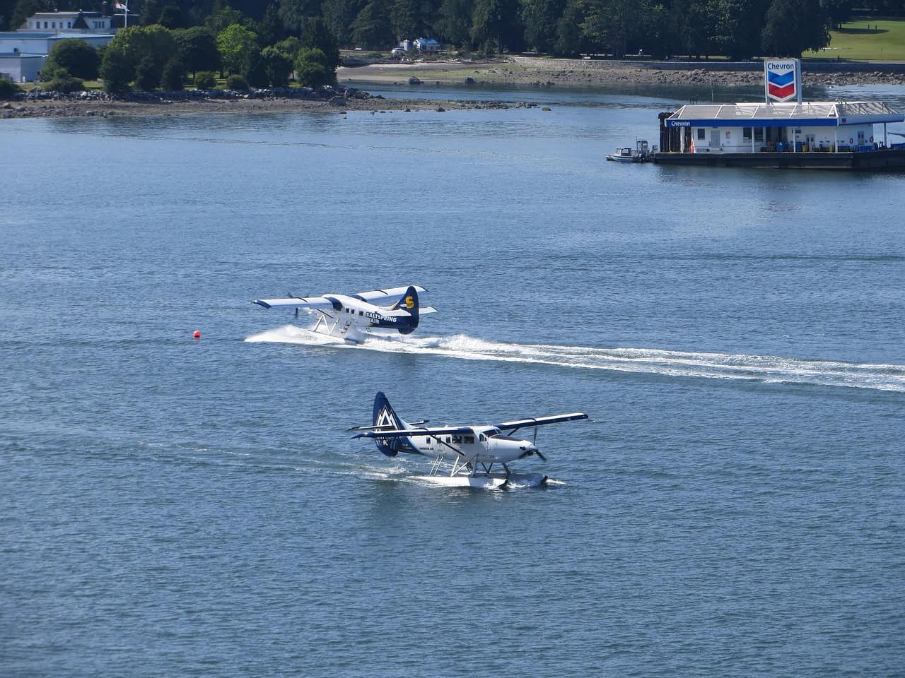
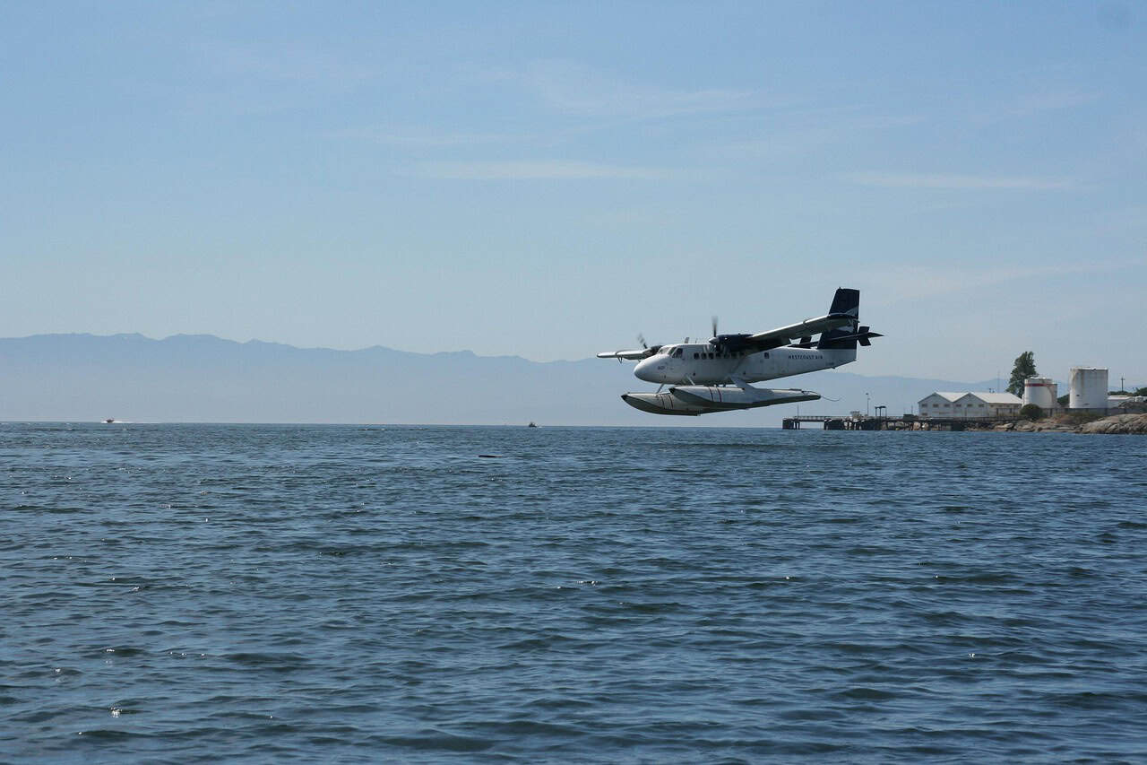
2. Vancouver Harbour to Victoria, Canada
Covering roughly 40 miles in about 30 minutes, this seaplane route operates in one of North America’s most congested harbor zones. Takeoffs occur amid ferries exceeding 300 feet in length and recreational boats moving at 10–15 knots. Wind gusts funneling through coastal inlets can spike suddenly to 25 knots, forcing rapid control adjustments. The landing zone is compact, with limited water clearance near docks and shorelines. Passengers often notice how quickly the plane transitions from skyline to splashdown, creating a sense of compressed time and heightened alertness.
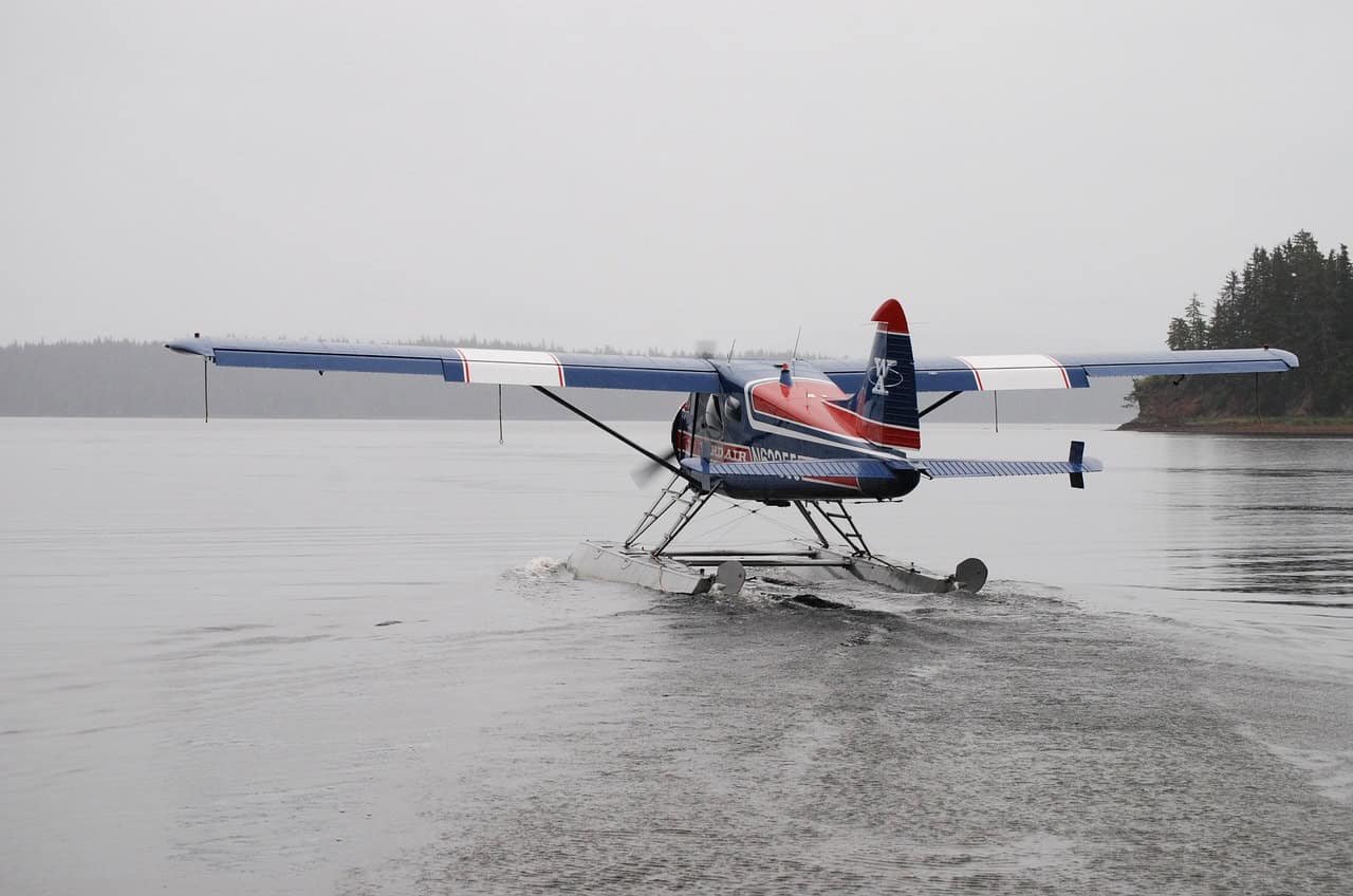
3. Juneau to Tracy Arm Fjord, Alaska
This flight stretches about 45 miles into narrow glacial corridors, often lasting 35–40 minutes. Vertical rock walls rise over 3,000 feet from the water, intensifying wind shear and turbulence. Surface temperatures hover near 4°C, while katabatic winds can accelerate to 30 knots without warning. Landing areas are restricted by floating ice and shifting currents, leaving little room for error. As the plane descends between cliffs and icebergs, passengers frequently fall silent, aware that the margin between air and water is measured in seconds.
4. Sydney Harbour Scenic Seaplane Flights, Australia
Operating within a 20–30 mile radius, these flights last around 20 minutes but demand extreme precision. Sydney Harbour sees more than 2,000 vessel movements daily, including ferries traveling at 25 knots. Coastal winds often gust between 18 and 28 knots, especially near the heads. Pilots must align landings between active marine lanes and fixed landmarks. As the plane touches down with the Opera House nearby, passengers often grip their seats, aware that beauty and congestion coexist in very tight quarters.
5. Bora Bora Lagoon Transfers, French Polynesia
Flights here are short, typically 10–15 miles and under 15 minutes but technically demanding. Lagoon depths vary from 2 to 30 meters, with coral heads rising close to the surface. Trade winds average 15–20 knots, creating choppy textures on otherwise clear water. Pilots rely heavily on visual depth perception during descent. Passengers often feel exposed as the aircraft skims low above reefs visible through the water, making the final seconds before touchdown feel unusually intimate and tense.
6. Hong Kong to Outlying Islands
Distances range from 15 to 60 miles, with flight times between 12 and 45 minutes. The challenge lies in airspace density rather than length. Wind speeds can exceed 30 knots due to urban wind tunneling between skyscrapers. Marine traffic density is among the highest globally, with thousands of daily vessel movements. Landings occur in confined coastal pockets where timing is critical. Passengers often sense the intensity as the aircraft threads between city structures and watercraft before settling onto a narrow strip of sea.
7. Lake Como Scenic Seaplane Flights, Italy
These flights typically cover 20–35 miles, lasting about 25 minutes. Steep mountain slopes exceeding 6,000 feet generate downdrafts that can suddenly roughen the lake surface. Wind speeds may jump from calm to 20 knots in minutes. Landing zones are constrained by shoreline development and boat traffic. Passengers often notice how quickly smooth air becomes turbulent, with the final approach demanding rapid corrections before the floats meet the water in a tightly controlled glide.
8. Kodiak Island Coastal Routes, Alaska
Covering distances of 40–100 miles, these flights average 45–70 minutes over exposed North Pacific waters. Wave heights can reach 1.5 meters even in moderate weather, while visibility frequently drops below 3 miles. Wind speeds often exceed 25 knots during frontal systems. Landings feel physical, with noticeable resistance as floats contact moving water. Passengers often describe a mix of awe and tension, amplified by the remoteness and the cold, steel-colored sea below.
9. Phuket to Private Island Transfers, Thailand
These routes span 15–50 miles and last 20–40 minutes. Tropical conditions mean rapid storm development, with wind shifts up to 20 knots within minutes. Swell heights can increase from 0.5 to 1.2 meters during squalls. Landing areas are small and often bordered by rocky outcrops. As rain curtains form ahead of descent, passengers frequently brace themselves, sensing how quickly calm skies can turn unpredictable in equatorial waters.
10. Seychelles Inter-Island Seaplane Flights
Inter-island seaplane routes in Seychelles usually span 20–90 miles, with flight durations between 30 and 60 minutes depending on wind and sea conditions. The islands’ steep granite peaks, some rising over 3,000 feet, disrupt airflow and create sudden gusts that often reach 25–30 knots near approach zones. Lagoon landing areas are tight and bordered by coral shelves just 1–3 meters below the surface. Water texture changes quickly with tide movement, forcing pilots to commit decisively. Passengers often sense the tension during descent as the aircraft aligns precisely between reef edges and shifting swells.
11. Rio de Janeiro Coastal Seaplane Routes, Brazil
These coastal flights typically cover 25–45 miles and average 30–40 minutes in duration. Rio’s dramatic topography, with mountains exceeding 2,000 feet rising directly from the shoreline, creates turbulent wind patterns that can spike beyond 26 knots. Humidity often reduces visibility to under 5 miles, while boat traffic remains constant below. Landing zones are narrow and closely bordered by urban structures. As the plane descends near Sugarloaf Mountain, passengers often become acutely aware of how little margin exists between water, rock, and city, heightening the final moments before touchdown.
12. Great Bear Lake Seaplane Routes, Canada
Flights across Great Bear Lake can exceed 150 miles, with durations reaching 90 minutes over uninterrupted water. The lake spans more than 31,000 square kilometers, offering almost no visual depth reference during descent. Even in summer, surface water temperatures remain near 2–4°C, and winds frequently build rolling swells approaching 1 meter in height. Landing zones feel exposed and unforgiving, with no nearby shoreline buffer. Passengers often report an intense stillness during approach, where the isolation magnifies every sound, vibration, and movement as the floats finally meet the water.
13. Palawan Island Hopping, Philippines
Seaplane routes in Palawan range from 20 to 75 miles, with flight times averaging 25–55 minutes. Towering limestone karsts rising over 1,000 feet funnel winds that can shift direction by 15–22 knots during descent. Many landing areas are hidden coves with limited maneuvering space and shallow entry paths. Water clarity often masks depth changes, increasing pilot workload. As the aircraft slips between cliffs toward narrow bays, passengers frequently feel a tightening silence, aware that precision and not speed defines the final seconds before landing.
14. Fiordland Seaplane Landings, New Zealand
Fiordland seaplane routes typically cover 30–85 miles and can last up to 60 minutes depending on weather. Sheer cliffs exceeding 4,000 feet generate strong downdrafts, while annual rainfall surpasses 6 meters, rapidly altering visibility. Wind gusts of 30–35 knots are common within narrow fjords, roughening water surfaces without warning. Landing areas are confined and dark, with limited visual contrast. During descent, passengers often hold their breath as the aircraft negotiates wind shear and confined space before the floats finally stabilize on the water.