We may earn money or products from the companies mentioned in this post. This means if you click on the link and purchase the item, I will receive a small commission at no extra cost to you ... you're just helping re-supply our family's travel fund.

Some roads don’t just take you somewhere. They change how you move through a day. You slow down, pull over, and watch the light shift across water, rock, or trees. You time a picnic to a viewpoint, trade speed for silence, and let a stretch of pavement tell its story in curves. Use this guide to pick your season, pack a camera you’ll actually use, and leave room for detours. The point isn’t miles. It’s the way the landscape stays with you long after you park.
1. Pacific Coast Highway, Big Sur, California
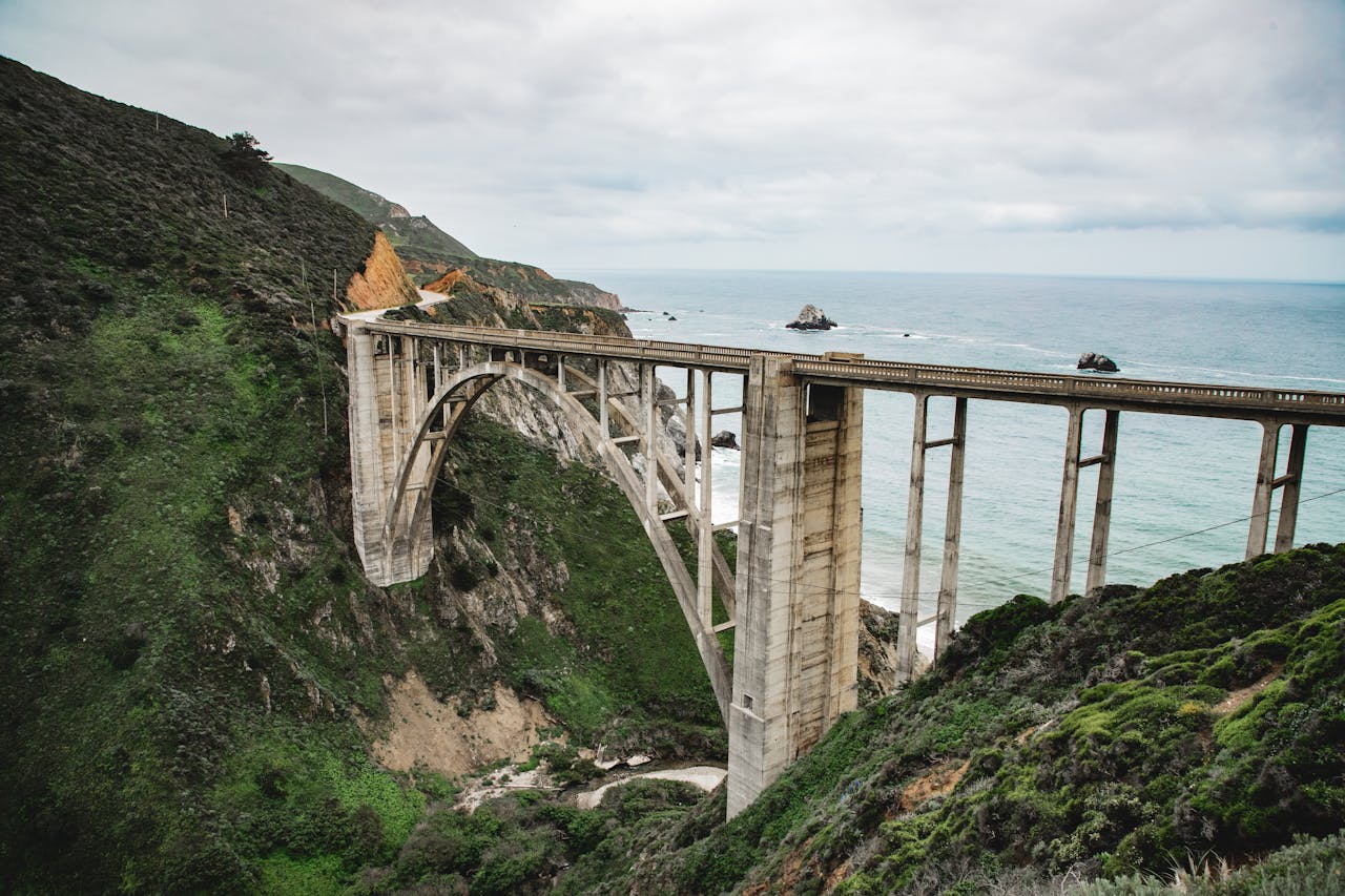
Here the Santa Lucia Mountains fall into the Pacific, and every pullout feels like a postcard. Cruise between Ragged Point and Carmel, cross Bixby Creek Bridge, and watch fog lift to reveal sea otters and cliffside coves. Go in spring for wildflowers or in Sept. for clear skies and calmer winds. Rockfall can close segments, so check conditions, then bring snacks and time. You will stop more than you think, which is the entire point of this drive.
2. Blue Ridge Parkway, Virginia and North Carolina
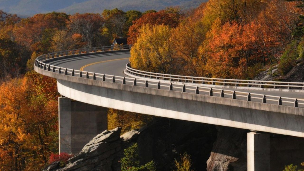
This is a ribbon of two-lane calm built for lingering. Drift past mileposts to overlooks where the Appalachians layer into blue. Rhododendron and flame azalea light up late spring, and fall turns the hills to copper. Speed limits stay low, which suits the mood. Walk a short trail to Mabry Mill or Humpback Rocks, then picnic with a view and a sweater. The parkway rewards unhurried mornings and the habit of pulling over when a valley opens.
3. Overseas Highway, Florida Keys
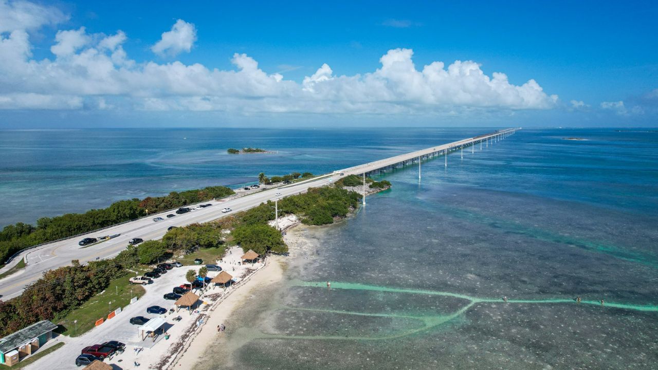
It is water to the horizon for most of the 113 miles between Key Largo and Key West. You glide across 42 bridges, including the Seven Mile Bridge, with mangroves, flats, and shrimp boats on both sides. Sunrise belongs to Islamorada, sunset to Mallory Square, and snorkeling fits neatly in the middle. Watch for Key deer near Big Pine and pelicans on the railings. Roll the windows down and let salt air set the soundtrack at an easy pace.
4. Going-to-the-Sun Road, Glacier National Park, Montana
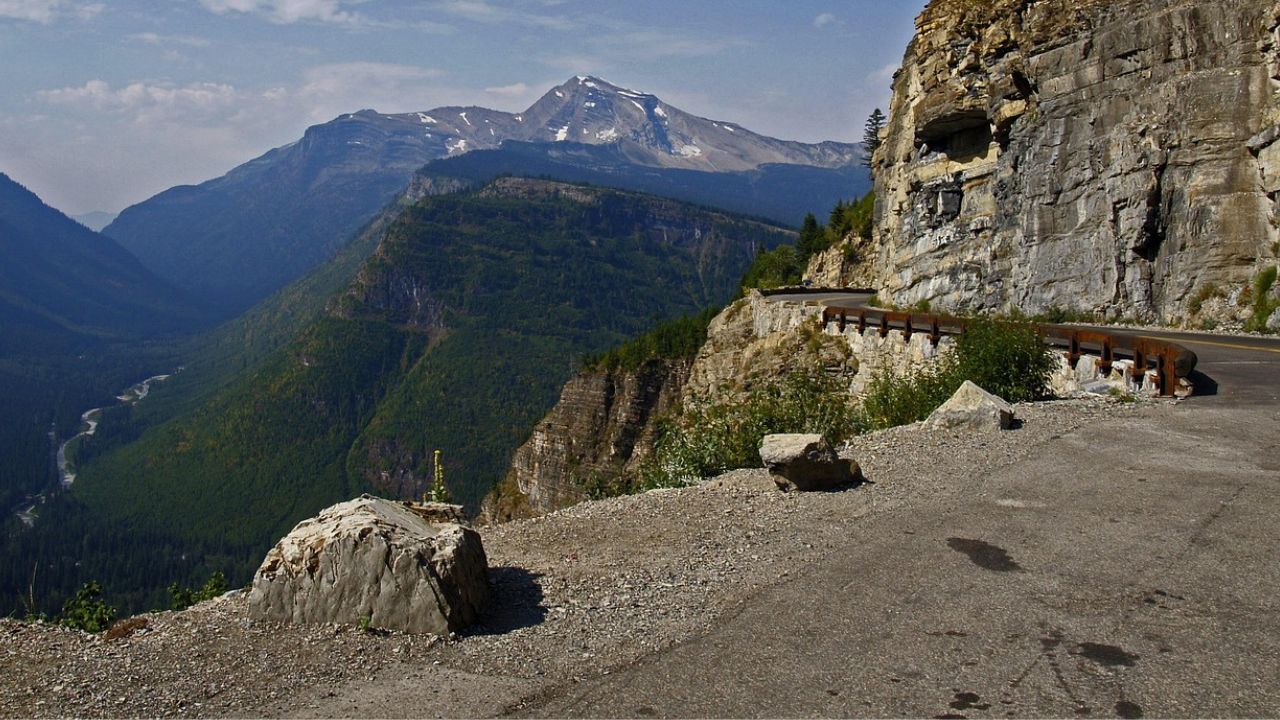
Carved into cliffs and meadows, this road climbs to Logan Pass where mountain goats pick their way through wildflowers. You hug stone guardwalls, pass Weeping Wall, and watch glacial valleys fall away. The season is short, often late June to Sept., and the weather can flip in an hour. Start early, expect traffic, and treat every turnout like a bonus hike. On clear days the peaks seem close enough to touch, then disappear into evening alpenglow.
5. Beartooth Highway, Montana and Wyoming
Switchbacks carry you to 10,947 feet and a high country of tarns, meadows, and wind. Even in July you might see snowbanks along the shoulder. The drive links Red Lodge to the northeast gate of Yellowstone, but it feels like its own trip, with lakes that beg for a roadside lunch and air that tastes cold and clean. Watch for marmots on rocks and storms that build fast. This is a place to gear down, breathe, and look around.
6. Natchez Trace Parkway, Mississippi, Alabama, and Tennessee
This 444-mile route follows an old footpath of traders and travelers, and the calm is built in. No billboards, few trucks, a steady 50 mph, and pullouts that teach you the story of each bend. Walk to cypress swamps, stand by ancient mounds, and let spring wildflowers or October color set the scene. Small towns offer pie and conversation. The Trace is less about peaks and more about pace, which is why you arrive rested instead of wired.
7. Million Dollar Highway, Colorado
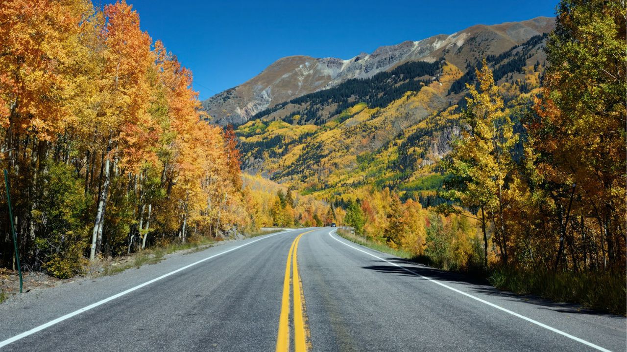
US 550 climbs from Ouray to Silverton along cliffs that make you sit up straight. Red Mountain Pass tops 11,000 feet, mining relics dot the slopes, and guardrails give way to clean edges and big views. In summer, wildflowers rim the road; in fall, aspens go gold. Use low gear on descents and watch for afternoon storms that roll fast. Pull over for a breath at each overlook, then keep climbing. The San Juans earn every superlative.
8. Scenic Byway 12, Utah
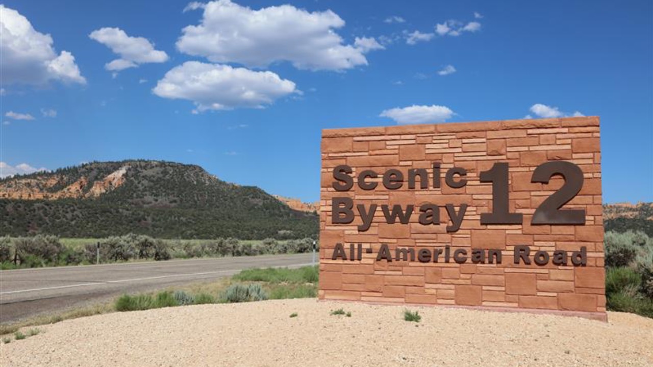
From Bryce Canyon’s hoodoos to Capitol Reef’s orchards, this 122-mile byway strings together national parks, slickrock, and slot canyons. The Hogsback narrows to a ridge with drop-offs on both sides, and the Escalante River winds below like a green thread. Stop for short hikes to Calf Creek Falls or a trail in Kodachrome Basin. Light shifts from rose to rust to ruby as the day goes on. Bring water, respect cryptobiotic soil, and let red rock reset your sense of scale.
9. Hana Highway, Maui, Hawaii
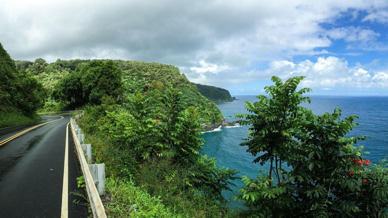
You trace a lush coastline through bamboo, breadfruit, and waterfalls, with 620 curves and 59 one-lane bridges keeping speeds human. Start at first light, share pullouts, and never trespass on private land. Swim at Waianapanapa’s black sand when conditions allow, then continue to Kipahulu for trails under giant banyans. Pack snacks and patience, then return the same way or circle cautiously on dry days. The road is the experience, not the obstacle to it.
10. Kancamagus Highway, New Hampshire
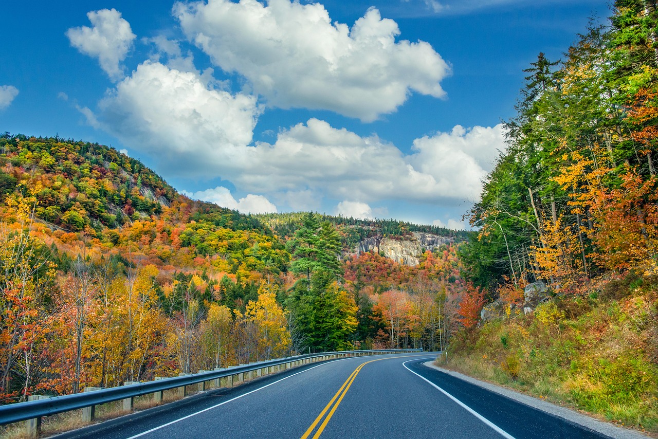
The Kanc runs 34.5 miles through the White Mountain National Forest, trading billboards for birch and the steady rush of the Swift River. In late Sept. and early Oct. the hills catch fire with color, and covered bridges frame the scene. Pull over for Sabbaday Falls, then scan ridgelines where hawks ride thermals. There are no gas stations, so arrive ready. Even on busy weekends, a short walk from the road can give you quiet and a pocket of still air.
11. Historic Columbia River Highway, Oregon
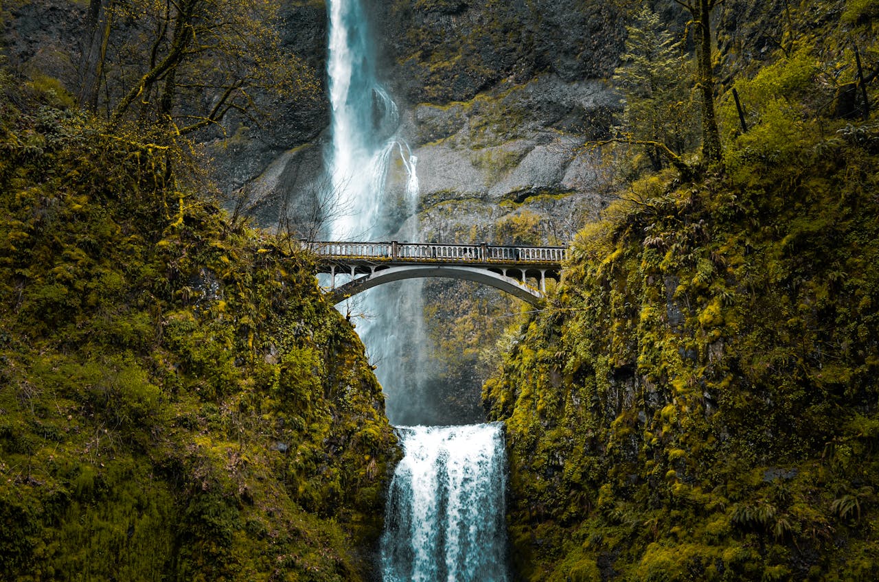
Engineers carved this drive to showcase a gorge cut by ice age floods. Crown Point’s Vista House watches over it, and a string of waterfalls drops to moss and basalt below. Walk to Latourell, then to Multnomah early or late to dodge crowds, and feel the cool drift from spray. Winds can be strong, and cyclists share the road, so give space. Old stonework, ferns, and river light make this feel timeless even when the schedule is not.
12. Seward Highway, Alaska
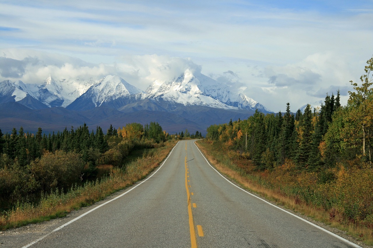
Between Anchorage and Seward, mountains meet ocean and the road threads the seam. Turnagain Arm delivers bore tides and beluga sightings, while Dall sheep pick their way along cliffs. Pullouts come often, and every one begs for a photo. In summer, the sun lingers and the greens look electric; in shoulder seasons, the glaciers glow. Bring layers, binoculars, and time for a detour to Exit Glacier. This is a drive that turns weather into theater.
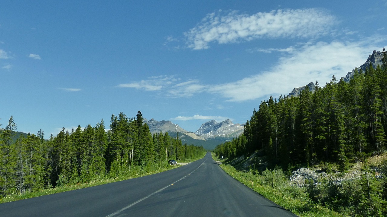
13. North Cascades Highway, Washington
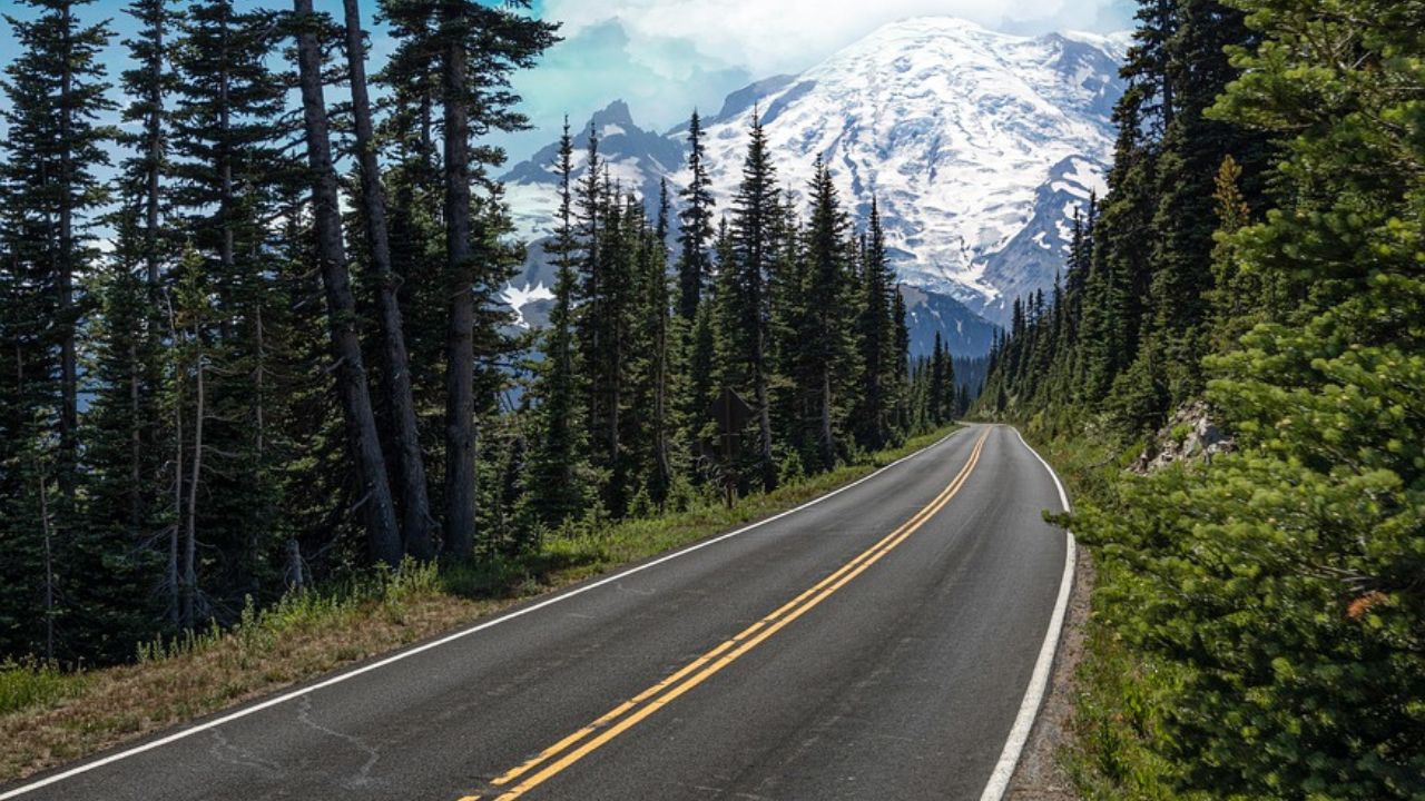
State Route 20 slices into a serrated skyline where rivers run glacial blue. Diablo Lake’s color feels unreal until you see the silt in your hands. The season can be short if snow piles high, so late spring through fall is your window. Trailheads tempt you at every bend, and old fire lookouts reward a few extra miles on foot. End in Winthrop for a walkable main street and a sunset that turns peaks rose and then violet.
14. Great River Road, Mississippi River States
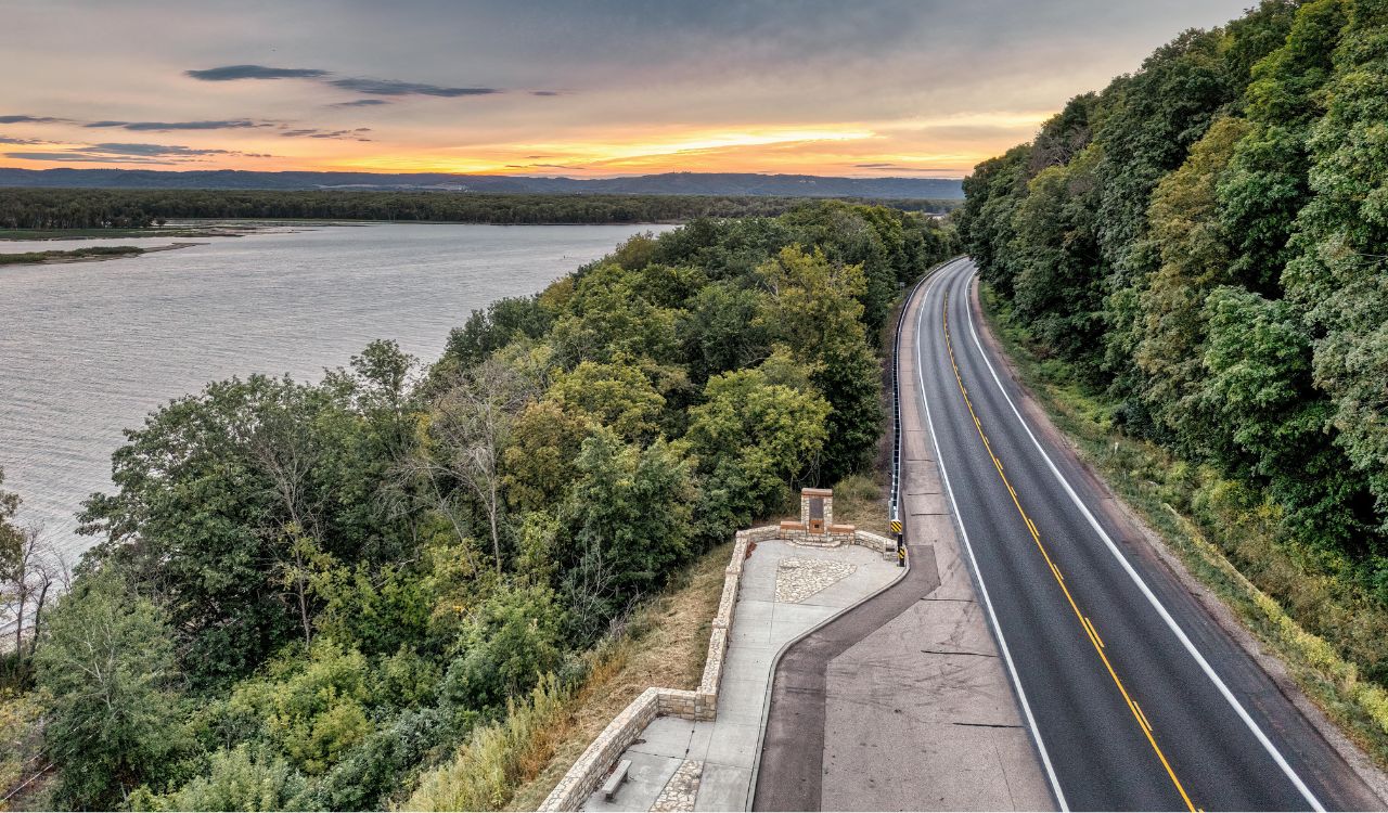
Tracing the Mississippi through ten states, this route ties small towns, levees, and river bends into one long story. Expect murals, blues joints, and barges moving slow water. Autumn color burns in bluffs from Minnesota to Iowa, while southern stretches hum with cicadas and barbecue smoke. Detours lead to Civil War sites or nature refuges. Take it in pieces, stop for pie or catfish, and let the river set the pace—it never hurries, and neither should you.