We may earn money or products from the companies mentioned in this post. This means if you click on the link and purchase the item, I will receive a small commission at no extra cost to you ... you're just helping re-supply our family's travel fund.

Extreme weather patterns expected in 2026 are projected to affect several popular road-trip routes across the world, reshaping how travelers plan long drives. With rising temperatures, heavier rainfall, and more frequent storms, experts warn that some scenic roads may face temporary closures, structural compromises, or higher maintenance demands. The following list highlights routes known for their beauty yet increasingly exposed to the changing climate, blending practical data with what travelers should realistically expect next year.
1. Pacific Coast Highway – California, USA
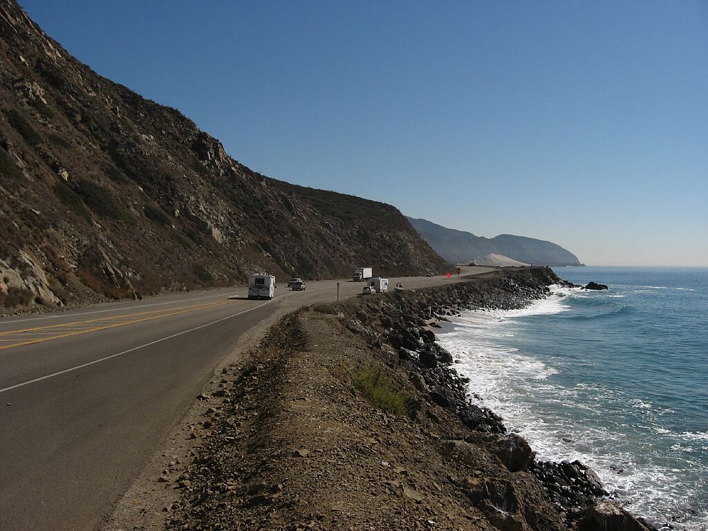
Stretching over 655 miles, California’s Pacific Coast Highway is already known for its dramatic cliffs and ocean views, but experts warn heavier storms in 2026 may increase landslide activity by 20–30% along vulnerable segments. Damage costs on this route have exceeded $1 billion in the last decade, making it one of the most climate-sensitive highways. With rising sea levels and wave erosion, certain stretches could face recurring closures, especially around Big Sur.
2. Blue Ridge Parkway – Virginia & North Carolina, USA
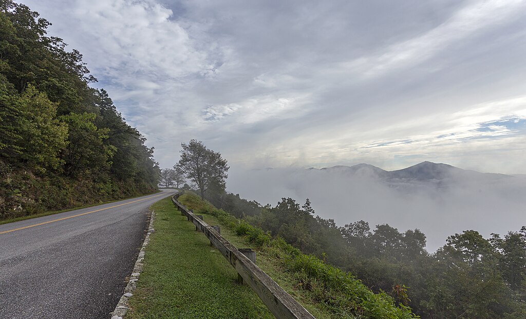
The Blue Ridge Parkway spans 469 miles through forested mountains that have seen a noticeable rise in extreme rainfall events. Forecast models suggest a 15% increase in heavy downpours during 2026, raising the risk of washouts and fog-related visibility issues along high-elevation bends. With nearly 15 million yearly visitors, congestion paired with unstable slopes could result in more seasonal closures, especially during spring and late summer storms.
3. Route 66 – Midwest & Southwest, USA
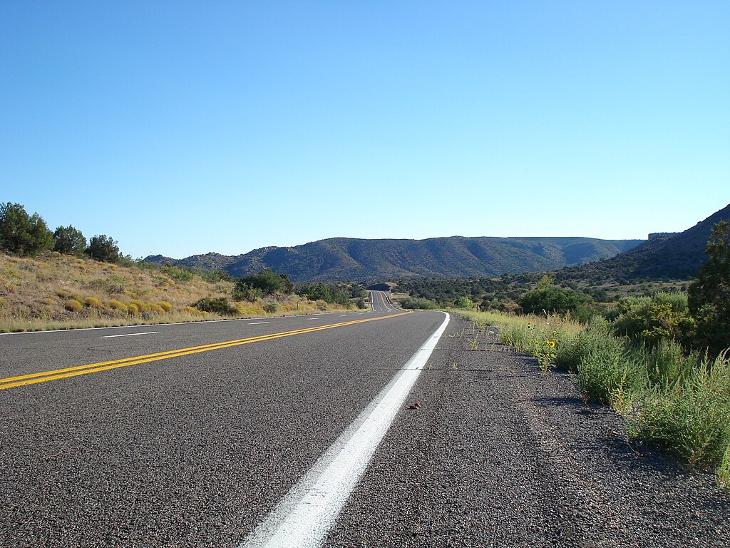
The legendary 2,448-mile Route 66 faces mounting stress from rising temperatures, especially across Arizona and New Mexico. Heatwaves are expected to push road-surface temperatures past 60°C, accelerating pavement cracking by nearly 25%. Dry thunderstorms and monsoon bursts may also cause flash flooding across desert zones. As sections cross older towns and lightly maintained roads, travelers in 2026 may encounter more detours and repair zones than usual.
4. Great Ocean Road – Victoria, Australia
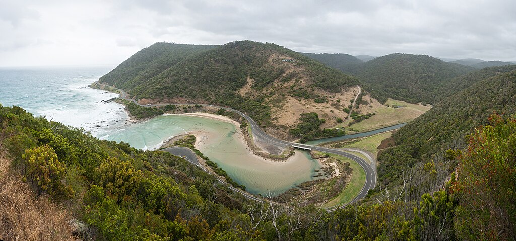
Running 151 miles along Australia’s southern coast, the Great Ocean Road is particularly vulnerable to coastal erosion and king-tide flooding. Wave heights in the region have risen by 5–8% over two decades, and meteorologists project more intense storm surges in 2026. These conditions can undermine cliffside foundations and lead to temporary road subsidence. With over 3 million visitors annually, authorities expect more precautionary closures during peak storm weeks.
5. Ring Road – Iceland
Iceland’s Ring Road loops around the island for 828 miles, passing glaciers, volcanic plains, and flood-prone lowlands. Melting-glacier runoff is increasing by roughly 2% a year, and scientists warn that sudden glacial outburst floods could become more common in 2026. Strong winds exceeding 50 mph are also projected to rise in frequency, making driving conditions unpredictable. As a result, long stretches may require tighter monitoring or short-notice shutdowns.
6. North Coast 500 – Scotland, UK
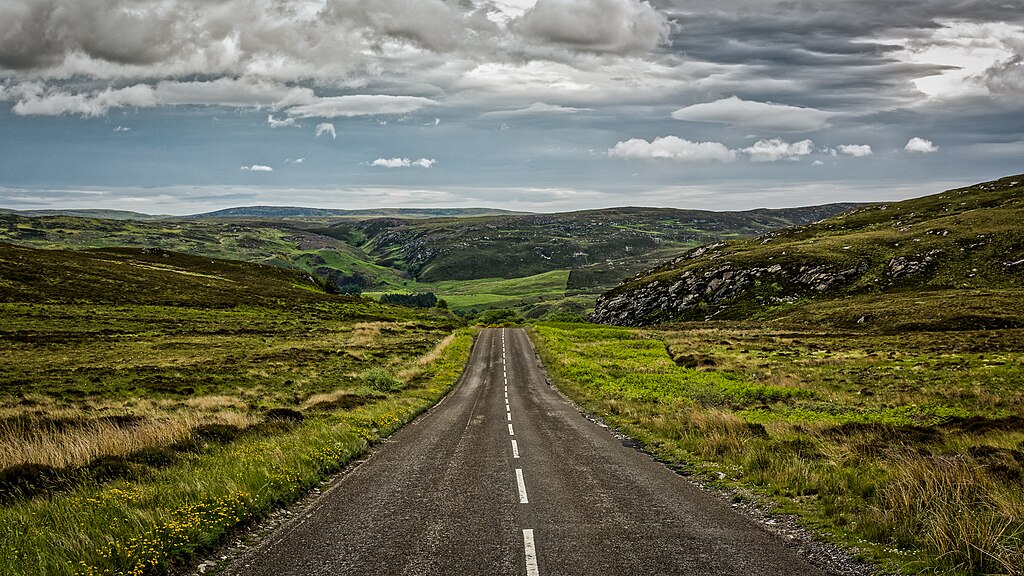
This popular 516-mile loop around northern Scotland is at growing risk from heavy rainfall, which has increased by nearly 17% over the past thirty years. In 2026, further intensification could lead to more flooding around single-track coastal stretches and cause tidal surges to spill onto exposed roadbeds. Wind gusts above 60 mph are expected to become more frequent, making campervan travel more challenging for visitors tackling the route.
7. Amalfi Coast Road – Campania, Italy

The Amalfi Drive, measuring 37 miles, winds along cliffs that have seen a rise in rainfall extremes linked to Mediterranean warming. Experts note a potential 12–18% increase in intense storms during 2026, raising landslide risks on its narrow, stone-walled sections. Traffic volume often exceeds 1 million vehicles per season, which slows evacuation and repair efforts. Scenic as it is, travelers might face delays, height restrictions, or partial traffic controls.
8. Garden Route – Western & Eastern Cape, South Africa
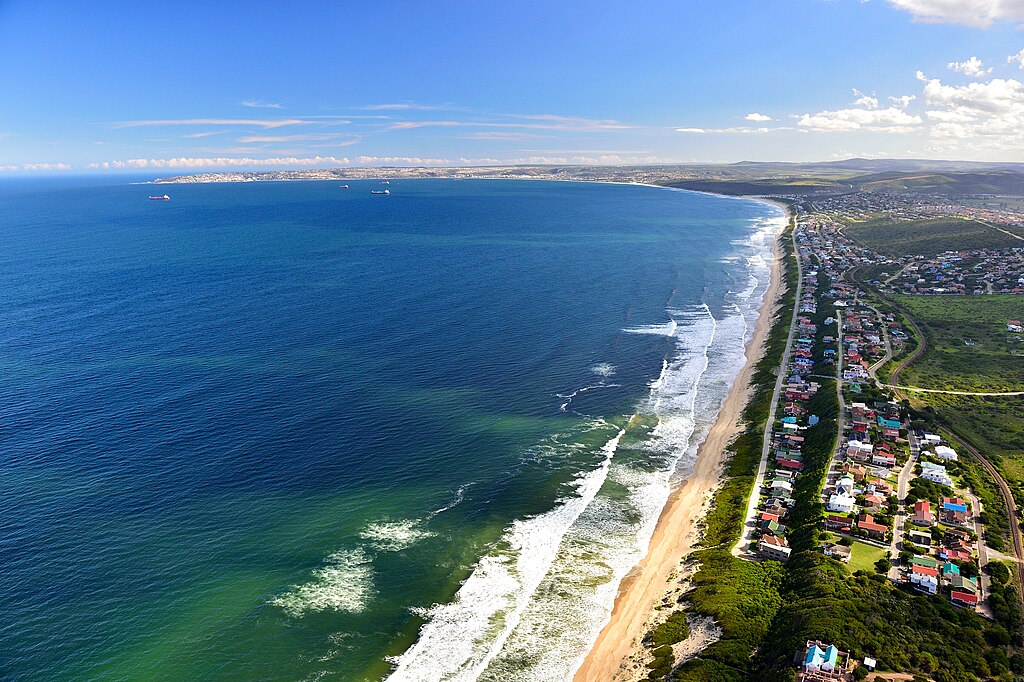
Running roughly 190 miles, the Garden Route faces environmental stress as heatwaves and sudden rainfall bursts grow more severe. Regional climate studies predict a 10–15% rise in high-intensity storms for 2026. These can trigger flash floods around river crossings and weaken certain coastal segments exposed to erosion. With tourist numbers exceeding 300,000 yearly, authorities have already started reinforcing bridges and drainage systems ahead of expected spikes in weather volatility.
9. Karakoram Highway – Pakistan & China
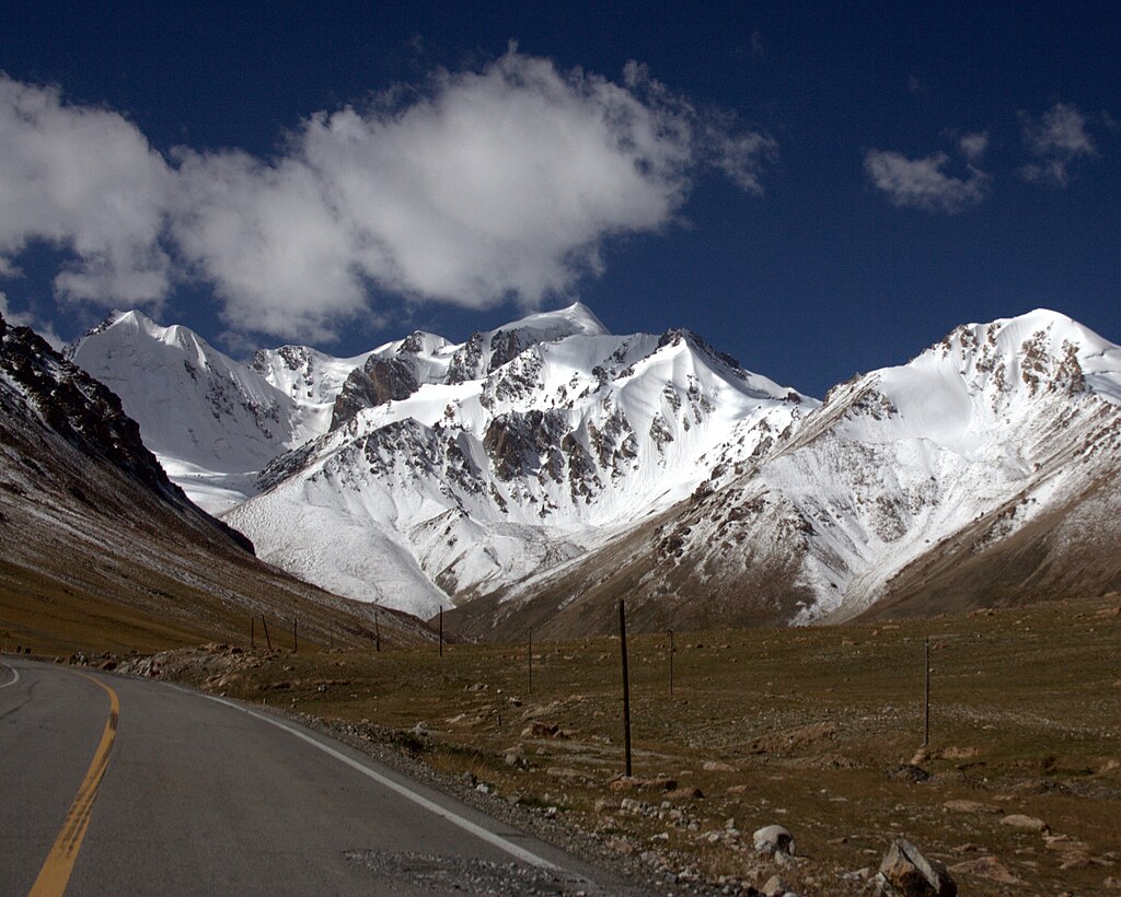
This 810-mile high-altitude highway is particularly sensitive to extreme rainfall and the rapid melting of nearby glaciers. Experts anticipate a 20% jump in monsoon-related landslides in 2026, which could block or damage narrow mountain passages for days at a time. Rockfall events have increased steadily over the past decade, and shifting permafrost zones weaken road foundations. Travelers should expect potential delays and frequent maintenance activity along steep sections.
10. Sea-to-Sky Highway – British Columbia, Canada
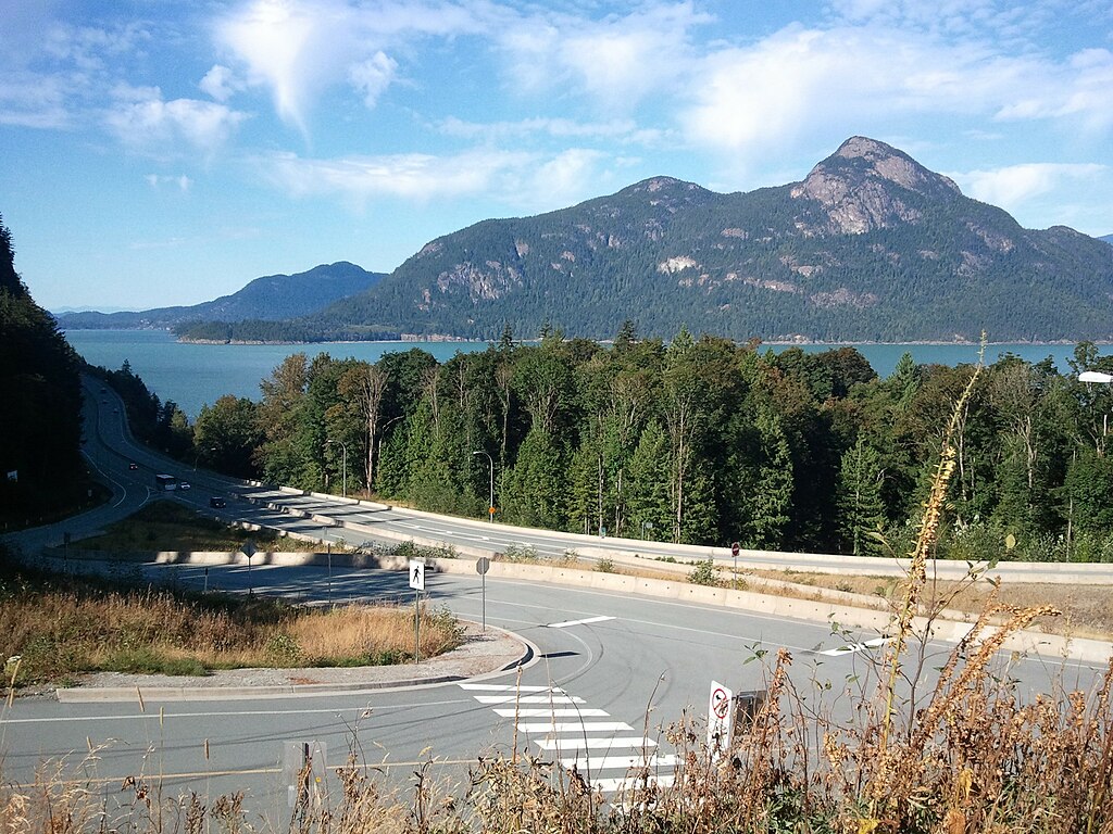
The 75-mile Sea-to-Sky Highway is known for coastal cliffs and mountainous terrain, both increasingly affected by heavy winter storms. Precipitation in the region has risen by 8–12%, and 2026 is expected to bring stronger atmospheric-river events. These storms can cause rockslides, road flooding, and slope instability. With daily traffic sometimes exceeding 100,000 vehicles, even small disruptions can create significant travel delays, especially during ski-season peaks.
11. Overseas Highway – Florida Keys, USA

Spanning 113 miles, this iconic highway sits barely above sea level, making it highly vulnerable to tidal flooding and storm surges. Sea levels in the Keys have risen about 9 inches since the mid-20th century, and projections for 2026 show more frequent “sunny-day” floods. Stronger tropical storms may also inundate long bridges, forcing closures. With over 3 million drivers yearly, disruptions could become more common, particularly during hurricane season.