We may earn money or products from the companies mentioned in this post. This means if you click on the link and purchase the item, I will receive a small commission at no extra cost to you ... you're just helping re-supply our family's travel fund.
Even in an era of satellites, deep-sea drones, and high-resolution mapping, parts of our planet remain stubbornly beyond routine human access. These places are not just remote, they are biologically fragile, politically restricted, geographically extreme, or physically dangerous. Below are eleven of the most mysterious frontiers left on Earth, where distance is measured in hundreds of miles and survival depends on precision, technology, and luck.
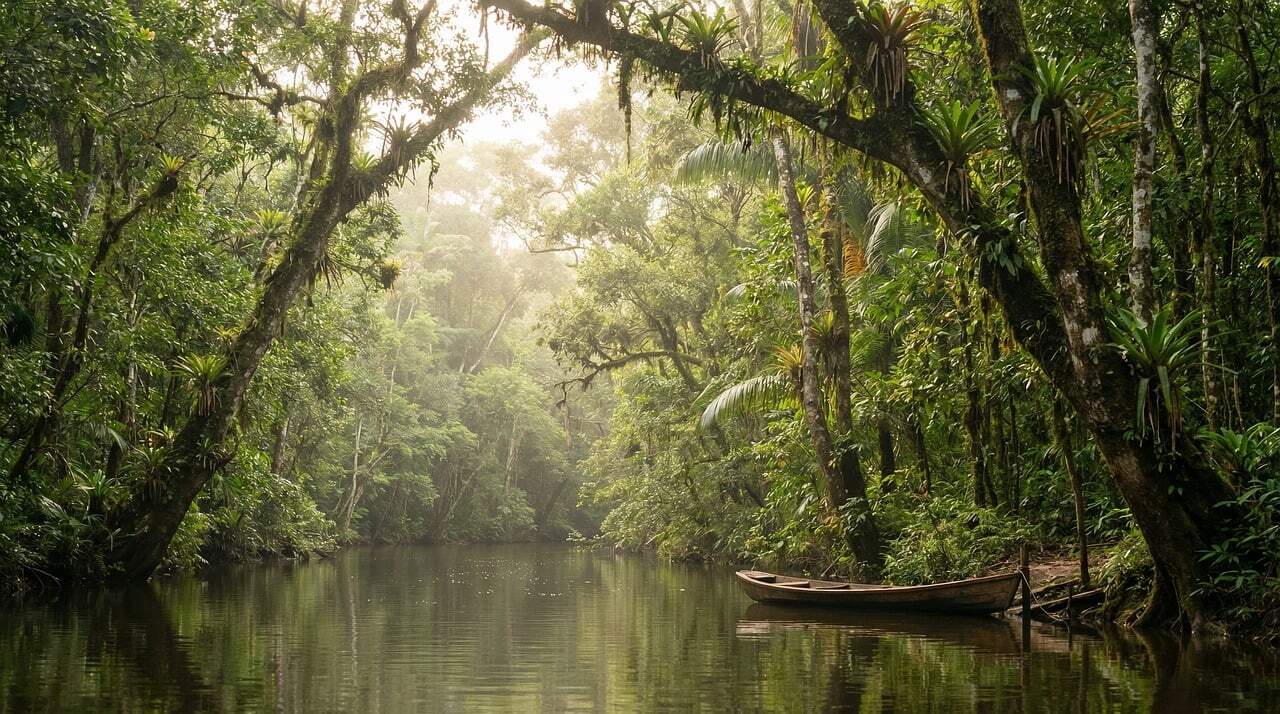
1. Vale do Javari, Brazil
Spanning roughly 85,000 square kilometers (about 32,800 square miles), this protected region in western Brazil remains one of the most isolated human-inhabited areas on Earth. It shelters more than 20 uncontacted Indigenous groups, making it the highest concentration globally.
Dense rainforest, winding tributaries, and limited river access keep outsiders away. Brazilian law strictly restricts entry to preserve cultural autonomy and prevent disease transmission. Even aerial surveys reveal only scattered clearings.
Its remoteness over 500 kilometers (310 miles) from major urban centers ensures that large portions of this rainforest remain virtually undocumented by modern science.
2. North Sentinel Island, India
Covering just 59 square kilometers (23 square miles), this small island in the Andaman Sea is home to the Sentinelese people, who have lived in isolation for an estimated 30,000 years. Contact attempts are prohibited by Indian law.
The island lies around 1,200 kilometers (746 miles) from mainland India. Coral reefs form a natural barrier, preventing easy landing, and the surrounding waters are legally restricted.
Despite satellite imagery, little is known about the island’s interior ecosystem. Its beaches and forests remain among the few inhabited landscapes where modern civilization has never successfully established contact.
3. Mariana Trench, Pacific Ocean
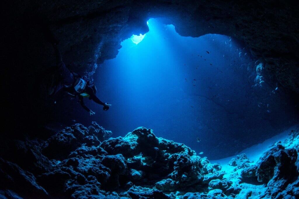
Plunging to nearly 11 kilometers (6.8 miles) at Challenger Deep, this is the deepest known point on Earth. The trench stretches over 2,500 kilometers (1,553 miles) across the western Pacific.
Only a handful of crewed descents, fewer than 10 in total, have reached its bottom. Pressure exceeds 1,000 times that at sea level, enough to crush conventional submarines.
Despite extreme darkness and temperatures near freezing, life forms survive here. Scientists estimate that more than 80% of the ocean floor worldwide remains unmapped, leaving vast mysteries beneath the waves.
4. Antarctica Interior
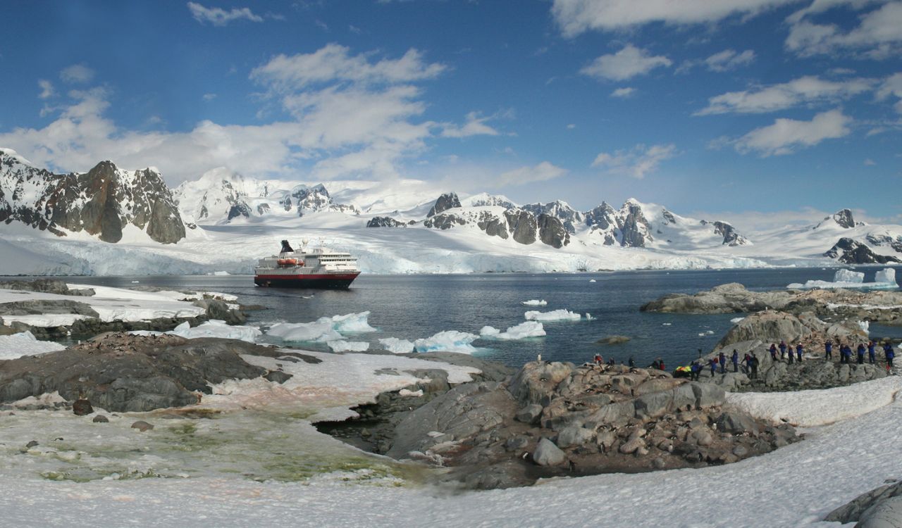
Antarctica spans about 14 million square kilometers (5.4 million square miles), yet its vast interior sees fewer than 1,000 visitors annually. Winter temperatures drop below −60°C (−76°F), making extended exploration perilous.
The East Antarctic Plateau rises over 3,000 meters (9,842 feet) above sea level. Beneath kilometers of ice lie subglacial lakes untouched for millions of years.
Harsh katabatic winds exceeding 200 kilometers per hour (124 miles per hour) limit travel. Large sections remain unexplored due to logistical costs, extreme isolation, and environmental protection treaties.
5. Greenland Ice Sheet, Greenland
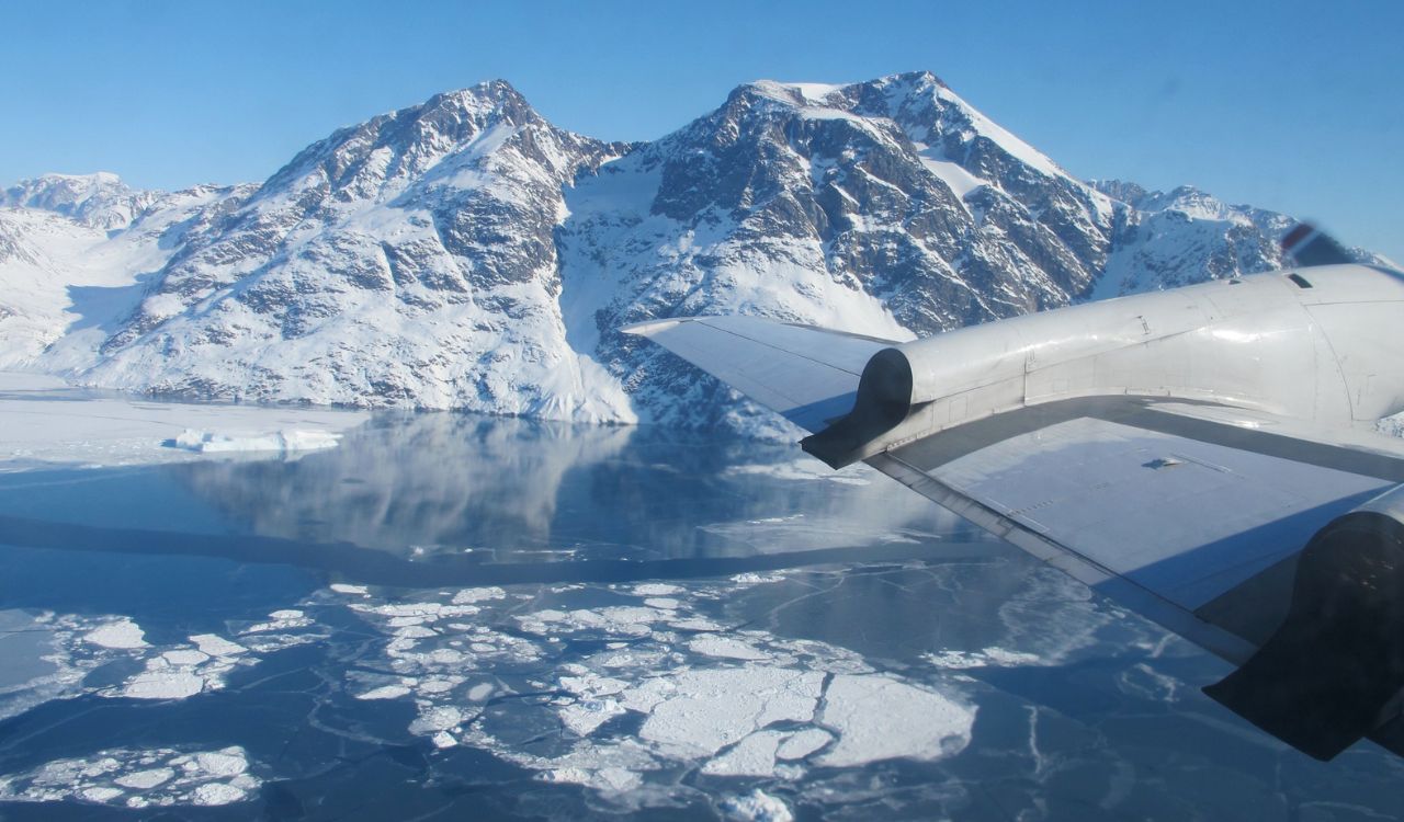
Covering approximately 1.7 million square kilometers (656,000 square miles), this ice sheet is nearly three times the size of Texas. Ice thickness averages 1.5 kilometers (0.93 miles), reaching over 3 kilometers (1.86 miles) in places.
The interior receives fewer than 30 scientific expeditions annually. Crevasses, whiteout conditions, and shifting ice make travel hazardous even with GPS support.
Beneath the ice lie hidden mountain ranges and subglacial rivers still being mapped. Despite climate monitoring efforts, much of its terrain remains unseen by human eyes.
6. Gangkhar Puensum, Bhutan
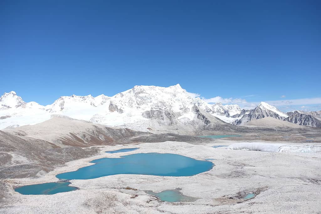
At 7,570 meters (24,836 feet), Gangkhar Puensum is the highest unclimbed mountain in the world. It lies along the Bhutan–China border in the eastern Himalayas.
Bhutan banned mountaineering above 6,000 meters (19,685 feet) in 1994 due to spiritual beliefs. The mountain remains untouched by summits, with only a few exploratory attempts made before restrictions tightened.
Its remote valleys sit over 200 kilometers (124 miles) from major towns. Steep ridges and unpredictable weather further protect its pristine slopes from human footprints.
7. Tsingy de Bemaraha, Madagascar
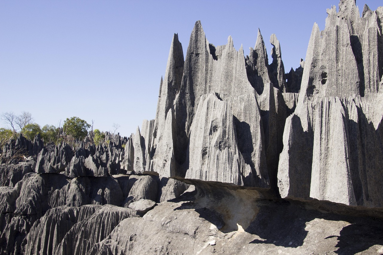
This UNESCO-listed reserve spans about 1,575 square kilometers (608 square miles) of razor-sharp limestone formations. Some stone spires rise over 70 meters (230 feet), creating labyrinthine terrain.
Much of the interior remains inaccessible without ropes and climbing gear. The area lies around 300 kilometers (186 miles) from Madagascar’s capital.
Researchers continue discovering endemic species, including lemurs and reptiles found nowhere else. The jagged landscape has limited full biological surveys, leaving pockets of biodiversity still undocumented.
8. Namib Desert, Southern Africa
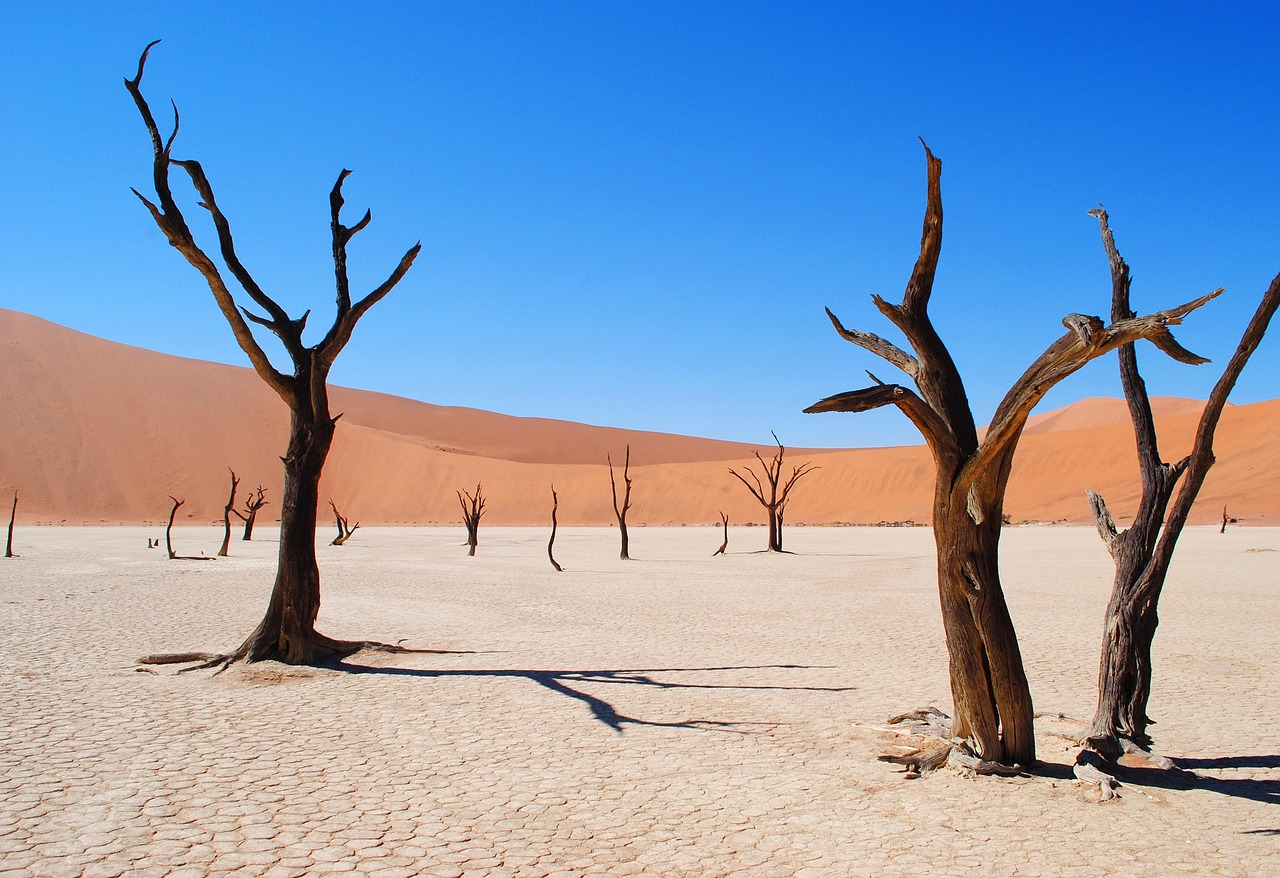
Stretching roughly 2,000 kilometers (1,243 miles) along the Atlantic coast, the Namib is considered the world’s oldest desert, estimated at 55 million years old. Its area covers about 81,000 square kilometers (31,274 square miles).
Towering dunes exceed 300 meters (984 feet). Interior gravel plains see minimal human presence due to extreme aridity; some regions receive less than 10 millimeters of rain annually.
Large expanses remain biologically underexplored, especially in shifting dune fields where access roads are nonexistent.
9. Son Doong Cave, Vietnam
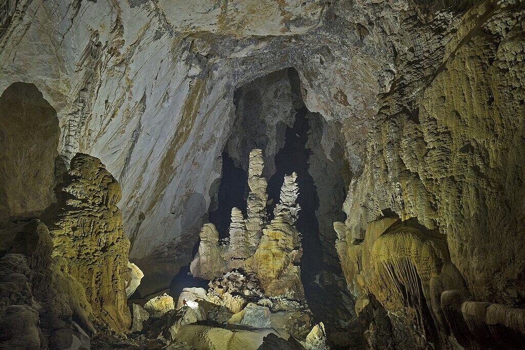
Discovered in 1991 and fully explored in 2009, Son Doong extends nearly 9 kilometers (5.6 miles) in length. Its main cavern rises over 200 meters (656 feet) high and 150 meters (492 feet) wide.
Located about 500 kilometers (310 miles) south of Hanoi, access requires a multi-day jungle trek. Annual visitor numbers are capped at roughly 1,000 to protect the ecosystem.
Inside are subterranean jungles and rivers. Vast sections remain partially surveyed due to safety and conservation concerns.
10. Kamchatka Peninsula, Russia
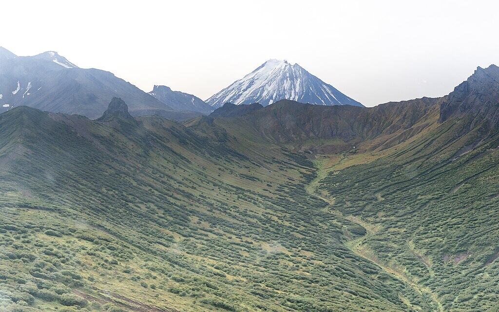
Covering around 270,000 square kilometers (104,250 square miles), Kamchatka hosts over 300 volcanoes, 29 of them active. It lies roughly 6,800 kilometers (4,225 miles) east of Moscow.
Sparse infrastructure means some regions require helicopter access. Brown bear density is among the highest globally, adding natural risk.
Despite geological research, lava fields, valleys, and remote tundra areas remain rarely visited due to cost, weather, and isolation.
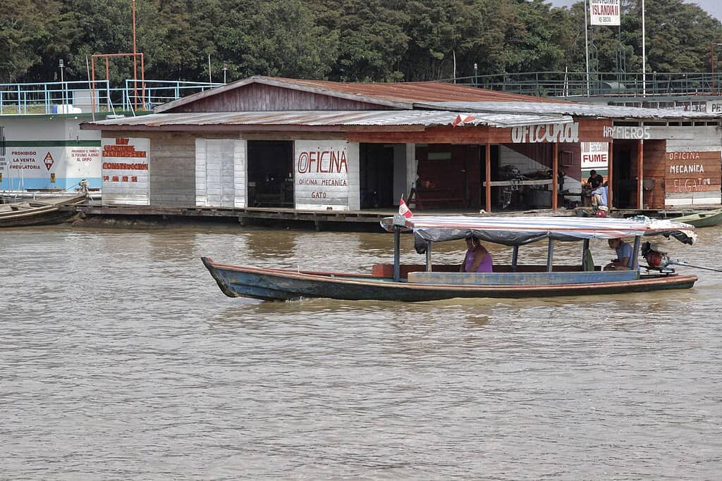
11. Amazon Rainforest Interior
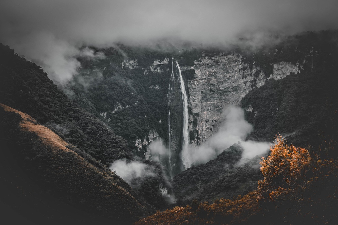
The Amazon spans about 5.5 million square kilometers (2.1 million square miles) across nine countries. While river corridors are known, interior sections remain difficult to access.
Certain areas lie over 1,000 kilometers (621 miles) from major cities. Dense canopy blocks satellite clarity, complicating mapping efforts.
Scientists estimate that thousands of plant and insect species remain undiscovered. Even today, large tracts of this rainforest continue to resist thorough exploration.